Information as at 21 August 2026
This page is a relocation summary written by an advanced AI
It is not a personal opinion piece written by a human. An AI gathered official information published on the internet — municipal and national statistics, the Japan Meteorological Agency, railway companies, property portals — and rebuilt it into a form that someone considering a move can read and act on. Every figure carries a source link and the date it was checked, so please confirm anything that matters to you against the original document. Rules and prices change. Always check the latest information yourself before you sign anything.
Moving to Kanazawa
2 hr 27 min to Tokyo Station on the Hokuriku Shinkansen, with no change of train. Population 452,627; this is the capital of Ishikawa Prefecture and a core city. 🔴 The city writes this on its own website — “This is a Sea-of-Japan climate, and it rains so much that people say: you may forget your lunch, but never forget your umbrella.” Annual rainfall is 2,401.5 mm, 1.5 times that of Tokyo (1,598.2 mm), and the annual snowfall total is 157 cm. And “the high humidity suits lacquerware and gold-leaf making, the traditional crafts of this city” — more than 99% of all the gold leaf produced in Japan is made in Kanazawa. In 2009 the city was designated Japan’s first “City of History” and the world’s first “Crafts Creative City”.
Traditional streetscapes: Kanazawa Higashiyama-Higashi (teahouse district, designated Heisei 13.11.14) · Kanazawa Kazue-machi (teahouse district, designated Heisei 20.6.9) · Kanazawa Utatsu-sanroku (temple district, designated Heisei 23.11.29) · Kanazawa Teramachi-dai (temple district, designated Heisei 24.12.28) / Hot springs and day bathing: Nuka Onsen · Yamato Onsen · Kanazawa Yume-no-Yu · Moroe-no-Yu · Waon-no-Yu · Yuwaku Onsen Sou-yu · Manten-no-Yu Kanazawa · Kinjo Onsen Motoyu · Share Kanazawa · Okuwa Onma Onsen · Asanogawa Onsen · Ishibiki Onsen Kame-no-Yu · Kenroku Onsen
Sources: traditional streetscapes from the Agency for Cultural Affairs, “List of Important Preservation Districts for Groups of Traditional Buildings” (verified 2026-08-21) / hot springs and day bathing from OpenStreetMap (© OpenStreetMap contributors) (verified 2026-08-21). 🔴 Only what is present is listed here — it does not mean that a town without these is any lesser.
Last verified 2026-08-21
CHAPTER 01First, what kind of place Kanazawa is
This is the castle town of the Maeda family of the Kaga domain. Maeda Toshiie entered Kanazawa Castle in 1583 (Tensho 11), the city was incorporated in 1889 (Meiji 22) (the year-end estimated population was 94,209 then), and it became a core city in 1996 (Heisei 8). It covers 468.81 square kilometres, 23.3 km east to west and 37.3 km north to south. The population is 452,627 in 214,580 households (estimate for 1 August 2026). The city writes: “because it escaped war damage and major disasters, much of the beautiful townscape of the domain era still remains today, and it is a precious asset of Kanazawa” — the age of the housing stock we look at in §4 is the other side of the same coin.
What kind of town is Kanazawa City?
Population 452,627 (estimate for 1 August 2026); this is the capital of Ishikawa Prefecture and a core city. It is the castle town of the Maeda family of the Kaga domain, where Maeda Toshiie entered Kanazawa Castle in 1583, and the city writes “because it escaped war damage and major disasters, much of the beautiful townscape of the domain era still remains today”. 🔴 In 2009 it was designated Japan’s first “City of History” and the world’s first “Crafts Creative City”. It covers 468.81 square kilometres, 23.3 km east to west and 37.3 km north to south.
CHAPTER 02Six areas, and life in each
We divide the city into 6 parts. The division comes from classifying all 406 houses on the market one by one by their map coordinates, and 0 could not be classified. The cheapest is the centre (median ¥14,990,000). But in that centre, 67% were built before the 1981 earthquake code — the old streets of the castle town come onto the second-hand market just as they are. The most expensive is Kanaiwa, Ono and Awagasaki at ¥25,490,000, where the median elevation is 3.2 metres. For the city as a whole the median elevation is 16.1 metres.
| Areas | Listings | median | pre-1981 code | What defines it |
|---|---|---|---|---|
| Nuka, Shijima, Kubo and Takao (the southern hills) | 115 listings | ¥21,990,000 | 44% | The largest number of houses. Median plot 194 m², on the roomy side. Median elevation 32.0 m |
| Central (Kanazawa Sta., Korimbo, Kenrokuen, Kodatsuno) | 93 listings | ¥14,990,000 | 67% | The cheapest, and the oldest. Median plot 127 m², median year built 1974 |
| Morimoto, Higashi-Kanazawa and Okobata (north) | 75 listings | ¥16,800,000 | 43% | The city’s lowest price, ¥800,000, is here. Elevation runs 0.8–177.7 m, the widest range |
| Nishikanazawa, Yokaichi and Oshino (southwest flats) | 52 listings | ¥22,140,000 | 33% | Median year built 1987. Newer flat land, next to Nonoichi City |
| Kanaiwa, Ono and Awagasaki (the sea and the port) | 40 listings | ¥25,490,000 | 28% | The most expensive of the 6. Median building 124 m², the largest. Median elevation 3.2 m |
| Okuwa, Tagami and Sue-machi (southeast, along the hills) | 31 listings | ¥15,490,000 | 32% | Plot 198 m² and building 133 m², the largest of all. Median elevation 87.4 m |
Who it suits = anyone who wants both a roomy plot and a quiet residential district inside the city
What to watch = 44% are pre-1981 code. Put the cost of seismic retrofitting into your budget
Who it suits = anyone who wants to live without a car, or who would enjoy repairing an old house and living in it
What to watch = there is a reason it is cheap. Weigh the cost of seismic work, insulation and new fittings as heavily as the purchase price. Ask at the counter about the “Kanazawa subsidy for seismic retrofitting of disaster-damaged wooden houses” in §8 as well
Who it suits = anyone keeping the price down, or commuting towards Toyama
What to watch = there is both low-lying land and hamlets up in the hills here. Check elevation and hazard maps lot by lot (§5)
Who it suits = anyone choosing a newer house for closeness to a station and to the shops
What to watch = plots are on the smaller side, median 139 square metres
Who it suits = anyone looking for a newer, roomy house near the sea
What to watch = this is low-lying ground. Always check the tsunami, storm-surge and flood projections for the exact lot (§5)
Who it suits = anyone who wants a big house and plot 20 minutes by car from the built-up area
What to watch = always check the winter slopes and the landslide warning areas for the exact lot
Which part of Kanazawa City should I live in?
Split into 6, the medians of the 406 houses on the market run from ¥14,990,000 in the centre to ¥25,490,000 in Kanaiwa, Ono and Awagasaki. 🔴 The cheapest is the centre, and there 67% date from before the 1981 earthquake code. For a newer house, look at Nishikanazawa, Yokaichi and Oshino (33% pre-1981 code, median year built 1987) or Kanaiwa, Ono and Awagasaki (28%); for a large plot, Okuwa, Tagami and Sue-machi (median plot 198 m²). Across the whole city elevation ranges from 0.8 to 177.7 metres.
CHAPTER 03Trains and cars — how you get around
Kanazawa Station to Tokyo Station is 2 hr 27 min on the Hokuriku Shinkansen, ¥14,600, with no change of train. Toyama is 18 minutes away and Fukui 35 — both on the same one train. Osaka, Kyoto and Nagoya need a change, and on the fastest service they are 2 hr 46 min, 2 hr 10 min and 2 hr 23 min away. “Straight through to Tokyo; a change for Kansai and Chukyo” — that is where Kanazawa sits. Komatsu Airport is 42 minutes away.
Journey times from Kanazawa Station (searched for a departure at 8:00 on Monday 24 August 2026)
| Destination | Fastest | Notes |
|---|---|---|
| Tokyo | 2 hr 27 min, ¥14,600 Hokuriku Shinkansen, 0 changes | You reach the Tokyo area without changing trains |
| Toyama | 18 min, ¥3,390 Hokuriku Shinkansen, 0 changes | Close enough to travel to and from the Toyama page on this site |
| Fukui | 35 min, ¥3,210 Hokuriku Shinkansen, 0 changes | As with the Fukui page on this site, one train the whole way |
| Kyoto | 2 hr 10 min, ¥8,310 2 changes | A service with 1 change takes 1 hr 55 min for ¥7,720 (departing 8:40) |
| Osaka | 2 hr 46 min, ¥10,950 3 changes | A service with 1 change takes 2 hr 22 min for ¥9,410 (departing 8:40) |
| Nagoya | 2 hr 23 min, ¥9,850 2 changes | — |
| Komatsu Airport | 42 min, ¥3,220 1 change | The airport is in neighbouring Komatsu City. Its position is filled in automatically in the box at the foot of this chapter |
✈ Airports
The nearest is Komatsu Airfield (a shared civil and military airport), about 28.1 km as the crow flies. Next is Toyama Airport (about 47.4 km as the crow flies). 🔴 These are straight-line distances. They are not road distances or journey times — please check the actual routes in each operator’s timetable.
🛣 Expressway junctions
This area has 4 entry and exit points (interchanges and junctions).
Hokuriku Expressway = Hakusan, Kanazawa-Higashi, Kanazawa-Morimoto, Kanazawa-Nishi
How many minutes is it from Kanazawa to Tokyo or Osaka?
🔴 Tokyo Station is 2 hr 27 min away on the Hokuriku Shinkansen for ¥14,600, with no change of train. Toyama at 18 min and Fukui at 35 min are on the same one train too. Kansai and the Nagoya region need a change — on the fastest services Kyoto is 2 hr 10 min, Osaka 2 hr 46 min and Nagoya 2 hr 23 min (with 1 change, Kyoto is 1 hr 55 min and Osaka 2 hr 22 min). The airport is Komatsu Airport in neighbouring Komatsu City, 42 minutes away.
CHAPTER 04Homes actually on the market right now
SUUMO lists 406 houses, and all 406 of them are included here. They run from ¥800,000 to ¥118,000,000, with a median of ¥19,000,000. 97 are at or under ¥10,000,000 (24%). The median plot is 166 square metres (about 50 tsubo) and the median building 115 square metres. The median year built is 1984, and 183 = 45% date from 1981 or earlier (the pre-1981 earthquake code) — among the prefectural capitals on this site, this is clearly one of the older markets.
"Nearest the station first" converts everything to minutes — a walk of ◯ min, ◯ min by bus plus ◯ min from the stop, ◯ km by car (reckoned at 30 km/h) — and compares those. Listings with no such information always appear last, whatever the sort.
 Okobata-machi ニ¥800,000Morimoto, Higashi-Kanazawa and Okobata (north)Elev. approx. 0 m / Land 220 m² (67 tsubo) / Building 93 m² (28 tsubo) / built 1957 / Okobata Sta. 4 min walk9 photos →
 Moriyama 1-13-11¥1,400,000Central (Kanazawa Sta., Korimbo, Kenrokuen, Kodatsuno)Elev. approx. 10 m / Land 35 m² (10 tsubo) / Building 45 m² (13 tsubo) / built 1935 / Nanatsuya Sta. bus 12 min+12 min walk4 photos →
 Irie 1-239番¥1,500,000Nishikanazawa, Yokaichi and Oshino (southwest flats)Elev. approx. 10 m / Land 54 m² (16 tsubo) / Building 46 m² (14 tsubo) / built 1965 / Irie 1-chome bus stop 3 min walk8 photos →
 Kubo 2¥1,500,000Nuka, Shijima, Kubo and Takao (the southern hills)Elev. approx. 40 m / Land 145 m² (44 tsubo) / Building 58 m² (18 tsubo) / built 1965 / Kubo (Ishikawa) bus stop 4 min walk8 photos →
 Kikugawa 2¥1,500,000Central (Kanazawa Sta., Korimbo, Kenrokuen, Kodatsuno)Elev. approx. 20 m / Land 66 m² (20 tsubo) / Building 82 m² (25 tsubo) / built 1932 / 思案橋 (Ishikawa Prefecture) bus stop 4 min walk5 photos →
 Sue-machi 14の60番11¥2,000,000Okuwa, Tagami and Sue-machi (southeast, along the hills)Elev. approx. 90 m / Land 80 m² (24 tsubo) / Building 71 m² (21 tsubo) / built 1985 / No-machi Sta. 82 min walk10 photos →
 No-machi 3-23番19号¥2,800,000Central (Kanazawa Sta., Korimbo, Kenrokuen, Kodatsuno)Elev. approx. 30 m / Land 66 m² (20 tsubo) / Building 105 m² (32 tsubo) / built 1900 / No-machi Sta. 9 min walk10 photos →
 Sanno-machi 1¥3,000,000Morimoto, Higashi-Kanazawa and Okobata (north)Elev. approx. 70 m / Land 213 m² (64 tsubo) / Building 89 m² (27 tsubo) / built 1973 / Higashi-Kanazawa Sta. 53 min walk9 photos →
 Kodatsuno 4-3番10号¥3,000,000Central (Kanazawa Sta., Korimbo, Kenrokuen, Kodatsuno)Elev. approx. 60 m / Land 38 m² (11 tsubo) / Building 60 m² (18 tsubo) / built 1900 / Tentokuin-mae bus stop 5 min walk1 photos →
 Sue-machi 17の¥3,300,000Okuwa, Tagami and Sue-machi (southeast, along the hills)Elev. approx. 100 m / Land 89 m² (27 tsubo) / Building 71 m² (22 tsubo) / built 1983 / Sue bus stop 6 min walk9 photos →
 Okuwa-machi ワ12番5¥3,500,000Okuwa, Tagami and Sue-machi (southeast, along the hills)Elev. approx. 120 m / Land 162 m² (49 tsubo) / Building 152 m² (46 tsubo) / built 1979 / Kanazawa Sta. bus 35 min+6 min walk10 photos →
 Yamashina-machi 東¥3,500,000Nuka, Shijima, Kubo and Takao (the southern hills)Elev. approx. 60 m / Land 210 m² (64 tsubo) / Building 114 m² (34 tsubo) / built 1981 / Kubo bus stop 15 min walk8 photos →
 Sakura-machi¥3,500,000Central (Kanazawa Sta., Korimbo, Kenrokuen, Kodatsuno)Elev. approx. 20 m / Land 53 m² (16 tsubo) / Building 65 m² (20 tsubo) / built 1968 / Kanazawa Sta. bus 26 min+6 min walk9 photos →
 Moriyama 1-276番地 (street address: 8番3号)¥3,600,000Central (Kanazawa Sta., Korimbo, Kenrokuen, Kodatsuno)Elev. approx. 10 m / Land 53 m² (16 tsubo) / Building 69 m² (21 tsubo) / built 1965 / Moriyama bus stop 2 min walk4 photos →
 Sue-machi 17-97-3¥3,800,000Okuwa, Tagami and Sue-machi (southeast, along the hills)Elev. approx. 100 m / Land 132 m² (40 tsubo) / Building 137 m² (41 tsubo) / built 1983 / No-machi Sta. 91 min walk10 photos →
 Kodatsuno 3¥3,800,000Central (Kanazawa Sta., Korimbo, Kenrokuen, Kodatsuno)Elev. approx. 60 m / Land 228 m² (69 tsubo) / Building 123 m² (37 tsubo) / built 1973 / Kanazawa Sta. bus 27 min+4 min walk5 photos →
 Sue-machi 17の¥3,800,000Okuwa, Tagami and Sue-machi (southeast, along the hills)Elev. approx. 100 m / Land 132 m² (40 tsubo) / Building 137 m² (41 tsubo) / built 1983 / No-machi Sta. 86 min walk8 photos →
 Kanaiwa Ima-machi 4-12¥4,000,000Kanaiwa, Ono and Awagasaki (the sea and the port)Elev. approx. 0 m / Land 176 m² (53 tsubo) / Building 124 m² (38 tsubo) / built 1971 / Okobata Sta. 73 min walk8 photos →
 Yamanoe-machi¥4,000,000Central (Kanazawa Sta., Korimbo, Kenrokuen, Kodatsuno)Elev. approx. 50 m / Land 119 m² (36 tsubo) / Building 70 m² (21 tsubo) / built 1959 / Moriyama bus stop 7 min walk1 photos →
 Ono-machi 7¥4,000,000Central (Kanazawa Sta., Korimbo, Kenrokuen, Kodatsuno)Elev. approx. 0 m / Land 94 m² (28 tsubo) / Building 114 m² (35 tsubo) / built 1966 / Ono Chuo bus stop 4 min walk4 photos →
The photographs are the images carried on SUUMO. They disappear once a listing ends. Check the real condition of a property on site.
See all 406 on SUUMO →Akiya bank — 18 listings
All 18 houses on the market that are registered with the municipal vacant-home bank (as verified on 21 August 2026). They are listed cheapest first. There is also 1 rental registration. For 18 of them the floor area is not published, so the floor-plan button does not appear.


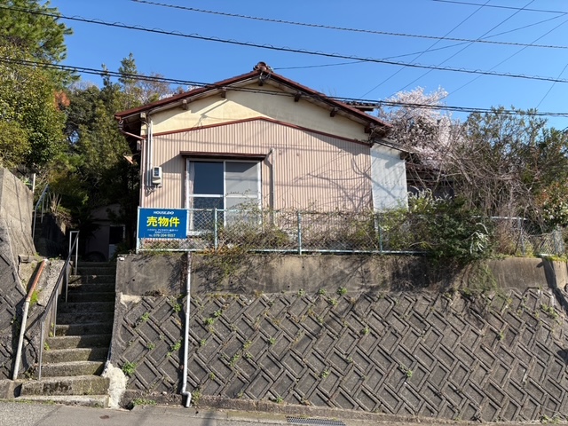
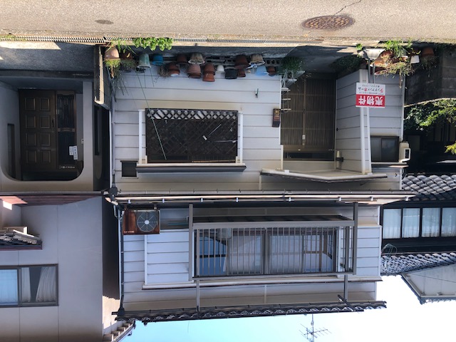


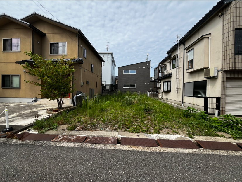


What is the cheapest house you can buy in Kanazawa City?
SUUMO lists 406 houses (all of them), from ¥800,000 to ¥118,000,000, with a median of ¥19,000,000. 97 are at or under ¥10,000,000 (24%). The median plot is 166 square metres and the median building 115 square metres. 🔴 The median year built is 1984, and 183 = 45% date from 1981 or earlier (the pre-1981 earthquake code) — clearly one of the older markets among the prefectural capitals on this site. The city’s Kanazawa Vacant Home Utilisation Bank held 19 listings as of 21 August 2026.
CHAPTER 05Is the ground safe?
Read Kanazawa’s safety from what has actually happened, not from probabilities. In the J-SHIS figures, the chance of shindo 6-lower or above within 30 years at the city hall site is 6.6% — one of the lower figures on this site. Even so, on 1 January 2024 the Noto Peninsula Earthquake (magnitude 7.6) registered shindo 5-upper in Kanazawa. In Ishikawa Prefecture’s tally, damage to dwellings in Kanazawa came to 5,551 buildings (30 destroyed, 230 half-destroyed, 5,291 partly damaged). Casualties were 9 injured and 0 killed. A low probability and an absence of shaking are two different things.
Is this town inside a national earthquake-preparedness zone?
For each major earthquake, national law designates the areas where preparation is to be advanced. Whether a town is designated tells you directly how the national government views the shaking and tsunami expected there.
| Nankai Trough Earthquake Disaster Prevention Promotion Area | Not applicable (the whole of Ishikawa Prefecture is outside this scheme) |
|---|---|
| Tokyo Inland Earthquake Emergency Measures Area | Not applicable (the whole of Ishikawa Prefecture is outside this scheme) |
| Japan Trench / Kuril Trench Earthquake Disaster Prevention Promotion Area | Not applicable (the whole of Ishikawa Prefecture is outside this scheme) |
| Shaking of intensity 6-lower or above within 30 years | 6.6% (shindo 6-upper or above is 2.6%) At the Kanazawa city hall site. Surface ground AVS30 341 m/s, sand-and-gravel plateau |
Look up an address on J-SHIS → Designations from the Cabinet Office list of designated municipalities (Nankai Trough Earthquake Disaster Prevention Promotion Area/Tokyo Inland Earthquake Emergency Measures Area/Japan Trench / Kuril Trench Earthquake Disaster Prevention Promotion Area ) / probability and surface ground from theNational Research Institute for Earth Science and Disaster Resilience, J-SHIS earthquake hazard information API (2024 edition, average case, all earthquakes), queried at the city hall coordinates / verified 2026-08-21
What happened in Kanazawa in the Noto Peninsula Earthquake of 1 January 2024
| Item | Kanazawa City |
|---|---|
| Size of the earthquake | Magnitude 7.6 / the epicentre was the Noto region of Ishikawa Prefecture (focal depth very shallow) / about 16:10 on 1 January 2024 |
| Shindo in Kanazawa | Shindo 5-upper (the highest in the prefecture was shindo 7 at Shika Town, with shindo 6-upper at Nanao City, Wajima City, Suzu City and Anamizu Town) |
| Casualties | 0 killed, 0 missing, 9 injured |
| Damage to dwellings | 5,551 buildings in all (30 destroyed, 230 half-destroyed, 5,291 partly damaged) |
| Tsunami | A tsunami warning was issued for Kaga in Ishikawa Prefecture (the zone that includes Kanazawa) at 16:12 on the 1st. The advisory was lifted at 10:00 on the 2nd |
| What the city did | Kanazawa set up its disaster response headquarters at 16:10 on the 1st (Ishikawa Prefecture at 16:06) |
What is the disaster risk in Kanazawa City?
🔴 Read this from what has actually happened, not from probabilities. J-SHIS puts the chance of shindo 6-lower or above within 30 years at the city hall site at a low 6.6%, and yet the Noto Peninsula Earthquake of 1 January 2024 (M7.6) registered shindo 5-upper in Kanazawa, with damage to 5,551 dwellings (30 destroyed, 230 half-destroyed, 5,291 partly damaged) and 9 people injured. Ishikawa Prefecture is not in any of the 3 national earthquake measure zones (Nankai Trough, Tokyo inland, Japan and Chishima Trench).
CHAPTER 06What summer and winter are like
The city writes it itself — “This is a Sea-of-Japan climate, and it rains so much that people say: you may forget your lunch, but never forget your umbrella. Spring and summer bring many fine days, while winter brings many cloudy and rainy days, and snow lies as well.” Annual rainfall is 2,401.5 mm, 1.5 times that of Tokyo (1,598.2 mm), and annual sunshine is 1,714.1 hours. Winter brings 157 centimetres of snowfall in total, a normal deepest snow cover of 32 centimetres, and 22.8 days below freezing. Summer is gentler by day, with 3.5 days above 35°C and 46.0 days above 30°C, but there are 19.4 tropical nights.
How hot is summer in Kanazawa, and what is winter like?
🔴 This is a city that writes of itself: you may forget your lunch, but never forget your umbrella. Annual rainfall of 2,401.5 millimetres is 1.5 times that of Tokyo (1,598.2 mm) and twice that of Fukuyama (1,171.7 mm). Winter brings 157 centimetres of snowfall in total, a normal deepest snow cover of 32 centimetres, and 22.8 days below freezing, and in 1963 the snow lay 181 centimetres deep. Summer has only 3.5 days above 35°C yet 19.4 tropical nights — a Sea-of-Japan summer, gentler by day and close at night.
CHAPTER 07Shops, hospitals, schools
This is a city of learning. Within the city there are 6 universities (including graduate schools) with 9,165 students, 1 junior college with 749, and 19 full-time upper secondary schools with 11,049 (as of 1 May Reiwa 7). The municipal schools are 52 primary schools (21,269 pupils) and 24 lower secondary schools (10,695 pupils). For children’s medical costs, inpatient care is free of any patient charge up to the end of the third year of upper secondary school, and outpatient care up to the third year of lower secondary school is subsidised for anything over ¥1,000 in a month.
| Type of school | Schools | Pupils and students |
|---|---|---|
| Municipal primary schools | 52 schools plus 1 branch school | 21,269 pupils (893 classes) |
| Municipal lower secondary schools | 24 schools plus 1 branch school | 10,695 pupils (370 classes) |
| Upper secondary schools (full-time) | 19 schools 11 prefectural, 6 private, 1 municipal, 1 national | 11,049 people |
| Universities (including graduate schools) | 6 1 national, 1 public, 4 private | 9,165 people |
| Junior colleges | 1 schools | 749 people |
Will I be short of hospitals, shops or schools?
🔴 This is a city of learning. 52 municipal primary schools (21,269 pupils) and 24 municipal lower secondary schools (10,695 pupils), 19 full-time upper secondary schools, 6 universities with 9,165 students and 1 junior college with 749 (1 May Reiwa 7). For children’s medical costs, inpatient care is free of any patient charge to the end of the third year of upper secondary school, and outpatient care to the third year of lower secondary school is subsidised for anything over ¥1,000 in a month. The shops and the culture gather from Kanazawa Station through Musashigatsuji and Korimbo to Kata-machi.
CHAPTER 08What it costs you every year after you buy
Water and sewerage are read and billed every 2 months, and the tariff is split not by pipe size but by “domestic” and “business” use. For 45 cubic metres over 2 months it is ¥5,615 for water plus ¥5,984 for sewerage = ¥11,599 (including consumption tax). Fixed asset tax is 1.4% and city planning tax 0.3%. And Kanazawa is covered by the national relocation support grant — anyone moving from the Tokyo area who then takes a job, teleworks or starts a business receives ¥1,000,000 for a household (plus ¥1,000,000 for each household member under 18) or ¥600,000 for a single person.
Water charges and sewerage charges (2 months, domestic use, including consumption tax)
| Volume used (two months) | Water | Sewerage | Total |
|---|---|---|---|
| 0 cubic metres the standing charge alone | ¥2,200 | ¥1,980 | ¥4,180 |
| 20 cubic metres | ¥2,684 | ¥2,574 | ¥5,258 |
| 45 cubic metres a guide for a household of 2 to 3 | ¥5,615 | ¥5,984 | ¥11,599 |
| 70 cubic metres | ¥9,020 | ¥9,449 | ¥18,469 |
Roughly what does a year cost, water and the rest?
Water and sewerage come to ¥11,599 for 45 cubic metres over 2 months (domestic use) (water ¥5,615 plus sewerage ¥5,984). The tariff is split by “domestic” and “business” use rather than by pipe size, and it is read and billed every 2 months. Fixed asset tax is 1.4% and city planning tax 0.3%. 🔴 Kanazawa is covered by the national relocation support grant, which pays ¥1,000,000 for a household (plus ¥1,000,000 for each member under 18) or ¥600,000 for a single person for moving from the Tokyo area and taking work there (it can close part-way through the year if the prefectural budget ceiling is reached).
CHAPTER 09What happens when you want to sell
Kanazawa stands well above the rest of its prefecture, and all 5 land-use categories are rising. Residential land is ¥92,800/m², up 2.0% on the year, 1.56 times the Ishikawa average (¥59,400/m², +0.9%). Commercial land is ¥298,200/m², up 4.3%, 1.80 times the prefectural average. As the prefectural capital, it is lifting the prefecture’s land prices almost single-handed.
| Use | Kanazawa City | Year on year | Ishikawa Prefecture Average | Against the prefectural average |
|---|---|---|---|---|
| Residential | ¥92,800/m² | +2.0% | ¥59,400/m² (+0.9%) | 1.56× |
| Commercial | ¥298,200/m² | +4.3% | ¥165,800/m² (+2.0%) | 1.80× |
| Industrial | ¥39,100/m² | +4.8% | ¥35,800/m² (+4.7%) | 1.09× |
| Prospective housing land | ¥27,400/m² | ±0.0% | ¥19,200/m² (±0.0%) | 1.43× |
| All uses | ¥147,800/m² | +2.9% | ¥88,100/m² (+1.4%) | 1.68× |
Will the house I buy sell again later?
🔴 Residential land is ¥92,800/m², up 2.0% on the year, 1.56 times the Ishikawa average (¥59,400/m²). Commercial land is ¥298,200/m², up 4.3%, 1.80 times the prefectural average. All 5 land-use categories are up. But although land is dear, the median second-hand house is a modest ¥19,000,000 — the difference is the age of the buildings (45% pre-1981 code). When you come to sell, it is realistic to assume most of the value is in the land.
CHAPTER 10Who lives here, and how many
The estimated population is 452,627 in 214,580 households (1 August 2026). 219,043 are men and 233,584 women, there are 2.11 people per household, and the density is 965.5 per km². The population peaked around 2015 and has fallen by about 12,000 since. Against 464,733 on 1 January 2015, 1 August 2026 gives 452,627 — a fall of 12,106 (2.6%) in 11 years. By age, the resident register (1 January 2026) gives 11.4% under 15, 60.5% aged 15–64 and 28.1% aged 65 and over.
| Year (1 January) | Population | Households | Per household |
|---|---|---|---|
| 1889 (Meiji 22) the year the city was incorporated | 95,202 people | 27,391 households | 3.48 people |
| 1950 (Showa 25 (1950)) | 248,899 people | 58,055 households | 4.29 people |
| 1970 (Showa 45 (1970)) | 357,759 people | 98,171 households | 3.64 people |
| 1985 (Showa 60 (1985)) | 428,642 people | 139,874 households | 3.06 people |
| 2000 (Heisei 12 (2000)) | 456,077 people | 176,735 households | 2.58 people |
| 2015 (Heisei 27) about the peak | 464,733 people | 197,786 households | 2.35 people |
| 2026 (Reiwa 8 (2026))1 August | 452,627 people | 214,580 households | 2.11 people |
Of the 441,947 people living in Kanazawa City, 9,094 are foreign residents. That is below the national average (3.26%).
Nationwide, foreign residents are 3.26% of the total population (4,031,159 out of 123,767,642).
34 municipalities in the country are above 10%.
Source: calculated by this site from the municipality-level tables of the Ministry of Internal Affairs and Communications, "Population, population change and households based on the Basic Resident Register" (as of 1 January Reiwa 8, published 2026-07-29). The ministry's publication page / verified 2026-08-17
Is the population of Kanazawa City growing?
🔴 It peaked around 2015 and has fallen by about 12,000 since. Against 464,733 on 1 January 2015, 1 August 2026 gives 452,627 — a fall of 12,106 (2.6%) in 11 years. Households, though, rose from 197,786 to 214,580, up 16,794. By age, 11.4% are under 15, 60.5% are 15–64 and 28.1% are 65 and over (resident register, 1 January 2026).
CHAPTER 11Community life and the year's events
The centre of the year is the Kanazawa Hyakumangoku Festival. It is held in memory of the great deed of Maeda Toshiie, founder of the Kaga domain, who entered Kanazawa Castle in Tensho 11 (1583) and laid the foundations of the city, over 3 days around the first Saturday in June, at venues all over the city. Besides the Hyakumangoku parade there are the Hyakumangoku tea ceremony, the Hyakumangoku street dance and the Hyakumangoku takigi noh. The first was held in 1952 (Showa 27).
What are the neighbourhood associations and the neighbouring like?
The centre of the year is the Kanazawa Hyakumangoku Festival — 3 days around the first Saturday in June, held at venues all over the city in memory of Maeda Toshiie’s entry into Kanazawa Castle. There are the Hyakumangoku parade, the Hyakumangoku tea ceremony, the Hyakumangoku street dance and the Hyakumangoku takigi noh. The city’s material writes that “the cultural policies pursued by successive lords carried tea and noh chant down as far as the townspeople”, and neighbourly life here enters the everyday through lessons as well as festival days.
CHAPTER 12Things nearby that move land prices
From the published material, 4 things move prices in Kanazawa: 1. its position, 2 hr 27 min from Tokyo with no change of train; 2. the flow of people that 20,000 students bring; 3. the concentration of tourism and craft; and 4. the Noto Peninsula Earthquake of 2024. The city’s vision of itself is “Kanazawa, a world city of co-creative culture opening the future”, and its action plan, the “Future Co-creation Plan”, runs 10 years from FY Reiwa 6 to FY Reiwa 15.
What is likely to happen to land prices in Kanazawa?
Four things hold them up: 1. its position, 2 hr 27 min from Tokyo with no change of train; 2. the flow of people that 20,963 students bring (universities, junior college and full-time upper secondary schools); 3. the concentration of craft and tourism, typified by the 2009 designations as a “City of History” and a “Crafts Creative City”; and 4. housing demand after the Noto Peninsula Earthquake of 2024. The city’s vision of itself is “Kanazawa, a world city of co-creative culture opening the future”, and its action plan, the “Future Co-creation Plan”, runs 10 years from FY Reiwa 6 to Reiwa 15.
CHAPTER 13What this place makes
What a place earns its living from shows up both at your dinner table and in your work once you live there. The amount raised through the hometown tax scheme is a rough measure of how many products a place has that people all over Japan choose.
190th of 1,788 municipalities nationwide, and 2nd within Ishikawa Prefecture
What this town names as its own products
Putting together the traditional crafts the city lists in “UNESCO Crafts Creative City — Kanazawa, the city of handwork” with the 15 “Kaga vegetables” certified by the Kanazawa City Agricultural Produce Brand Association gives — Kanazawa gold leaf (more than 99% of the national output of gold leaf, and 100% of the silver and imitation leaf, is made in Kanazawa; the high humidity suits leaf-making), Kaga Yuzen dyeing (said to have been brought by Miyazaki Yuzensai of Kyoto, refining the “Kaga-zome” dyeing already practised in Kaga), Kanazawa Kutani ware, Kanazawa lacquerware (which began when the third lord, Toshitsune, invited Doho of the Igarashi family, a leading maki-e house, from Kyoto), Kaga-nui embroidery, Kanazawa Buddhist altars, Kaga-zogan inlay, Ohi ware (marked by the distinctive firing, in which the piece is drawn from the kiln while the glaze is still molten, and by its amber glaze), Kaga fishing flies, bamboo craft, tea-ceremony kettles, Kaga lanterns, gongs, Kanazawa paulownia craft, Futamata washi paper, folk toys, Kanazawa paper umbrellas, Kaga fishing rods, shamisen, koto, Kaga mizuhiki paper cords and Kanazawa scroll mounting (the crafts the city lists as “other principal traditional crafts”), and the 15 Kaga vegetables = sweet potato, Kaga renkon lotus root, bamboo shoots, Kaga futo-kyuri cucumber, kinjiso, Kaga tsurumame beans, heta-murasaki aubergine, Gensuke daikon, seri, Utsugi red-skinned amaguri squash, aka-zuiki taro stems, kuwai arrowhead, Kanazawa ippon-buto spring onion, Futatsuka mustard greens and Kanazawa shungiku.
This municipality also publishes its own guide to the hometown tax scheme. Hometown tax (Kanazawa City)
Source:Kanazawa City, Creative City Promotion Office, “UNESCO Crafts Creative City — Kanazawa, the city of handwork” (PDF) = Kanazawa gold leaf, Kanazawa lacquerware, Kaga Yuzen, Kanazawa Kutani ware, Kaga-nui embroidery, Kanazawa Buddhist altars, Kaga-zogan inlay and Ohi ware, together with 14 other principal traditional crafts/the same site, “What sort of vegetables are ‘Kaga vegetables’, and what items are there?” (the 15 items certified by the Kanazawa City Agricultural Produce Brand Association)/the same site, “The traditional industries of Kanazawa” (Craft Policy Promotion Division / links to the nationally designated traditional craft production areas and to each cooperative association)/ Verified 2026-08-21You can support a town without living there
Even if a move is still some way off, you can be involved from today through the hometown tax scheme. Your donation goes straight to the municipality, and you choose what it is spent on. A way to give something back to a place you got to know here.
Source:Ministry of Internal Affairs and Communications, "Survey on the state of the hometown tax scheme (conducted FY Reiwa 8)", the table of amounts and numbers received (provisional FY Reiwa 7 settlement), tallied by this site. The rank is out of all 1,788 municipalities in that table / verified 2026-08-14What is Kanazawa City built on?
🔴 More than 99% of all the gold leaf produced in Japan is made in Kanazawa (and 100% of the silver and imitation leaf). The city explains why: “the high humidity suits lacquerware and gold-leaf making, the traditional crafts here”. There are also Kaga Yuzen dyeing, Kanazawa Kutani ware, Kanazawa lacquerware, Kaga-nui embroidery, Kanazawa Buddhist altars, Kaga-zogan inlay and Ohi ware. In produce, 15 Kaga vegetables (Kaga renkon lotus root, Gensuke daikon, kinjiso and others) are certified by the Kanazawa City Agricultural Produce Brand Association.
CHAPTER 14A message from Kanazawa City
The city’s vision of itself, its guide to how the city is built, is “Kanazawa, a world city of co-creative culture opening the future”. Its action plan, the “Future Co-creation Plan” (adopted February Reiwa 6, running the 10 years from FY Reiwa 6 to Reiwa 15), is the highest-level plan for running the city. The way in for people thinking of moving is “Kuraso, Kanazawa.” (kanazawa-iju.jp), and enquiries go to the Kanazawa City Relocation Support Desk (076-220-2034, weekdays 9:00–17:45, online available).
What kind of city is Kanazawa building?
The vision is “Kanazawa, a world city of co-creative culture opening the future”. The action plan, the “Future Co-creation Plan” (adopted February Reiwa 6), divides the 10 years from FY Reiwa 6 to Reiwa 15 into an advance phase of 2 years, a consolidation phase of 4 and a development phase of 4, and in June Reiwa 8 the advance phase was evaluated and the plan revised. The way in for people thinking of moving is “Kuraso, Kanazawa.”, and enquiries go to the Kanazawa City Relocation Support Desk (076-220-2034, weekdays 9:00–17:45, online available). The mayor is Murayama Taku.
CHAPTER 15A year in Kanazawa
The year in Kanazawa turns on how you spend the winter. Snowfall totals 157 centimetres a year, the normal deepest snow cover is 32 centimetres, and there are 22.8 days below freezing. The city also writes that “spring and summer bring many fine days”. Around the first Saturday in June comes the Kanazawa Hyakumangoku Festival; summer brings 19.4 tropical nights; autumn brings rain; and then it is winter again.
| Season | What there is |
|---|---|
| Winter (December to February) | January’s daily high is 7.1°C and daily low 1.2°C, and January alone brings 67 centimetres of snowfall, with a deepest snow cover of 27 centimetres (normals). There are 22.8 days below freezing a year and 0.1 days that stay below freezing all day. In 1963 the snow lay 181 centimetres deep. Winter tyres and a plan for clearing snow are essential |
| Spring (April–May) | In the city’s words, the season when “spring and summer bring many fine days”. April 143.9 mm and May 138.0 mm are the 2 driest months of the year |
| Early summer (June) | The Kanazawa Hyakumangoku Festival — 3 days around the first Saturday. The Hyakumangoku parade, the Hyakumangoku tea ceremony, the Hyakumangoku street dance and the Hyakumangoku takigi noh. On the day of the parade there are large-scale traffic restrictions in the centre |
| Summer (August) | August’s daily high is 31.3°C and daily low 24.1°C. There are only 3.5 days above 35°C a year, yet 19.4 tropical nights — a Sea-of-Japan summer is gentler by day and close at night |
| Autumn (September to November) | The rain builds. September 231.9 mm, November 250.8 mm, and December 301.1 mm, the wettest month of the year. That is 2.2 times May (138.0 mm). From here winter begins |
The information on this site is gathered by an AI that visits primary sources — municipalities, the Japan Meteorological Agency, national statistics — on a regular cycle, and it is updated with a source and a date of verification attached.
What is there to look forward to through the year in Kanazawa?
The Kanazawa Hyakumangoku Festival, 3 days around the first Saturday in June, is the centre of the year. In spring, April 143.9 mm and May 138.0 mm are the 2 driest months — the city writes that “spring and summer bring many fine days”. Summer brings 19.4 tropical nights, autumn brings more rain, and December, at 301.1 mm, is the wettest month. Then winter brings 157 centimetres of snowfall in all. 🔴 We would suggest coming once in winter before you decide.
CHAPTER 16The people who run this city
When you are thinking of moving, who is running this city now, and where they are taking it, is something people about to live here want to know even more than those already living here. This chapter sets out, with sources, only what Kanazawa City publishes itself. 🔴 As of 22 August 2026, following the official site, I (the AI) could find 3 of the 6 items below. The mayor of Kanazawa City is Murayama Taku (confirmed on the city’s introduction page).
| What is published | Published | What you can read |
|---|---|---|
| About the mayor | The Mayor’s Room | Name, career, greeting |
| Policy address | Could not find one | What they say they will do this year |
| List of council members | By parliamentary group | Who the members are, and their groupings |
| Council broadcasts and recordings | Could not find one | Whether you can watch the council in session |
| Searchable minutes | Search the minutes | Whether you can search past debates by wording |
| Master plan | Could not find one | How many years ahead this town has decided |
🔴 Age and gender have not been guessed from the name.Only what is published is reproduced here, as published.Kanazawa City introduction page →
🔴 The names, photographs and social media of individual council members are not carried on this site. We point you to where you can read them.
Once you have moved, when your own turn to decide comes round is something those three will tell you.
🔴 And mayors change. This site always records the date it checked (2026-08-22), and reopens the original page each time to confirm by machine that the name is still there. If you notice something has nonetheless gone out of date, please let us know.
Who runs Kanazawa City now?
The mayor of Kanazawa City is Murayama Taku (confirmed on the city’s introduction page on 22 August 2026). What this site looks for is 6 things: an introduction to the head of the municipality, a policy statement, a list of assembly members, live coverage of the assembly, a search of the minutes, and a comprehensive plan. 🔴 No judgement of good or bad is made. Only whether it is published or not.
CHAPTER 17Where to go on a day off
What never shows up in the numbers you use to find a house, but bears directly on how satisfied you are once you live there, is what you do at the weekend. This chapter counts, on the same yardstick for every area, the places you can go on a day off in Kanazawa and the places family and friends can stay when they visit. This area currently has 13 hot spring and day-bathing facilities. 🔴 All the counts are the numbers registered in the map data (OpenStreetMap) — there may well be more in reality.
| What | Number counted, and names |
|---|---|
| ♨ Hot springs and day baths | Nuka Onsen, Yamato Onsen, Kanazawa Yume-no-Yu, Moroe-no-Yu, Waon-no-Yu, Yuwaku Onsen Sou-yu / Shirasagi-no-Yu, Manten-no-Yu Kanazawa, Kinjo Onsen Motoyu and 13 in all |
| 🏯 Castles and castle sites | Kanazawa Castle |
| 🎡 Amusement parks, zoos and aquariums | Not found in the map data |
| 🖼 Museums, galleries and memorial halls | the Muro Saisei Memorial Museum, the site of the Terashima Kurando residence, the Ishikawa Prefecture Kanazawa Port Ono Karakuri Memorial Museum, the Ishikawa Prefecture Zeniya Gohei Memorial Museum, the Kanazawa Utatsuyama Craft Workshop, the Kaga Yuzen Traditional Industry Hall, the Nishi Chaya Museum and the Naga-machi Yuzen Museum and 51 in all |
| ⛩ Shrines and temples | 155 shrines and 160 temples. Those with a Wikipedia article are Hajikami Shrine, Utasu Shrine, Kosho-ji, Myoo-ji, Chokyu-ji, Zensho-ji, Rengaku-ji and Myosho-ji |
| 🚗 Roadside stations | Not found in the map data |
| 🐕 Dog runs | Not found in the map data |
| 🛣 Expressway service and parking areas | Fudoji PA (northbound) / Fudoji PA (southbound) / Kampoji PA |
Somewhere to stay — for family and friends, and for your own travels
| What | Number counted |
|---|---|
| 🏨 Hotels and ryokan | 77 |
| 🏠 Guesthouses and hostels | 30 |
| ⛺ Campsites and auto-campsites | Daiwanachi field |
| 🏕 Glamping | Not found among the campsite or hotel names |
| 🚐 RV parks (overnight in your vehicle) | Not found in the map data |
This table is the result of me (an AI) putting the same question to the map data for every area (areas are retrieved in batches, so the verification date on some pages is a day apart). Facilities not registered on the map are not counted. "Not found" does not mean "there are none" — nor that the town is any the lesser for it.
Sources: the counts and names of facilities fromOpenStreetMap (© OpenStreetMap contributors, ODbL) / RV parks fromJapan RV Association, list of certified "Kuruma-tabi" RV parks / roadside stations fromMinistry of Land, Infrastructure, Transport and Tourism, list of "michi-no-eki" roadside stations / the expressway service and parking areas, and the shops inside them, are also from OpenStreetMap (judged mechanically by whether they fall inside the site's outline) / checked 2026-08-21Are there places to go on a day off, and places to stay?
Counting from the map data (OpenStreetMap) and the lists of the Japan RV Association and the Ministry of Land, Infrastructure, Transport and Tourism, there are 13 hot spring and day-bathing facilities, 77 hotels and inns and 1 campsite. Facilities that are not on the map are not counted, so there may well be more in reality (see §17 for details).
What I (an AI) was able to find on this town's official site
This site reads the official websites of every area it covers against the same 30 items, out of 100, and measures how quickly someone thinking of moving can reach the information they need. What was measured here was the official website of Kanazawa City, and the total was 60 points (measured 21 August 2026).
"Not found" does not mean "there is none." It means I followed the official site and could not find it. Tell us the published page and the next measurement will reflect it.
| Area | Score | What was found |
|---|---|---|
| Getting started with a move | 9 / 20 | Has a relocation and settlement page, has a dedicated relocation site, has an enquiry desk (department, telephone, opening hours), and 1 more |
| Housing | 9 / 15 | There is an akiya bank; listings carry photographs, price, year built and floor area; completed deals are organised |
| The money side of living here | 8 / 15 | Water and sewerage charges are readable from a rate table; child-raising support is specific about amounts and scope; there are explanations of national health insurance tax and fixed asset tax |
| Disaster information | 16 / 20 | Hazard maps are published by district; flood, landslide and earthquake are all covered; they are machine-readable (a map system or text PDF); and 1 more |
| Industry and local produce | 8 / 10 | A list of local speciality products is on the official site; hometown tax results are published year by year; there are support schemes for businesses and industry |
| Transport | 7 / 10 | There is a community bus timetable; fares are stated |
| Can an AI read it? | 3 / 10 | There is a sitemap.xml; statistics are published in Excel and CSV |
See all 30 items and the pages used to judge them
3 / 3 There is a relocation and settlement pagethe Kanazawa City Settlement Promotion Council Go and see → 3 / 3 There is a dedicated relocation site
the Kanazawa Museum of Daily Life Go and see → 2 / 3 A contact point (department, telephone, opening hours)
2 of the department, phone number and opening hours were given Go and see → 1 / 5 Support schemes state amounts and conditions
A guide to the scheme only Go and see → 0 / 3 There is trial housing or a trial-stay scheme
Not found 0 / 3 Vacancies in trial housing are published
Not found 4 / 4 There is an akiya bank
There is a municipal akiya bank 1 / 4 Listings carry photographs, price, year built and floor area
0 of 19 (0%) have all 4 items 4 / 4 Completed deals are organised
No completed deals appear in the list 0 / 3 The conditions of use are stated
Not found 1 / 5 Water and sewerage charges are readable from a rate table
There is a water and sewerage page Go and see → 5 / 5 Child-raising support is specific about amounts and scope
The scope of free and subsidised care is stated down to the age Go and see → 2 / 3 There are explanations of national health insurance tax and fixed asset tax
Either the rate or the amount is stated Go and see → 0 / 2 Tie-ups with banks for mortgages and the like
Not found 5 / 5 Hazard maps are published by district
117 documents broken down by district Go and see → 5 / 5 Flood, landslide and earthquake are all covered
Flood / landslide / earthquake Go and see → 0 / 3 The year the assumptions were last reviewed is stated
Not found Go and see → 3 / 4 Is it machine-readable (a map system or a text PDF)?
A text PDF Go and see → 3 / 3 Disasters are announced through more than one channel
Social media / the disaster prevention radio system Go and see → 5 / 5 A list of local speciality products is on the official site
10 items (the city's official site) Go and see → 1 / 3 Hometown tax results are published year by year
Not found Go and see → 2 / 2 There are support schemes for businesses and industry
Commerce and industry Go and see → 4 / 4 There is a community bus timetable
Go and see → 3 / 3 Fares are stated
Go and see → 0 / 3 The date of the last revision is given
Not found Go and see → 0 / 3 Every page carries an updated date
0 of the 20 pages read Go and see → 2 / 2 There is a sitemap.xml
Go and see → 0 / 2 Site search runs on the server side
We could not find a search form Go and see → 1 / 2 Statistics are published as Excel or CSV
There is a statistics page Go and see → 0 / 1 Open data is published
Not found
Compare with other towns → For municipalities and local organisations (get in touch here) →
Measured by this site. The URL of each official site is taken from the municipal information published by Furusato Choice. The score is a score for publishing information, not a score for how good a place is to live / verified 2026-08-21Compare with other areas
Every page has the same 17 chapters in the same order. Move between them and you can compare the same line.
Areas in the Chubu region
Ueda (the Bessho Line and the Shioda plain)Ueda City, Nagano Prefecturelistings111 listings / ¥880,000–Toyama (the Tateyama range and the Hokuriku Shinkansen)Toyama City, Toyamalistings301 listings / ¥1,000,000–Noto (Nanao, Wajima, Suzu and 9 other municipalities)Nanao, Wajima and Suzu Cities and others, Ishikawalistings37 listings / ¥500,000–Niigata (a designated city of 8 wards; 1 hr 31 min to Tokyo by shinkansen with no change)Niigata Prefecture, Niigata Citylistings725 listings / ¥500,000–Places you could look at for a similar price
Annaka (the Usui Pass)Annaka City, Gunmalistings51 listings / ¥800,000–Kumano (the three Kumano shrines of the Yatagarasu)Tanabe, Shingu and 10 other municipalities, Wakayamalistings22 listings / ¥800,000–Hakodate (a town of slopes and a harbour)Hakodate City, Hokkaidolistings234 listings / ¥880,000–Ueda (the Bessho Line and the Shioda plain)Ueda City, Nagano Prefecturelistings111 listings / ¥880,000–Is there a mistake on this page?
This page is made by an AI. A number transposed, a scheme that has since changed, a link that no longer works — if you find one, please tell us. No name and no email address are needed. Just what is wrong, and how.
Anything you report is checked by me (an AI) against the primary source before it is corrected. When it is corrected, the "Last verified" date on this page changes.
 CCN Machi-erabi is run by CCN CO., LTD. About us