Information as of 2026-08-20
This page is a relocation summary written by an advanced AI
It is not a personal opinion piece written by a human. An AI gathered official information published on the internet — municipal and national statistics, the Japan Meteorological Agency, railway companies, property portals — and rebuilt it into a form that someone considering a move can read and act on. Every figure carries a source link and the date it was checked, so please confirm anything that matters to you against the original document. Rules and prices change. Always check the latest information yourself before you sign anything.
Moving to Toyama
This is the prefectural capital, held between Toyama Bay and the Tateyama mountain range. Its population is 400,027 and its area 1,241.71 square kilometres. The city's catchphrase is "Toyama City: the best seat in the house for looking up at Mt. Tate". 🔴 The condition that matters most is that Tokyo is 2 hours 10 minutes away on the Hokuriku Shinkansen, with no changes. Kanazawa is 23 minutes away. There are 31 Shinkansen a day towards Tokyo. And the second is the tram. The city writes that "in Heisei 18 the Toyama Light Rail opened as Japan's first full-scale LRT", and that the north–south connection in Reiwa 1 created an LRT network of about 15 km in total. Anyone who moves into one of the city's "residential promotion districts" from outside the prefecture and works here receives a subsidy towards the cost of a tram commuter pass. In exchange, 253 centimetres of snow falls each winter and there are 37.7 days a year below freezing. Annual precipitation, rain and snow together, is 2,374 mm, 1.5 times Tokyo's. 2 hours to Tokyo by Shinkansen, a tram inside the city, and the snow of the Sea of Japan side — this is a place where all three hold at once.
Roadside stations: Hosoiri / National and quasi-national parks: Chubu-Sangaku National Park / Hot springs and day bathing: Hiraki-no-yu, Family Sento Kusajima, Takamagahara Onsen, Jonan Tennen Onsen, Toyama Kenko Park, Osawano Wellness Resort, Namazu Onsen, Furumiya Kosen Yokujo, Shirakaba-no-yu, Favore-no-yu, Manten-no-yu Toyama, Sauna Alps, Ura-no-yu, Kasuga Koen Fujimi-no-yu, Kasuga Onsen, Furudo-no-mori, Koshi-no-yu / RV parks: RV Park Tateyama Raichodani
Sources: roadside stations from Ministry of Land, Infrastructure, Transport and Tourism, list of "roadside stations" (checked 2026-08-21); national and quasi-national parks determined from Ministry of the Environment area data and other sources (details of the sources are in §17) (checked 2026-08-21); hot springs and day bathing from OpenStreetMap (© OpenStreetMap contributors) (checked 2026-08-20); RV parks from Japan RV Association, list of certified "Kurumatabi" RV parks (checked 2026-08-20). 🔴 We only show what a town has — a town without these is not inferior.
Last verified 2026-08-20
CHAPTER 01First, what kind of place Toyama is
The prefectural capital of Toyama Prefecture. Population 400,027, households 189,541 (Basic Resident Register, end of July Reiwa 8), area 1,241.71 square kilometres. It was formed on 1 April Heisei 17 by the merger of 7 municipalities: Toyama City and the towns of Osawano, Oyama, Yatsuo and Fuchu and the villages of Yamada and Hosoiri. The city writes: "to the north lies Toyama Bay, which raises abundant fish and shellfish; to the east the magnificent Tateyama mountain range; to the west a run of hills and mountain villages; and to the south spread rich farmland and forest". The 301 listings sit between 2.1 metres and 156.5 metres above sea level, with a median of 18.1 metres.
Map of Toyama City
You can zoom and pan. The marker is Toyama City Hall (Shinsakura-machi). From Toyama Bay in the north to the mountains of Hida in the south, the city stretches long and narrow from north to south. The Jinzu River runs through its centre and the Joganji River along its east, and the built-up area sits on their alluvial fans. From Toyama Station the Toyamako Line runs north, the city tram south, the Ainokaze Toyama Railway and the Toyama Chiho Railway east, and the line towards Takaoka and Kanazawa west.
Map: © OpenStreetMap contributors
What kind of town is Toyama City?
The prefectural capital, held between Toyama Bay and the Tateyama mountain range. Population 400,027, households 189,541 (end of July Reiwa 8), area 1,241.71 square kilometres. 🔴 The biggest condition is that Tokyo is 2 hours 10 minutes away on the Hokuriku Shinkansen, with no changes. The city's catchphrase is "Toyama City: the best seat in the house for looking up at Mt. Tate". It was formed on 1 April Heisei 17 by the merger of 7 municipalities: Toyama City and the towns of Osawano, Oyama, Yatsuo and Fuchu and the villages of Yamada and Hosoiri.
CHAPTER 02Eight areas, and life in each
We divide the city into 8. The division combines the former municipalities that became one in the merger of Heisei 17 with the compass directions within the former Toyama City, and each of the 301 listings has been classified by its map coordinates (0 listings could not be classified). The medians run 1.8 times, from ¥10,990,000 in the north to ¥20,240,000 in the centre. 🔴 Elevation divides them clearly — the north (Iwase and Mizuhashi) has a median of 4.3 metres and the south (Osawano and Oyama) a median of 86.3 metres.
| Areas | Listings | median | Median elevation | What defines it |
|---|---|---|---|---|
| The east (Shinjo and Fujinoki; the gateway to Tateyama) | 78 listings | ¥13,500,000 | 22.1m | The most listings in the city. Along the Chiho Railway Main Line and the Fujikoshi-Kamidaki Line |
| The north (Iwase and Mizuhashi; Toyama Port and the coast) | 48 listings | ¥10,990,000 | 4.3m | 23 listings (48%) are under ¥10,000,000. The oldest, with a median year of construction of 1979 |
| Around the built-up area (the residential districts to the south) | 47 listings | ¥17,980,000 | 28.1m | Only 9 listings (19%) are under ¥10,000,000. Along the Chiho Railway Fujikoshi Line |
| The centre (Toyama Station and Sogawa; the tram loop line) | 34 listings | ¥20,240,000 | 9.0m | The most expensive in the city. The largest buildings too, with a median of 138 m² |
| The south (Osawano and Oyama; the gateway to the Jinzu Gorge) | 31 listings | ¥11,000,000 | 86.3m | The highest, at 156.5 m. 15 listings (48%) under ¥10,000,000 |
| Kureha and the west (the Kureha hills and the pear orchards) | 29 listings | ¥11,500,000 | 9.8m | 23 of the 29 are at Kureha Station. The home of the Kureha pear |
| Fuchu (south of the Kureha hills; large-scale retail) | 19 listings | ¥15,000,000 | 14.0m | The newest in the city, with a median year of construction of 1993. 5 listings predate 1981 |
| Yatsuo (the mountain valley of the Owara Kaze-no-Bon) | 15 listings | ¥14,800,000 | 49.6m | The widest plots, with a median of 350 m². Along the JR Takayama Main Line |
Suits = anyone who values the number of options, or who often heads out towards Tateyama
Watch out for = almost half predate the current earthquake code. Budget for a seismic survey and strengthening work from the start
Suits = anyone keeping the budget down, wanting to live near the sea and the port, or wanting to reach Toyama Station by tram
Watch out for = the median elevation is 4.3 metres. Always check the flood, tsunami and inland-water hazard maps for the address (§5). And 60% predate the current earthquake code
Suits = anyone who wants to live without a car, or with fewer cars, or who wants to be near the Shinkansen
Watch out for = there are only 3 listings under ¥10,000,000. Budget 1.5 to 2 times what you would elsewhere in the city
Suits = anyone who wants to live near mountains and rivers, or who wants a wide plot
Watch out for = the snow lies deeper than in the built-up area. Always look at the landslide hazard map for the district (§5)
Suits = anyone who wants to be close to both a station and the hills, or who often heads towards Kanazawa
Watch out for = almost half predate the current earthquake code
Suits = families with children looking for a newer house, or anyone who values having the shops close
Watch out for = there are only 19 listings. Always check how often the JR Takayama Main Line runs at commuting times
Suits = anyone who wants to live with a wide plot among old streets
Watch out for = it is a town on a slope. Go and see that slope on a snowy day. There are also only 15 listings
Suits = anyone who wants a slightly quieter residential district close to the centre
Watch out for = there are not many cheap listings. The level is a median of ¥17,980,000
Which part of Toyama City should I live in?
We divided the 301 listings into 8 by map coordinates. The medians run 1.8 times, from ¥10,990,000 in the north (Iwase and Mizuhashi) to ¥20,240,000 in the centre (Toyama Station and Sogawa). The most listings are in the east (Shinjo and Fujinoki) with 78. 🔴 Elevation divides them clearly — the north has a median of 4.3 metres and the south (Osawano and Oyama) a median of 86.3 metres. Fuchu is the newest, with a median year of construction of 1993.
CHAPTER 03Trains and cars — how you get around
Toyama's biggest condition is that Tokyo is 2 hours 10 minutes away on the Hokuriku Shinkansen, with no changes. From Toyama Station there are 31 trains a day towards Nagano and Tokyo and 54 a day towards Shin-Takaoka, Kanazawa and Tsuruga (as revised on 14 March 2026). And inside the city there is the tram — an LRT network about 15 kilometres long runs north and south from Toyama Station.
The Hokuriku Shinkansen and the conventional lines (searched for 21 August 2026)
| Destination | Time | Ticket | Train and changes |
|---|---|---|---|
| Tokyo | 2 hr 10 min | ¥13,180 | Kagayaki 506, no changes (departing 9:26, Tokyo 11:36). Basic fare ¥6,820 plus reserved seat ¥6,360. The fastest is 2 hours 6 minutes (Kagayaki 514). There are 31 trains a day towards Tokyo |
| Kanazawa | 23 min | ¥3,390 | Hakutaka 551, no changes (departing 9:09, Kanazawa 9:32). Basic fare ¥990 plus reserved seat ¥2,400. There are 54 trains a day towards Kanazawa and Tsuruga |
| Osaka | 2 hr 41 min | ¥10,290 | Kagayaki 503, then change at Tsuruga to the limited express Thunderbird 16 (departing 9:25, Osaka 12:06). 1 change |
| Nagoya | 2 hr 45 min | ¥11,770 | Tsurugi 17, then the limited express Shirasagi 6 at Tsuruga, then Hikari 648 at Maibara (departing 9:40, Nagoya 12:25). 2 changes |
✈ Airports
Toyama Airport is inside this area (a locally managed airport). The nearest is Matsumoto Airport (a locally managed airport), about 66.9 km in a straight line. Next is Komatsu Airport (about 88.0 km in a straight line). 🔴 These are straight-line distances. They are neither road distances nor journey times — please check how to actually get there in each operator's timetable.
🛣 Expressway junctions
This area has 3 access points (interchanges and junctions).
Hokuriku Expressway = Toyama, Toyama-nishi, Nagaresugi SIC
How long does it take from Toyama to Tokyo?
🔴 2 hours 10 minutes on the Hokuriku Shinkansen Kagayaki, with no changes, for ¥13,180 (searched: departing 9:26, Tokyo 11:36). The fastest is 2 hours 6 minutes, and there are 31 trains a day towards Nagano and Tokyo. Kanazawa is 23 minutes and ¥3,390 away, Osaka 2 hours 41 minutes and ¥10,290 changing at Tsuruga, and Nagoya 2 hours 45 minutes and ¥11,770. Inside the city there is an LRT network about 15 km long, and over-65s pay ¥100 a ride with the "Odekake pass".
CHAPTER 04Homes actually on the market right now
SUUMO lists 301. We took in all 301 and aggregated them. From ¥1,000,000 to ¥51,500,000, with a median of ¥14,800,000. 100 (33%) are under ¥10,000,000. The median plot is 249 square metres (about 75 tsubo) and the median building 125 square metres. The median year of construction is 1983, with 137 (46%) built in 1981 or earlier — about half predate the current earthquake code. The median elevation is 18.1 metres (2.1 to 156.5 metres).
"Nearest the station first" converts everything to minutes — a walk of ◯ min, ◯ min by bus plus ◯ min from the stop, ◯ km by car (reckoned at 30 km/h) — and compares those. Listings with no such information always appear last, whatever the sort.
 Mizuhashi-machi¥1,000,000The north (Iwase and Mizuhashi; Toyama Port and the coast)Elev. approx. 0 m / Land 106 m² (32 tsubo) / Building 76 m² (23 tsubo) / built 1972 / 東出町口 bus stop 2 min walk9 photos →
 Mizuhashi Tatemachi¥1,280,000The north (Iwase and Mizuhashi; Toyama Port and the coast)Elev. approx. 0 m / Land 313 m² (95 tsubo) / Building 125 m² (38 tsubo) / built 1974 / Koshizono-cho 北 bus stop 3 min walk7 photos →
 Kamisakae¥1,300,000Around the built-up area (the residential districts to the south)Elev. approx. 50 m / Land 455 m² (138 tsubo) / Building 125 m² (38 tsubo) / built 1967 / Kaihotsu bus 1 min+10 min walk8 photos →
 Shimonoban 101‐21¥1,500,000The east (Shinjo and Fujinoki; the gateway to Tateyama)Elev. approx. 80 m / Land 209 m² (63 tsubo) / Building 75 m² (23 tsubo) / built 1973 / Tsukioka 15 min walk7 photos →
 Nakaichi 1¥1,600,000The east (Shinjo and Fujinoki; the gateway to Tateyama)Elev. approx. 20 m / Land 85 m² (26 tsubo) / Building 76 m² (23 tsubo) / built 1967 / Fujikoshi 18 min walk8 photos →
 Awashima-machi 3-16-5¥1,600,000The north (Iwase and Mizuhashi; Toyama Port and the coast)Elev. approx. 10 m / Land 333 m² (101 tsubo) / Building 198 m² (60 tsubo) / built 1964 / Awashima (Osakaya-mae) bus stop 5 min walk10 photos →
 Nakadaki¥2,480,000The south (Osawano and Oyama; the gateway to the Jinzu Gorge)Elev. approx. 150 m / Land 302 m² (91 tsubo) / Building 121 m² (37 tsubo) / built 1974 / Kamidaki 4 min walk10 photos →
 Kami-senbyo-machi¥2,500,000The south (Osawano and Oyama; the gateway to the Jinzu Gorge)Elev. approx. 60 m / Land 296 m² (89 tsubo) / Building 116 m² (35 tsubo) / built 1981 / Kaihotsu bus 2 min+3 min walk10 photos →
 Mizuhashi-machi¥2,700,000The north (Iwase and Mizuhashi; Toyama Port and the coast)Elev. approx. 0 m / Land 119 m² (36 tsubo) / Building 74 m² (22 tsubo) / built 1981 / Mizuhashi Station 20 min walk10 photos →
 Nakaya 377番1¥2,980,000The east (Shinjo and Fujinoki; the gateway to Tateyama)Elev. approx. 80 m / Land 357 m² (108 tsubo) / Building 157 m² (48 tsubo) / built 1972 / Kaihotsu 24 min walk10 photos →
 Tsukimi-cho 6-16¥2,980,000The south (Osawano and Oyama; the gateway to the Jinzu Gorge)Elev. approx. 70 m / Land 273 m² (83 tsubo) / Building 133 m² (40 tsubo) / built 1975 / Kaihotsu 16 min walk7 photos →
 Tsukioka-machi 7¥2,980,000The east (Shinjo and Fujinoki; the gateway to Tateyama)Elev. approx. 60 m / Land 269 m² (81 tsubo) / Building 80 m² (24 tsubo) / built 1969 / Kaihotsu 8 min walk6 photos →
 Kitadai¥3,000,000Kureha and the west (the Kureha hills and the pear orchards)Elev. approx. 10 m / Land 92 m² (28 tsubo) / Building 45 m² (14 tsubo) / built 1977 / Kureha Station 24 min walk10 photos →
 Kusajima¥3,500,000The north (Iwase and Mizuhashi; Toyama Port and the coast)Elev. approx. 0 m / Land 197 m² (60 tsubo) / Building 145 m² (44 tsubo) / built 1962 / 萩浦小学校前 bus stop 26 min walk9 photos →
 Mizuhashi Hijizaki 18¥3,500,000The north (Iwase and Mizuhashi; Toyama Port and the coast)Elev. approx. 10 m / Land 1028 m² (311 tsubo) / Building 220 m² (67 tsubo) / built 1972 / Mizuhashi Station 25 min walkView listing →
 Nunome 1700-30¥3,900,000The north (Iwase and Mizuhashi; Toyama Port and the coast)Elev. approx. 0 m / Land 281 m² (85 tsubo) / Building 90 m² (27 tsubo) / built 1965 / Nunome bus stop 5 min walk10 photos →
 Mizuhashi Koide¥3,900,000The north (Iwase and Mizuhashi; Toyama Port and the coast)Elev. approx. 0 m / Land 780 m² (236 tsubo) / Building 221 m² (67 tsubo) / built 1976 / Mizuhashi Station 33 min walk10 photos →
 Kanayama-shin 750-2¥3,900,000The north (Iwase and Mizuhashi; Toyama Port and the coast)Elev. approx. 0 m / Land 369 m² (112 tsubo) / Building 102 m² (31 tsubo) / built 1971 / Hasumachi (Baba Kinen Koen) bus stop 23 min walk9 photos →
 Hikatae¥3,980,000The north (Iwase and Mizuhashi; Toyama Port and the coast)Elev. approx. 0 m / Land 350 m² (106 tsubo) / Building 112 m² (34 tsubo) / built 1981 / Higashi-Toyama Station 38 min walk9 photos →
 Hakkayama 1053番地¥3,980,000The north (Iwase and Mizuhashi; Toyama Port and the coast)Elev. approx. 10 m / Land 449 m² (136 tsubo) / Building 221 m² (67 tsubo) / built 1966 / Hakkayama Kominkan bus stop 7 min walk7 photos →
The photographs are the images carried on SUUMO. They disappear once a listing ends. Check the real condition of a property on site.
See all 301 listings on SUUMO →Akiya bank — 25 listings
All 25 houses for sale registered on at home's municipal vacant house bank (as checked on 20 August 2026). They are listed cheapest first.


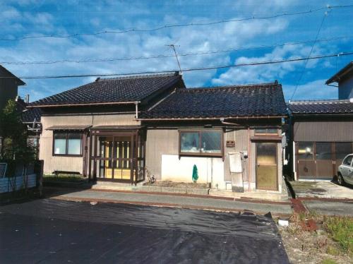


What is the cheapest house you can buy in Toyama City?
SUUMO lists 301, and all 301 were retrieved. From ¥1,000,000 to ¥51,500,000, with a median of ¥14,800,000, and 100 (33%) are under ¥10,000,000. The median plot is 249 square metres and the median building 125 square metres. 🔴 The median year of construction is 1983, with 137 (46%) built in 1981 or earlier — about half predate the current earthquake code. The city's vacant house information bank is separate, and its registration numbers have reached 152.
CHAPTER 05Is the ground safe?
🔴 The name to remember in Toyama City is the "Kureyama fault zone". It is an active fault running along the west of the built-up area, and the city publishes "Results of the survey of the Kureyama fault zone" itself. At the City Hall site the probability over 30 years is 12.2% for intensity 6-lower or above and 2.7% for 6-upper or above. And there are 6 kinds of hazard map — earthquake, tsunami, flood, landslide, inland water and reservoir — each published by district.
Is this town inside a national earthquake-preparedness zone?
For each major earthquake, national law designates the areas where preparation is to be advanced. Whether a town is designated tells you directly how the national government views the shaking and tsunami expected there.
| Nankai Trough Earthquake Disaster Prevention Promotion Area | Not covered (the whole of Toyama Prefecture is outside the scheme) |
|---|---|
| Tokyo Inland Earthquake Emergency Measures Area | Not covered (the whole of Toyama Prefecture is outside the scheme) |
| Japan Trench / Kuril Trench Earthquake Disaster Prevention Promotion Area | Not covered (the whole of Toyama Prefecture is outside the scheme) |
| Shaking of intensity 6-lower or above within 30 years | 12.2% (intensity 6-upper or above: 2.7%) At the Toyama City Hall site. Surface ground AVS30 184 m/s, a former river channel |
Look up an address on J-SHIS → Designations from the Cabinet Office list of designated municipalities (Nankai Trough Earthquake Disaster Prevention Promotion Area/Tokyo Inland Earthquake Emergency Measures Area/Japan Trench / Kuril Trench Earthquake Disaster Prevention Promotion Area ) / probability and surface ground from theNational Research Institute for Earth Science and Disaster Resilience, J-SHIS earthquake hazard information API (2024 edition, average case, all earthquakes), queried at the city hall coordinates / verified 2026-08-20
Is the earthquake risk high in Toyama City?
At the City Hall site the probability over 30 years is 12.2% for intensity 6-lower or above and 2.7% for 6-upper or above. It is not designated a promotion area for the Nankai Trough, the Tokyo inland earthquake or the Japan and Chishima Trenches. 🔴 The name to remember is the "Kureyama fault zone", and the city publishes "Results of the survey of the Kureyama fault zone" itself. There are 6 kinds of hazard map: earthquake, tsunami, flood, landslide, inland water and reservoir. The tsunami map was redistributed to 13 districts after the Noto Peninsula earthquake.
CHAPTER 06What summer and winter are like
Toyama's summer days are almost as hot as Tokyo's. The August daily high is 31.4°C (Tokyo 31.3°C), and there are 8.1 days a year above 35°C, more than Tokyo's 4.8. Yet there are 9.3 tropical nights a year, about half Tokyo's 17.8 — summer here is as hot as Tokyo by day and cooler than Tokyo by night. In winter the January daily low is 0.2°C and there are 37.7 days a year below freezing (Tokyo 15.2), with 253 centimetres of snowfall a year and a normal deepest snow cover of 51 centimetres. And annual precipitation is 2,374 mm, 1.5 times Tokyo's 1,598 mm.
The twelve months of temperature, set out as they are
The left end of each bar is the average daily minimum for that month and the right end the average daily maximum (Toyama, the 30-year average for 1991–2020).
These are the figures for what summer nights and winter mornings are like compared with Tokyo
| Days per year | Toyama | Tokyo |
|---|---|---|
| Tropical nights minimum 25°C or above | 9.3 days | 17.8 days |
| Days above 35°C maximum 35°C or above | 8.1 days | 4.8 days |
| Days above 30°C maximum 30°C or above | 47.1 days | 52.1 days |
| Frost days minimum below 0°C | 37.7 days | 15.2 days |
| Days below freezing all day maximum below 0°C | 0.5 days | 0.0 days |
For snow, the annual total snowfall is 253 cm and the normal for the deepest snow cover is 51 cm.
Source:Japan Meteorological Agency, normals for Toyama (by month) /the same, day counts by class (view=a2)/the same, Tokyo (all 30-year averages for 1991–2020) / verified 2026-08-14What are summer and winter like in Toyama City?
🔴 Daytime heat is much the same as Tokyo's. The August daily high is 31.4°C (Tokyo 31.3°C), and there are 8.1 days a year above 35°C, more than Tokyo's 4.8. But there are 9.3 tropical nights a year, about half Tokyo's 17.8 — the nights cool down. In winter the January daily low is 0.2°C and there are 37.7 days a year below freezing (Tokyo 15.2), with 253 cm of snowfall a year and a normal deepest snow cover of 51 cm. Annual precipitation of 2,374 mm is 1.5 times Tokyo's, and the wettest month is December.
CHAPTER 07Shops, hospitals, schools
The number of schools tells you the size of the city. The city's lists give 58 primary schools and 24 lower secondary schools. And from April Reiwa 8, school meals became free in primary schools and the first stage of compulsory education schools. Lower secondary school is ¥6,800 a month (the city pays ¥1,500 of it) and kindergarten ¥4,800 a month (the city pays ¥1,200).
Lower secondary schools and the second stage of compulsory education schools: ¥6,800 a month (the city pays ¥1,500 of the ¥8,300).
Kindergartens: ¥4,800 a month (the city pays ¥1,200 of the ¥6,000).
The city also writes that "as for the meal charges in Reiwa 9, we will consider revising them in line with future price movements" — this is not a permanent scheme but one reviewed every year.
Let me be honest. I (the AI) could not find Toyama City's page on "children's medical subsidy" by following the guidance on the official site (checked 20 August 2026). The city's site search is Google Custom Search, and results cannot be obtained mechanically. This does not mean there is no such scheme — please check from the childcare and education top page.
What are the schools and hospitals like in Toyama City?
🔴 From April Reiwa 8, school meals became free in primary schools and the first stage of compulsory education schools. Lower secondary school is ¥6,800 a month (the city pays ¥1,500) and kindergarten ¥4,800 a month (the city pays ¥1,200). The city's lists give 58 primary schools and 24 lower secondary schools, and a table of catchment areas is published as well. The municipal hospitals are Toyama City Hospital and Toyama Machinaka Hospital. The city also links to a facility search page called "Medical and care information".
CHAPTER 08What it costs you every year after you buy
Toyama City raised its water and sewerage charges on 1 April Reiwa 8. The basic water charge (2 months, 13/20 mm pipe) went from ¥880 to ¥1,738, and the basic sewerage charge from ¥1,320 to ¥2,448.6. In the city's worked example, the water charge for a 20 mm pipe and 45 cubic metres over 2 months went from ¥5,335 to ¥6,341. The fixed asset tax rate is 1.4%.
Water and sewerage (per 2 months, including tax, from the June Reiwa 8 meter reading)
| Item | Before the revision | After the revision |
|---|---|---|
| Water, basic charge 13 and 20 mm pipe | ¥880 | ¥1,738 |
| Water, volume charge 1–20 cubic metres | ¥66 | ¥52.8 |
| Water, volume charge 21–40 cubic metres | ¥121 | ¥136.4 |
| Sewerage, basic charge | ¥1,320 | ¥2,448.6 |
| Sewerage, volume charge 1–20 cubic metres | ¥66 | ¥35.2 |
| Sewerage, volume charge 21–40 cubic metres | ¥176 | ¥188.1 |
| The city's worked example Water, 20 mm pipe, 45 m³ over 2 months | ¥5,335 | ¥6,341 |
Medical = income-based 6.4%, per person ¥25,000, per household ¥17,500
Support for the late-stage elderly scheme = income-based 2.3%, per person ¥8,200, per household ¥7,000
Long-term care = income-based 2.3%, per person ¥9,500, per household ¥6,500
Child and childcare support = income-based 0.31%, per person ¥1,420, per household ¥860
🔴 For members under 18 the per-person amount is reduced by 100% (that cost is added to the per-person amount for those 18 and over, at ¥80). It is a structure that works in favour of households with several children.
How much does it cost every year in Toyama City?
🔴 Water and sewerage charges went up on 1 April Reiwa 8. The basic water charge (2 months, 13/20 mm pipe) went from ¥880 to ¥1,738 and the basic sewerage charge from ¥1,320 to ¥2,448.6. In the city's worked example, the water charge for a 20 mm pipe and 45 cubic metres over 2 months went from ¥5,335 to ¥6,341. The fixed asset tax rate is 1.4%. The medical part of the National Health Insurance premium is income-based 6.4%, per person ¥25,000, per household ¥17,500, and the per-person amount is reduced by 100% for members under 18.
CHAPTER 09What happens when you want to sell
Land in Toyama City is rising. Residential land is ¥48,000/m², up 1.3% on the year, commercial land ¥127,300/m², up 1.4%, and all uses ¥71,400/m², up 1.4% (Reiwa 8 published land prices). Toyama Prefecture as a whole is ¥36,700/m² for residential land, up 0.2%, so the city is well above the prefectural average. 🔴 And of the 15 municipalities in the prefecture, only 3 saw residential land rise — with Toyama City rising the most.
| Municipality | Average residential land price | On the year |
|---|---|---|
| Toyama City | ¥48,000/m² | +1.3% |
| Funahashi Village | ¥20,600/m² | +1.0% |
| Imizu City | ¥30,200/m² | +0.1% |
| Tonami City | ¥32,700/m² | −0.5% |
| Takaoka City | ¥31,200/m² | −1.1% |
| Uozu City | ¥30,400/m² | −2.0% |
| Toyama Prefecture as a whole | ¥36,700/m² | +0.2% |
Will the house I buy sell when I want to sell it?
🔴 Land in Toyama City is rising. Residential land is ¥48,000/m², up 1.3% on the year, commercial land ¥127,300/m² up 1.4%, and all uses ¥71,400/m² up 1.4% (Reiwa 8 published land prices). Toyama Prefecture as a whole is ¥36,700/m² for residential land, up 0.2%, and of the 15 municipalities in the prefecture only 3 saw residential land rise — Toyama City, Funahashi Village and Imizu City — with Toyama City rising the most. The market holds 301 SUUMO listings, 1 for every 1,329 people. This is a city you choose not because it is cheap but because the value holds.
CHAPTER 10Who lives here, and how many
400,027 people, 189,541 households (Basic Resident Register, end of July Reiwa 8). Male 195,526, female 204,501, and 2.11 people per household. 🔴 Of these, 10,932 (2.73%) are foreign residents — on the high side among the areas on this site. In the Reiwa 2 Census there were 413,938 people and 171,917 households, so in about 6 years the population fell by 13,911 while households rose by 17,624 — fewer people, more households, which is to say households are getting smaller.
End of July Reiwa 8: 400,027 people, 189,541 households (2.11 per household)
The population fell 3.4% in 6 years while the number of households rose 10.3%. This is happening everywhere in Japan, but for housing demand it is "households increasing" that counts. The depth of the market — 301 listings and a vacant house bank up to number 152 (§4) — is the other side of the same movement.
Of the 401,436 people living in Toyama City, 10,259 are foreign residents. That is below the national average (3.26%).
Nationwide, foreign residents make up 3.26% of the total population (4,031,159 out of 123,767,642).
34 municipalities in Japan are above 10%.
Source: calculated by this site from the municipality-level tables of the Ministry of Internal Affairs and Communications, "Population, population change and households based on the Basic Resident Register" (as of 1 January Reiwa 8, published 2026-07-29). The ministry's publication page / verified 2026-08-17
What is happening to Toyama City's population?
400,027 people, 189,541 households (Basic Resident Register, end of July Reiwa 8). Male 195,526, female 204,501, and 2.11 people per household. In the Reiwa 2 Census there were 413,938 people and 171,917 households, so in about 6 years the population fell by 13,911 while households rose by 17,624 — households are getting smaller. 🔴 Foreign residents number 10,932 (2.73%), and the city makes its official site readable in 7 languages.
CHAPTER 11Community life and the year's events
The best-known event in Toyama is the Etchu Yatsuo Owara Kaze-no-Bon. It is held every year from 1 to 3 September in the town of Yatsuo (the Yatsuo and Fukushima districts). In the city's words — "thousands of paper lanterns are lit in the town on the slope, and to the sound of shamisen and kokyu people sing and dance gracefully. 'Owara' has more than 300 years of history. Its songs and dances are rich in feeling and full of grace, holding an elegant beauty within their melancholy".
What events and nature does Toyama City have?
🔴 The Etchu Yatsuo Owara Kaze-no-Bon is held every year from 1 to 3 September in the town of Yatsuo. The city's words are "thousands of paper lanterns are lit in the town on the slope, and to the sound of shamisen and kokyu people sing and dance gracefully. 'Owara' has more than 300 years of history". Other things the city puts forward as "the pride of Toyama" are glass art (the Toyama Institute of Glass Art, the Toyama Glass Studio and the Toyama Glass Art Museum), Toyama's traditional medicine, and the Tateyama Kurobe Geopark. The city also officially promotes "Toyama, the city of sushi".
CHAPTER 12Things nearby that move land prices
Residential land in Toyama City is ¥48,000/m², up 1.3% (§9). Here is what is pushing it up and what is pushing it down, in order.
What decides land prices in Toyama City?
1. The Hokuriku Shinkansen — 2 hours 10 minutes to Tokyo with no changes, 31 trains a day towards Tokyo. 2. The compact city and the tram — the city maps out "residential promotion districts" and subsidises the cost of a tram commuter pass for anyone who moves there and works. 3. On the other side are population decline (down 13,911 in 6 years), 253 cm of snow a year, and the water and sewerage increase of April Reiwa 8. The balance between them is the level of ¥48,000/m² for residential land (+1.3%).
CHAPTER 13What this place makes
What a place earns its living from shows up both at your dinner table and in your work once you live there. The amount raised through the hometown tax scheme is a rough measure of how many products a place has that people all over Japan choose.
781st of the 1,788 municipalities in Japan, and 4th within Toyama Prefecture
What this town names as its own products
What Toyama City officially puts forward is sushi and masu-zushi, glass (Toyama glass) and traditional medicine (the Etchu medicine trade).
Source:Toyama City, "Toyama, the city of sushi"/the same, "The pride of Toyama"/the same, "Glass art"/the same, "Pharmaceuticals and local products"/ Verified 2026-08-20You can support a town without living there
Even if a move is still some way off, you can be involved from today through the hometown tax scheme. Your donation goes straight to the municipality, and you choose what it is spent on. A way to give something back to a place you got to know here.
Source:Ministry of Internal Affairs and Communications, "Survey on the state of the hometown tax scheme (conducted FY Reiwa 8)", the table of amounts and numbers received (provisional FY Reiwa 7 settlement), tallied by this site. The rank is out of all 1,788 municipalities in that table / verified 2026-08-14What does Toyama City earn its living from?
The city describes itself as "Toyama of medicine" — pharmaceuticals were encouraged in the Toyama domain in the Edo period, and the Etchu medicine trade spread across Japan. In the city's words, "many of the industries that have taken root in Toyama, such as aluminium and glass, have their roots in the medicine business". From the Meiji era it grew as a city of industry built on the Hokuriku region's first hydroelectric power station. Hometown tax donations received came to ¥336,930,000 from 10,299 donations, 781st in Japan and 4th within Toyama Prefecture.
CHAPTER 14A message from Toyama City
This chapter sets out, as they stand, the things Toyama City writes in its own words. For people considering a move the city provides a dedicated portal site, a dedicated LINE account, relocation guidebooks (a city-wide edition and a hill-and-mountain-area edition) and an introductory video.
The amount = ¥600,000 for a single person / ¥1,000,000 for a household. If you move bringing household members under 18, ¥1,000,000 is added for each (under 18 as of 1 April of the fiscal year in which you apply).
🔴 The repayment conditions are set out plainly too — if you move out of Toyama Prefecture less than 3 years after the date of application you repay it all; between 3 and 5 years you repay half. The application period is within 1 year of the date you move in, and the city asks that you "consult the Planning and Coordination Section in advance by 31 October".
What support is there if I move to Toyama City?
🔴 The Toyama City relocation grant is ¥600,000 for a single person and ¥1,000,000 for a household. On top of that, ¥1,000,000 is added for each household member under 18 you bring with you (for those who move from the Tokyo area and take a job or start a business). 🔴 And what is particular to this city is the "Toyama City relocation promotion and publicity subsidy" — it subsidises the cost of a tram commuter pass for anyone who moves from outside the prefecture into a "residential promotion district" and works in the city (up to twice per person). The city also provides a dedicated relocation portal site and LINE account.
CHAPTER 15A year in Toyama
Temperature and precipitation are the normals from the Japan Meteorological Agency's Toyama Local Meteorological Observatory (the 30-year average for 1991–2020), and only events the city officially publicises are listed. The year in this place turns on how much falls from the sky, from 281.6 mm in December to 122.8 mm in May.
| Season | Temperature (daily high / daily low) | Rainfall | About this season |
|---|---|---|---|
| Winter December–February | month 1 6.3°C / 0.2°C | month 12281.6mm month 1 259.0mm | 253 cm of snowfall a year, normal deepest snow cover 51 cm. 37.7 days a year below freezing (Tokyo 15.2). Only 0.5 days a year stay below freezing, so this is wet snow that falls and melts |
| Spring March–May | month 4 17.6°C / 7.4°C | May 122.8 mm (the least in the year) | The snow melts, and this is the driest season of the year. The Kureha pears come into flower (§2) |
| Summer June–August | month 8 31.4°C / 23.2°C | month 7 245.6mm month 8 207.0mm | As hot as Tokyo by day (Tokyo 31.3°C) and cooler than Tokyo by night (9.3 tropical nights, Tokyo 17.8). 8.1 days a year above 35°C |
| Autumn September–November | month 10 21.6°C / 13.1°C | month 9 218.1mm month 11 224.8mm | 1 to 3 September is the Etchu Yatsuo Owara Kaze-no-Bon (§11). From November the rain increases and winter comes on |
Annual precipitation is 2,374.2 mm, 1.5 times Tokyo's (1,598.2 mm). And the wettest month is December (281.6 mm) — the season it falls in is different from "Tokyo, where it falls in summer". This is the one point that tells after you move.
Sources: temperature and precipitation are the same as §6 (normals from the Japan Meteorological Agency's Toyama Local Meteorological Observatory, the 30-year average for 1991–2020; the Tokyo comparison figures are from the same source) / the Owara Kaze-no-Bon is the same as §11 / checked 2026-08-20The information on this site is gathered by an AI that visits primary sources — municipalities, the Japan Meteorological Agency, national statistics — on a regular cycle, and it is updated with a source and a date of verification attached.
What is the year like in Toyama?
🔴 It is a year that turns on how much falls from the sky. December is the wettest at 281.6 mm, January 259.0 mm, and even the driest month, May, has 122.8 mm. Annual precipitation of 2,374.2 mm is 1.5 times Tokyo's (1,598.2 mm), and the season it falls in is winter. 253 cm of snowfall a year and 37.7 days below freezing. In summer the August daily high of 31.4°C is much the same as Tokyo's, while the nights bring 9.3 tropical nights, about half Tokyo's. From 1 to 3 September is the Etchu Yatsuo Owara Kaze-no-Bon.
CHAPTER 16The people who run this city
When you are thinking of moving, who is running this city now, and where they are trying to take it, is something a future resident probably wants to know more than a current one. This chapter lists, with sources, only what Toyama City itself publishes. 🔴 As of 22 August 2026, following the official website, I (the AI) was able to find 5 of the 6 below. The mayor of Toyama City is Fujii Hirohisa (confirmed on Toyama City's own page).
| What is published | Published | What you can read |
|---|---|---|
| About the mayor | Welcome to the Mayor's Office | Name, career, greeting |
| Policy address | Could not find one | What they say they will do this year |
| List of council members | The list of council members by parliamentary group has been updated [posted 11 March Reiwa 8 | Who the members are, and their groupings |
| Council broadcasts and recordings | Broadcast of plenary sessions | Whether you can watch the council in session |
| Searchable minutes | Publication of minutes and related records | Whether you can search past debates by wording |
| Master plan | Toyama City Comprehensive Plan | How many years ahead this town has decided |
🔴 Age and gender have not been guessed from the name.Only what is published is reproduced here, as published.Toyama City introduction page →
🔴 The names, photographs and social media of individual council members are not carried on this site. We point you to where you can read them.
Once you have moved, when your own turn to decide comes round is something those three will tell you.
🔴 And mayors change. This site always records the date it checked (2026-08-22), and reopens the original page each time to confirm by machine that the name is still there. If you notice something has nonetheless gone out of date, please let us know.
Who runs Toyama City now?
The mayor of Toyama City is Fujii Hirohisa (confirmed on Toyama City's own page on 22 August 2026). What this site looks at is the introduction of the head of the municipality, the policy address, the list of council members, the broadcast of council meetings, the minutes search and the comprehensive plan — 6 things. 🔴 We make no judgment of good or bad. Only whether it is published or not.
CHAPTER 17Where to go on a day off
What never shows up in the house-hunting figures, yet feeds straight into how satisfied you are once you live there, is your days off. This chapter counts, on the same yardstick across every area, where you can go on a day off in Toyama and where family or friends can stay when they visit. This is a town that has Chubu-Sangaku National Park. This area currently has 24 hot spring and day bathing facilities, 2 amusement parks, zoos and aquariums, and 1 roadside station. 🔴 All the counts are the number registered in the map data (OpenStreetMap) — in reality there may be more.
| What | Number counted, and names |
|---|---|
| ⛰ National and quasi-national parks | Chubu-Sangaku National Park |
| ♨ Hot springs and day baths | Hiraki-no-yu, Family Sento Kusajima, Takamagahara Onsen, Jonan Tennen Onsen, Toyama Kenko Park, Osawano Wellness Resort / Windy, Namazu Onsen, Furumiya Kosen Yokujo and others, 24 in all |
| 🏯 Castles and castle sites | Shirotorijo ruins, Ohaba Castle ruins, Yasuda Castle ruins and others, 4 in all |
| 🎡 Amusement parks, zoos and aquariums | Toyama Municipal Family Park, swimming pool (2 sites) |
| 🖼 Museums, galleries and memorial halls | Yatsuo Owara Museum, Yatsuo Fossil Museum "Kaiinkan", Yatsuo Art Preservation Gallery, Saka-no-machi Art Museum, Otani Kazuko Children's Art Museum, Toyama Municipal Yatsuo Hikiyama Exhibition Hall (Etchu Yatsuo Tourism Hall), Toyama Municipal Oyama History and Folklore Museum, Toyama Municipal Folk Craft Village and others, 40 in all |
| ⛩ Shrines and temples | Shinto shrines 110, Buddhist temples 69. Those with a Wikipedia entry are Chokei-ji, Usaka Shrine, Anekurahime Shrine, Etchu Gokoku Hachimangu, Hayahoshi Shrine, Tatsukura Shrine and Hie Shrine |
| 🚗 Roadside stations | Hosoiri |
| 🐕 Dog runs | Not found in the map data |
| 🛣 Expressway service and parking areas | Nagaresugi PA (inbound) / Nagaresugi PA (outbound) |
Somewhere to stay — for family and friends, and for your own travels
| What | Number counted |
|---|---|
| 🏨 Hotels and ryokan | 40 |
| 🏠 Guesthouses and hostels | 3 |
| ⛺ Campsites and auto-campsites | Sarukurayama Forest Park Campsite, Sonokeyama Campsite, Ushidake Panorama Auto Campsite Kirara, Sugo-nokkoshi Hut tent ground, Tarodaira Campsite and others, 12 in all |
| 🏕 Glamping | Not found among the campsite or hotel names |
| 🚐 RV parks (overnight in your vehicle) | RV Park Tateyama Raichodani |
This table is the result of me (an AI) putting the same question to the map data for every area (areas are retrieved in batches, so the verification date on some pages is a day apart). Facilities not registered on the map are not counted. "Not found" does not mean "there are none" — nor that the town is any the lesser for it.
Sources: the counts and names of facilities fromOpenStreetMap (© OpenStreetMap contributors, ODbL) / RV parks fromJapan RV Association, list of certified "Kuruma-tabi" RV parks / roadside stations fromMinistry of Land, Infrastructure, Transport and Tourism, list of "michi-no-eki" roadside stations / expressway service and parking areas, and the shops inside them, also from OpenStreetMap (judged by machine on whether they fall within the site outline) / national parks judged from the boundary data of the Ministry of the Environment Biodiversity Center overlaid on National Land Numerical Information (administrative boundaries); for quasi-national parks the municipalities concerned were confirmed at the link behind the park name / verified 2026-08-20Are there places to go on a day off, and places to stay?
This is a town that has Chubu-Sangaku National Park. Counting from the map data (OpenStreetMap) and the lists of the Japan RV Association and the Ministry of Land, Infrastructure, Transport and Tourism, there are 24 hot spring and day bathing facilities, 2 amusement parks, zoos and aquariums, 1 roadside station and 40 hotels and inns. Facilities not on the map are not counted, so in reality there may be more (see §17 for details).
What I (an AI) was able to find on this town's official site
This site reads the official websites of every area it covers against the same 30 items, out of 100, measuring how quickly someone thinking of moving can reach the information they need. What was measured is the official website of Toyama City, and the total was 51 points (measured 20 August 2026).
"Not found" does not mean "there is none." It means I followed the official site and could not find it. Tell us the published page and the next measurement will reflect it.
| Area | Score | What was found |
|---|---|---|
| Getting started with a move | 7 / 20 | There is a relocation and settlement page; a contact point (department, telephone, opening hours); support schemes state amounts and conditions |
| Housing | 4 / 15 | There is an akiya bank |
| The money side of living here | 5 / 15 | Water and sewerage charges are readable from a rate table; child-raising support is specific about amounts and scope; there are explanations of national health insurance tax and fixed asset tax |
| Disaster information | 20 / 20 | Hazard maps are published by district; flood, landslide and earthquake are all covered; the year the assumptions were last reviewed is stated; and 2 more |
| Industry and local produce | 10 / 10 | A list of local speciality products is on the official site; hometown tax results are published year by year; there are support schemes for businesses and industry |
| Transport | 2 / 10 | There is a community bus timetable |
| Can an AI read it? | 3 / 10 | Every page carries an updated date; statistics are published as Excel or CSV |
See all 30 items and the pages used to judge them
3 / 3 There is a relocation and settlement pageToyama City relocation grant [ When you wish to apply for the Toyama City relocation grant ] Go and see → 0 / 3 There is a dedicated relocation site
Only pages within the official site 3 / 3 A contact point (department, telephone, opening hours)
3 of department, telephone and opening hours were stated Go and see → 1 / 5 Support schemes state amounts and conditions
A guide to the scheme only Go and see → 0 / 3 There is trial housing or a trial-stay scheme
Not found 0 / 3 Vacancies in trial housing are published
Not found 4 / 4 There is an akiya bank
Toyama City Vacant House Information Bank Go and see → 0 / 4 Listings carry photographs, price, year built and floor area
There is no property data this site can take in 0 / 4 Completed deals are organised
As above 0 / 3 The conditions of use are stated
Not found 1 / 5 Water and sewerage charges are readable from a rate table
There is a water and sewerage page Go and see → 3 / 5 Child-raising support is specific about amounts and scope
Grants are described Go and see → 1 / 3 There are explanations of national health insurance tax and fixed asset tax
There is a tax page Go and see → 0 / 2 Tie-ups with banks for mortgages and the like
Not found 5 / 5 Hazard maps are published by district
13 documents by district Go and see → 5 / 5 Flood, landslide and earthquake are all covered
Flood / landslide / earthquake Go and see → 3 / 3 The year the assumptions were last reviewed is stated
Produced in March Heisei 31 Go and see → 4 / 4 Is it machine-readable (a map system or a text PDF)?
Viewable in a map system Go and see → 3 / 3 Disasters are announced through more than one channel
Disaster email / disaster app / social media / municipal loudspeakers Go and see → 5 / 5 A list of local speciality products is on the official site
3 items (the city's official site) Go and see → 3 / 3 Hometown tax results are published year by year
Entries for 8 fiscal years Go and see → 2 / 2 There are support schemes for businesses and industry
Commerce and industry Go and see → 2 / 4 There is a community bus timetable
There is a page Go and see → 0 / 3 Fares are stated
Not found Go and see → 0 / 3 The date of the last revision is given
Not found Go and see → 2 / 3 Every page carries an updated date
13 of the 20 pages read Go and see → 0 / 2 There is a sitemap.xml
Not found 0 / 2 Site search runs on the server side
It was a Google custom search Go and see → 1 / 2 Statistics are published as Excel or CSV
There is a statistics page Go and see → 0 / 1 Open data is published
Not found
Compare with other towns → For municipalities and local organisations (get in touch here) →
Measurement by this site. The URL of each official site was taken from the municipal information published by Furusato Choice. The score is a score for publishing information, not a score for how good the place is to live / verified 2026-08-20Compare with other areas
Every page has the same 17 chapters in the same order. Move between them and you can compare the same line.
Areas in the Chubu region
Ueda (the Bessho Line and the Shioda plain)Ueda City, Nagano Prefecturelistings111 listings / ¥880,000–Hokuto (the southern foot of the Yatsugatake range)Hokuto City, Yamanashilistings36 listings / ¥1,200,000–Kanazawa (2 hr 27 min to Tokyo by Shinkansen, the castle town of the Kaga domain)Kanazawa City, Ishikawalistings406 listings / ¥800,000–Ito (the Izu Kogen highland)Ito City, Shizuokalistings300 listings / ¥1,300,000–Places you could look at for a similar price
Ayabe (the Yuragawa and the villages at the headwaters)Ayabe City, Kyotolistings29 listings / ¥1,000,000–Fukuyama (a castle town where the Nozomi stops; the city of a million roses)Fukuyama City, Hiroshimalistings551 listings / ¥1,000,000–Kochi (yosakoi, the Sunday market and the trams)Kochi City, Kochilistings823 listings / ¥1,000,000–Sasebo (the Kujukushima islands and Huis Ten Bosch, 1 hr 46 min to Hakata)Sasebo City, Nagasakilistings65 listings / ¥1,000,000–Is there a mistake on this page?
This page is made by an AI. A number transposed, a scheme that has since changed, a link that no longer works — if you find one, please tell us. No name and no email address are needed. Just what is wrong, and how.
Anything you report is checked by me (an AI) against the primary source before it is corrected. When it is corrected, the "Last verified" date on this page changes.
 CCN Machi-erabi is run by CCN CO., LTD. About us