This page is a relocation summary written by an advanced AI
It is not a personal opinion piece written by a human. An AI gathered official information published on the internet — municipal and national statistics, the Japan Meteorological Agency, railway companies, property portals — and rebuilt it into a form that someone considering a move can read and act on. Every figure carries a source link and the date it was checked, so please confirm anything that matters to you against the original document. Rules and prices change. Always check the latest information yourself before you sign anything.
Moving to Tateyama
From Tateyama Station to Tokyo Station: one express bus, no transfers, 1 hour 54 minutes at the fastest. Buses for Tokyo Station and for Shinjuku (Busta Shinjuku) leave alternately every 30 minutes from 5 in the morning until the evening. There are 29 departures a day from Tateyama Station (16 for Tokyo, 13 for Shinjuku), the first at 5:00 and the last at 20:00. The fare is ¥2,700. Population 41,127, area 110.05 square kilometres, 34.3 kilometres of coastline.
🔴 And what sets Tateyama apart most is its temperature. The city's statistical yearbook opens with the words "Tateyama, blessed with a natural setting that is warm in winter and cool in summer…" — in the Japan Meteorological Agency's normals, days above 35°C average 0.5 a year and days below 0°C all day average 0.0. It reaches 35°C only once every two years, and there is no day that stays below freezing. Tateyama Bay is a calm bay known as "Kagamigaura", and Mount Fuji and the Izu Islands are visible from it.
Population
41,127 people
2025 Population Census (preliminary) • 19,413 households
Homes for sale
32 listings
¥3,980,000– / median ¥20,900,000
To Tokyo
1 hr 54 min
Express bus • 0 transfers • ¥2,700
Residential land price
¥28,100/m²
+0.2% year on year / 21.6% of the Chiba Prefecture average
Medical costs for children
to the end of the school year at 18
¥300 per outpatient visit and per day of hospitalisation / no income limit
Days above 35°C
0.5 days a year
Tateyama observatory • Tokyo has 4.8 days
Days below 0°C all day
0.0 days a year
There is no day that stays below 0°C
City area
110.05km²
17 km east–west • 16 km north–south / 34.3 km of coastline
At the very south of the Boso Peninsula, on the east side of the entrance to Tokyo Bay. The "History" section of the city's statistical yearbook opens like this: "Tateyama, blessed with a natural setting that is warm in winter and cool in summer, flourished as the core city of the Awa region after Satomi Yoshiyasu moved his residence to Tateyama Castle in 1591 (Tensho 19)." Its position is 139°52′ east, 34°59′ north; area 110.05 square kilometres, 17 kilometres east to west and 16 kilometres north to south, with 34.3 kilometres of coastline. The land breaks down into 23.84 square kilometres of forest, 14.35 of paddy field, 11.02 of residential land and 8.45 of dry field, plus 45.00 square kilometres of roads and other uses. 21.7% of the city is forest and 20.7% is farmland — this is a town of the sea and, at the same time, a town of farming and forestry.
Tateyama Bay is called "Kagamigaura"From the city's statistical yearbook: "Of the 190 km of coastline, Tateyama City holds 34.3 km, and from it Mount Fuji and the Izu Islands can be seen. Tateyama Bay in particular is also known as 'Kagamigaura', a natural harbour with calm waves, and is famous nationwide as a supplier of the bait sardines that bonito fishing cannot do without.""Because Tateyama's climate is mild, it has been known since the Edo period as a place of white sand and green pines; many writers and artists stayed here, and these people can be said to have been the forerunners of its tourists." — Tateyama as a resort runs in an unbroken line from the Edo period.In 1958 (Showa 33), 7 cities and 3 towns including Tateyama City were designated as Minami-Boso Quasi-National Park.
The city was made from three towns and six villagesOn 3 November 1939 (Showa 14), the three towns of Tateyama-Hojo, Nago and Funakata merged to create Tateyama City (the fifth city in Chiba Prefecture). Its area then was 27.15 square kilometres. Then on 3 May 1954 (Showa 29) the six villages of Nishizaki, Kanbe, Tomisaki, Toyofusa, Tateno and Kokonoe (82.56 square kilometres) were absorbed, bringing it to 109.71 square kilometres.
Tateyama-Hojo Town had itself been formed in 1933 (Showa 8) by the merger of Tateyama Town and Hojo Town. Those "3 towns + 6 villages" survive today as the 10 districts described in §2. After that the area grew a little at a time through reclamation of public water surfaces, and after revisions by the Geospatial Information Authority of Japan it now stands at 110.05 square kilometres.
A castle town of the Satomi clan — and a military townFrom the city's chronology: around 1456 (Kosho 2) Satomi Yoshizane ruled Awa from Inamura Castle / in 1591 (Tensho 19) Satomi Yoshiyasu moved to Tateyama Castle and built the castle town / in 1614 (Keicho 19) Satomi Tadayoshi was transferred to Kurayoshi, ending Satomi rule. Publication of "Nanso Satomi Hakkenden" began (1814–1842), two hundred years later.
In modern times it was a military town: the Tateyama Naval Air Group was established in 1930 (Showa 5), followed by the Tateyama Naval Gunnery School and the Sunosaki Naval Air Group, and in the city's words this "deepened its character as a military city". US forces entered Tateyama in 1945 (Showa 20), and the Tateyama Air Group of the Coastal Safety Force (later the Maritime Self-Defense Force) was established in 1953 (Showa 28). "With the end of the war it regained its former quiet, and thereafter (…) it began to develop as a tourist city."
From "the tip of a peninsula" to "a town connected to the capital"In the city's words: "This region has the character of a peninsula, but with the opening of the Tokyo Bay Aqua-Line in 1997 (Heisei 9) and the full opening of the Tateyama Expressway in 2007 (Heisei 19), access to the city centre improved dramatically." As §3 shows, the reason 29 express buses a day now run from Tateyama Station to Tokyo Station and Shinjuku is those two roads.
After that came the Tateyama Sunset Pier (Tateyama Port multi-purpose tourist pier) in 2010 (Heisei 22) and the "Nagisa-no-Eki" Tateyama exchange hub in 2012 (Heisei 24). In the city's words, "we are advancing waterfront town-building that makes use of Tateyama Bay." The vision for the city's future is "Everyone in the lead — a town that is fun to live in and fun to visit: Tateyama" (5th Tateyama City Comprehensive Plan, March 2026).
Sources: position, area, coastline, current land use, history and chronology fromTateyama City, "Tateyama City Statistical Yearbook", the sections "Contents, history, changes in the municipal area" and "Land and weather" (PDF • "Tateyama Statistics 2024" • updated 17 July 2026 / position 139°52′ east, 34°59′ north / area 110.05 km², coastline 34.3 km, extent 17 km east–west and 16 km north–south / current land use as of Reiwa 6.1.1: total 110.05 km² = paddy field 14.35 • dry field 8.45 • residential land 11.02 • forest 23.84 • pasture 0.04 • wasteland 2.61 • miscellaneous land 4.74 • roads and other 45.00 / "Tateyama, blessed with a natural setting that is warm in winter and cool in summer, flourished as the core city of the Awa region after Satomi Yoshiyasu moved his residence to Tateyama Castle in 1591 (Tensho 19)" "On 3 November 1939 (Showa 14) the three towns of Tateyama-Hojo, Nago and Funakata merged and city status was granted, and Tateyama City was born" "On 3 May 1954 (Showa 29) the six villages of Nishizaki, Kanbe, Tomisaki, Toyofusa, Tateno and Kokonoe were merged in, forming the present Tateyama City" "The establishment of the Tateyama Naval Air Group in 1930 (Showa 5), followed in quick succession by the Tateyama Naval Gunnery School and the Sunosaki Naval Air Group, deepened its character as a military city" "In 1958 (Showa 33), 7 cities and 3 towns including Tateyama City were designated as Minami-Boso Quasi-National Park" "Of the 190 km of coastline, Tateyama City holds 34.3 km, and from it Mount Fuji and the Izu Islands can be seen. Tateyama Bay in particular is also known as 'Kagamigaura', a natural harbour with calm waves, and is famous nationwide as a supplier of the bait sardines that bonito fishing cannot do without" "Because Tateyama's climate is mild, it has been known since the Edo period as a place of white sand and green pines; many writers and artists stayed here, and these people can be said to have been the forerunners of its tourists" "This region has the character of a peninsula, but with the opening of the Tokyo Bay Aqua-Line in 1997 (Heisei 9) and the full opening of the Tateyama Expressway in 2007 (Heisei 19), access to the city centre improved dramatically" / changes in the municipal area: Showa 14.11.3 city status 27.15 km² • Showa 29.5.3 six villages absorbed 82.56 km², giving 109.71 km² • Heisei 26.10.1 revision by the Geospatial Information Authority 110.15 km² • Heisei 28.10.1 revision 110.05 km²) andthe same, "Tateyama City Basic Data"(updated 5 August 2026 / area of Tateyama City as of 1 April 2026: 110.05 km² • source: Geospatial Information Authority of Japan, Ministry of Land, Infrastructure, Transport and Tourism, "Survey of the area of prefectures and municipalities of Japan") / the chronology fromthe same, "The history of Tateyama"(updated 1 June 2023 / around 1456 (Kosho 2) Satomi Yoshizane ruled Awa from Inamura Castle / 1591 (Tensho 19) Satomi Yoshiyasu moved to Tateyama Castle and built the castle town / 1614 (Keicho 19) Satomi Tadayoshi was transferred to Kurayoshi / 1930 (Showa 5) the Tateyama Naval Air Group was established / 1945 (Showa 20) US forces entered Tateyama / 1953 (Showa 28) the Tateyama Air Group of the Coastal Safety Force (later the Maritime Self-Defense Force) was established / 1958 (Showa 33) the coast of southern Boso was designated a Quasi-National Park / 2010 (Heisei 22) the Tateyama Sunset Pier was completed / 2012 (Heisei 24) the "Nagisa-no-Eki" Tateyama exchange hub opened) / the vision for the city's future fromthe same, "Policy statement for fiscal 2026"(PDF • 25 February 2026, first regular session of the Tateyama City Council of 2026 / the vision for the town 10 years from now set out in the "5th Tateyama City Comprehensive Plan": "Everyone in the lead — a town that is fun to live in and fun to visit: Tateyama") / checked 2026-08-25
What kind of town is Tateyama City?
At the very south of the Boso Peninsula, on the east side of the entrance to Tokyo Bay. The city's statistical yearbook opens with the words "Tateyama, blessed with a natural setting that is warm in winter and cool in summer, flourished as the core city of the Awa region after Satomi Yoshiyasu moved his residence to Tateyama Castle in 1591 (Tensho 19)." Population 41,127 (2025 Population Census, preliminary • 19,413 households), area 110.05 square kilometres, 17 kilometres east to west and 16 kilometres north to south, 34.3 kilometres of coastline. 🔴 Tateyama Bay is a calm bay known as "Kagamigaura", and in the city's words "from Tateyama City, Mount Fuji and the Izu Islands can be seen."In 1958 (Showa 33) it was designated as Minami-Boso Quasi-National Park.
CHAPTER 0210 areas, and life in each
Tateyama City calls its own town "the 10 districts". The city's "History of Tateyama" page states that "Tateyama City, with both sea and mountains, is divided into the 10 districts of Tateyama, Hojo, Nago, Funakata, Nishizaki, Kanbe, Tomisaki, Toyofusa, Tateno and Kokonoe", and the page for people considering moving here links to it as "About Tateyama's 10 districts". As §1 explains, this is the shape of the 3-town-plus-6-village merger, preserved as it was, and the monthly "population by district" the city publishes, and the wild boar catch figures (§12), are both compiled by these 10 districts. This page uses the same 10 districts (population as of 1 August 2026, Basic Resident Register).
District
Population
listings
What kind of place it is (the city's description)
Hojo Hojo
12,330 people 6,652 households
2 listings 398–¥18,500,000
"The centre of Tateyama City, between the Heguri River and the Shioiri River. From the Meiji period on it developed as the political and economic core of Awa County, and once the railway station opened, the shopping street around it thrived."Tateyama Station, City Hall and Hojo Beach are here. The elevation of homes for sale is 4.8–6.9 metres
Tateyama Tateyama
10,354 people 5,989 households
5 listings 420–¥85,800,000
"In the centre of the city, laid out as the castle town of Tateyama Castle, built by the Satomi clan in the Warring States period, and prospering as a port town. It also has deep ties to the war — a naval air group was stationed here in the early Showa period."Shiroyama Park and the south shore of Tateyama Bay. Elevation 6.4–23.2 metres
Nago Nago
4,983 people 2,543 households
2 listings 1,430–¥19,990,000
"It has prospered since ancient times as the temple town of Nagoji, the 33rd stop on the Bando Kannon pilgrimage. It lies north of the Heguri River, and its west side faces Tokyo Bay. The south is flat and the north is mountainous, and rice growing, vegetables, dairy farming and fruit cultivation have been carried on here." The nearest station is Nako-Funakata. Elevation 4.3–5.5 metres
Tateno Tateno
3,221 people 1,674 households
3 listings 1,199–¥19,800,000
"An area spreading across the flat land in the east of Tateyama City. In the Nara period the provincial temple was placed here and it developed as the centre of Awa. Burial mounds, remains of the ancient jori land-division grid, and the historic site of Inamura Castle, the base of the Satomi clan, all remain. Rice and vegetable growing are active in this district, and pick-your-own strawberry farms in particular are one of its representative industries." Elevation 15.8–18.1 metres
Kanbe Kanbe
2,606 people 1,411 households
5 listings 2,950–¥137,000,000
"South of Tateyama, home to Awa Shrine, the first-ranked shrine of Awa Province. In ancient times the houses of the people who supported Awa Shrine stood here, which is why it is called Kanbe. On farmland protected by windbreak forest, vegetables such as lettuce and flowers are grown intensively."Its median asking price of ¥77,700,000 is the highest of the 10 districts (holiday homes and resort houses at Heisaura)
Funakata Funakata
2,527 people 1,403 households
3 listings 1,850–¥22,990,000
"Fishing has been active here for a long time and it is still one of Tateyama's main fishing bases. In the Edo period it prospered on the shipping trade that sent dried sardine fertiliser and firewood to Edo, and it is the birthplace of the bait sardines supplied to bonito boats. It was also known as a production area for Boshu uchiwa (round fans)."The Gake-Kannon (Daifukuji Temple) is here. At 3.4–7.6 metres its elevation is the lowest of the 10 districts
Nishizaki Nishizaki
2,153 people 1,240 households
8 listings 500–¥249,800,000
"It juts far out on the west side of the city and is surrounded by sea on three sides. Because the mountains come right down to the shore there is little flat land, and it has prospered on flower growing and fishing that make use of the mild climate."Sunosaki Lighthouse, Hasama and Ito. It has the most homes for sale, 8, and the highest price, ¥249,800,000, is here too
Toyofusa Toyofusa
2,058 people 1,073 households
4 listings 880–¥41,800,000
"A mountain-valley area in the south-east of Tateyama City. The land is rich and farming centred on rice has been carried on here since long ago. The Hata district is known as a leading producer of sen'ryo (coral berry), and many medieval remains survive at Kanamari and Nishinagata." At 13.7–90.6 metres, the elevation of homes for sale is the highest of the 10 districts
Kokonoe Kokonoe
1,512 people 780 households
—
"On the easternmost side of Tateyama City; it took this name when 9 villages merged. On the rich flatland, farming such as rice growing and dairying is carried on. Land development advanced here from the Nara period, and rock-cut tombs and Buddhist statues show that local magnates were active here in medieval times."Kokonoe Station on the Uchibo Line is here
Tomisaki Tomisaki
640 people 400 households
—
"A district at the southern tip of Tateyama City, facing the sea. There is little flat land and the houses gather around Tomisaki Fishing Port. Fishing has been active since long ago, and in the Meiji period it prospered on tuna longline fishing. It is the place where Aoki Shigeru painted 'A Gift of the Sea', and the birthplace of 'Awa-bushi', the song sung in the Awa region." Only the two oaza of Mera and Aihama
80% of the population lives in the 4 coastal districtsOf the 10 districts, Hojo 12,330, Tateyama 10,354, Nago 4,983 and Funakata 2,527 — these four hold 30,194 people, or 71.2% of the city. As §1 explains, these four are the 3 towns (Tateyama-Hojo, Nago, Funakata) that merged in 1939 (Showa 14) to become Tateyama City.
The remaining 6 districts (the 6 villages absorbed in 1954, Showa 29) are Tateno 3,221, Kanbe 2,606, Nishizaki 2,153, Toyofusa 2,058, Kokonoe 1,512 and Tomisaki 640, together 12,190 people. By area the 6 districts are far larger, and the people are gathered in the 4 — that is the map of Tateyama. Shops, schools, hospitals and the station are all concentrated in Hojo and Tateyama (§7).
Asking prices differ completely from district to districtAssigning the 32 listings to the 10 districts, the medians are Kanbe ¥77,700,000, Tateyama ¥29,800,000, Nishizaki ¥25,200,000, Tateno ¥19,100,000, Funakata ¥18,500,000, Nago ¥17,140,000, Toyofusa ¥15,850,000 and Hojo ¥11,240,000. That is a 7-fold spread.
The expensive properties in Kanbe and Nishizaki are holiday homes and resort houses built at Heisaura and along the shore (most built between 2015 and 2023). On the other hand, on the station side of Hojo, Tateyama, Nago and Funakata there are second-hand houses from ¥3,980,000 to the ¥20,000,000s. Within "the same Tateyama" the budget is a completely different world, so with the cards in §4, look at the district name before you look at the price.
The district names are the school namesAs §7 shows, the elementary schools are Funakata, Nago, Hojo, Tateyama, Nishizaki, Bonan, Kanamari, Toyofusa, Tateno and Kokonoe — almost the same names as the 10 districts (Bonan is the school formed in 2017, Heisei 29, by merging Kanbe and Tomisaki elementary schools). The junior high schools are also three: Tateyama, Daiichi and Bonan.
In April 2026 (Reiwa 8), Funakata and Nago elementary schools merged to become "Nako-Funakata Elementary School". Further, a reorganisation of the junior high schools is planned for April 2027 (Reiwa 9), and the merger of Hojo and Tateyama elementary schools for fiscal 2027 (§7). The district names and the school names will keep shifting a little at a time from here.
The 10 districts are also the unit of disaster managementAs §5 shows, the city compiled the damage from the 2019 Boso Peninsula Typhoon by district: "Tomisaki district: about 80%; Funakata and Nishizaki districts: about 50% of households suffered damage." The wild boar catch figures in §12 are also by district — Toyofusa 798, Kanbe 622 and Nishizaki 440, against 1 in Hojo.
The figures the city publishes almost always come out in these 10 districts. When a property catches your eye, first check which district it is in — the city's hazard maps and evacuation sites can all be looked up by this unit.
Sources: the division into 10 districts and the description of each district fromTateyama City, "The history of Tateyama"(updated 1 June 2023 / "Tateyama City, with both sea and mountains, is divided into the 10 districts of Tateyama, Hojo, Nago, Funakata, Nishizaki, Kanbe, Tomisaki, Toyofusa, Tateno and Kokonoe" / the description of each district is quoted directly from the body of that page). This page isthe same, "To everyone considering moving to Tateyama City"(updated 21 August 2026), where "STEP3 Housing" links to it as "About Tateyama's 10 districts" / population and households by district fromthe same, "Population by district, fiscal 2026"(Excel • Basic Resident Register population as of 1 August 2026 / total 42,384 people, 23,165 households / Tateyama district 10,354 people 5,989 households • Hojo district 12,330 people 6,652 households • Nago district 4,983 people 2,543 households • Funakata district 2,527 people 1,403 households • Nishizaki district 2,153 people 1,240 households • Kanbe district 2,606 people 1,411 households • Tomisaki district 640 people 400 households • Toyofusa district 2,058 people 1,073 households • Tateno district 3,221 people 1,674 households • Kokonoe district 1,512 people 780 households / this site matched the town-block population in the same table to the 10 districts and checked the values) / the property figures for each district are the same SUUMO data as §4, assigned to these 10 districts and tallied by this site (using the same correspondence table of town blocks as the Basic Resident Register) / checked 2026-08-25
Which part of Tateyama City should I live in?
🔴 Tateyama City calls its own town "the 10 districts" — Tateyama, Hojo, Nago, Funakata, Nishizaki, Kanbe, Tomisaki, Toyofusa, Tateno and Kokonoe. The populations are Hojo 12,330, Tateyama 10,354, Nago 4,983, Tateno 3,221, Kanbe 2,606, Funakata 2,527, Nishizaki 2,153, Toyofusa 2,058, Kokonoe 1,512 and Tomisaki 640 (1 August 2026). The median second-hand house price is Hojo ¥11,240,000, Toyofusa ¥15,850,000, Nago ¥17,140,000, Funakata ¥18,500,000, Tateno ¥19,100,000, Nishizaki ¥25,200,000, Tateyama ¥29,800,000 and Kanbe ¥77,700,000. The station, City Hall and the shops are centred on Hojo; the coastal resort houses are in Kanbe and Nishizaki.
CHAPTER 03Trains and cars — how you get around
The lead role in Tateyama is played by the express bus, not the train. From in front of Tateyama Station it is 1 hour 54 minutes at the fastest to Tokyo Station (Nihombashi exit), ¥2,700, with no transfer, and 2 hours 2 minutes to Busta Shinjuku, ¥2,700, with no transfer. These two leave alternately every 30 minutes from 5 in the morning until 16:30, and after that there are departures for Tokyo at 17:00, 18:00, 19:00 and 20:00, and for Shinjuku at 18:30. There are 29 departures a day from Tateyama Station (16 for Tokyo, 13 for Shinjuku), the first at 5:00 and the last at 20:00. A commuter pass costs ¥89,100 a month. From Tateyama Station on the JR Uchibo Line there are 21 trains a day towards Chiba (the first at 4:45) and 17 towards Awa-Kamogawa. The city has three stations: Tateyama, Nako-Funakata and Kokonoe.
How long it takes from Tateyama Station, and to where (searched live for Wednesday 26 August 2026, morning / express buses from the timetable revised on 12 December 2025)
Tateyama Station 10:00 → Tokyo Station Nihombashi exit 11:54 (Boso Nanohana No. 12). In the morning, 5:00 → 7:01 (2 hours 1 minute). 16 departures a day. Commuter pass ¥89,100 a month, ¥252,720 for 3 months. By train it is 2 hours 28 minutes and ¥3,180, changing to a limited express at Chiba
Tateyama Station 7:20 → Chiba Station 9:03. By JR Uchibo Line it is 1 hour 44 minutes (Tateyama 7:10 → Chiba 8:54, departing from Tateyama)
Kisarazu
1 hour 4 minutes 0 transfers (JR Uchibo Line)
Tateyama 7:10 → Kisarazu 8:14. By express bus it is about 50 minutes to the Kisarazu Hatorino bus stop
Nako-Funakata
4 minutes 0 transfers (JR Uchibo Line)
The neighbouring station in the city. Kokonoe is also 4 minutes from Tateyama (towards Awa-Kamogawa)
Haneda Airport
About 2 hours 30 minutes 1 transfer
In a straight line it is a close 62.8 kilometres, and it is the nearest airport from the city. As §17 notes, there is no airport inside Tateyama City
Departures a day from Tateyama Station (counted by this site on a weekday, 25 August 2026)
Line and direction
Services
First and last departure
Express bus towards Tokyo Station
16
5:00 – 20:00 (Boso Nanohana, on the hour)
Express bus towards Busta Shinjuku
13
5:30 – 18:30 (Shinjuku Nanohana, at half past each hour)
JR Uchibo Line towards Kisarazu and Chiba
21
4:45 〜 22:03
JR Uchibo Line towards Awa-Kamogawa
17
4:58 〜 22:54
"You can set off for Tokyo or Shinjuku every 30 minutes" — that is transport in TateyamaLaid out from the express bus timetable, departures from Tateyama Station run 5:00 Tokyo, 5:30 Shinjuku, 6:00 Tokyo, 6:30 Shinjuku, 7:00 Tokyo, 7:30 Shinjuku… — alternating neatly every 30 minutes until 16:30. After that come 17:00 Tokyo, 18:00 Tokyo, 18:30 Shinjuku, 19:00 Tokyo and 20:00 Tokyo. The journey takes 1 hour 54 minutes to 2 hours 6 minutes to Tokyo and 2 hours 2 minutes to Shinjuku, and barely varies.
The inbound direction (Tokyo → Tateyama) is the same: Tokyo Station Yaesu south exit 6:20 → Tateyama Station 8:10 = 1 hour 50 minutes, and Busta Shinjuku 8:50 → Tateyama Station 10:50 = 2 hours 0 minutes. Take the first bus at 5:00 and you reach Tokyo Station at 7:01. Seats are reserved, so you need to book before boarding.
Tateyama Station is not the only stopBefore Tateyama Station the express buses call at Highway Oasis Furari and Tomiura Biwa Club, and beyond Tateyama Station some services continue to Nanso Bunka Hall and Kokonoe Station (some Boso Nanohana services) or to Miyagi, Tautau Terrace Tateyama-mae, Awa-Shiomi, Nishizaki, Kyukamura-mae and Ito Fishing Port (beyond Tateyama Station they run as ordinary route buses).
In other words, even if you live in the Nishizaki district of §2, there are services you can board for Tokyo without changing at Tateyama Station.The ticket window in the Tateyama area is Kyukamura Tateyama.Paper commuter passes are not sold at Tateyama Station, so passes are smartphone passes.
Trains run roughly once an hourTateyama Station on the JR Uchibo Line has 21 trains towards Chiba and 17 towards Awa-Kamogawa. By hour that is 1 at 4, 2 at 5, 2 at 6, 1 at 7 and 2 at 8, then 1 an hour from 9 to 20, none at 21, and 1 at 22 (towards Chiba). Towards Awa-Kamogawa there are none at 5 and none at 20.
Nako-Funakata Station has 21 towards Chiba (3 at 6), and Kokonoe Station has 17 towards Tateyama. In the morning, trains towards Chiba start from Tateyama Station itself in the 7 o'clock hour — the 7:10 for Chiba passes 23 stations and arrives at 8:54, and changing there to the Shiosai limited express gets you to Tokyo at 9:34.
By car: the Tateyama Expressway and the Boso Flower LineAs §1 notes, the Higashi-Kanto Expressway Tateyama Route (the Tateyama Expressway) opened along its full length in 2007 (Heisei 19). There is, however, no expressway interchange inside Tateyama City — the nearest is Tomiura Interchange in Minamiboso City, where the Tateyama Expressway ends (beyond that it becomes the Futtsu-Tateyama Road and National Route 127).
The roads inside the city are National Route 127 (the Tateyama Bypass, fully opened in 1993, Heisei 5) and the "Boso Flower Line", opened in 1966 (Showa 41) as the Nanboshu Toll Road — a coastal road chosen as one of Japan's 100 finest roads. As §15 notes, rape blossoms bloom along it from January into February. Getting around inside the city, there is the city-centre circular bus "Kaimaru" and the on-demand service "Choisoko Minamiboso–Tateyama" run jointly with Minamiboso City; in fiscal 2026 the city will continue reviewing Kaimaru's operating method and timetable and trialling a public ride-share service in the late-night hours.
Sources: express bus times, fares and pass prices fromJR Bus Kanto, "Tokyo and Shinjuku – Kisarazu Hatorino, Kazusa-Minato, Tateyama and Awa-Shirahama (Boso Nanohana / Shinjuku Nanohana) digital timetable"(revised 12 December 2025 • operators JR Bus Kanto and Nitto Kotsu / outbound from Tateyama Station to Tokyo Station Nihombashi exit = 5:00→7:01, 6:00→8:01, 7:00→9:01, 8:00→10:06, 9:00→11:01, 10:00→11:54, 11:00→13:06, 12:00→14:01, 13:00→15:06, 14:00→16:06, 15:00→17:01, 16:00→17:54, 17:00→19:01, 18:00→19:54, 19:00→20:54, 20:00→22:01 = 16 services / from Tateyama Station to Busta Shinjuku = 5:30→7:32, 6:30→8:32, 7:30→9:32, 8:30→10:32, 9:30→11:32, 10:30→12:32, 11:30→13:32, 12:30→14:32, 13:30→15:32, 14:30→16:32, 15:30→17:32, 16:30→18:32, 18:30→about 20:32 = 13 services / inbound Tokyo Station Yaesu south exit 6:20 → Tateyama Station 8:10 and others / fares Tokyo Station ⇔ Tomiura Biwa Club–Tateyama Station–Kokonoe Station: ordinary fare ¥2,700 [¥2,650 on Kosoku Bus Net] • busy season ¥2,800 • peak season ¥3,000 • on board ¥3,100 / Busta Shinjuku ⇔ Tomiura Biwa Club–Tateyama Station: the same / commuter pass ¥89,100 for 1 month, ¥252,720 for 3 months; student pass ¥81,000 for 1 month, ¥218,700 for 3 months / "Seats are reserved, so please buy your ticket in advance" "* Paper commuter passes are not sold at Tateyama Station" / ticket window in the Tateyama area = Kyukamura Tateyama / "☆ Between Tateyama Station and Kyukamura, Ito Fishing Port, and between Awa-Kanbe and Awa-Shirahama, the buses run as ordinary route buses") / journey times fromYahoo! TransitforWednesday 26 August 2026as searched live by this site (Tateyama → Tokyo = depart 7:06, arrive 9:34, 2 hours 28 minutes, ¥3,180 [ticket ¥2,420 + limited express charge ¥760], 1 transfer [Tateyama 7:10, Uchibo Line starting here, for Chiba → Chiba 8:54 / Chiba 9:03, Shiosai limited express No. 8 for Tokyo → Tokyo 9:34], 129 km / Tateyama Station 7:20 → Chiba Station 9:03, express bus, Nitto Kotsu, Nanso Satomi, ¥1,680) / the services shown change from day to day / the number of Uchibo Line trains was counted by this site from the same Yahoo! Transit timetables ona weekday, 25 August 2026(Tateyama towards Kisarazu and Chiba 21 trains, 4:45–22:03 / Tateyama towards Kazusa-Ichinomiya and Awa-Kamogawa 17 trains, 4:58–22:54 / Nako-Funakata towards Kisarazu and Chiba 21 trains, 4:49–22:07 / Kokonoe towards Kisarazu and Tateyama 17 trains, 5:21–21:56) / airports and interchanges fromNational Land Numerical Information(C28 Airports, 2021 edition • N06 Expressways time series, 2025 edition), cross-checked against the city boundary by this site (0 airports and 0 interchanges or junctions inside Tateyama City / the nearest is Tokyo International Airport, 62.8 km in a straight line) / the opening years of the Tateyama Bypass, the Boso Flower Line and the Tateyama Expressway fromTateyama City, "The history of Tateyama"(1966 (Showa 41) the Nanboshu Toll Road (Boso Flower Line) opened / 1993 (Heisei 5) National Route 127 Tateyama Bypass fully opened / 2007 (Heisei 19) the Higashi-Kanto Expressway Tateyama Route fully opened) / Kaimaru, Choisoko and the ride-share fromthe same, "Policy statement for fiscal 2026"(PDF • "We will review the operating method and timetable of the city-centre circular bus 'Kaimaru' and aim to provide a sustainable mobility service" "We will continue to operate Choisoko Minamiboso–Tateyama, carried out as a project of the Settlement Self-Reliance Zone initiative, and will continue the trial operation of a public ride-share service in the late-night hours") / checked 2026-08-25
✈ Airports
The nearest is Tokyo International Airport (a hub airport managed by the national government), about 62.8 km in a straight line. 🔴 This is a straight-line distance. It is neither road distance nor journey time — please check the actual route with each operator's timetable.
🛣 Expressway junctions
There is no expressway entrance or junction inside this area. You will use an interchange in a neighbouring town.
🔴 From Tateyama Station to Tokyo Station (Nihombashi exit) it is one express bus, no transfers, 1 hour 54 minutes at the fastest, ¥2,700.To Busta Shinjuku it is 2 hours 2 minutes, also ¥2,700, and the two leave alternately every 30 minutes from 5 in the morning until 16:30. There are 29 departures a day from Tateyama Station (16 for Tokyo, 13 for Shinjuku), the first at 5:00 and the last at 20:00. A commuter pass is ¥89,100 a month. The JR Uchibo Line has 21 trains a day towards Chiba and 17 towards Awa-Kamogawa; by train it is 2 hours 28 minutes and ¥3,180 to Tokyo, changing to a limited express at Chiba. The city has three stations: Tateyama, Nako-Funakata and Kokonoe.
CHAPTER 04Homes actually on the market right now
SUUMO lists 32 properties, and all 32 are included here. From ¥3,980,000 to ¥249,800,000, median ¥20,900,000. 4 are ¥10,000,000 or less (12%). The median plot is 340 square metres (about 103 tsubo) and the median building 102 square metres. The median year of construction is 1998, and 11 (34%) were built in 1981 or earlier (the old earthquake standard). Elevation runs 3.4–90.6 metres (median 13.2 metres). Tateyama's listings mix two markets: second-hand houses near the station, and resort houses along the shore — look at the district names in §2 first. The city's vacant-house bank also has 4 listings at the moment (¥3,500,000–¥6,000,000) (§9).
Sort
"Nearest the station first" converts everything to minutes — a walk of ◯ min, ◯ min by bus plus ◯ min from the stop, ◯ km by car (reckoned at 30 km/h) — and compares those. Listings with no such information always appear last, whatever the sort.
A median plot of 340 square metres is large even for this siteThe median plot area of the 32 listings is 340 square metres, about 103 tsubo. Set beside other towns on this site — Mito 267, Matsue 259, Kofu 224, Mishima 195 square metres — Tateyama is larger than any of them. The largest plot is 5,804 square metres (Nishikawana, ¥5,000,000), followed by 3,243 square metres (Okada, ¥12,800,000) and 2,372 square metres (Menuma, ¥45,000,000).
"Houses with big plots come onto the market just as they are" is what the second-hand market in Tateyama looks like. As §8 explains, property tax applies to land as well, so when you buy a large plot, be sure to check the assessed value of that land.
The cheapest, ¥3,980,000, is 15 minutes' walk from Tateyama StationThe cheapest is ¥3,980,000 at Nagasuka in the Hojo district (plot 220 square metres, building 84 square metres, built August 1976, 15 minutes' walk from "Tateyama" on the JR Uchibo Line, 4LDK). Next come ¥4,200,000 at Miyagi in the Tateyama district (plot 298 square metres, built October 1960, 11 minutes by bus plus 3 minutes' walk) and ¥5,000,000 at Nishikawana in the Nishizaki district (plot 5,804 square metres, built October 1970).
4 listings (12%) are ¥10,000,000 or less, and all 4 buildings date from 1981 or earlier. As §8 notes, the city continues to support seismic diagnosis and seismic retrofitting of homes. If your plan is to buy cheap and repair, look at that scheme first.
At the top end are the resort houses along the shoreThe highest are ¥249,800,000 at Nishikawana in the Nishizaki district (plot 377 square metres, building 199 square metres, built March 1999, 4LDK), two at ¥137,000,000 at Sunomiya in the Kanbe district (both built August 2023, 3LDK, plots 757–801 square metres), and ¥85,800,000 at Numa in the Tateyama district (plot 2,033 square metres, built September 2015, 5LDK).
At Sunomiya in the Kanbe district there is also a ¥77,700,000 "block sale of all 4 container units" (building 13 square metres, one room, built October 2021). 5 of the 32 listings are above ¥50,000,000 — and because they pull the median up, read "the Tateyama market" not from the median of ¥20,900,000 but from the district figures (§2).
The nearest station is almost always "Tateyama"Among the 32 listings the nearest station is Tateyama for 24, Nako-Funakata for 5, Kokonoe for 1, and not stated for 3 (duplicates removed). However only 8 are described in terms of "walking"; the rest say "◯ minutes by bus + ◯ minutes' walk" or "◯ km by car". The furthest is "Tateyama", 12.8 kilometres by car (Nishikawana).
In Tateyama it is more practical to look at "the district and the bus stop" than at the distance from a station. As §3 notes, some express bus services run right into the Nishizaki district (Awa-Shiomi, Nishizaki, Kyukamura-mae, Ito Fishing Port). When you view a property, be sure to check the nearest bus stop and how often buses run.
Akiya bank — 4 listings
All 4 homes for sale registered with the municipal vacant-house bank (as checked on 25 August 2026). They are listed cheapest first.
How much does a second-hand house in Tateyama City cost?
SUUMO lists 32 properties, and all 32 were counted (25 August 2026). From ¥3,980,000 to ¥249,800,000, median ¥20,900,000. 4 are ¥10,000,000 or less (12%). The median plot is 340 square metres (about 103 tsubo) and the median building 102 square metres. The median year of construction is 1998, and 11 (34%) were built in 1981 or earlier (the old earthquake standard). Elevation runs 3.4–90.6 metres (median 13.2 metres). 🔴 A median plot of 340 square metres is larger than Mito 267, Matsue 259, Kofu 224 and Mishima 195 square metres on this site.
CHAPTER 05Is the ground safe?
Tateyama City is designated under all three national schemes: Nankai Trough, Tokyo Inland, and Japan and Chishima Trench. And in the 2019 (Reiwa 1) Boso Peninsula Typhoon, 6,597 homes in the city were damaged — 30% of its roughly 23,000 households: a maximum instantaneous wind speed of 48.8 metres per second, and power cuts affecting up to 24,700 households, with 12 days to full restoration. The city has since published a single volume reviewing its disaster response. For tsunami, Chiba Prefecture's latest damage estimate (May 2026) gives a maximum of 5.0 metres arriving in 20 minutes in a Taisho-type Kanto earthquake, and 9.1 metres in 41 minutes in an earthquake off the east of the Boso Peninsula. There are 815 landslide warning zones (of which 805 are special warning zones).
Is this town inside a national earthquake-preparedness zone?
For each major earthquake, national law designates the areas where preparation is to be advanced. Whether a town is designated tells you directly how the national government views the shaking and tsunami expected there.
Nankai Trough Earthquake Disaster Prevention Promotion Area
Designated
Tokyo Inland Earthquake Emergency Measures Area
Designated
Japan Trench / Kuril Trench Earthquake Disaster Prevention Promotion Area
Designated
Shaking of intensity 6-lower or above within 30 years
74.1% (26.5% for intensity 6-upper or above) At the Tateyama City Hall site. Surface ground is AVS30 260 m/s, sand bar and sand-gravel bar
This probability is for the single 250-metre grid square the city hall stands in.
The Tateyama City town hall stands onsandbar or gravel bar(AVS30 260 m/s), and the 74.1% above is the value for that point. Even within Tateyama City it changes greatly between the low ground along the rivers and the terraces.
When a listing interests you, look it up by its street address.Enter an address on the J-SHIS map and it shows the probability and the ground for that 250-metre mesh.
Chiba Prefecture's damage estimate (published May 2026) — the tsunami that would reach Tateyama City
Earthquake modelled
Maximum tsunami height
Arrival time
Damage estimate for the whole prefecture
Earthquake off the east of the Boso Peninsula Mw8.5 • newly set this time
T.P. 9.1 metres
41 min
Maximum intensity 7 in the prefecture. About 113,600 buildings destroyed or burnt, about 42,100 deaths, about 796,000 evacuees (after 2 weeks). This is the earthquake newly set by Chiba Prefecture this time, derived from research on tsunami deposits from about 1,000 years ago. On the outer Boso side the heights are greater still: Isumi City 12.8 metres, Choshi City 12.5 metres, Ichinomiya Town 12.1 metres
Maximum intensity 7 in the prefecture. About 33,800 buildings destroyed or burnt, about 920 deaths, about 190,000 evacuees (after 2 weeks). In this earthquake, Tateyama City's 5.0 metres is the highest estimate of any coastal municipality in Chiba Prefecture (Minamiboso City 4.7 metres, Kyonan Town 3.6 metres, Futtsu City 3.2 metres, Kamogawa City 3.0 metres)
Because it is an inland earthquake, no tsunami is assumed. Maximum intensity 6-upper in the prefecture. About 76,000 buildings destroyed or burnt, about 2,400 deaths
Housing damage in the 2019 Boso Peninsula Typhoon (Typhoon No. 15) — number of disaster victim certificates issued, as of 25 January 2021
Category
Listings
The city's record
Totally destroyed
101 listings
From the city's review report: "The greatest damage was roofing material blown off houses by the gale. Damage to houses in the districts facing the sea was severe, and across Tateyama City as a whole more than 6,000 homes were damaged."
Severely half-destroyed
235 listings
Emergency temporary housing was used by 314 people in 145 households (as of 16 November 2020)
Half-destroyed
1,392 listings
Applications were made for 2,203 emergency repairs and 1,793 repair subsidies — 3,996 in total
Partially damaged
4,869 listings
Demolition and removal of damaged houses (138 publicly funded demolitions, 57 reimbursements for self-funded demolition) = 195
Total
6,597 listings
The city's note: "Damage occurred to 30% of the roughly 23,000 households in Tateyama City as a whole" "Tomisaki district: about 80%; Funakata and Nishizaki districts: about 50% of households suffered damage."Human casualties were 0 dead or missing (2 disaster-related deaths)
The city has put what happened in 2019 into a single volumeFrom the city's review report: "In the small hours of 9 September, Typhoon No. 15 struck the Kanto region directly. In Tateyama City, at about 2:30 in the morning, a maximum instantaneous wind speed of 48.8 m/s was recorded — the second highest on record. The ferocious, tornado-like wind from the south-southwest caused building damage, power and water cuts and communications failures, and the whole city suffered severe damage."
The power cuts are recorded day by day as well: 600 households at 22:53 on 8 September (Nago and Funakata districts and elsewhere), 24,700 at 1:30 on the 9th (the whole city), 19,900 on the 12th, 12,600 on the 14th, 600 on the 18th, 200 on the 20th, and 0 — restored — at 10:00 on the 21st. "Transmission along all of the city's utility poles was restored as above, but restoring power where the service drop to individual homes was faulty required a further 4 to 5 days."That is about 12 days plus 4 to 5.
Two more struck within the next monthFor the East Japan Typhoon (Typhoon No. 19) on 12 October, the city writes: "Partly because we called for early evacuation based on the experience of Typhoon No. 15, a record 2,332 people evacuated to 17 shelters.""The raging wind caused many further problems, including blue tarpaulins being torn from houses damaged in the Boso Peninsula Typhoon." The power cut reached a maximum of 9,300 households and was restored at 13:40 on the 16th.
25 October brought heavy rain: "The 24-hour rainfall that day reached 207.5 mm, causing road flooding and landslides across the city, closing roads and also flooding homes near rivers above and below floor level."Three times in a month and a half. That is what happened in Tateyama in 2019.
What the city changed afterwardsThe review report was made by "gathering opinions and requests from each neighbourhood association, the city council and each department of the city government, and compiling 'opinions and issues' and 'future responses' for each item", and is divided into 19 items (collecting and passing on information / cooperation with voluntary disaster-prevention organisations / opening and running shelters / relief supplies / restoring electricity, telephones and water / roads, fallen trees and utility poles / education / industrial recovery / waste / volunteers / people vulnerable in disasters / safety / crime prevention / support for victims / support for damaged houses / receiving outside assistance, and others).
One example of what actually changed: "By concluding an agreement with the power supplier TEPCO Power Grid, Inc., we have built a framework for mutual cooperation on rapid restoration of power (mutual cooperation on clearing fallen trees and so on)."In fiscal 2026 the city again states that it will "strengthen the framework for exercising the full range of public functions from emergency response through to disaster recovery when a large-scale disaster occurs."
815 landslide warning zones — a large number for the size of the cityCounting from Chiba Prefecture's list of designated sites (as of 7 August 2026), Tateyama City has 815 zones — made up of 790 for steep-slope collapse, 24 for debris flow and 1 for landslide. Of these, 805 are special warning zones (red zones). By oaza the largest are Kanamari 49, Takewara 40, Masaki 39, Komoguchi 30, Yamamoto 30, Higashinagata 24, Nishinagata 22 and Kamimakura 22.
They are concentrated in the inland valleys — Toyofusa, Kokonoe and Tateno in §2. The city publishes a web disaster-prevention map on which earthquakes (shaking and liquefaction), tsunami (assuming 5 metres in the inner bay and 10 metres in the outer bay from Sunosaki), floods (the Heguri, Shioiri, Sakai, Nagao and Bakuro rivers) and landslides can be viewed on a computer or a smartphone. Once you have settled on a property, look at these four first.
What happened on this coast in the Genroku earthquakeThe city's chronology carries a single line: "1703 (Genroku 16) Genroku earthquake. Great tsunami damage at Mera and Aihama." Mera and Aihama are in the Tomisaki district of §2, the fishing villages at the southern tip of the city. The "Taisho-type Kanto earthquake, 5.0 metres, 20 minutes" in the table above is the estimate for an earthquake of this family (the Sagami Trough).
The city's chronology also carries another line: "around 4000 BC the Numa coral bed emerges above sea level."That this coast is land that has been lifted up with each earthquake is written in the city's own chronology. The Great Kanto Earthquake of 1923 (Taisho 12) appears there too.
The shaking varies greatly between districtsThe J-SHIS figure above (74.1% for intensity 6-lower or above within 30 years) is the value for the single 250-metre cell in which Tateyama City Hall stands, and the ground there is a sand bar and sand-gravel bar (AVS30 260 metres per second) — the Hojo district of §2, the low ground between the Heguri River and the Shioiri River.
Even within the same city it changes greatly between the terraces and the low ground along the rivers. The elevation of the listings in §4 ranges from 3.4 metres (Funakata) to 90.6 metres (Toyofusa). Once you have a specific address in mind, enter it on the J-SHIS map and look at the value and the ground for that cell.
Sources: tsunami and damage estimates fromChiba Prefecture, "Chiba Prefecture earthquake damage estimate survey (fiscal 2024–2025)"andthe same, "Results of the Chiba Prefecture earthquake damage estimate survey (summary)"(PDF • May 2026 / assumed earthquakes = earthquake directly beneath north-western Chiba Prefecture Mw7.3 • Taisho-type Kanto earthquake Mw7.9 [ground motion] Mw8.0 [tsunami] • earthquake off the east of the Boso Peninsula Mw8.5 / maximum tsunami height for each coastal municipality; levee conditions = river levees and sea walls present, floodgates closed [but destroyed if overtopped], initial tide level = mean spring high water / Tateyama City: Taisho-type Kanto earthquake 5.0 m, 20 minutes; earthquake off the east of the Boso Peninsula 9.1 m, 41 minutes / earthquake directly beneath north-western Chiba Prefecture = maximum assumed intensity 6-upper • no tsunami assumed because it is an inland earthquake • about 76,000 buildings destroyed or burnt • about 2,400 deaths • about 872,000 evacuees [after 2 weeks] / Taisho-type Kanto earthquake = maximum assumed intensity 7 • about 33,800 buildings destroyed or burnt • about 920 deaths • about 190,000 evacuees / earthquake off the east of the Boso Peninsula = maximum assumed intensity 7 • about 113,600 buildings destroyed or burnt • about 42,100 deaths • about 796,000 evacuees / "Recent study of tsunami deposits found on the Kujukuri Plain has shown the possibility that an earthquake bringing a large tsunami not known from historical records occurred about 1,000 years ago" / detailed damage figures by municipality are stated as "details to be published at a later date") / the 2019 typhoon damage fromTateyama City, "Review of the disaster response to the damage from the 2019 Boso Peninsula Typhoon and other events"(PDF • 12 February 2021 / "In the small hours of 9 September, Typhoon No. 15 struck the Kanto region directly. In Tateyama City, at about 2:30 in the morning, a maximum instantaneous wind speed of 48.8 m/s was recorded — the second highest on record. The ferocious, tornado-like wind from the south-southwest caused building damage, power and water cuts and communications failures, and the whole city suffered severe damage" "The greatest damage was roofing material blown off houses by the gale. Damage to houses in the districts facing the sea was severe, and across Tateyama City as a whole more than 6,000 homes were damaged" / housing damage (disaster victim certificates issued, as of 25 January 2021) totally destroyed 101 • severely half-destroyed 235 • half-destroyed 1,392 • partially damaged 4,869 • total 6,597 / "Damage occurred to 30% of the roughly 23,000 households in Tateyama City as a whole" "Tomisaki district: about 80%; Funakata and Nishizaki districts: about 50% of households suffered damage" / human casualties (as of 19 January 2021) Boso Peninsula Typhoon: 0 dead or missing [2 disaster-related deaths] / power cuts (figures published on the website of TEPCO Power Grid, Inc.) 8 September 22:53 600 households [Nago, Funakata districts and elsewhere] • 9th 1:30 24,700 [the whole city] • 12th 12:00 19,900 • 13th 12:00 18,100 • 13th 20:00 15,900 • 14th 12:00 12,600 • 18th 12:00 600 • 19th 12:00 400 [Toyofusa district and elsewhere] • 20th 12:00 200 • 21st 10:00 restored, 0 / "Transmission along all of the city's utility poles was restored as above, but restoring power where the service drop to individual homes was faulty required a further 4 to 5 days" / Typhoon No. 19: 12 October 20:00 4,400 households • 20:30 9,300 • 16th 13:40 restored / "Typhoon No. 19 … Partly because we called for early evacuation based on the experience of Typhoon No. 15, a record 2,332 people evacuated to 17 shelters" "The raging wind caused many further problems, including blue tarpaulins being torn from houses damaged in the Boso Peninsula Typhoon" / heavy rain on 25 October: "The 24-hour rainfall that day reached 207.5 mm, causing road flooding and landslides across the city" / emergency repairs 2,203 [1,778 with work and payment completed] • repair subsidies 1,793 [1,143 completed] • total 3,996 / emergency temporary housing: 314 people / 145 households applied [as of 16 November 2020] / demolition and removal: 138 publicly funded • 57 reimbursed • total 195 / "By concluding an agreement with the power supplier TEPCO Power Grid, Inc., we have built a framework for mutual cooperation on rapid restoration of power (mutual cooperation on clearing fallen trees and so on)") / the weather records for the typhoons fromthe same, "Tateyama City Statistical Yearbook", the section "Land and weather" (PDF • (3) Typhoons [those that affected or damaged this city] Reiwa 1, 9.8–9.9 Typhoon No. 15: minimum sea-level pressure 978.8 hPa • maximum wind speed 28.4 m/sec [south] • maximum instantaneous wind speed 48.8 m/sec • total rainfall 192.0 mm / Reiwa 1, 10.12–10.13 Typhoon No. 19: 975.5 hPa • 20.7 m/sec • 33.9 m/sec • 133.5 mm / source: Choshi Local Meteorological Observatory) / the landslide warning zones fromChiba Prefecture, "Number and list of designated landslide warning zones and similar areas"(Excel • as of 7 August 2026 / number of zones by municipality: Tateyama City 815 / breakdown counted by this site from the list of designated sites = steep-slope collapse 790 • debris flow 24 • landslide 1, of which 805 carry a special warning zone notification number / by oaza: Kanamari 49 • Takewara 40 • Masaki 39 • Komoguchi 30 • Yamamoto 30 • Higashinagata 24 • Nishinagata 22 • Kamimakura 22 • Sano 20 • Sakuna 20 and others) / the hazard maps fromTateyama City, "Tateyama City web disaster-prevention map"(earthquakes [liquefaction and ease of shaking] • floods [the Heguri, Shioiri, Sakai, Nagao and Bakuro rivers] • landslides • tsunami [assuming 5 m in the inner bay and 10 m in the outer bay from Sunosaki]) / the Genroku earthquake and the Great Kanto Earthquake fromthe same, "The history of Tateyama"(1703 (Genroku 16) Genroku earthquake. Great tsunami damage at Mera and Aihama / 1923 (Taisho 12) Great Kanto Earthquake / around 4000 BC the Numa coral bed emerges above sea level) / the disaster-management framework fromthe same, "Policy statement for fiscal 2026"(PDF) / Verified 2026-08-25
Does Tateyama City have an akiya bank?
🔴 Yes. The Tateyama City vacant-house bank started on 1 August 2023 (Reiwa 5), and as of 25 August 2026 it has 4 listings — Kasana ¥5,500,000, Nishikawana ¥3,500,000, Nagasuka ¥4,900,000 and Aihama ¥6,000,000 (all 4 for sale). In the city's words, the system works like this: "Viewing and negotiating on a vacant house is open only to those who have registered as users of the Tateyama City vacant-house bank (those who have received a notification of vacant-house use registration (Form No. 12) from Tateyama City)." After registering, you apply for a viewing through the vacant-house consultation office, Ikeda Shoji Co., Ltd. (0470-22-0158). Each listing comes with a PDF summary giving plot area, floor area, year and month of construction, water and sewerage, road frontage, and the distance to the elementary and junior high schools.
CHAPTER 06What summer and winter are like
Tateyama has a Japan Meteorological Agency surface observatory (station number 47672). In the normals (1991–2020) the annual mean is 16.2°C and annual rainfall 1,845.9 mm. The average daily high in August is 30.8°C and the average daily low in January is 1.2°C. By day count there are 0.5 days above 35°C, 45.1 days above 30°C, 15.3 tropical nights, 27.3 days below 0°C and 0.0 days below 0°C all day. Total annual snowfall is just 1 centimetre, and the deepest snow cover is also 1 centimetre. As §1 notes, the city's statistical yearbook opens with "Tateyama, blessed with a natural setting that is warm in winter and cool in summer" — and that one sentence turns straight into these figures. The wettest month is October with 257.5 mm and the driest February with 81.9 mm.
35°C comes once every two years, and there is no day below freezingDays above 35°C average 0.5 a year — it reaches 35°C only once every two years. Set beside other towns on this site: Kofu 16.9 days, Tokyo 4.8, Mishima 2.8, Kisarazu 2.1, Miura 0.3. Tateyama is second only to Miura for how few it has.
In winter, days below 0°C all day average 0.0 a year and days with a low below 0°C average 27.3. The average daily low in January is 1.2°C and annual snowfall is 1 centimetre. There are a few chilly mornings a month, and that is all.There are almost no days that require studded snow tyres, though as §2 notes, the higher inland areas such as Toyofusa and Kokonoe are colder than the coast.
What "cool in summer" means is an average daily high of 30.8°CDays above 30°C average 45.1 a year and tropical nights (a low of 25°C or more) 15.3 a year. The August mean is 26.7°C, the daily high 30.8°C and the daily low 23.7°C. The July daily high is 28.9°C.Because it is surrounded by sea on three sides, a sea breeze comes in during the day and the sea does not cool right down at night — the daytime does not climb far, and the night does not fall far. That is summer in Tateyama. The "flower growing that makes use of the mild climate" in the description of the Nishizaki district in §2, and the Boshu loquats of §13, are products of this climate. An annual mean of 16.2°C is a little higher than Tokyo's 15.8°C.
Rain comes mostly in autumn, and wind is there all yearBy month the rainfall is highest in October 257.5 mm, September 222.0 mm, June 211.5 mm and July 179.2 mm, and lowest in February 81.9 mm and January 85.9 mm. The annual total of 1,845.9 mm is about 20% more than Tokyo's 1,598.2 mm.
In the city's statistical yearbook (2023) the annual mean wind speed is 3.4 metres per second and the prevailing wind is from the south-west, with 107 days of rain, 12 days of snow and 6 days of fog. As §5 shows, the greatest disaster for Tateyama was wind. When choosing a house, take one look at the shape of the roof and whether wind from the south-west can pass through.
The twelve months of temperature, set out as they are
The left end of each bar is the average daily minimum for that month and the right end the average daily maximum (Tateyama, the 30-year average for 1991–2020).
month 1
1.2〜11.3℃
month 2
1.8〜11.9℃
month 3
5.1〜14.6℃
month 4
9.7〜19.0℃
month 5
14.5〜22.8℃
month 6
18.4〜25.2℃
month 7
22.4〜28.9℃
month 8
23.7〜30.8℃
month 9
20.3〜27.8℃
month 10
14.6〜23.0℃
month 11
8.9〜18.4℃
month 12
3.8〜13.9℃
-2℃11℃24℃37℃
15.3 days / 27.3 days
15.3 tropical nights (Tokyo 17.8) and 27.3 days below 0°C (Tokyo 15.2). These are the figures for how summer nights and winter mornings compare with Tokyo
Days per year
Tateyama
Tokyo
Tropical nights minimum 25°C or above
15.3 days
17.8 days
Days above 35°C maximum 35°C or above
0.5 days
4.8 days
Days above 30°C maximum 30°C or above
45.1 days
52.1 days
Frost days minimum below 0°C
27.3 days
15.2 days
Days below freezing all day maximum below 0°C
0.0 days
0.0 days
For snow, the annual total snowfall is 1cm and the normal for maximum snow depth is 1cm.
Source:Japan Meteorological Agency, normals for Tateyama (by month) /the same, day counts by class (view=a2)/the same, Tokyo (all 30-year averages for 1991–2020) / verified 2026-08-14Source:Japan Meteorological Agency, normals for "Tateyama" (1991–2020) (monthly temperature and rainfall / normals by number of days= 27.3 days below 0°C • 15.3 tropical nights • 0.0 days below 0°C all day • 114.3 days above 25°C • 45.1 days above 30°C • 0.5 days above 35°C /normals for snow= total annual snowfall 1 centimetre • deepest snow cover 1 centimetre / annual mean 16.2°C • annual rainfall 1,845.9 mm • annual daily high 20.6°C • annual daily low 12.0°C / January: mean 6.4°C • daily high 11.3°C • daily low 1.2°C • rainfall 85.9 mm / August: mean 26.7°C • daily high 30.8°C • daily low 23.7°C • rainfall 103.4 mm / October: rainfall 257.5 mm / February: rainfall 81.9 mm) / wind speed, wind direction and weather day counts fromTateyama City, "Tateyama City Statistical Yearbook", the section "Land and weather" (PDF • 4 Weather (1) weather table, 2023: mean temperature 17.7°C • mean humidity 74% • 107 days of rain • total rainfall 1,612.5 mm • mean wind speed 3.4 m/s • prevailing wind south-west / (2) weather phenomenon days, 2023: rain 107 days • snow 12 days • fog 6 days / source: Choshi Local Meteorological Observatory) / the day counts for Kofu, Tokyo, Mishima, Kisarazu and Miura are from the same sources as the respective pages on this site / checked 2026-08-25
Is Tateyama free of natural-disaster risk?
🔴 Tateyama City is designated under all three national schemes: Nankai Trough, Tokyo Inland, and Japan and Chishima Trench. In Chiba Prefecture's latest damage estimate (May 2026), the tsunami is T.P. 5.0 metres arriving in 20 minutes in a Taisho-type Kanto earthquake (the highest estimate of any coastal municipality in Chiba Prefecture for that earthquake) and T.P. 9.1 metres in 41 minutes in an earthquake off the east of the Boso Peninsula. There are 815 landslide warning zones (of which 805 are special warning zones). 🔴 And in the 2019 Boso Peninsula Typhoon a maximum instantaneous wind speed of 48.8 metres per second was recorded, and 6,597 homes were damaged (101 totally destroyed, 235 severely half-destroyed, 1,392 half-destroyed, 4,869 partially damaged). The city records that 30% of its roughly 23,000 households were affected, and has published a single volume reviewing its disaster response.
CHAPTER 07Shops, hospitals, schools
Children's medical costs in Tateyama City are ¥300 per outpatient visit and per day of hospitalisation, until 31 March of the school year in which the child turns 18 (free for households not liable for the income-based portion of municipal residents' tax; dispensing and hospital meal charges are free for all households). There is no income limit. Within the same month at the same medical institution, the 11th day of hospitalisation and the 6th outpatient visit onwards are free. Schools: 10 municipal elementary schools and 3 municipal junior high schools (in April 2026 Funakata and Nago elementary schools merged and Nako-Funakata Elementary School opened). For night-time emergencies, the Awa Regional Medical Center (0470-25-5111) is on standby every day. The city has three high schools — Chiba Prefectural Awa High School, Chiba Prefectural Tateyama Sogo High School and the private Awa Nishi High School — and the Awa Medical and Welfare College.
If you fall ill in the night (Awa Medical Association, "Night-time standby institutions", August 2026)
When
Where to go
Every day (night)
Awa Regional Medical Center (1155 Yamamoto, Tateyama City • 0470-25-5111). As a designated secondary emergency hospital it handles emergencies 24 hours a day, 365 days a year.
Every day (night, on rota)
Alongside the Awa Regional Medical Center, one more institution takes the rota each day. Inside Tateyama City these are Tateyama Hospital (0470-22-1122) and Akamon Orthopaedics and Internal Medicine (0470-22-0008); outside the city, Minamiboso Municipal Tomiyama National Health Insurance Hospital, Kyonan Town National Health Insurance Kyonan Hospital, Kamogawa Municipal National Health Insurance Hospital, Oda Hospital and Tojo Hospital take turns
Checking who is on duty on a given day
The Awa Medical Association website carries a monthly calendar of "night-time standby institutions" and "holiday standby institutions"
10 municipal elementary schools and 3 municipal junior high schools — though a reorganisation is under wayThe elementary schools are the 10 of Funakata, Nago, Hojo, Tateyama, Nishizaki, Bonan, Kanamari, Toyofusa, Tateno and Kokonoe (as of 1 May 2023, 1,695 pupils). The junior high schools are three: Tateyama 718, Daiichi 174 and Bonan 74 (966 pupils). As §2 notes, the district names are the school names.
In April 2026, Funakata and Nago elementary schools merged and "Nako-Funakata Elementary School" opened. At the same time, "Manabi-no-Mori Bonan Elementary School and its Kanamari branch" opened as the first small-scale school of choice in the southern Boso region. In the city's words, it is a school that "provides distinctive education making use of the advantages of small numbers and the character of the area". A reorganisation of the junior high schools is planned for April 2027, and the merger of Hojo and Tateyama elementary schools for fiscal 2027.
In fiscal 2027 the prefecture's first "school of diversified learning" will openFrom the city's fiscal 2026 policy statement: "To strengthen learning support for children who find it hard to attend school or cannot attend, we are preparing for the fiscal 2027 opening of a 'school of diversified learning' — the prefecture's first full-campus integrated elementary and junior high school."
There is more: "we opened the 'Certified Children's Centre OURS Tateyama', a publicly and privately linked integrated kindergarten and nursery open 365 days a year", "the new school building for Tateyama Junior High School, the largest in the Awa region, was completed", "we newly opened a Children and Families Centre inside the Community Centre", and "we subsidised part of the cost of seasonal influenza vaccination for third-year junior high school students". Design work is also under way for Bonan Children's Centre to move into the current Bonan Junior High School building in April 2027.
5 hospitals, 44 clinics, and 118 doctorsIn the Chiba Prefecture health statistics annual report (2023), Tateyama City's medical facilities are 5 hospitals (4 general, 1 psychiatric), 44 general clinics and 24 dental clinics. Staff number 118 doctors, 38 dentists, 120 pharmacists and 783 nurses and similar (2022, a survey held every two years).
Tateyama City sits at the centre of the Awa region (Tateyama, Kamogawa and Minamiboso cities and Kyonan Town), and healthcare is supported jointly by those four municipalities. As §10 notes, the reason the daytime population is about 1,300 higher than the night-time population (102.9%) is that people commute in from outside — because the hospitals, the high schools and the city hall (the centre of Awa County) are in Tateyama.
3 high schools and 1 vocational collegeAs of 1 May 2023: Chiba Prefectural Awa High School 715 students (18 classes), Chiba Prefectural Tateyama Sogo High School (170 full-time, 27 part-time), and the private Awa Nishi High School 285 — 1,197 in total. In addition there are Chiba Prefectural Awa Special Needs School (including the Tateyama school for the deaf and the Kamogawa classroom) with 170 students and the Awa Medical and Welfare College with 114.
As §13 notes, Mayor Mori Shoichi is himself a graduate of Chiba Prefectural Awa High School (class of 1986). The city has produced a "Booklet on our elementary and junior high schools — let's learn together at the schools of this town; the school that suits you is right here" and a "Leaflet on small-scale schools of choice", and put them on the page for people considering moving here — so that the conversation can start from choosing a school.
Sources: medical costs for children from Tateyama City, "Children's medical cost subsidy scheme"(updated 1 April 2026 / eligible: "children up to 31 March of the school year in which they turn 18" / out-of-pocket cost (from 1 August 2023): households liable for the income-based portion of municipal residents' tax = ¥300 per day of hospitalisation, ¥300 per outpatient visit, dispensing free, hospital meal charges free; households not liable = hospitalisation free, outpatient free / "Within the same month at the same medical institution, the out-of-pocket cost is free from the 11th day of hospitalisation and the 6th outpatient visit onwards" "There is no income limit") / school numbers and pupil numbers fromthe same, "Tateyama City Statistical Yearbook", the section "Education and culture" (PDF • as of 1 May each year / 2023: 10 elementary schools, 111 classes, 1,695 pupils [Funakata 100 • Nago 204 • Hojo 622 • Tateyama 348 • Nishizaki 39 • Bonan 112 • Kanamari 16 • Toyofusa 53 • Tateno 130 • Kokonoe 71] / 3 junior high schools, 41 classes, 966 pupils [Daiichi 174 • Tateyama 718 • Bonan 74], note "Daini and Daisan junior high schools were merged into Tateyama Junior High School in April 2021" / 3 high schools, 46 classes, 1,197 students [Prefectural Awa High School 715 • Prefectural Tateyama Sogo High School full-time 170 / part-time 27 • private Awa Nishi High School 285] / 1 special needs school, 170 students / 1 miscellaneous or specialised college, 114 students [Awa Medical and Welfare College] / 10 kindergartens and children's centres, 255 children / note "Kanbe and Tomisaki elementary schools closed in March 2017. Bonan Elementary School opened in April 2017") / the school reorganisation, the Children and Families Centre and the school of diversified learning fromthe same, "Policy statement for fiscal 2026"(PDF • 25 February 2026 / "Under the 'Tateyama City municipal elementary and junior high school reorganisation plan', in April 2026 we will merge Funakata and Nago elementary schools and open Nako-Funakata Elementary School as a new school, and at the same time open 'Manabi-no-Mori Bonan Elementary School and its Kanamari branch' as the first small-scale school of choice in the southern Boso region, providing distinctive education making use of the advantages of small numbers and the character of the area" "To strengthen learning support for children who find it hard to attend school or cannot attend, we are preparing for the fiscal 2027 opening of a 'school of diversified learning' — the prefecture's first full-campus integrated elementary and junior high school" "Looking ahead to the fiscal 2027 merger of the elementary schools, we will proceed with renovation work on the buildings of Hojo and Tateyama elementary schools" "Looking ahead to the reorganisation of the junior high schools in April 2027, we will carry out the detailed design for the relocation of Bonan Children's Centre, which will use the current Bonan Junior High School building" "We opened the 'Certified Children's Centre OURS Tateyama', a publicly and privately linked integrated kindergarten and nursery open 365 days a year" "The new school building for Tateyama Junior High School, the largest in the Awa region, was completed" "We newly opened a Children and Families Centre inside the Community Centre" "To prevent the onset and severity of seasonal influenza among third-year junior high school students, we subsidised part of the cost of seasonal influenza vaccination") / medical facilities and staff fromthe same, "Tateyama City Statistical Yearbook", the section "Social welfare, health and hygiene" (PDF • 5 Number of medical facilities [Chiba Prefecture health statistics annual report] 2023: 5 hospitals [1 psychiatric • 4 general] • 44 general clinics • 24 dental clinics / 6 Medical staff [Chiba Prefecture survey of physicians, dentists and pharmacists; Chiba Prefecture nursing situation] 2022: total 1,059 • doctors 118 • dentists 38 • pharmacists 120 • nurses and similar 783) / the night-time rota fromAwa Medical Association, "Night-time standby institutions"(calendar for August 2026 / Awa Regional Medical Center 0470-25-5111 every day / on rota: Tateyama Hospital 0470-22-1122 • Akamon Orthopaedics and Internal Medicine 0470-22-0008 • Minamiboso Municipal Tomiyama National Health Insurance Hospital 0470-58-0301 • Kyonan Town National Health Insurance Kyonan Hospital 0470-55-2125 • Kamogawa Municipal National Health Insurance Hospital 04-7097-1221 • Oda Hospital 04-7092-1128 • Tojo Hospital 04-7092-1207) / the school booklets fromTateyama City, "To everyone considering moving to Tateyama City"(updated 21 August 2026 / "Booklet on our elementary and junior high schools — let's learn together at the schools of this town; the school that suits you is right here" "Leaflet on small-scale schools of choice — the elementary school that suits you is right here") / checked 2026-08-25
What are summer and winter like in Tateyama?
🔴 Tateyama has a Japan Meteorological Agency observatory (station number 47672). In the normals (1991–2020) the annual mean is 16.2°C and annual rainfall 1,845.9 mm. The average daily high in August is 30.8°C and the average daily low in January 1.2°C. By day count there are 0.5 days above 35°C, 45.1 days above 30°C, 15.3 tropical nights, 27.3 days below 0°C and 0.0 days below 0°C all day. 🔴 35°C comes once every two years, and there is no day that stays below freezing (Tokyo has 4.8 days above 35°C). Total annual snowfall is 1 centimetre and the deepest snow cover is also 1 centimetre. The wettest month is October with 257.5 mm.
CHAPTER 08What it costs you every year after you buy
The whole of Tateyama City is a city planning area, so the city planning tax applies everywhere. In the city's words, "it is a purpose tax levied on land and houses within a city planning area under the City Planning Act (the whole of Tateyama City is designated as a city planning area)."Property tax 1.4% + city planning tax 0.3% = 1.7% in total.On the other hand, the sewerage coverage rate is 12.5%, and most houses in the city use a septic tank or night-soil collection (fiscal 2023, 5,500 people inside the treatment area). Water is supplied by the Miyoshi Water Supply Authority (Tateyama City and the Tomiura and Miyoshi areas of Minamiboso City), and the tariff was revised on 1 October 2024.
Water and sewerage (for 20 cubic metres over 2 months, including consumption tax)
Item
2 months
Detail
Water Miyoshi Water Supply Authority • 13 mm meter
¥4,356
Basic charge ¥1,804 (2 months, 13 mm meter) + volume charge (¥99/m³ for 1–16 m³ and ¥242/m³ for 17–40 m³). Revised on 1 October 2024. For a 20 mm meter the basic charge is ¥3,476
Sewerage Only for houses that are connected
¥3,124
Basic charge ¥1,200 a month + volume charge (¥22/m³ up to 10 m³, ¥170/m³ above that). Only 12.5% of the city's population (5,500 people) is connected to the sewer. Every other house uses a septic tank (8,626 combined, 9,629 single-purpose) or night-soil collection, and maintenance is at the owner's expense
Total (with sewerage)
¥7,480
That is ¥3,740 a month. This applies, however, only to a small part of the city. Which of the two a house in the §4 cards uses must be checked property by property (the summary sheets in the city's vacant-house bank say "flush toilet (night-soil collection)", "simplified flush (night-soil collection)" or "septic tank")
"The whole city is a city planning area" is a feature of TateyamaJust as the city says, the whole of Tateyama City is a city planning area. So the 0.3% city planning tax applies in the valleys of Toyofusa as much as on the coast at Nishizaki. With the 1.4% property tax that makes 1.7%, the same as Kisarazu City on this site — the maximum permitted rate.
The tax-free thresholds are ¥300,000 for land, ¥200,000 for buildings and ¥1,500,000 for depreciable assets, and if the property tax falls below the threshold, no city planning tax is charged either. The tax notice arrives in early April each year. As §4 notes, plots in Tateyama are large (median 340 square metres), so always look at the assessed value of the land.
What a 12.5% sewerage rate meansIn the city's statistical yearbook (fiscal 2023), the sewerage system has 1 treatment plant (the Kagamigaura Clean Center), 44,491 metres of pipe, a treatment area of 208.8 hectares, 5,500 people inside the treatment area, and a coverage rate against total population of 12.5%. That is 0.5 points in four years, from 12.0% in fiscal 2019.
Septic tanks, meanwhile, number 8,626 combined and 9,629 single-purpose (as of 31 March 2023). In Tateyama, "buying a house with a septic tank" is the normal case.The city has a subsidy scheme for combined septic tanks, and a septic tank requires a statutory inspection once a year plus maintenance and cleaning. Before you buy, always ask about that house's treatment method and its running costs.
Water charges rose in October 2024The Miyoshi Water Supply Authority's tariff is the one revised on 1 October 2024. The basic charge for a 13 mm meter is ¥1,804 for 2 months, and the volume charge is ¥99 for 1–16 m³, ¥242 for 17–40 m³ and ¥297 for 41–80 m³ (all including tax, per 2 months). The authority's worked example gives ¥9,196 for 40 cubic metres over 2 months.
The authority supplies Tateyama City and the Tomiura and Miyoshi areas of Minamiboso City, with 20,386 supplied households, annual supply of 4,801,801 cubic metres and 397,335 metres of distribution main (fiscal 2023). Both the water source and the service counter are shared between Tateyama City and part of Minamiboso City.
What the city offers people who move hereThe Tateyama City relocation and settlement promotion grant — for "incoming families with children" who rent privately in the city, half the rent (up to ¥20,000 a month, rounded down to the nearest ¥1,000) for up to 12 months. The scheme runs from 1 April 2026 to 31 March 2027, within the budget, and ends when the budget is used up. It covers households including a child in the third year of junior high school or younger; moves from Kamogawa City, Minamiboso City and Kyonan Town are excluded, and the application must be made within a year of moving in.
One of the conditions is that "someone in the household has had a relocation consultation at the relocation consultation desk run by Tateyama City" — going to the consultation desk first is the gateway to the scheme (§14). There is also the Tateyama City relocation support grant for UIJ-turn business start-ups and employment. For fiscal 2026 the city again writes that it will "provide relocation support grants that encourage UIJ-turn moves and employment from the Tokyo area."
Sources: fixed asset tax fromTateyama City, "What the property tax is"(updated 28 December 2023 / "taxable base × tax rate (1.4%) = the tax" / tax-free thresholds: land ¥300,000, buildings ¥200,000, depreciable assets ¥1,500,000 / "Tax notices are scheduled to be sent out in early April each year"), the city planning tax fromthe same, "City planning tax"("The city planning tax is a purpose tax levied on land and houses within a city planning area under the City Planning Act (the whole of Tateyama City is designated as a city planning area), to be applied to the cost of projects such as roads, sewers and parks" "the tax = taxable base × tax rate (0.3%)" "Where the property tax falls below the tax-free threshold, no city planning tax is charged") / water charges fromMiyoshi Water Supply Authority, "Water tariff"(tariff after the revision of 1 October 2024 • including consumption tax and local consumption tax / basic charge per 2 months: 13 mm ¥1,804 • 20 mm ¥3,476 • 25 mm ¥5,060 / volume charge per 2 months: 1–16 m³ ¥99 • 17–40 m³ ¥242 • 41–80 m³ ¥297 • 81–200 m³ ¥352 / worked example: ordinary use, 13 mm meter, 40 cubic metres used (2 months) = ¥9,196) / sewerage charges fromTateyama City, "Sewerage charges"(quick-reference table of charges, ordinary use, 2 months, including 10% consumption tax / 0 m³ ¥2,640 • 20 m³ ¥3,124 • 40 m³ ¥6,864 / basic charge ¥1,200 + ¥22 × 10 m³ + ¥170 × the excess) / the sewerage coverage rate and septic tanks fromthe same, "Tateyama City Statistical Yearbook", the sections "Transport and communications, electricity, gas and water" and "Social welfare, health and hygiene" (PDF • 3 Water and sewerage (3) Sewerage, fiscal 2023: 1 treatment plant • 44,491.28 m of pipe • treatment area 208.8 ha • 5,500 people inside the treatment area • coverage rate against total population 12.5% • annual volume treated 601,107 m³ / source: Sewerage Division / (1) Water supply, fiscal 2023: 20,386 supplied households • annual supply 4,801,801 m³ • 397,335 m of distribution main / (2) List of water supply operations, as of the end of March 2023: Miyoshi Water Supply Authority, planned service population 48,752, current service population 43,499 / source: Miyoshi Water Supply Authority / 7 Number of environmental hygiene facilities, as of Reiwa 5.3.31: septic tanks (single-purpose) 9,629 • (combined) 8,626) / the relocation and settlement promotion grant fromthe same, "Tateyama City relocation and settlement promotion grant scheme"(updated 1 April 2025 • "[Applications for fiscal 2026 are open]" / scheme period: one year, 1 April 2026 to 31 March 2027 / amount: "half of the monthly rent (up to ¥20,000 a month, rounded down to the nearest ¥1,000)" / period covered: "12 months from the month the grant starts, up to March 2027" / "incoming family with children = a household including a person in the third year of junior high school or younger who has moved into this city from another municipality (excluding Kamogawa City, Minamiboso City and Kyonan Town in Awa County) by the day of application and is recorded in this city's Basic Resident Register" / condition: "someone in the household has had a relocation consultation at the relocation consultation desk run by Tateyama City" "move into a private rental home in the city and apply within one year of moving in" / "* The grant is paid within the budget. Please note that it ends once the budget is used up") andthe same, "Relocation support schemes"(Tateyama City relocation support grant for UIJ-turn business start-ups and employment / Tateyama City relocation and settlement promotion grant scheme),the same, "Policy statement for fiscal 2026"(PDF • "we provided relocation support grants that encourage UIJ-turn moves and employment from the Tokyo area" "We will support seismic diagnosis and seismic retrofitting of homes, reduce damage such as collapse of houses in an earthquake, and advance town-building that is safe and resilient to disaster") / checked 2026-08-25
What are the schools and hospitals in Tateyama City like?
🔴 Children's medical costs are ¥300 per outpatient visit and per day of hospitalisation until 31 March of the school year in which the child turns 18 (free for households not liable for the income-based portion of municipal residents' tax; dispensing and hospital meal charges are free for all households), and there is no income limit. Schools: 10 municipal elementary schools and 3 municipal junior high schools (1,695 pupils and 966 pupils). In April 2026 Funakata and Nago elementary schools merged and Nako-Funakata Elementary School opened, and "Manabi-no-Mori Bonan Elementary School and its Kanamari branch" became the first small-scale school of choice in the southern Boso region. Medical facilities: 5 hospitals, 44 general clinics and 24 dental clinics, with 118 doctors. At night, the Awa Regional Medical Center (0470-25-5111) is on standby every day.
CHAPTER 09What happens when you want to sell
In the 2026 land price publication, residential land in Tateyama City stood at ¥28,100 per square metre, up 0.2% year on year. The Chiba Prefecture average for residential land is ¥130,000 per square metre (+4.6%) — Tateyama City is 21.6% of that. Commercial land is ¥46,200 (+0.7%) and the all-use average ¥34,100 (+0.3%), so all three are up. As an entrance for those selling, the city started the "Tateyama City vacant-house bank" on 1 August 2023 — 4 properties (¥3,500,000–¥6,000,000) are listed at present, and viewing and negotiating are open only to those registered as users with the city.
Use
Tateyama City
Chiba
Where it stands within Chiba Prefecture
Residential
¥28,100/m² +0.2% year on year (4 survey points)
¥130,000/m² +4.6%
27th among the 35 cities excluding Chiba City. Close to it are Katori ¥29,400, Asahi ¥28,300, Togane ¥28,200, Tateyama ¥28,100 and Mobara ¥27,900. Urayasu City, the highest at ¥393,400, is 14 times higher — the same budget buys a very different amount of land
Commercial
¥46,200/m² +0.7% (2 survey points)
¥386,500/m² +5.8%
1.6 times residential land. As §2 notes, the commercial centre is Hojo (in front of Tateyama Station)
All-use average
¥34,100/m² +0.3% (6 survey points)
¥171,200/m² +5.0%
Tateyama City has 6 land price survey points in total (4 residential, 2 commercial). There are no industrial land points
Prices are not falling. They are simply rising more gently than the prefecture averageIn the 2026 land price publication, Tateyama City was +0.2% for residential land, +0.7% for commercial land and +0.3% for all uses. All three are above the previous year. Chiba Prefecture as a whole, meanwhile, rose sharply — +4.6% for residential land and +5.0% for all uses — driven by growth in the north-west of the prefecture, such as Nagareyama +13.3%, Matsudo +8.7% and Kamagaya +7.5%.
Among the neighbouring towns of southern Boso: Kamogawa ¥23,700 (+0.1%), Katsuura ¥21,900 (−0.8%), Isumi ¥16,600 (−0.6%) and Futtsu ¥16,200 (−0.7%). Among the cities of Awa and the outer Boso coast, only Tateyama and Kamogawa are rising.
The city's vacant-house bank has 4 listings at presentThe Tateyama City vacant-house bankstarted on 1 August 2023. The city's page carries four listings — No. 2 (Kasana, ¥5,500,000), No. 5 (Nishikawana, ¥3,500,000), No. 6 (Nagasuka, ¥4,900,000) and No. 7 (Aihama, ¥6,000,000) — all four for sale (2 further properties already under contract are kept on the page marked "handling ended").
The system works like this: "Viewing and negotiating on a vacant house is open only to those who have registered as users of the Tateyama City vacant-house bank (those who have received a notification of vacant-house use registration (Form No. 12) from Tateyama City)."After registering, you apply for a viewing through the vacant-house consultation office, Ikeda Shoji Co., Ltd. (0470-22-0158).Each listing comes with a PDF "summary sheet and floor plan" giving plot area, floor area, year and month of construction, water and sewerage, road frontage, and the distance to the elementary and junior high schools.
What the 4 vacant-house bank listings are likeNo. 2, Kasana aza Nakadai, ¥5,500,000 — timber, 2 storeys, plot 257.85 square metres, floor area 38.06 square metres, built January 1983 (Showa 58), Category I residential zone, night-soil collection, propane, parking for 1 car, 4.5 kilometres to Tateyama Station, 2.3 kilometres to Tateyama Elementary School.
No. 5, Nishikawana aza Kawama, ¥3,500,000 — concrete block, single storey, plot 99.17 square metres, floor area 49.68 square metres, built November 1989 (Heisei 1), unzoned area, simplified flush (night-soil collection), 9 kilometres to Tateyama Station. No. 6, Nagasuka aza Uramachi, ¥4,900,000 — timber, plot 274.38 square metres, floor area 69.42 square metres, year and month of construction "unknown", flush (western style), 1.6 kilometres to Tateyama Station, 1.4 kilometres to Hojo Elementary School. No. 7, Aihama aza Matsuzaki, ¥6,000,000 — timber, plot 324.37 square metres, floor area 70.38 square metres, built November 1976 (Showa 51), septic tank, 11.0 kilometres to Tateyama Station. All are described as "sold as they stand".
Think about leaving, too, before you arriveAs §10 shows, Tateyama City's population fell from 45,153 in 2020 to 41,127 in 2025 — down 8.92% in five years. As §4 shows, SUUMO lists 32 properties — a market with few buyers and few sellers.
On the other hand, Tateyama has another side: "1,722 thousand (1,722,000) tourists a year, and 180 places to stay with room for 5,920 people" (city statistics, 2023 / §17). For fiscal 2026 the city is considering introducing its own accommodation tax and preparing to set up a destination management organisation (DMO). As §2 shows, there is a resort-house market along the shore at Kanbe and Nishizaki, and buyers there come from all over the country. The exit looks different depending on which district your house is in.
Sources: land prices fromChiba Prefecture, "2026 land price publication: average prices and average rates of change by municipality and by use"(PDF • Tateyama City: residential land, 4 points, ¥28,100/m², +0.2% • commercial land, 2 points, ¥46,200/m², +0.7% • all uses, 6 points, ¥34,100/m², +0.3% / Chiba Prefecture total: residential land, 954 points, ¥130,000/m², +4.6% • commercial land, 206 points, ¥386,500/m², +5.8% • industrial land, 68 points, ¥107,500/m², +9.3% • all uses, 1,233 points, ¥171,200/m², +5.0% / Urayasu ¥393,400 • Ichikawa ¥306,700 • Narashino ¥204,400 • Funabashi ¥198,600 • Nagareyama ¥194,400 +13.3% • Matsudo ¥170,300 +8.7% • Kashiwa ¥141,700 • Kamagaya ¥104,600 +7.5% • Katori ¥29,400 • Asahi ¥28,300 • Togane ¥28,200 • Mobara ¥27,900 −0.3% • Kamogawa ¥23,700 +0.1% • Katsuura ¥21,900 −0.8% • Isumi ¥16,600 −0.6% • Futtsu ¥16,200 −0.7% / the ranking was compiled by this site across the 35 cities excluding Chiba City) andthe same, "2026 land price publication"/ the vacant-house bank fromTateyama City, "List of vacant houses registered with the Tateyama City vacant-house bank"(last updated Reiwa 8. 3. 19 / property summary No. 2, Kasana, Tateyama City, for sale, ¥5,500,000 / No. 5, Nishikawana, Tateyama City, for sale, ¥3,500,000 (sale) / No. 6, Nagasuka, Tateyama City, for sale, ¥4,900,000 / No. 7, Aihama, Tateyama City, for sale, ¥6,000,000 / properties under contract: No. 3 Inuishi and No. 4 Takai / "Viewing and negotiating on a vacant house is open only to those who have registered as users of the Tateyama City vacant-house bank (those who have received a notification of vacant-house use registration (Form No. 12) from Tateyama City)" "After receiving the notification of vacant-house use registration, please apply for a viewing through the vacant-house consultation office, Ikeda Shoji Co., Ltd. (TEL: 0470-22-0158)" "[Note] Where the listing differs from the actual condition, the actual condition takes precedence") and the "summary sheet and floor plan" PDF for each property (No. 2, Kasana aza Nakadai: zoning Category I residential zone • structure timber, 2 storeys • plot area 257.85 m² • floor area 38.06 m² • built January 1983 (Showa 58) • water Miyoshi Water Supply Authority • drainage flush toilet (night-soil collection) • gas propane • parking 1 car • JR Tateyama Station 4.5 km • Tateyama Elementary School 2.3 km / No. 5, Nishikawana aza Kawama: zoning unzoned area • structure concrete block, single storey • plot area 99.17 m² • floor area 49.68 m² • built November 1989 (Heisei 1) • drainage simplified flush (night-soil collection) • JR Tateyama Station 9 km • Nishizaki Elementary School 4.9 km / No. 6, Nagasuka aza Uramachi: zoning Category I residential zone • structure timber • plot area 274.38 m² • floor area 69.42 m² • built: unknown • drainage flush (western style) • JR Tateyama Station 1.6 km • Hojo Elementary School 1.4 km / No. 8 [No. 7 in the list], Aihama aza Matsuzaki: zoning none • structure timber • plot area 324.37 m² • floor area 70.38 m² • built November 1976 (Showa 51) • drainage septic tank • JR Tateyama Station 11.0 km • Bonan Elementary School 2.3 km / notes on each PDF: "• Sold as it stands. • The floor plan is also subject to the actual condition.") / the start date of the vacant-house bank fromthe same, "To everyone considering moving to Tateyama City"("With the aim of promoting the use of vacant houses that can still be put to use, the city started the Tateyama City vacant-house bank scheme on 1 August 2023") / tourist numbers and accommodation fromthe same, "Tateyama City Statistical Yearbook", the section "Tourism, public safety and fire services" (PDF • 1 Accommodation, as of Reiwa 5.3.31: total 180 establishments • capacity 5,920 [inns and hotels 79 establishments, 4,565 people; simple lodgings (seasonal) 2 establishments, 39 people; simple lodgings (year-round) 99 establishments, 1,316 people] • source: Awa Health and Welfare Centre / 2 Tourist arrivals by purpose, in thousands, 2023: total 1,722 • cultural tourism 569 [shrine and temple visits 283 • viewing cultural properties 286] • industrial tourism 49 [fruit picking and similar 49] • sports tourism 290 [sea bathing 57 • surfing 107 • golf 113 • sports events 13] • general tourism 814 [blossom viewing and flower picking 119 • amusement parks 15 • various events 214 • other 466] • source: Tourism and Port Division) / the accommodation tax and the DMO fromthe same, "Policy statement for fiscal 2026"(PDF) / Verified 2026-08-25
How much does owning a home in Tateyama City cost each year?
Property tax 1.4% and city planning tax 0.3%, making 1.7% in total. 🔴 The whole of Tateyama City is a city planning area, so the city planning tax applies everywhere. The tax-free thresholds are ¥300,000 for land, ¥200,000 for buildings and ¥1,500,000 for depreciable assets. Water and sewerage come to ¥7,480 for 20 cubic metres over 2 months (water ¥4,356 + sewerage ¥3,124, both including tax). 🔴 The sewerage coverage rate, however, is 12.5% (5,500 people inside the treatment area), and most houses in the city use a septic tank (8,626 combined, 9,629 single-purpose) or night-soil collection. Water is supplied by the Miyoshi Water Supply Authority, and the tariff was revised on 1 October 2024.
CHAPTER 10Who lives here, and how many
In the 2025 Population Census (preliminary), the population of Tateyama City is 41,127. That is 4,026 fewer, or 8.92% down, from 45,153 in 2020. Households number 19,413 (down 4.24% from 20,272 in 2020). Population density is 373.7 per square kilometre. In the Basic Resident Register it is 42,384 people in 23,165 households as of 1 August 2026 (including 726 foreign residents). The daytime population, meanwhile, is higher than the night-time population — 102.9% in 2020 — as the centre of the Awa region, people commute in from outside the city. The population peaked at 59,424 in 1950 (Showa 25).
The population peaked at 59,424 in 1950Set out from the Population Census: 1920 (Taisho 9) 45,657 → 1935 (Showa 10) 49,167 → 1947 (Showa 22) 58,908 → 1950 (Showa 25) 59,424 (the peak) → 1960 (Showa 35) 57,643 → 1980 (Showa 55) 56,257 → 1990 (Heisei 2) 54,575 → 2000 (Heisei 12) 51,412 → 2010 (Heisei 22) 49,290 → 2020 (Reiwa 2) 45,153 → 2025 (Reiwa 7) 41,127.
Over 75 years it has come back to 69% of the peak. Households, meanwhile, rose steadily from 9,323 in 1920 to 20,272 in 2020, and fell for the first time to 19,413 in 2025. The number of people per household has gone from 4.89 in 1930 (Showa 5) to 2.12 in 2025 — the people have decreased, but the number of homes needed has stayed roughly flat.
A town with more people by dayIn the 2020 Population Census, against a night-time (resident) population of 45,153 there was a daytime population of 46,470. With 6,221 flowing in and 5,012 flowing out, the day is 1,209 people higher, or 102.9%. In 2000 (Heisei 12) it was 106.5% (8,208 in, 4,847 out).
As §1 notes, "since the Awa County office was established at Hojo Town in 1897 (Meiji 30), it has prospered as the political, economic and cultural centre of the Awa region" — the 5 hospitals, 3 high schools and 1 college of §7, the city hall, and the tourism of §17. That this is "a town people come to work in and travel into" shows up in this figure.
The age breakdown of the 10 districts (1 August 2026, Basic Resident Register)The monthly population-by-district table the city publishes also gives a breakdown into under 15, 15–64 and 65 and over. Working out the share aged 65 and over gives Tomisaki 64.7%, Nishizaki 58.5%, Funakata 48.6%, Kanbe 49.3%, Toyofusa 49.5%, Kokonoe 45.1%, Nago 39.2%, Tateyama 39.3%, Tateno 38.6% and Hojo 35.7%. For the city as a whole it is 17,563 of 42,384, or 41.4%.
The share under 15 is highest in Hojo 9.1%, Tateno 9.3% and Nago 9.4%, and lowest in Tomisaki 3.4% and Nishizaki 4.6%. As §2 notes, families with children are concentrated in Hojo, Tateno and Nago — and the schools stand around those three districts too (§7).
What the city is facingFrom the city's fiscal 2026 policy statement: "We have entered a society of full-scale population decline, and as various resources shrink, new challenges that no one has experienced before are surfacing in many fields" "With the fall in the working-age population and the diversification of attitudes to work, the country as a whole has fallen into a shortage of people, and Tateyama City Hall too faces organisational difficulties that would have been unimaginable a generation ago."
On that basis: "To maintain, into the future, an administrative organisation that can steadily carry out the policies that are genuinely needed, we have been advancing a major reform of the organisation as a whole across every department since last year" — a city-wide "organisational reform" with fiscal 2025 to fiscal 2027 as its reform period. These are the city's own words for its situation.
Sources: the 2025 Population Census fromStatistics Bureau of Japan, "2025 Population Census, preliminary tabulation of population (population by sex and total number of households)"(published 29 May 2026 • e-Stat / 12205 Tateyama City: population 41,127 [male 19,757 • female 21,370] • 2020: 45,153 • change −4,026 • −8.92% • population density 373.7 per km² • area 110.05 km² / households 19,413 • 2020: 20,272 • change −859 • −4.24%) andChiba Prefecture, "On the 'preliminary' results of the 2025 Population Census (population and households of Chiba Prefecture from the summary tables)"(PDF • 20 May 2026) / the population trend and daytime population fromTateyama City, "Tateyama City Statistical Yearbook", the section "Population" (PDF • 1 Population Census (1) Population trend = 1920 (Taisho 9) 9,323 households, 45,657 people • 1935 (Showa 10) 10,242 households, 49,167 • 1947 (Showa 22) 12,650 households, 58,908 • 1950 (Showa 25) 12,514 households, 59,424 • 1960 (Showa 35) 12,986 households, 57,643 • 1980 (Showa 55) 16,753 households, 56,257 • 1990 (Heisei 2) 18,059 households, 54,575 • 2000 (Heisei 12) 19,218 households, 51,412 • 2010 (Heisei 22) 20,232 households, 49,290 • 2020 (Reiwa 2) 20,272 households, 45,153 / people per household: 1930 (Showa 5) 4.89 • 2020 2.23 / (3) Daytime population trend = 2020: night-time population 45,153 • daytime population 46,470 • inflow 6,221 • outflow 5,012; 2000 (Heisei 12): night-time 51,409 • daytime 54,770 • inflow 8,208 • outflow 4,847 / (2) Households and population by district, Reiwa 2.10.1 Population Census) / the age breakdown by district fromthe same, "Population by district, fiscal 2026"(Excel • as of 1 August 2026, Basic Resident Register / total 42,384 people • under 15: 3,424 • 15–64: 21,550 • 65 and over: 17,563 / aged 65 and over: Tateyama district 4,064 • Hojo 4,406 • Nago 1,953 • Funakata 1,228 • Nishizaki 1,259 • Kanbe 1,285 • Tomisaki 414 • Toyofusa 1,019 • Tateno 1,244 • Kokonoe 682 / under 15: Tateyama 789 • Hojo 1,127 • Nago 466 • Funakata 144 • Nishizaki 100 • Kanbe 176 • Tomisaki 22 • Toyofusa 136 • Tateno 300 • Kokonoe 103 / the percentages were calculated by this site) / the city's own account of population decline fromthe same, "Policy statement for fiscal 2026"(PDF • "We have entered a society of full-scale population decline, and as various resources shrink, new challenges that no one has experienced before are surfacing in many fields" "With the fall in the working-age population and the diversification of attitudes to work, the country as a whole has fallen into a shortage of people, and Tateyama City Hall too faces organisational difficulties that would have been unimaginable a generation ago" "To maintain, into the future, an administrative organisation that can steadily carry out the policies that are genuinely needed, we have been advancing a major reform of the organisation as a whole across every department since last year" "a city-wide 'organisational reform' with fiscal 2025 to fiscal 2027 as its reform period") / checked 2026-08-25
Share of foreign residents
1.57%national average 3.26%
Of the 42,801 people living in Tateyama City, 672 are foreign residents. That is below the national average of 3.26%.
Nationally, foreign residents make up 3.26% of the total population (4,031,159 of 123,767,642).
34 municipalities in Japan are above 10%.
Source: calculated by this site from the municipality-level tables of the Ministry of Internal Affairs and Communications, "Population, population change and households based on the Basic Resident Register" (as of 1 January Reiwa 8, published 2026-07-29). The ministry's publication page / verified 2026-08-17
What happens when you come to sell a house in Tateyama City?
🔴 In the 2026 land price publication, residential land in Tateyama City stood at ¥28,100 per square metre, up 0.2% year on year. Commercial land is ¥46,200 (+0.7%) and the all-use average ¥34,100 (+0.3%), so all three are up. The Chiba Prefecture average for residential land is ¥130,000 (+4.6%), so Tateyama City is 21.6% of that. Close to it are Katori ¥29,400, Asahi ¥28,300, Togane ¥28,200 and Mobara ¥27,900, while nearby in southern Boso are Kamogawa ¥23,700, Katsuura ¥21,900, Isumi ¥16,600 and Futtsu ¥16,200. 🔴 Among the cities of Awa and the outer Boso coast, only Tateyama and Kamogawa are rising.
CHAPTER 11Community life and the year's events
Tateyama City has a page headed "Please join your neighbourhood association!" aimed at people considering moving here. It is linked directly from the city's relocation guide (STEP5 Everyday life), so whether to join is shown to you before you come. As §2 notes, the city's unit is the 10 districts, and the neighbourhood associations sit below them. For fiscal 2026 the city states that it will "work through, together with residents, the various issues facing neighbourhood associations and other groups that form the foundation of community-building, and enrich local activity". The year's events begin with the Tateyama Wakashio Marathon in January, and the Tateyama Tourism Festival and the Tateyama Bay Fireworks Festival in July and August are the centre of the summer (§15).
The consultation desk is a non-profit sitting inside City HallAs §14 notes, Tateyama City's relocation consultation desk is inside the Community Development Division on the 2nd floor of City Hall Building 4, and the advisers are three members of the non-profit Osekkai — Yashiro Kensho (Wednesdays, Thursdays and other days; chair of Osekkai), Okamura Aya (Mondays and Tuesdays) and Nabeta Yukari (Fridays). It is open Monday to Saturday, 9 in the morning to 4 in the afternoon (booking preferred on weekdays, booking essential on Saturdays).
It takes the form of "local people sitting at the government counter". The city's fiscal 2026 policy statement also mentions "relocation consultations with the non-profit Osekkai as the point of contact". There is also a "trial stay scheme" run jointly with Minamiboso City, and the relocation guide "Sumitchi" is a joint production of the two cities.
The city's newsletter is the monthly "Dan-dan Tateyama"What the city's relocation page points you to is: the newsletter "Dan-dan Tateyama" (published monthly; in the city's words "local news in season", readable from the first issue), "The everyday handbook" [the "user's manual" for life in Tateyama], and "Minamiboso ex-press — Minapure" (in the city's words, "a team of women writers delivering information you can actually use").
In STEP6 Meeting people on its relocation page, the city writes: "'I want to live in this town because this person is here!' — connections with people matter a great deal when you move. Why not build ties with the people of Tateyama before you move? Chances to do so are lying around everywhere. If you find it hard to spot them, please use the relocation consultation desk."
January's Wakashio Marathon opens the town's yearThe Tateyama Wakashio Marathon is the 47th, the Fukuhara Arinobu Cup (2026). The venue is Fukuhara Arinobu Ground (the Tateyama municipal sports field), and the events are the full marathon, 10 kilometres and a 2-kilometre family run. Chiba Prefecture's tourism site describes it as "a race run along the western tip of the Boso Peninsula, blessed with sea views" and "a race whose warm support from the roadside and whose setting — Mount Fuji across Tateyama Bay, and the rape blossoms of the Boso Flower Line — are very warmly received".
The Boso Flower Line of §3 is one of Japan's 100 finest roads, and at the time of the race (late January) rape blossoms line the road from the 20-kilometre mark onwards. "Running through rape blossoms in January" — an event that works only because of the 0.0 days below 0°C all day in §6.
In summer, fireworks rise from the seaThe Tateyama Tourism Festival Tateyama Bay Fireworks Festival was in its 62nd year (2025). The venue is Hojo Beach (the Hojo district of §2). Chiba Prefecture's tourism site describes it: "With Tateyama Bay — known as 'Kagamigaura' for its calm waves — as the stage, it colours the night sky and the sea surface at once." The speciality is "the 'underwater fireworks' launched directly from the surface of the sea", and "the light spreading in a half-circle is reflected in the water, and a dreamlike scene unfolds as if the sea itself had become a canvas of light".
The city's event listing also includes the "Tateyama City Circle Festival" (41st, February) and the "Tateyama Umimachi Festa". The city's Sports Division also holds the "National High School Kendo Tournament for the Wakashio Flag" (41st).
Sources: neighbourhood associations, the newsletter and the consultation desk fromTateyama City, "To everyone considering moving to Tateyama City"(updated 21 August 2026 / STEP2 Getting advice: "Tateyama City runs a relocation consultation desk. Housing, work, schools — we think through 'life after you move' together with you" "Place: Community Development Division, 2nd floor, City Hall Building 4 (402 Hojo, Tateyama City, 294-0045)" "Open: Monday to Saturday (booking preferred on weekdays, booking essential on Saturdays; closed Sundays and public holidays)" "Hours: 9:00 to 16:00" "Enquiries and bookings: ☎ 0470-22-3136 (Tateyama City Community Development Division)" / the advisers (the non-profit Osekkai): Yashiro Kensho (Wednesdays, Thursdays and other days; chair of Osekkai) / Okamura Aya (Mondays and Tuesdays) / Nabeta Yukari (Fridays) / STEP5 Everyday life: "Please join your neighbourhood association!"; the newsletter "Dan-dan Tateyama" [published monthly; local news in season] / "The everyday handbook" [the "user's manual" for life in Tateyama] / "Minamiboso ex-press — Minapure" [a team of women writers delivering information you can actually use] / the relocation guide "Sumitchi", jointly produced by Tateyama City and Minamiboso City / STEP6 Meeting people: "'I want to live in this town because this person is here!' — connections with people matter a great deal when you move. Why not build ties with the people of Tateyama before you move? Chances to do so are lying around everywhere. If you find it hard to spot them, please use the relocation consultation desk.") / the city's policy on neighbourhood associations and the trial stay fromthe same, "Policy statement for fiscal 2026"(PDF • "We will work through, together with residents, the various issues facing neighbourhood associations and other groups that form the foundation of community-building, and enrich local activity" "We will carry out relocation consultations with the non-profit Osekkai as the point of contact, and a 'trial stay scheme' making use of the strengths and character of both cities, to encourage relocation, settlement and employment") / the Wakashio Marathon fromChiba Prefecture official tourism site, Chiba Kanko Navi, "Tateyama Wakashio Marathon"(venue: Fukuhara Arinobu Ground (the Tateyama municipal sports field) / events: full marathon, 10 km, 2 km family run / "a race run along the western tip of the Boso Peninsula, blessed with sea views" "a race whose warm support from the roadside and whose setting — Mount Fuji across Tateyama Bay, and the rape blossoms of the Boso Flower Line — are very warmly received") andTateyama City, "Fukuhara Arinobu Cup: the 47th Tateyama Wakashio Marathon"/ the fireworks festival fromChiba Kanko Navi, "The 62nd Tateyama Tourism Festival Tateyama Bay Fireworks Festival / Hojo Beach"("With Tateyama Bay — known as 'Kagamigaura' for its calm waves — as the stage, it colours the night sky and the sea surface at once" "the 'underwater fireworks' launched directly from the surface of the sea" "the light spreading in a half-circle is reflected in the water, and a dreamlike scene unfolds as if the sea itself had become a canvas of light") / other events fromTateyama City, "Event listing"/ Verified 2026-08-25
What kind of people live in Tateyama City, and how many?
41,127 in the 2025 Population Census (preliminary), 4,026 fewer, or 8.92% down, from 45,153 in 2020. Households number 19,413, or 2.12 people each. In the Basic Resident Register it is 42,384 people in 23,165 households as of 1 August 2026 (including 726 foreign residents). The population peaked at 59,424 in 1950 (Showa 25). 🔴 The daytime population, meanwhile, is higher than the night-time population — 102.9% in 2020 (6,221 in, 5,012 out) — as the centre of the Awa region, people commute in from outside the city. Those aged 65 and over are 41.4% of the city as a whole, ranging by district from Hojo 35.7% to Tomisaki 64.7%.
CHAPTER 12Things nearby that move land prices
Tateyama City's wild boar catch was 2,675 animals in fiscal 2025. In fiscal 2015 it was 195, so it has grown 13.7-fold in 10 years. Reeves's muntjac numbered 168, sika deer 67, raccoons 171 and raccoon dogs 339. And the catch differs completely from district to district — Toyofusa 798, Kanbe 622 and Nishizaki 440, against 1 in Hojo. The city publishes these figures every year, by the same 10 districts as §2. There is also the Maritime Self-Defense Force Tateyama Air Base inside the city, and the city has a department for defence affairs.
Wild boar caught by district, fiscal 2025 (Tateyama City, Agriculture, Forestry and Fisheries Division)
District
Animals caught
Of which juveniles
Toyofusa
798
113. As §2 notes, this is "a mountain-valley area in the south-east of Tateyama City", and the highest in the city
Kanbe
622
86. A district where "on farmland protected by windbreak forest, vegetables such as lettuce and flowers are grown intensively"
Nishizaki
440
54. A district where "because the mountains come right down to the shore there is little flat land"
Tateyama
258
46
Kokonoe
208
34
Nago
185
22
Tateno
132
24
Funakata
17
2
Tomisaki
14
1
Hojo
1
0. This is the built-up area with Tateyama Station and City Hall
If you are going to have a field, look at this table firstThe city holds permission from Chiba Prefecture to capture wild boar, sika deer, Reeves's muntjac, raccoons, masked palm civets, raccoon dogs, hares, Japanese macaques, rhesus macaques and their hybrids, crows, grey starlings, brown-eared bulbuls, night herons, ducks, sparrows and green pheasants (males only). The department in charge is the Farmland and Wildlife Countermeasures Section, Agriculture, Forestry and Fisheries Division, Construction and Economy Department (0470-22-3396).
The trend in the catch is 195 in fiscal 2015 → 496 in fiscal 2016 → 642 in fiscal 2017 → … → 2,675 in fiscal 2025. Reeves's muntjac went from 1 in fiscal 2015 to 168 in fiscal 2025 — a species that has newly increased over these 10 years. The built-up areas (Hojo, Funakata, Tomisaki) and the valleys (Toyofusa, Kanbe, Nishizaki) are completely different stories. When you look at a listing with a large plot in the §4 cards, look at the figure for that district at the same time.
There is a Maritime Self-Defense Force air baseAs §1 notes, Tateyama has a history that "deepened its character as a military city" from the establishment of the Tateyama Naval Air Group in 1930 (Showa 5), and the Tateyama Air Group of the Coastal Safety Force (later the Maritime Self-Defense Force) was set up in 1953 (Showa 28). The city has a page for "defence affairs" in its administration section (City government > Plans and projects).
The sound of helicopters is part of daily life around the base. If that concerns you, we suggest viewing a property twice, at different times of day. The city also has facilities that tell this history, such as the Akayama Underground Fortress (a war site, open to visitors) and the Tateyama City Museum (§17).
The town's industry is centred on the tertiary sectorFrom the city's relocation page (STEP4 Work): "Tateyama City's main industry is the tertiary sector. Because it is a tourist area there are many businesses in food service and accommodation, but in recent years, with an ageing population, medical and welfare-related fields have also grown." Jobs can be found in the vacancy listings Hello Work Tateyama publishes twice a month.
For fishing, the 2018 statistics give an annual catch of 4,305 tonnes — sardines 2,071 tonnes, mackerel 1,058, horse mackerel 312, yellowtail 256 and bonito 162, with spiny lobster 9 tonnes and turban shell 15 tonnes. Sardines are half the total. The sentence in §1 — "famous nationwide as a supplier of the bait sardines that bonito fishing cannot do without" — still shows up in the figures.
In fiscal 2026 the city is advancing "sea business"From the city's fiscal 2026 policy statement: "In Tateyama City, which is pursuing waterfront town-building, we advanced work based on the 'Tateyama City Funakata Sea Business Promotion Project Basic Plan', aimed at creating activity and employment in the Funakata district around Funakata Fishing Port by making use of local resources."
Alongside that: "For the development of the 'Funakata Bypass', which aims to improve access to the coast, provide an evacuation route in a disaster and end flooding in the surrounding area, we will carry out the related design work and road improvement works." There is also "the creation of a crowdfunding-type grant for attracting companies and supporting start-ups", "activity to attract companies in partnership with specialist operators who have know-how in attracting satellite offices" and "the conclusion of a sister-city agreement with Su'ao, Taiwan". A "location optimisation plan" is to be drawn up during fiscal 2026.
Sources: the numbers of wild boar and other animals caught fromTateyama City, "Wild boar and other animals caught"(updated 17 April 2026 / catch within the city fiscal 2015–fiscal 2025 • wild boar caught by district fiscal 2017–fiscal 2025 / fiscal 2025 catch within the city = wild boar 2,675 [adults 2,293 • juveniles 382] • sika deer 67 • Reeves's muntjac 168 • small mammals 622 [macaques 7 • raccoons 171 • masked palm civets 67 • raccoon dogs 339 • hares 38] • total 3,532 / fiscal 2015: wild boar 195 • sika deer 1 • Reeves's muntjac 1 / fiscal 2025 wild boar caught by district = Toyofusa 798 [juveniles 113] • Kanbe 622 [86] • Nishizaki 440 [54] • Tateyama 258 [46] • Kokonoe 208 [34] • Nago 185 [22] • Tateno 132 [24] • Funakata 17 [2] • Tomisaki 14 [1] • Hojo 1 [0] • total 2,675 [382]) andthe same, "Dealing with harmful wildlife — if your crops are damaged"(wildlife for which capture permission is held = wild boar, sika deer, Reeves's muntjac, raccoons, masked palm civets, raccoon dogs, hares, Japanese macaques, rhesus macaques and hybrids of Japanese and rhesus macaques, crows, grey starlings, brown-eared bulbuls, night herons, ducks, sparrows and green pheasants (males only) / Farmland and Wildlife Countermeasures Section, Agriculture, Forestry and Fisheries Division, Construction and Economy Department, 0470-22-3396) / the Self-Defense Force and the military-town history fromthe same, "Tateyama City Statistical Yearbook", the section "History" (PDF • "The establishment of the Tateyama Naval Air Group in 1930 (Showa 5), followed in quick succession by the Tateyama Naval Gunnery School and the Sunosaki Naval Air Group, deepened its character as a military city" "The Tateyama Air Group of the Coastal Safety Force (Maritime Self-Defense Force) was established in 1953 (Showa 28)") andthe same, "Plans and projects"(the page covering "defence affairs") / industry and jobs fromthe same, "To everyone considering moving to Tateyama City"(STEP4 Work: "Tateyama City's main industry is the tertiary sector. Because it is a tourist area there are many businesses in food service and accommodation, but in recent years, with an ageing population, medical and welfare-related fields have also grown" "For work in Tateyama, check the vacancy listings Hello Work Tateyama publishes twice a month!") / the fish catch fromthe same, "Tateyama City Statistical Yearbook", the section "Fisheries" (PDF • 7 Catch by species, 2018 Kanto Agriculture, Forestry and Fisheries Statistical Yearbook / total 4,305 t • sardines 2,071 t • mackerel 1,058 t • horse mackerel 312 t • yellowtail 256 t • bonito 162 t • sea bass 40 t • chicken grunt 39 t • sea bream 22 t • spiny lobster 9 t • turban shell 15 t / note "From 2019 onwards, figures by municipality are not calculated") / the sea business, the Funakata Bypass, attracting companies, the sister city and the location optimisation plan fromthe same, "Policy statement for fiscal 2026"(PDF • 25 February 2026 / "In Tateyama City, which is pursuing waterfront town-building, we advanced work based on the 'Tateyama City Funakata Sea Business Promotion Project Basic Plan', aimed at creating activity and employment in the Funakata district around Funakata Fishing Port by making use of local resources" "We concluded a sister-city agreement with Su'ao, Taiwan, and look forward to private exchange centred on the economic field" "We created a crowdfunding-type grant for attracting companies and supporting start-ups" "We will promote activity to attract companies in partnership with specialist operators who have know-how in attracting satellite offices" "For the development of the 'Funakata Bypass', which aims to improve access to the coast, provide an evacuation route in a disaster and end flooding in the surrounding area, we will carry out the related design work and road improvement works" "We will draw up a 'location optimisation plan' during fiscal 2026") / checked 2026-08-25
What is community life like in Tateyama City?
🔴 Tateyama City puts "Please join your neighbourhood association!" on the page for people considering moving here. For fiscal 2026 the city states that it will "work through, together with residents, the various issues facing neighbourhood associations and other groups that form the foundation of community-building, and enrich local activity". The consultation desk is inside the Community Development Division on the 2nd floor of City Hall Building 4, and the advisers are three members of the non-profit Osekkai (Yashiro Kensho, Okamura Aya and Nabeta Yukari). The centre of the year is the Tateyama Wakashio Marathon in late January (the 47th, the Fukuhara Arinobu Cup) and the Tateyama Tourism Festival Tateyama Bay Fireworks Festival in summer (the 62nd, at Hojo Beach).
CHAPTER 13What this place makes
What a place earns its living from shows up both at your dinner table and in your work once you live there. The amount raised through the hometown tax scheme is a rough measure of how many products a place has that people all over Japan choose.
¥726,080,000
Hometown tax donations received in fiscal 2025 (16,789 donations). 445th of the 1,788 municipalities in Japan, and 10th within Chiba Prefecture
What this town names as its own products
Tateyama's produce is written by the city itself, inside its description of the 10 districts. From "Tateyama's 10 districts" in §2: Funakata is "the birthplace of the bait sardines supplied to bonito boats. It was also known as a production area for Boshu uchiwa (round fans)", Nishizaki "prospered on flower growing and fishing that make use of the mild climate", Kanbe has "farmland protected by windbreak forest, where vegetables such as lettuce and flowers are grown intensively", Toyofusa's "Hata district is known as a leading producer of sen'ryo (coral berry)", and Tateno has "rice and vegetable growing, and pick-your-own strawberry farms in particular are one of its representative industries". As §6 notes, there are 0.5 days above 35°C and 0.0 days below 0°C all day — and that climate turns straight into this produce.Boshu loquats — presented to the Imperial Household every year since 1909 (Meiji 42). Chiba Prefecture announced that 2026 is the 110th presentation, with the fruit chosen from 8 loquat associations in Minamiboso City, Tateyama City and Kyonan Town. In the city's statistical yearbook (2020 Census of Agriculture and Forestry), the most widely grown fruit in Tateyama City is loquat — 23 open-field operators, 563 ares (next are satsuma mandarin, 6 operators, 84 ares, and Japanese pear, 5 operators, 76 ares). Open-field loquats are harvested and shipped from late May to about late June • Boshu uchiwa — designated a traditional craft by the Ministry of Economy, Trade and Industry on 17 March 2003 (Heisei 15). In the city's words, "the first such designation in Chiba Prefecture", and "one of Japan's three great uchiwa, alongside the 'Marugame uchiwa' of Shikoku and the 'Kyo uchiwa' of Kyoto". It is made by "using fine female bamboo, splitting a stem about 1.5 centimetres thick into 40 to 64 parts to make the ribs, then weaving them with thread into a fan shape", and "all 21 steps are done by hand". It is produced in Tateyama City and Minamiboso City • Bait sardines, and sardines — as §1 notes, the city's statistical yearbook says it is "famous nationwide as a supplier of the bait sardines that bonito fishing cannot do without". Of the annual catch (2018) of 4,305 tonnes, sardines account for 2,071 tonnes, or 48%. Next come mackerel 1,058 tonnes, horse mackerel 312 tonnes, yellowtail 256 tonnes and bonito 162 tonnes. Spiny lobster 9 tonnes and turban shell 15 tonnes are also landed • Flowers — as §2 notes, the Nishizaki district has "flower growing that makes use of the mild climate" and the Kanbe district "grows vegetables such as lettuce and flowers intensively". In protected-cultivation area (2020 Census of Agriculture and Forestry), flowers and flowering trees account for 89 farms, more than the 67 growing vegetables. The name of the road in §3, the Boso Flower Line, comes from this too • Sen'ryo (coral berry) — from the description of the Toyofusa district in §2: "the Hata district is known as a leading producer of sen'ryo". It is an auspicious plant used in New Year decorations, and is shipped in winter • Pick-your-own strawberry farms — from the description of the Tateno district in §2: "rice and vegetable growing are active in this district, and pick-your-own strawberry farms in particular are one of its representative industries". Strawberry picking is one of the pleasures in §17 • Chiba Kosho-gu hand tools — designated a traditional craft by the Minister of Economy, Trade and Industry in 2017 (Heisei 29). It appears in the city's chronology. Following Boshu uchiwa, it is the second such designation in Chiba Prefecture.
Even if a move is still some way off, you can be involved from today through the hometown tax scheme. Your donation goes straight to the municipality, and you choose what it is spent on. A way to give something back to a place you got to know here.
Is there anything to watch out for in Tateyama City with wildlife or the surroundings?
🔴 Tateyama City's wild boar catch was 2,675 animals in fiscal 2025 (195 in fiscal 2015). Reeves's muntjac 168, sika deer 67, raccoons 171, raccoon dogs 339. 🔴 It differs completely from district to district — Toyofusa 798, Kanbe 622 and Nishizaki 440, against 1 in Hojo, 17 in Funakata and 14 in Tomisaki. The city publishes these figures by the 10 districts every year. The department in charge is the Farmland and Wildlife Countermeasures Section, Agriculture, Forestry and Fisheries Division, Construction and Economy Department (0470-22-3396). There is also the Maritime Self-Defense Force Tateyama Air Base inside the city, and the city has a department for "defence affairs".
CHAPTER 14A message from Tateyama City
At the very top of Tateyama City's relocation page it says: "Putting 'thinking about life after you move' first." And the description of the consultation desk reads "Housing, work, schools — we think through 'life after you move' together with you." The desk is inside the Community Development Division on the 2nd floor of City Hall Building 4, open Monday to Saturday, 9 in the morning to 4 in the afternoon, telephone 0470-22-3136. The advisers are from the non-profit Osekkai. The page is built in six steps: STEP1 Getting started / STEP2 Getting advice / STEP3 Housing / STEP4 Work / STEP5 Everyday life / STEP6 Meeting people.
What the city shows you first is not a scheme but a deskSTEP1 of the relocation page is "What kind of place is Tateyama City?", with photographs and video (interviews with 4 households who moved here before you, and "A 27-year-old man's relocation consultation. We follow the reality of moving to the countryside and the search for a home"). STEP2, immediately after, is the consultation desk.
STEP3, housing, says "For housing in Tateyama City, please ask us at STEP2. We will make suggestions to suit your own style of moving." — the order is to listen first, rather than to lay out property listings. The relocation and settlement promotion grant in §8 also carries the condition that "someone in the household has had a relocation consultation at the relocation consultation desk", so the gateway to the scheme is the desk as well.
It appears in the ranking in Takarajimasha's "Inaka Gurashi no Hon"At the top of the city's relocation page it says: "Takarajimasha, 'Inaka Gurashi no Hon', February 2022 issue, 2022 edition, 10th Best Countryside to Live In Ranking. Ranking by 12 regions of Japan, Greater Tokyo region: Tateyama City — 3rd in the young people and singles category, 4th in the families-with-children category, 4th in the seniors category!"It placed high in the Greater Tokyo region in all three age categories. The city puts this one line at the very top of the relocation page, right after "Putting 'thinking about life after you move' first".
The mayor holds up two phrasesWhat Mayor Mori Shoichi of §13 looks back on in the fiscal 2026 policy statement are the two phrases from his pledges: "a town young people come back to, and want to come back to" and "a town where everyone is glad they live". "In my third year since taking office as Mayor of Tateyama City, last year too I worked on each policy towards realising (…) the pledges I set out."
And the vision of the 5th Tateyama City Comprehensive Plan is "Everyone in the lead — a town that is fun to live in and fun to visit: Tateyama". In the city's words it was "considered over and again together with the members of the Tateyama City Comprehensive Plan Council, including high school students attending high schools in the city"; the basic concept was set in December 2025 and the plan completed in March 2026. Fiscal 2026 is described as "the year we set sail towards realising it".
The city writes honestly about where it standsTowards the end of the same policy statement it says: "Finally, in the face of a difficult financial position including a fall in reserve fund balances, together with issues such as staff shortages and a weakening of organisational capacity caused by rapid change in the age profile of employees, we aim for administrative and financial management that can steadily carry out the policies genuinely needed of a basic local authority."
And then: "The effect of reduced running costs from consolidating public facilities — the reorganisation of elementary and junior high schools, kindergartens and nurseries and so on — is gradually appearing, and including the effects of the organisational reform the whole city government worked on together this year, a light on the improvement of administrative and financial management has begun, faintly, to show."The general account for fiscal 2026 is ¥23,562,000,000 (up ¥1,660,000,000, or 7.6%, on the previous year's initial budget), and the drawdown from the financial adjustment fund is ¥692,000,000, ¥352,000,000 less than the previous year.
To the people of Tateyama City— if anything on this page is wrong or out of date, please tell us. We will correct it with a source and a date checked.Information you would like us to add— please let us know about that too.Get in touch here →
Source:Tateyama City, "To everyone considering moving to Tateyama City"(updated 21 August 2026 / "Putting 'thinking about life after you move' first." / "Takarajimasha, 'Inaka Gurashi no Hon', February 2022 issue, 2022 edition, 10th Best Countryside to Live In Ranking. Ranking by 12 regions of Japan, Greater Tokyo region: Tateyama City — 3rd in the young people and singles category, 4th in the families-with-children category, 4th in the seniors category!" / STEP1 Getting started: "What kind of place is Tateyama City?" "Interviews with 4 households who moved here before you. Watch them as a guide to the 'life in Tateyama' you have in mind" "A 27-year-old man's relocation consultation. We follow the reality of moving to the countryside and the search for a home" / STEP2 Getting advice: "Tateyama City runs a relocation consultation desk. Housing, work, schools — we think through 'life after you move' together with you" "Place: Community Development Division, 2nd floor, City Hall Building 4 (402 Hojo, Tateyama City, 294-0045)" "Open: Monday to Saturday (booking preferred on weekdays, booking essential on Saturdays; closed Sundays and public holidays)" "Hours: 9:00 to 16:00" "Enquiries and bookings: ☎ 0470-22-3136 (Tateyama City Community Development Division)" "Saturday relocation consultations are possible only for those who have booked by the previous day" / STEP3 Housing: "For housing in Tateyama City, please ask us at STEP2. We will make suggestions to suit your own style of moving.") / the mayor's pledges, the comprehensive plan and the budget fromthe same, "Policy statement for fiscal 2026"(PDF • 25 February 2026, first regular session of the Tateyama City Council of 2026 / "In my third year since taking office as Mayor of Tateyama City, last year too I worked on each policy towards realising the pledges I set out — 'a town young people come back to, and want to come back to' and 'a town where everyone is glad they live'" "The '5th Tateyama City Comprehensive Plan', considered over and again together with the members of the Tateyama City Comprehensive Plan Council, including high school students attending high schools in the city, had its 'basic concept' set last December, and work is proceeding towards completion this March" "Fiscal 2026 is the year we set sail towards realising the vision for the town 10 years from now set out in this '5th Tateyama City Comprehensive Plan' — 'Everyone in the lead — a town that is fun to live in and fun to visit: Tateyama'" "Finally, in the face of a difficult financial position including a fall in reserve fund balances, together with issues such as staff shortages and a weakening of organisational capacity caused by rapid change in the age profile of employees, we aim for administrative and financial management that can steadily carry out the policies genuinely needed of a basic local authority, and will pursue further improvement through a city-wide 'organisational reform' with fiscal 2025 to fiscal 2027 as its reform period" "The effect of reduced running costs from consolidating public facilities — the reorganisation of elementary and junior high schools, kindergartens and nurseries and so on — is gradually appearing, and including the effects of the organisational reform the whole city government worked on together this year, a light on the improvement of administrative and financial management has begun, faintly, to show" "The total of the Tateyama City general account revenue and expenditure budget for fiscal 2026 is ¥23,562,000,000, an increase of ¥1,660,000,000, or 7.6 per cent, on the initial budget for fiscal 2025, while the drawdown from the financial adjustment fund is ¥692,000,000, a reduction of ¥352,000,000 on the previous year's initial budget") / checked 2026-08-25
What kind of town does Tateyama City aim to be?
🔴 At the very top of Tateyama City's relocation page it says "Putting 'thinking about life after you move' first." The description of the consultation desk likewise reads "Housing, work, schools — we think through 'life after you move' together with you." The vision of the 5th Tateyama City Comprehensive Plan (basic concept set in December 2025, plan completed in March 2026) is "Everyone in the lead — a town that is fun to live in and fun to visit: Tateyama", and the mayor's pledges are "a town young people come back to, and want to come back to" and "a town where everyone is glad they live". The general account for fiscal 2026 is ¥23,562,000,000 (up 7.6% on the previous year's initial budget).
CHAPTER 15A year in Tateyama
Tateyama's year begins with rape blossoms, rises to fireworks, and meets early summer with loquats. In the Japan Meteorological Agency normals for the Tateyama observatory there are 0.0 days below 0°C all day and 1 centimetre of annual snowfall, and 0.5 days above 35°C and 15.3 tropical nights. There are 27.3 days with a low below 0°C, so only the mornings turn cold. The events at the centre of the year are the Tateyama Wakashio Marathon in late January and the Tateyama Tourism Festival and Tateyama Bay Fireworks Festival in summer. In the fields and at sea there are Boshu loquats from late May to late June, sen'ryo in winter and strawberry picking in spring (§13). The wettest month is October with 257.5 mm and the driest February with 81.9 mm.
Season
What there is
Winter (December to February)
The January daily high is 11.3°C and the daily low 1.2°C. Days below 0°C all day average 0.0 a year — there is no day that stays below 0°C. Days with a low below 0°C average 27.3 a year, so the mornings are cold. Total annual snowfall is 1 centimetre and the deepest snow cover 1 centimetre. Rainfall is also at its lowest for the year — February 81.9 mm and January 85.9 mm. The Tateyama Wakashio Marathon is in late January — run through rape blossoms lining the Boso Flower Line (§11). In the fields, sen'ryo is shipped for the New Year (§13)
Spring (March to May)
The daily high is 14.6°C in March, 19.0°C in April and 22.8°C in May. Rainfall is 160.9 mm in March, 155.7 mm in April and 153.2 mm in May. As §13 notes, this is the season for strawberry picking at the farms in the Tateno district. Open-field Boshu loquats begin from late May.
Early summer (June–July)
211.5 mm in June and 179.2 mm in July. The daily high is 25.2°C in June and 28.9°C in July. June is the month of Boshu loquats — presented to the Imperial Household every year since 1909 (the 110th in 2026 • §13). It is the wettest part of the rainy season, and the heavy rain the flood hazard maps (the Heguri, Shioiri, Sakai, Nagao and Bakuro rivers) of §5 assume comes at this time of year
Summer (August)
The August daily high is 30.8°C and the daily low 23.7°C. Days above 35°C average 0.5 a year (Tokyo 4.8) and tropical nights 15.3 (Tokyo 17.8). At 103.4 mm the rainfall is less than half that of June, September and October — August is unexpectedly dry. The Tateyama Tourism Festival Tateyama Bay Fireworks Festival — at Hojo Beach, with "underwater fireworks" launched directly from the sea surface as its speciality (§11). It is the season for sea bathing and surfing; of the 2023 tourist arrivals, 57 thousand came for sea bathing and 107 thousand for surfing (§17)
Autumn (September to November)
The wettest month of the year is October with 257.5 mm, followed by September with 222.0 mm. The daily high is 27.8°C in September, 23.0°C in October and 18.4°C in November. This is typhoon season — as §5 notes, on 9 September, 12 October and 25 October 2019 Tateyama was struck three times in a row. The city's statistical yearbook keeps a list of "typhoons that affected or damaged this city", with the date of arrival, minimum sea-level pressure, maximum wind speed, maximum instantaneous wind speed and total rainfall
Sources: the climate is the same as §6 (Japan Meteorological Agency, normals for "Tateyama", 1991–2020) / the events are as in §11, the timing of crops and seafood as in §13, and the breakdown of tourist arrivals as in §17 / the typhoon records fromTateyama City, "Tateyama City Statistical Yearbook", the section "Land and weather" (PDF • (3) Typhoons (those that affected or damaged this city) / source: Choshi Local Meteorological Observatory) / dates and content change from year to year. Please check with the organiser before you set out / checked 2026-08-25
The information on this site is gathered by an AI that visits primary sources — municipalities, the Japan Meteorological Agency, national statistics — on a regular cycle, and it is updated with a source and a date of verification attached.
What are Tateyama City's local specialities?
🔴 Boshu loquats have been presented to the Imperial Household every year since 1909 (Meiji 42) (the 110th in 2026, chosen from 8 loquat associations in Minamiboso City, Tateyama City and Kyonan Town). The most widely grown fruit in the city is loquat — 23 open-field operators, 563 ares. 🔴 Boshu uchiwa was designated a traditional craft by the Ministry of Economy, Trade and Industry on 17 March 2003 (Heisei 15) — in the city's words, "the first such designation in Chiba Prefecture" and "one of Japan's three great uchiwa, alongside the 'Marugame uchiwa' of Shikoku and the 'Kyo uchiwa' of Kyoto", with all 21 steps done by hand. There are also bait sardines (2,071 tonnes of sardines out of a 4,305-tonne catch), flowers (89 farms growing flowers and flowering trees under protected cultivation), sen'ryo (the Hata district of Toyofusa) and pick-your-own strawberry farms (the Tateno district).
CHAPTER 16The people who run this city
When you are thinking about moving, who is running this town now, and where they are trying to take it is, I think, something a future resident wants to know even more than someone already living there. This chapter sets out, with sources, only what Tateyama City publishes itself. 🔴 As of 25 August 2026, following the official site, I (the AI) was able to find 6 of the 6 items below. The Mayor of Tateyama City is Mori Shoichi (confirmed on the city's own page).
How much of the council can you see?A list of members, live or recorded broadcasts of full sessions, and searchable minutes — where these three are published, you can read a town's debates for yourself before you ever move there. 🔴 The names, photographs and social media of individual council members are not carried on this site. We point you to where you can read them. Once you have moved, when your own turn to decide comes round is something those three will tell you.
How many years ahead has been decidedIn Tateyama City,Tateyama City Comprehensive Plan. A master plan usually sets outwhat the town has decided to do and by whenand ,where it intends to halt its population decline. 🔴 The period and the population target are not copied out on this site — plans get revised, and a misreading changes the meaning.Please check the official text from the link below.Tateyama City Comprehensive Plan →
🔴 What I do not do in this chapter① I do not try to guess sex or age from a name. Only what is published is shown. ② I do not write judgements of good or bad. Only "what they set out" and "the source for it". ③ I do not compare election candidates. 🔴 And mayors change. This site always records the date checked (25 August 2026), and reopens the original page each time to verify by machine that the name is still there. If you notice that it has nevertheless gone out of date, please let us know.
Source: allofficial site (Tateyama City), followed on 25 August 2026 to find these pages. What this site counted isonly whether something is published or not, and no judgement is made about the content / checked 2026-08-25
Who runs Tateyama City now?
The Mayor of Tateyama City is Mori Shoichi (confirmed on 25 August 2026 on Tateyama City's own page). What this site looks at is six things: the introduction of the head of the municipality, the policy statement, the list of council members, council broadcasts, the search of council minutes, and the comprehensive plan. 🔴 No judgement of good or bad is made. Only whether it is published or not.
CHAPTER 17Where to go on a day off
What does not show up in the numbers you use to find a house, but bears directly on how satisfied you are once you live there, is days off. This chapter counts, on the same measure for every area, the places you can go on a day off in Tateyama and the places family and friends can stay when they visit. This is a town with Minami-Boso Quasi-National Park. In this area there are at present 3 hot springs and day baths, 3 amusement parks, zoos or aquariums, and 1 roadside station. 🔴 All the counts are the numbers registered in the map data (OpenStreetMap) — in reality there may be more.
Dobutsu Hiroba • the Shiroyama Park peacock garden • Umibe-no-Hiroba (3 places)
🖼 Museums, galleries and memorial halls
Nagisa Museum • MJG Studio (X JAPAN) • Tateyama City Museum • the Aoki Shigeru "A Gift of the Sea" Memorial Hall and Kotani Residence (4 museums)
⛩ Shrines and temples
87 shrines and 94 temples. Those with a Wikipedia entry are Nagoji (Nago Kannon), the 33rd stop on the Bando pilgrimage • Tateyama Shrine • Suwa Shrine • Daifukuji • Rokkencho Suwa Shrine • Awa Kokubunji • Merazaki Shrine • Fukujuin
🚗 Roadside stations
Green Farm Tateyama
🐕 Dog runs
Not found in the map data
Somewhere to stay — for family and friends, and for your own travels
What
Number counted
🏨 Hotels and ryokan
23
🏠 Guesthouses and hostels
5
⛺ Campsites and auto-campsites
Camp Manavis • Camp Manavis Sea Site • THE CAMP • Tomisakikan Campsite • CAMPGROUND BREEZE TATEYAMA (5 places)
🏕 Glamping
Not found among the campsite or hotel names
🚐 RV parks (overnight in your vehicle)
Convenience-store RV Park Lawson Tateyama Route 127 Bypass • CAMPGROUNDBREEZETATEYAMA (formerly BREEZEFamilyCamp) • RV Park DOGKENNEL • RV Park Tateyama Club • RV Park OCEANFRONTTATEYAMA
This table is the result of me (an AI) putting the same question to the map data for every area (areas are retrieved in batches, so the verification date on some pages is a day apart). Facilities not registered on the map are not counted. "Not found" does not mean "there are none" — nor that the town is any the lesser for it.
Are there places to go on a day off, and places to stay?
This is a town with Minami-Boso Quasi-National Park. Counting from the map data (OpenStreetMap) and the lists from the RV Association and the Ministry of Land, Infrastructure, Transport and Tourism, there are 3 hot springs and day baths, 3 amusement parks, zoos or aquariums, 1 roadside station and 23 hotels and inns. Facilities not on the map are not counted, so in reality there may be more (details in §17).
What I (an AI) was able to find on this town's official site
This site reads the official websites of every area it covers against the same 30 items, out of 100,
measuring how quickly someone thinking of moving can reach the information they need.
What was measured is the official website of Tateyama City, and the total was 67 points (measured 25 August 2026).
"Not found" does not mean "there is none." It means I followed the official site and could not find it. Tell us the published page and the next measurement will reflect it.
Area
Score
What was found
Getting started with a move
11 / 20
There is a relocation and settlement page; a contact point (department, telephone, opening hours); support schemes state amounts and conditions
Housing
14 / 15
Has an akiya bank, listings carry photo, price, year built and floor area, sold listings are cleared away, and 1 more
The money side of living here
10 / 15
Water and sewerage charges are readable from a rate table; child-raising support is specific about amounts and scope; there are explanations of national health insurance tax and fixed asset tax
Disaster information
18 / 20
Hazard maps are published by district; flood, landslide and earthquake are all covered; the year the assumptions were last reviewed is stated; and 2 more
Industry and local produce
3 / 10
Hometown tax results are published year by year; there are support schemes for businesses and industry
Transport
6 / 10
There is a community bus timetable; fares are stated
Can an AI read it?
5 / 10
Every page carries an updated date; statistics are published as Excel or CSV; open data is published
See all 30 items and the pages used to judge them3 / 3 There is a relocation and settlement page Relocation support schemes Go and see →0 / 3 There is a dedicated relocation site Only pages within the official site3 / 3 A contact point (department, telephone, opening hours) 3 of department, telephone and opening hours were stated Go and see →5 / 5 Support schemes state amounts and conditions Both amounts and conditions Go and see →0 / 3 There is trial housing or a trial-stay scheme Not found0 / 3 Vacancies in trial housing are published Not found4 / 4 There is an akiya bank About the Tateyama City vacant-house bank Go and see →3 / 4 Listings carry photographs, price, year built and floor area 3 of the 4 listings (75%) have all 4 items Go and see →4 / 4 Completed deals are organised No completed deals appear in the list Go and see →3 / 3 The conditions of use are stated Go and see →4 / 5 Water and sewerage charges are readable from a rate table The charges are given as figures in the text Go and see →5 / 5 Child-raising support is specific about amounts and scope The scope of free and subsidised care is stated down to the age Go and see →1 / 3 There are explanations of national health insurance tax and fixed asset tax There is a tax page Go and see →0 / 2 Tie-ups with banks for mortgages and the like Not found5 / 5 Hazard maps are published by district 9 documents by area Go and see →5 / 5 Flood, landslide and earthquake are all covered Flood / landslide / earthquake Go and see →3 / 3 The year the assumptions were last reviewed is stated Reiwa 8 (2026), month 1updated Go and see →2 / 4 Is it machine-readable (a map system or a text PDF)? It appears to be a scanned-image PDF Go and see →3 / 3 Disasters are announced through more than one channel Disaster email / disaster app / social media / municipal loudspeakers / TV and radio Go and see →0 / 5 A list of local speciality products is on the official site Not found1 / 3 Hometown tax results are published year by year 7 fiscal years are recorded Go and see →2 / 2 There are support schemes for businesses and industry Commerce and industry promotion Go and see →4 / 4 There is a community bus timetable Go and see →2 / 3 Fares are stated There is material on fares, but the amounts could not be read from the text of the page Go and see →0 / 3 The date of the last revision is given Not found Go and see →2 / 3 Every page carries an updated date 12 of the 20 pages read Go and see →0 / 2 There is a sitemap.xml Not found0 / 2 Site search runs on the server side We could not find a search form Go and see →2 / 2 Statistics are published as Excel or CSV Go and see →1 / 1 Open data is published Go and see →
Measurement by this site. The URL of the official website was taken from the municipal information published by Furusato Choice.
The score is a score for information publishing, not a score for how easy the place is to live in / checked 2026-08-25
Compare with other areas
Every page has the same 17 chapters in the same order. Move between them and you can compare the same line.
This page is made by an AI. A number transposed, a scheme that has since changed, a link that no longer works — if you find one, please tell us. No name and no email address are needed. Just what is wrong, and how.
Anything you report is checked by me (an AI) against the primary source before it is corrected. When it is corrected, the "Last verified" date on this page changes.
 Nagasuka¥3,980,000Hojo district (Tateyama Station, City Hall and Hojo Beach)Elev. approx. 0 m / Land 220 m² (67 tsubo) / Building 84 m² (25 tsubo) / built 1976 / Tateyama Sta. 15 min walk9 photos →
 Miyagi¥4,200,000Tateyama district (Shiroyama and the south shore of Tateyama Bay)Elev. approx. 10 m / Land 298 m² (90 tsubo) / Building 84 m² (25 tsubo) / built 1960 / Tateyama Sta. bus 11 min+3 min walk8 photos →
 Nishikawana¥5,000,000Nishizaki district (Sunosaki Lighthouse and the west shore of Tateyama Bay)Elev. approx. 10 m / Land 5805 m² (1756 tsubo) / Building 191 m² (58 tsubo) / built 1970 / Tateyama Sta. 99 min walk8 photos →
 Nanjo¥8,800,000Toyofusa district (inland paddies and hills, Kanamari)Elev. approx. 10 m / Land 390 m² (118 tsubo) / Building 101 m² (31 tsubo) / built 198110 photos →
 Aburi 232-12¥11,990,000Tateno district (the Awa Kokubunji temple site and the Shioiri River valley)Elev. approx. 20 m / Land 237 m² (72 tsubo) / Building 84 m² (26 tsubo) / built 1982 / Tateyama Sta. 34 min walk10 photos →
 Okada¥12,800,000Toyofusa district (inland paddies and hills, Kanamari)Elev. approx. 90 m / Land 3243 m² (981 tsubo) / Building 55 m² (17 tsubo) / built 2005 / Tateyama Sta., 6.3km8 photos →
 Nago¥14,300,000Nago district (Nako-Funakata Station and Nagoji Temple)Elev. approx. 10 m / Land 164 m² (50 tsubo) / Building 84 m² (25 tsubo) / built 1969 / Nako-Funakata Sta. 11 min walk10 photos →
 Kamimakura¥14,800,000Tateyama district (Shiroyama and the south shore of Tateyama Bay)Elev. approx. 10 m / Land 235 m² (71 tsubo) / Building 165 m² (50 tsubo) / built 1958 / Tateyama Sta. 23 min walk9 photos →
 Hamada¥16,000,000Nishizaki district (Sunosaki Lighthouse and the west shore of Tateyama Bay)Elev. approx. 10 m / Land 125 m² (38 tsubo) / Building 100 m² (30 tsubo) / built 2000 / Tateyama Sta., 6.7kmView listing →
 Kawana¥18,500,000Funakata district (Funakata Fishing Port and the Gake-Kannon)Elev. approx. 0 m / Land 156 m² (47 tsubo) / Building 129 m² (39 tsubo) / built 1975 / Nako-Funakata Sta. 7 min walk10 photos →
 Kawana¥18,500,000Funakata district (Funakata Fishing Port and the Gake-Kannon)Elev. approx. 10 m / Land 156 m² (47 tsubo) / Building 129 m² (39 tsubo) / built 1948 / Nako-Funakata Sta. 8 min walk10 photos →
 Hojo¥18,500,000Hojo district (Tateyama Station, City Hall and Hojo Beach)Elev. approx. 10 m / Land 264 m² (80 tsubo) / Building 116 m² (35 tsubo) / built 1978 / Tateyama Sta. 7 min walk10 photos →
 Kanamari¥18,900,000Toyofusa district (inland paddies and hills, Kanamari)Elev. approx. 30 m / Land 695 m² (210 tsubo) / Building 127 m² (38 tsubo) / built 2002 / Tateyama Sta. bus 18 min+24 min walk9 photos →
 Hirose¥19,100,000Tateno district (the Awa Kokubunji temple site and the Shioiri River valley)Elev. approx. 20 m / Land 238 m² (72 tsubo) / Building 99 m² (30 tsubo) / built 2020 / Kokonoe Sta. 28 min walk9 photos →
 Aburi¥19,800,000Tateno district (the Awa Kokubunji temple site and the Shioiri River valley)Elev. approx. 20 m / Land 1215 m² (368 tsubo) / Building 102 m² (31 tsubo) / built 1973 / Tateyama Sta. 36 min walk10 photos →
 Nago 979-14¥19,990,000Nago district (Nako-Funakata Station and Nagoji Temple)Elev. approx. 0 m / Land 165 m² (50 tsubo) / Building 79 m² (24 tsubo) / built 2010 / Nako-Funakata Sta. 16 min walk10 photos →
 Konuma¥21,800,000Nishizaki district (Sunosaki Lighthouse and the west shore of Tateyama Bay)Elev. approx. 30 m / Land 331 m² (100 tsubo) / Building 161 m² (49 tsubo) / built 199210 photos →
 Funakata 238-1¥22,990,000Funakata district (Funakata Fishing Port and the Gake-Kannon)Elev. approx. 10 m / Land 235 m² (71 tsubo) / Building 130 m² (39 tsubo) / built 1994 / Nako-Funakata Sta. 3 min walk10 photos →
 Kagana¥23,600,000Nishizaki district (Sunosaki Lighthouse and the west shore of Tateyama Bay)Elev. approx. 20 m / Land 380 m² (115 tsubo) / Building 115 m² (35 tsubo) / built 2011 / Tateyama Sta. bus 11 min+70 min walk8 photos →
 Ito¥26,800,000Nishizaki district (Sunosaki Lighthouse and the west shore of Tateyama Bay)Elev. approx. 10 m / Land 212 m² (64 tsubo) / Building 84 m² (25 tsubo) / built 2019 / Tateyama Sta., 10.6km10 photos →
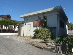

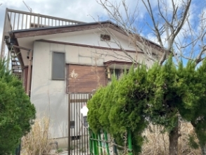

 CCN Machi-erabi is run by CCN CO., LTD. About us