Information as of 2026-08-16
This page is a relocation summary written by an advanced AI
It is not a personal opinion piece written by a human. An AI gathered official information published on the internet — municipal and national statistics, the Japan Meteorological Agency, railway companies, property portals — and rebuilt it into a form that someone considering a move can read and act on. Every figure carries a source link and the date it was checked, so please confirm anything that matters to you against the original document. Rules and prices change. Always check the latest information yourself before you sign anything.
Moving to Hatsukaichi City
At the western edge of Hiroshima Prefecture, this is the city that has Miyajima, a World Heritage site. JR Hatsukaichi Station is 23 minutes and ¥330 from Hiroshima Station, with no change of train. It covers 489.49 km², about 86% of it forest. From Miyajima on the Seto Inland Sea to the Nishi-Chugoku mountains — the city describes itself as having “a varied terrain running from the shores of Hiroshima Bay (the Seto Inland Sea coast) up to the Nishi-Chugoku mountains”. The population is 114,345. There are 227 second-hand houses on the market at present, running from ¥2,000,000 to ¥98,000,000, with a median of ¥25,990,000. And — the listings run from 2 metres to 877 metres in elevation. Within the same city, the district medians spread 5.4 times, from ¥6,400,000 to ¥34,800,000 (§2).
Roadside stations: Spa Rakan / Traditional streetscapes: Miyajima-cho, Hatsukaichi City (a temple town; designated Reiwa 3.8.2) / National and quasi-national parks: Setonaikai National Park, Nishi-Chugoku Sanchi Quasi-National Park / Hot springs and day baths: Natural Hot Spring Miyahama, Motoyu / RV parks: Miyahama Onsen RV Park
Sources: roadside stations from the Ministry of Land, Infrastructure, Transport and Tourism list of “michi-no-eki” (checked 2026-08-21); traditional streetscapes from the Agency for Cultural Affairs, “List of important preservation districts for groups of traditional buildings” (checked 2026-08-21); national and quasi-national parks judged from Ministry of the Environment boundary data and other sources (details in §17) (checked 2026-08-21); hot springs and day baths from OpenStreetMap (© OpenStreetMap contributors) (checked 2026-08-20); RV parks from Japan RV Association, list of certified “Kurumatabi” RV parks (checked 2026-08-20). 🔴 Only the things a town has are listed — it does not mean that a town without them is worse.
Last verified 2026-08-16
CHAPTER 01First, what kind of place Hatsukaichi is
The west of Hiroshima Prefecture. The city covers 489.49 km², about 86% of it forest. It is made up of five districts: Hatsukaichi and Ono on the coast, Miyajima on its island, Saiki inland and Yoshiwa in the mountains. The population is 114,345 in 54,241 households (as of 1 August 2026).
A city formed by mergers
In March 2003 Hatsukaichi City merged with the town of Saiki and the village of Yoshiwa, and in November 2005 with the towns of Ono and Miyajima, taking its present shape. The five districts were each separate towns and villages before that. Geologically, most of the mountains are granitic rock (hornblende-biotite granodiorite and biotite granite), which the city describes as “Cretaceous rock of the Mesozoic era, what is known as Hiroshima-type granite”. As for land use, there are 14,452 hectares of forest against 1,617 of building land (1 January 2023). The city planning area covers 23.9% of the city (11,685 hectares), of which the urbanisation promotion area is 2,100.4 hectares — just 4.3% of the city.
Sources: the position, terrain, area, geology, land use and history of mergers come fromHatsukaichi City, “I. Outline of Hatsukaichi City” (environmental report)(the quotations are from the body of that document. The land areas by category are as of 1 January 2023, from the Taxation Division) / the area and coordinates come fromthe same, “Position, area and so on”/the population and households are fromthe figures published on the same official site(Reiwa 8 (2026), 8/1as of) / Verified 2026-08-16Map of Hatsukaichi City
You can zoom and pan. The marker is Hatsukaichi city hall (Shimohera 1-chome). Hiroshima City is to the east (right), and the island floating in the sea to the south (below) is Miyajima. The strip running away to the north-west (upper left) is Saiki and Yoshiwa, continuing into the mountains along the borders with Shimane and Yamaguchi prefectures.
Map: © OpenStreetMap contributors
The six areas, and where the stations sit
The JR Sanyo Main Line and the Hiroden Miyajima Line run side by side along the coast. Of the 227 listings compiled, 192 are in this coastal strip, with 23 in Saiki and 12 in Yoshiwa inland. The stars mark the stations with the most listings. The upper left of the map (north-west) is Saiki and Yoshiwa — no stations there, a country of buses and cars. Positions, bearings and scale follow the real coordinates (stations from OpenStreetMap, points from the Geospatial Information Authority of Japan). You can scroll sideways.
What should I know first about moving to Hatsukaichi?
Of the 489.49 km², about 86% is forest, and one city holds both the sea and mountains of 1,000 metres. The listings run from 2 metres to 877 in elevation, so “Hatsukaichi City” alone settles neither the price nor the climate.
CHAPTER 02Six areas, and life in each
The medians run from ¥6,400,000 to ¥34,800,000 — a spread of 5.4 times. Of everywhere covered on this site, this is the city with the widest range inside it. Elevation runs from 2 metres to 877. “Hatsukaichi City” alone settles neither the price nor the climate.
Who it suits = anyone who wants the widest choice, and a house within walking distance of a station
What to watch = this is the gateway for tourists. Miyajima had 4,850,000 visitors in 2024 (§13). Look at how the roads and car parks fill up, on a weekday and at a weekend both
Who it suits = anyone who puts commuting time to Hiroshima City first, or wants both the council office and the hospital on foot
What to watch = the range runs from ¥10,800,000 to ¥98,000,000, a factor of 9. The city hall stands on reclaimed land (§5) — low ground close to the sea, so always check the elevation and the distance from the rivers
Who it suits = anyone who wants a well-planned estate somewhere quieter than the coast
What to watch = check how often the buses run, and when the last one goes, before anything else. This is also an area where houses built at the same time come onto the market together (§9)
Who it suits = anyone who wants a recently built house near the sea
What to watch = this has the highest median in the city. Onoura Station is 38 minutes and ¥510 from Hiroshima Station, 15 minutes further than Hatsukaichi (§3)
Who it suits = anyone who wants a house and land for under ¥10,000,000, or a family with children moving in from outside the city, who qualify for the settlement-promotion grant (§4)
What to watch = there is no station. The nearest stop is a bus stop, and this is car country
Who it suits = anyone seriously willing to buy a cool summer, or looking at the holiday-home areas (グリーンヒル南吉和, Rakan-no-sato). Moving to Yoshiwa brings the largest grants (up to ¥1,500,000 for a new build, ¥900,000 for a second-hand house)
What to watch = the snow. It comes down to whether you can accept 50 to 60 cm of it, and more than 40 minutes by car to the town, before anything else
Which part of Hatsukaichi should I live in?
The medians spread 5.4 times, from ¥6,400,000 to ¥34,800,000 — the widest range inside a single city of anywhere covered on this site. The most listings are the 76 at Ajina and Miyajimaguchi, facing Miyajima (a third of the 227 compiled).
CHAPTER 03Trains and cars — how you get around
Hatsukaichi’s transport is the JR Sanyo Main Line (6 stations) and the Hiroshima Electric Railway Miyajima Line (9 stations). Two railways run side by side along the coast. JR goes to Hiroshima Station; Hiroden runs straight on into the street trams of central Hiroshima.
To Hiroshima City
| Section | Time | One way |
|---|---|---|
| Hatsukaichi → Hiroshima | 23 min | ¥330, no change (Sanyo Main Line local). 15.5 km |
| Miyauchi-Kushido → Hiroshima | 26 min | ¥330, no change. 17.1 km. The busiest of the six JR stations (4,133 a day) |
| Ajina → Hiroshima | 29 min | ¥420, no change. 20.1 km |
| Miyajimaguchi → Hiroshima | 32 min | ¥420, no change. 21.8 km |
| Maezora → Hiroshima | 34 min | ¥420, no change. 23.6 km |
| Onoura → Hiroshima | 38 min | ¥510, no change. 26.7 km |
| Hatsukaichi → Iwakuni (Yamaguchi) | 34 min | ¥510, no change. 25.9 km |
All six JR stations in the city reach Hiroshima Station without a change. Even Onoura, the furthest, is 38 minutes and ¥510. Hatsukaichi, the nearest, is 23 minutes and ¥330 — the fastest and cheapest run to a prefectural capital of anywhere covered on this site. Westwards, Iwakuni (Yamaguchi Prefecture) is 34 minutes and ¥510 away. This is a city set exactly between Hiroshima and Iwakuni.
Sources: journey times, fares and operating distances come fromJR West's "My Daiya", from the actual services returned for boarding in the 8 o’clock hour on Wednesday 19 August 2026 (ordinary fares, ticket only) / checked 2026-08-16The Hiroden Miyajima Line — a flat ¥240 across the network since February 2025
The city has nine stations on the Hiroshima Electric Railway Miyajima Line (Sanyo-Jogakuen-mae, Hiroden-Hatsukaichi, Hatsukaichi-Shiyakusho-mae, Miyauchi, JA Hiroshima Byoin-mae, Jigozen, Ajina-higashi, Hiroden-Ajina and Hiroden-Miyajimaguchi). With the fare revision of 1 February 2025, Hiroden trams became a flat ¥240 across the whole network. Paying with “MOBIRY DAYS” makes it a flat ¥220. Unlike JR, Hiroden runs straight on into the street trams of central Hiroshima, reaching Kamiyacho and Hatchobori. JR for speed, Hiroden for going straight into the city centre — being able to use both is the shape of Hatsukaichi. Daily boardings and alightings run 5,536 at Hiroden-Miyajimaguchi, 3,358 at Hatsukaichi-Shiyakusho-mae, 3,144 at Hiroden-Ajina and 3,046 at Sanyo-Jogakuen-mae (31 March 2025).
Sources: the fare revision comes fromHiroshima Electric Railway, “On changes to tram and bus fares and to the fare and season-ticket system”(20 December 2024, carried on the Hatsukaichi City site) / the passenger and boarding figures come fromHatsukaichi City open data, “I-9 Average daily passengers at each JR station” and “I-10 Average daily boardings and alightings at each Hiroden station”(both as of 31 March 2025) / checked 2026-08-16Miyajima is 10 minutes away by ferry
About 10 minutes by ferry from Miyajimaguchi, ¥200 one way for an adult (two operators run it: JR West Miyajima Ferry and Miyajima Matsudai Kisen). On top of that comes the ¥100 Miyajima visitor tax, charged on the outward trip only (since 1 October 2023). Some people, though, do not pay it. The city’s ordinance excludes residents of the Miyajima-cho area and anyone commuting to work or school there for 48 hours a month or more from liability. Preschool children and holders of a disability certificate are exempt. People who cross to work or study on Miyajima are outside it — in other words, the tax is built to fall on those who visit, not on those who live there (§12).
Source:Hatsukaichi City, “Outline of the Miyajima visitor tax”(the amount, the start date, who falls outside it and who is exempt) / the ferry times and fares are the operators’ published figures / checked 2026-08-16Saiki and Yoshiwa are car country
Saiki (about 300 m up) and Yoshiwa (about 600 m) have no railway station. Listings give a bus stop as the nearest point, and some plots read “70 minutes’ walk to the bus stop”. Of the 227 listings in the city, 35 are on this inland side (§2). The city is long from north to south, and it is more than 30 km in a straight line from Miyajimaguchi to Yoshiwa. If you are looking for a house in Saiki or Yoshiwa, take a car as a given.
✈ Airports
The nearest is Iwakuni Airfield (a shared civil and military airport), about 29.4 km in a straight line. Next is Iwami Airport (about 47.7 km in a straight line). 🔴 These are straight-line distances, not road distances or journey times — please check the actual routes in each operator’s timetable.
🛣 Expressway junctions
This area has 4 entrances and exits (interchanges and junctions).
Sanyo Expressway = Miyajima smart IC, Hatsukaichi JCT
Chugoku Expressway = Yoshiwa
Hiroshima-Iwakuni Road = Ono
How long does it take from Hatsukaichi to Hiroshima City?
Hiroshima Station is 23 minutes and ¥330 from Hatsukaichi Station, with no change of train. Two lines run side by side along the coast — the JR Sanyo Main Line (6 stations) and the Hiroshima Electric Railway Miyajima Line (9 stations) — and Hiroden runs straight on into the street trams of central Hiroshima.
CHAPTER 04Homes actually on the market right now
SUUMO carries 227 second-hand houses. This page takes in and compiles all 227, and the list shows the 20 cheapest. They run from ¥2,000,000 to ¥98,000,000, with a median of ¥25,990,000. 25 are under ¥10,000,000 and 68 under ¥20,000,000.
"Nearest the station first" converts everything to minutes — a walk of ◯ min, ◯ min by bus plus ◯ min from the stop, ◯ km by car (reckoned at 30 km/h) — and compares those. Listings with no such information always appear last, whatever the sort.
 Ono Narukawa¥2,000,000Ono and Miyahama Onsen (the western coast)Elev. approx. 20 m / Land 413 m² (125 tsubo) / Building 50 m² (15 tsubo) / built 1960 / Kuba Sta. 21 min walk4 photos →
 Tomota¥2,500,000Saiki (Tsuta and Tomota, at about 300 m)Elev. approx. 270 m / Land 151 m² (46 tsubo) / Building 77 m² (23 tsubo) / built 1981 / 友和郵便局 bus stop 8 min walk10 photos →
 Tsuta¥2,800,000Saiki (Tsuta and Tomota, at about 300 m)Elev. approx. 290 m / Land 150 m² (45 tsubo) / Building 71 m² (22 tsubo) / built 1981 / 十王堂 bus stop 13 min walk3 photos →
 Hassaka 1¥3,540,000Ono and Miyahama Onsen (the western coast)Elev. approx. 50 m / Land 152 m² (46 tsubo) / Building 62 m² (19 tsubo) / built 1974 / Sunland-higashi 2 min walkSee 10 photos →
 Yoshiwa¥3,800,000Yoshiwa (the plateau above 600 m)Elev. approx. 590 m / Land 353 m² (107 tsubo) / Building 77 m² (23 tsubo) / built 1995 / Yoshiwa 支所 bus stop 21 min walk1 photos →
 Yoshiwa¥3,800,000Yoshiwa (the plateau above 600 m)Elev. approx. 590 m / Land 353 m² (107 tsubo) / Building 77 m² (23 tsubo) / built 1995 / Yoshiwa branch office 21 min walkSee 9 photos →
 Nakamichi¥3,900,000Yoshiwa (the plateau above 600 m)Elev. approx. 610 m / Land 380 m² (115 tsubo) / Building 63 m² (19 tsubo) / built 2000 / 柱ヶ瀬 bus stop 70 min walk7 photos →
 Tsuta¥4,900,000Saiki (Tsuta and Tomota, at about 300 m)Elev. approx. 290 m / Land 268 m² (81 tsubo) / Building 126 m² (38 tsubo) / built 1969 / Tsuta bus stop 2 min walk10 photos →
 Toge¥5,000,000Saiki (Tsuta and Tomota, at about 300 m)Elev. approx. 350 m / Land 462 m² (140 tsubo) / Building 81 m² (25 tsubo) / built 1988 / 上 Toge bus stop 10 min walk4 photos →
 Ono 8145-1¥5,000,000Ono and Miyahama Onsen (the western coast)Elev. approx. 110 m / Land 364 m² (110 tsubo) / Building 53 m² (16 tsubo) / built 1975 / Onoura Sta. 28 min walk10 photos →
 Nakamichi¥5,500,000Yoshiwa (the plateau above 600 m)Elev. approx. 610 m / Land 331 m² (100 tsubo) / Building 25 m² (8 tsubo) / built 20009 photos →
 Nakamichi¥5,800,000Yoshiwa (the plateau above 600 m)Elev. approx. 610 m / Land 471 m² (142 tsubo) / Building 50 m² (15 tsubo) / built 1996 / 注ヶ瀬 bus stop 64 min walk3 photos →
 Yoshiwa¥6,000,000Yoshiwa (the plateau above 600 m)Elev. approx. 590 m / Land 5060 m² (1531 tsubo) / Building 116 m² (35 tsubo) / built 1955 / 妙音寺原 bus stop 1 min walk4 photos →
 Kawazuhara¥6,000,000Saiki (Tsuta and Tomota, at about 300 m)Elev. approx. 280 m / Land 5,057 m² (1,530 tsubo) / Building 72 m² (22 tsubo) / built 1994 / Kawara Station 2 min walkSee 2 photos →
 Yoshiwa¥6,800,000Yoshiwa (the plateau above 600 m)Elev. approx. 590 m / Land 330 m² (100 tsubo) / Building 53 m² (16 tsubo) / built 2001 / Yoshiwa 支所 bus stop 6 min walk9 photos →
 Kujima¥6,900,000Saiki (Tsuta and Tomota, at about 300 m)Elev. approx. 350 m / Land 119 m² (36 tsubo) / Building 95 m² (29 tsubo) / built 1994 / 泉水入口 bus stop 10 min walk9 photos →
 Toge¥7,300,000Saiki (Tsuta and Tomota, at about 300 m)Elev. approx. 350 m / Land 206 m² (62 tsubo) / Building 81 m² (25 tsubo) / built 1981 / グランドハイツ前 bus stop 3 min walk6 photos →
 Nagahara¥7,800,000Saiki (Tsuta and Tomota, at about 300 m)Elev. approx. 320 m / Land 132 m² (40 tsubo) / Building 66 m² (20 tsubo) / built 1979 / 小坂 bus stop 6 min walk4 photos →
 Nagahara 5-63¥7,800,000Saiki (Tsuta and Tomota, at about 300 m)Elev. approx. 310 m / Land 2207 m² (668 tsubo) / Building 99 m² (30 tsubo) / built 1996 / 下大久保 bus stop 6 min walk3 photos →
 Toge 90-158¥8,000,000Saiki (Tsuta and Tomota, at about 300 m)Elev. approx. 340 m / Land 151 m² (46 tsubo) / Building 101 m² (31 tsubo) / built 1990 / グランドハイツ前 bus stop 5 min walk10 photos →
The photographs are the images carried on SUUMO. They disappear once a listing ends. Check the real condition of a property on site.
See all 227 on SUUMO → Source:SUUMO, second-hand detached houses, Hatsukaichi City(obtained 2026-08-16; 227 listed in total). The price range, median and district breakdown come fromlisted227 listingsall . Elevation is the value obtained by putting each listing's map coordinates through the Geospatial Information Authority of Japan elevation API (rounded to 10 m), andall 227 placed by each property’s own coordinatesThere are grants for moving to Saiki or Yoshiwa
Hatsukaichi City has a “settlement-promotion grant for the Saiki and Yoshiwa districts”. It is for households with children and the like moving into the Saiki or Yoshiwa district from outside the city. The coastal districts (Hatsukaichi, Ono and Miyajima) are not covered.
| Category | Saiki district | Yoshiwa district |
|---|---|---|
| Building or buying a new house | Up to ¥1,000,000 | Up to ¥1,500,000 (both within half the eligible cost) |
| Buying a second-hand house | Up to ¥600,000 | Up to ¥900,000 (as above) |
| Addition for children | ¥300,000 per child under 6, ¥200,000 per child aged 6 to under 18 | |
| Main conditions | The applicant or their spouse must have lived outside the city for three years or more before moving in / one of them must be under 50 / they must live with a spouse or a relative within the first degree / they must intend to settle for ten years or more | |
| Application deadline | Within six months of the date the building was registered, or of the date the whole household moved its residence | |
As §2 showed, the median in Saiki is ¥9,980,000 and in Yoshiwa ¥6,400,000. On top of that come ¥600,000 to ¥900,000 for a second-hand house, plus ¥400,000 to ¥600,000 for two children. Buy a ¥6,400,000 house in Yoshiwa with two children under 6 and the grant reaches ¥1,500,000 — large in proportion to the price.
The vacant-home bank, and the renovation grant
The city also runs a vacant-home bank. In its own words, it is “a system for introducing, through the city, vacant homes in the hill and mountain areas and elsewhere where ordinary estate agents do not go, and offering them to people who want to move to (and settle in) the city”. What is actually listed is mostly in Tsuta, Asahara and Yoshiwa, and includes holiday homes at “Rakan-no-sato” and “グリーンヒル南吉和” and an old house from around 1907. For renovation there is the “vacant-home use support grant” — half the renovation cost up to ¥400,000 (up to ¥600,000 for younger households or households with children), up to ¥200,000 for clearing furniture, up to ¥100,000 for the paperwork and up to ¥100,000 for materials if you do the work yourself. The scheme runs to 31 March 2027. Using this grant also brings a 0.25% cut in the annual rate for the first five years under the regional-partnership Flat 35. You may not demolish or resell for three years, however.
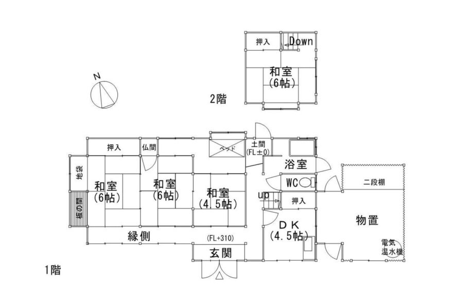
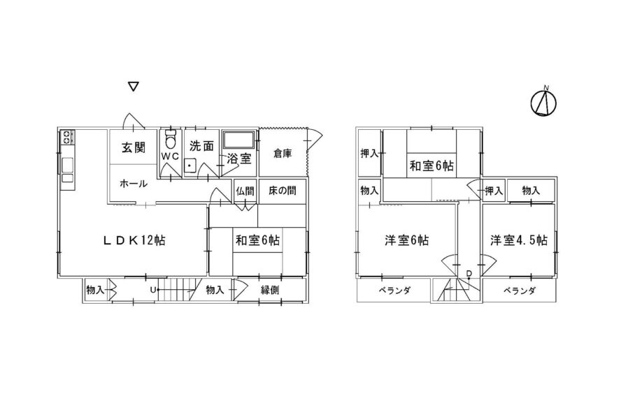
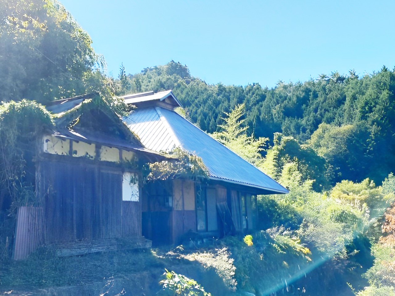
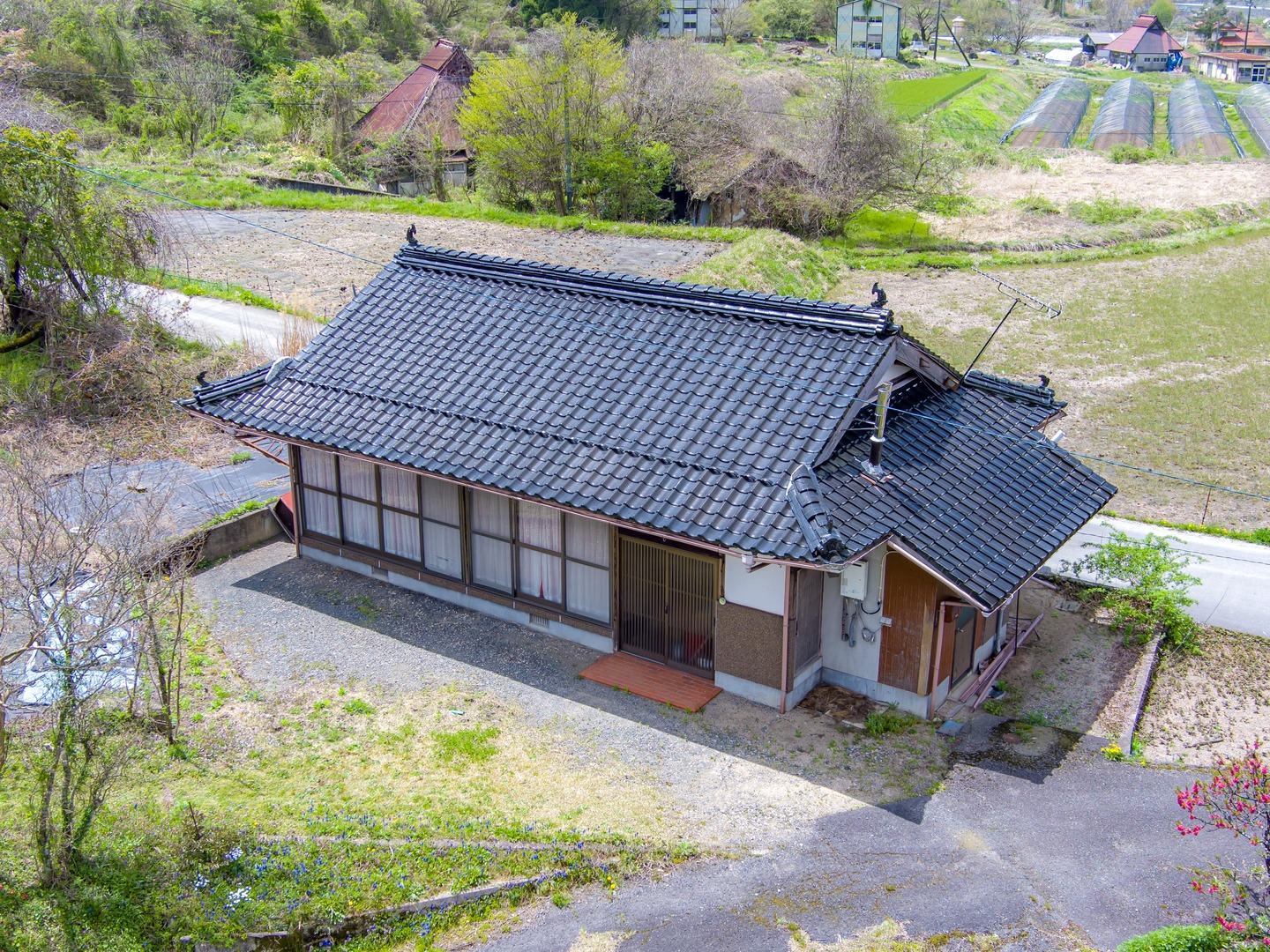
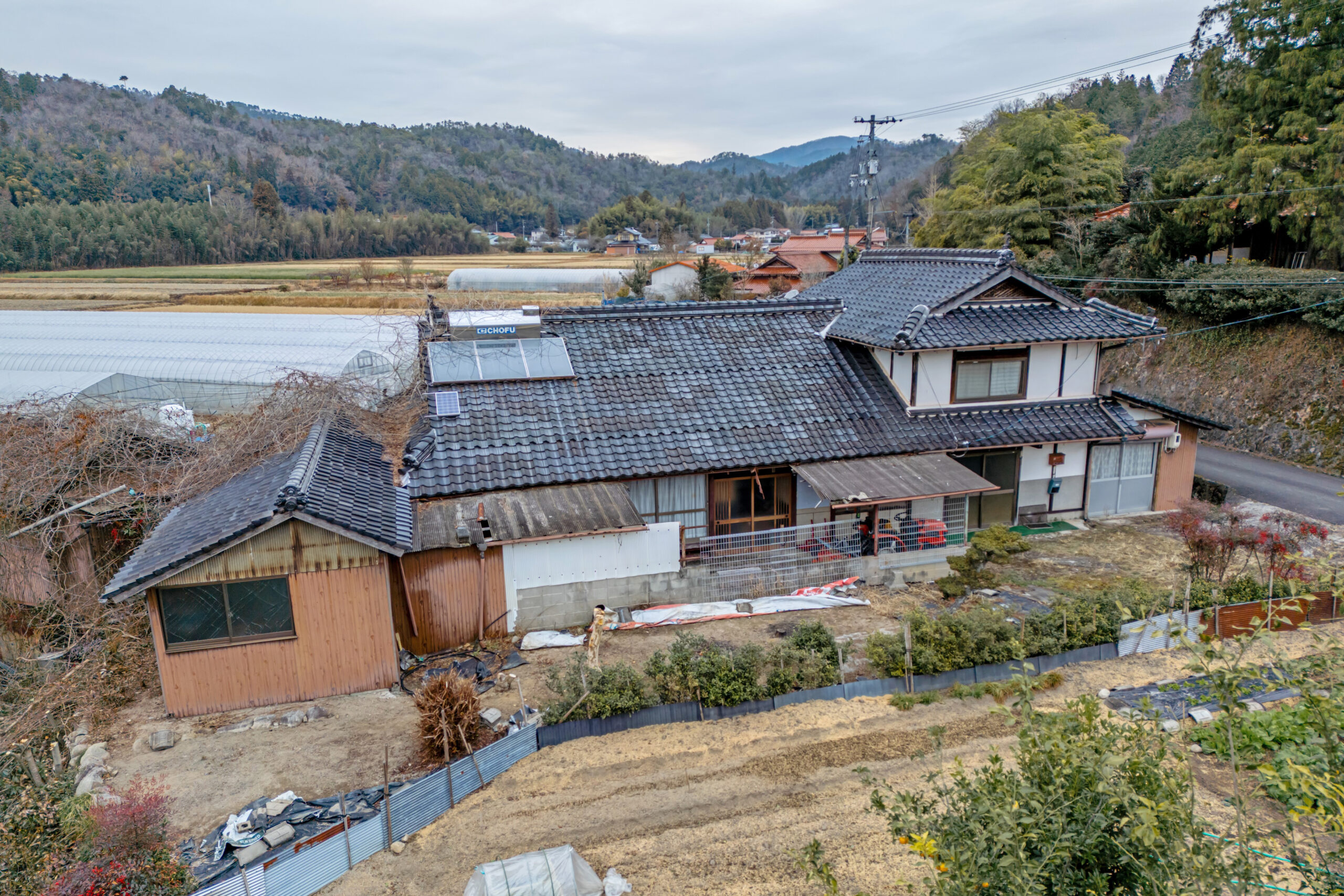
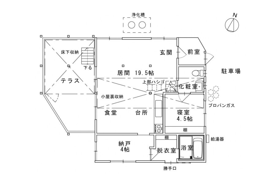
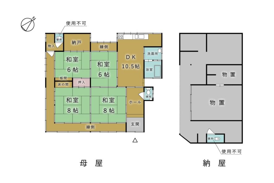
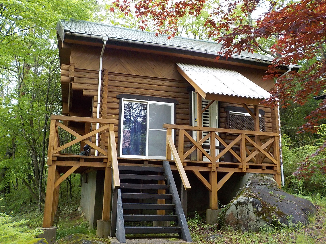
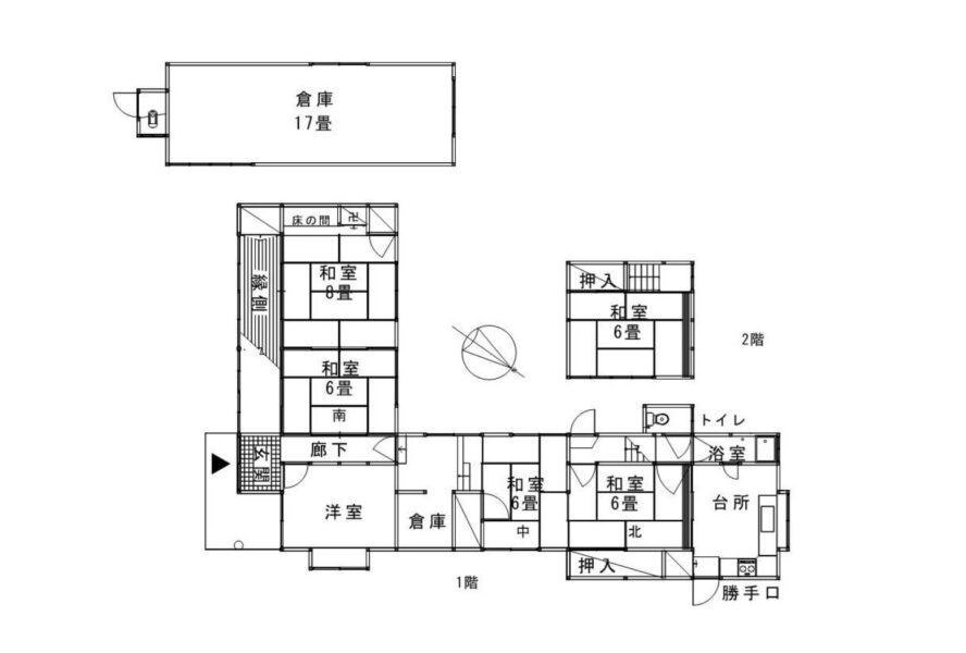
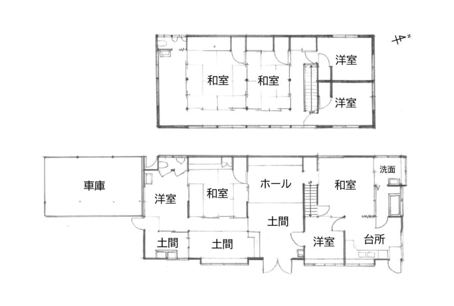
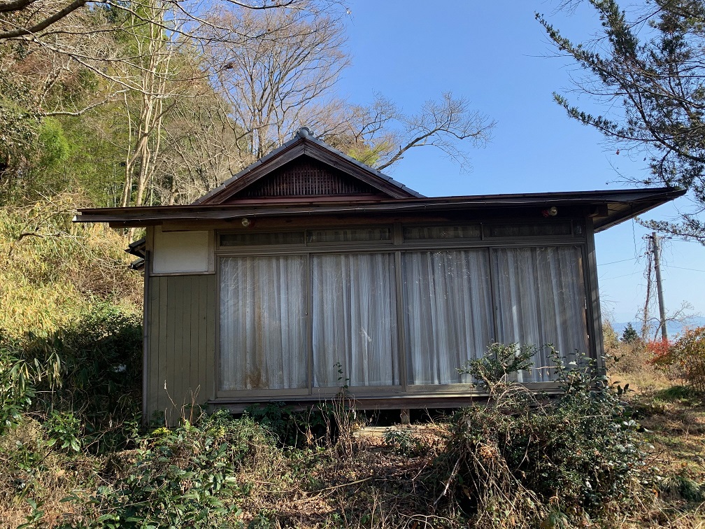
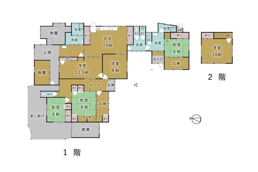
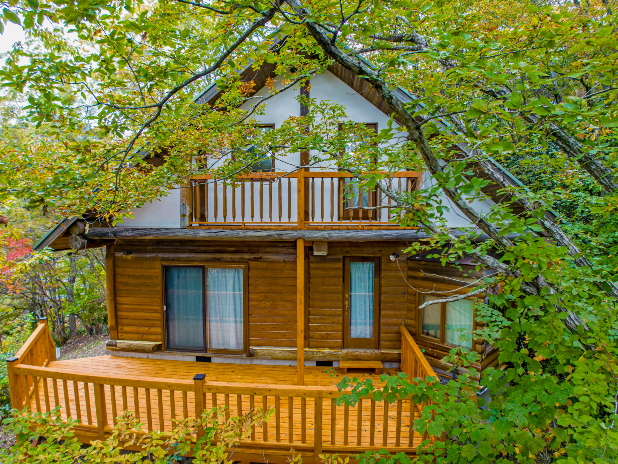
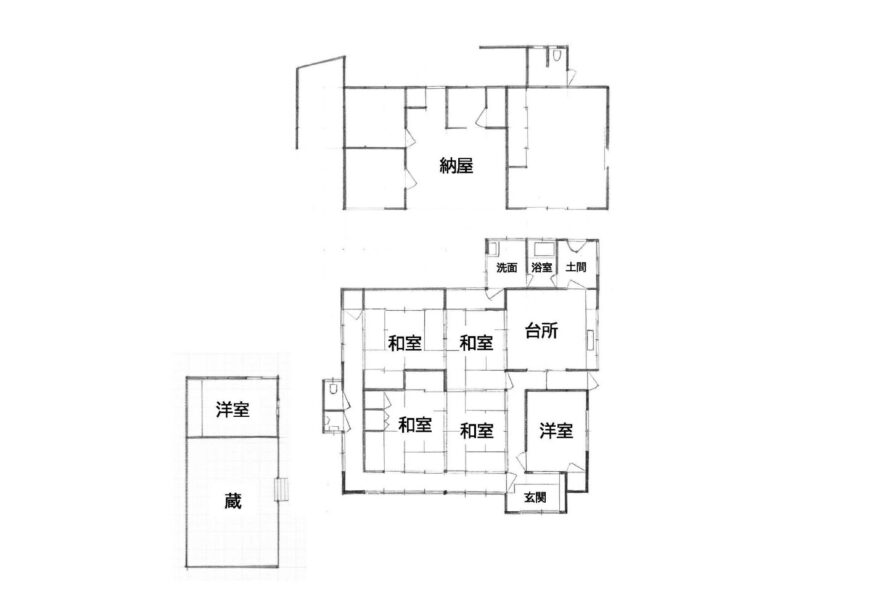
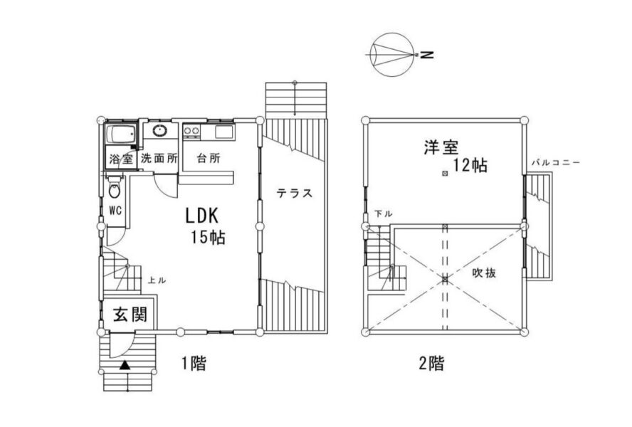
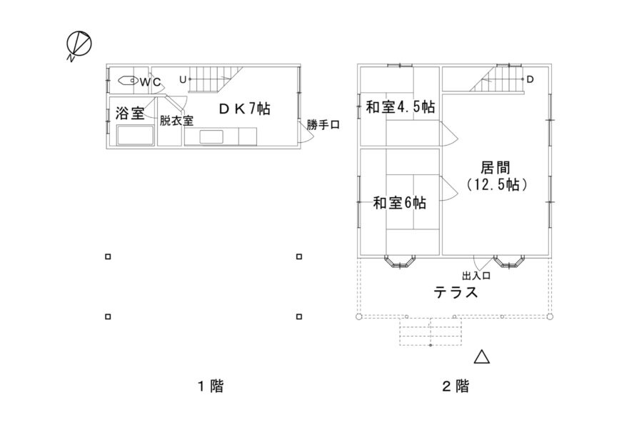
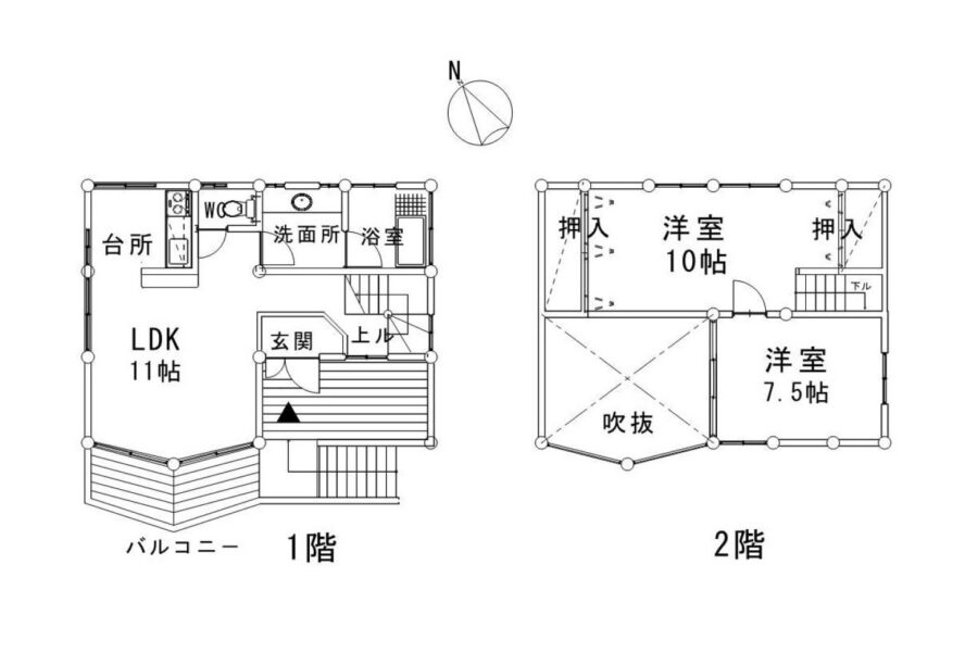
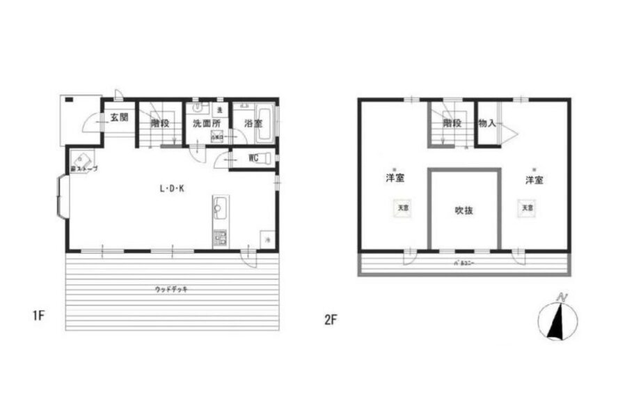
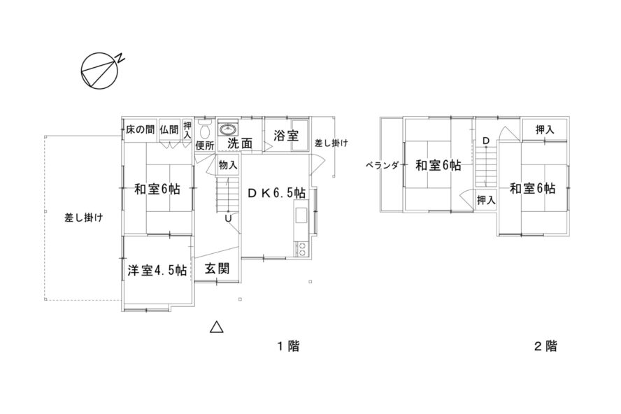
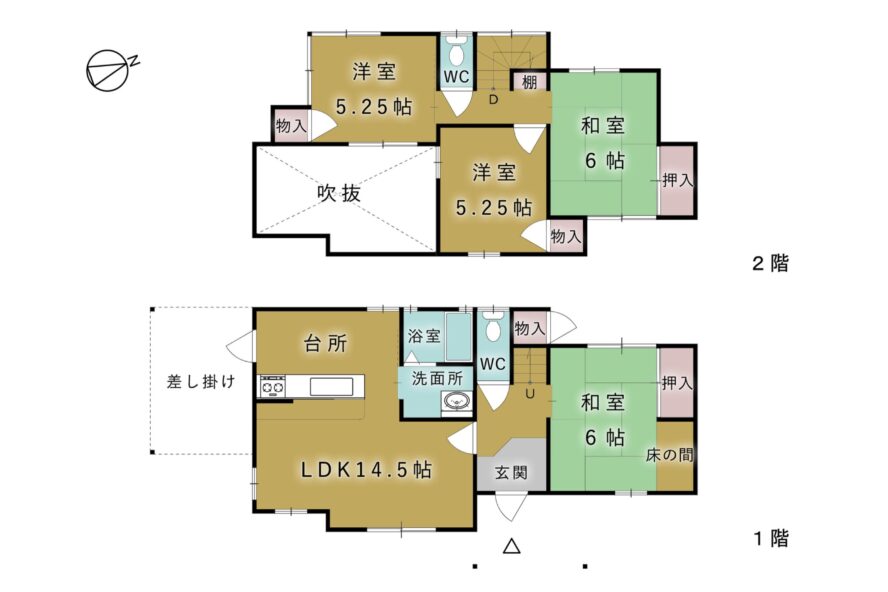
Akiya bank — 22 listings
This is every house for sale registered on the municipal vacant-home bank — 22 in all (as checked on 17 August 2026). They are listed cheapest first. There is also 1 registration for rent.


What is the cheapest house you can buy in Hatsukaichi?
SUUMO lists 227 second-hand houses, running from ¥2,000,000 to ¥98,000,000 with a median of ¥25,990,000. 25 are under ¥10,000,000 and 68 under ¥20,000,000.
CHAPTER 05Is the ground safe?
Hatsukaichi City is designated as an area for promoting Nankai Trough earthquake preparedness. The probability of shindo 6-lower or above within 30 years is 20.6%, and 4.2% for 6-upper or above (at the city hall site). The city hall, though, stands on reclaimed land, so this is a figure from the least favourable ground in the city.
Is this town inside a national earthquake-preparedness zone?
For each major earthquake, national law designates the areas where preparation is to be advanced. Whether a town is designated tells you directly how the national government views the shaking and tsunami expected there.
| Nankai Trough Earthquake Disaster Prevention Promotion Area | 🔴 Designated |
|---|---|
| Tokyo Inland Earthquake Emergency Measures Area | Not applicable (the whole of Hiroshima Prefecture is outside this scheme) |
| Japan Trench / Kuril Trench Earthquake Disaster Prevention Promotion Area | Not applicable (the whole of Hiroshima Prefecture is outside this scheme) |
| Shaking of intensity 6-lower or above within 30 years | 20.6% (4.2% for shindo 6-upper or above) At the Hatsukaichi city hall site. Surface ground: AVS30 236 m/s, reclaimed land |
Look up an address on J-SHIS → Designations from the Cabinet Office list of designated municipalities (Nankai Trough Earthquake Disaster Prevention Promotion Area/Tokyo Inland Earthquake Emergency Measures Area/Japan Trench / Kuril Trench Earthquake Disaster Prevention Promotion Area ) / probability and surface ground from theNational Research Institute for Earth Science and Disaster Resilience, J-SHIS earthquake hazard information API (2024 edition, average case, all earthquakes), queried at the city hall coordinates / verified 2026-08-16
The 20.6% is because the city hall stands on reclaimed land
The surface ground at the city hall site is reclaimed land (AVS30 236 m/s). The softer the ground, the more the shaking is amplified, so this 20.6% is a figure from the shakier side of the city. The city’s geology, meanwhile, is mostly granitic rock (Hiroshima-type granite) in the mountains (§1). Reclaimed land along the coast and granite hills up the slope are two entirely different things inside the same city. Set beside the other areas on this site — Iwaki 88.6%, Ise 75.0%, Tanabe 73.3%, Osaki 27.7%, Naha 20.8%, Hatsukaichi 20.6%, Inuyama 14.9%, Kawachinagano 14.3%, Ome 12.9%, Izumo 10.1% and Shimonoseki 5.6%.
The low side is the sea.Hatsukaichi, Ono and Miyajima face the Seto Inland Sea, and the city publishes hazard maps forlandslides, storm surge and tsunami.that the city hall site is reclaimed land shows,the flat ground along the coast includes land made by filling and reclamation.
The high side is slopes.Shikigaoka and Miyazono (17–132 m), Saiki (269–350 m) and Yoshiwa (592–877 m).The hilltop estates are cut-and-fill ground, and and inland the houses line the valleys。What you need to look at changes from area to area.
Before you go to view, open the hazard map for that address.
Is the disaster risk high in Hatsukaichi?
It is designated as an area for promoting Nankai Trough earthquake preparedness, and the probability of shindo 6-lower or above within 30 years is 20.6% (4.2% for 6-upper or above). That figure, though, is for the reclaimed land the city hall stands on, the least favourable ground in the city.
CHAPTER 06What summer and winter are like
Hatsukaichi City has two climates. The coast (Hatsukaichi, Ono and Miyajima) has the mild Seto Inland Sea climate. The Meteorological Agency’s Hatsukaichi Tsuta station in Saiki, inside the same city, records a January daily low of −2.9℃ and 103.9 nights a year below 0℃ — figures you would not believe belong to the same city.
The twelve months of temperature, set out as they are
The left end of each bar is the mean daily low for that month and the right end the mean daily high (Hatsukaichi, at Hiroshima; the 30-year mean for 1991–2020).
These are the numbers for how summer nights and winter mornings compare with Tokyo
| Days per year | Hatsukaichi (Hiroshima) | Tokyo |
|---|---|---|
| Tropical nights minimum 25°C or above | 33.2 days | 17.8 days |
| Days above 35°C maximum 35°C or above | 8.1 days | 4.8 days |
| Days above 30°C maximum 30°C or above | 64.3 days | 52.1 days |
| Frost days minimum below 0°C | 12.8 days | 15.2 days |
| Days below freezing all day maximum below 0°C | 0.0 days | 0.0 days |
For snow, the annual total is 8 cm and the normal deepest cover 5 cm.
Source:Japan Meteorological Agency, normals for Hiroshima (by month) /the same, day counts by class (view=a2)/the same, Tokyo (all 30-year averages for 1991–2020) / verified 2026-08-14Within the same city, nights below 0℃ number 12.8 and 103.9
| Normals for 1991–2020 | Hatsukaichi Tsuta In the city, at Saiki (about 300 m up) | Hiroshima Naka Ward, Hiroshima City | Tokyo |
|---|---|---|---|
| Annual mean temperature | 12.9℃ | 16.5℃ | 15.8℃ |
| January daily low | −2.9℃ | 2.0℃ | 1.2℃ |
| Nights below 0℃ | 103.9 a year | 12.8 a year | 15.2 days a year |
| Days below 0°C all day | 1.4 a year | 0.0 days a year | 0.0 days a year |
| August daily high | 30.7℃ | 32.8℃ | 31.3℃ |
| Tropical nights | 0.1 a year | 33.2 a year | 17.8 days a year |
| Days above 35°C | 2.3 a year | 8.1 days a year | 4.8 days a year |
| Annual rainfall | 1,948.7mm | 1,572.2mm | 1,598.2mm |
| July rainfall | 343.0mm | 279.8mm | 156.2mm |
The Hatsukaichi Tsuta station is inside Hatsukaichi City, in the Saiki district at about 300 metres (§2). There, nights below 0℃ number 103.9 a year and tropical nights 0.1 — on summer nights it is all but certain to fall below 25℃. Hiroshima, standing for the coastal side of the same city, has 12.8 nights below 0℃ and 33.2 tropical nights. Within one city, nights below freezing differ 8 times over and tropical nights 330 times. For rain, Tsuta gets 1,948.7 mm a year, about 380 mm more than Hiroshima. July alone brings 343.0 mm — closer to the mountains, the rain concentrates in the rainy season.
Here is what the city writes about Yoshiwa
Yoshiwa (592–877 m) has no Meteorological Agency station. The city’s environmental report describes its climate like this — “cool and wet; the mean temperature on the flat is around 11℃, and in January it falls to −6℃ and is particularly cold. August is relatively low at around 24℃, so summer is comfortable, but being a basin it is prone to fog and is humid. Rainfall is around 2,400 mm a year, with monthly rainfall around 200 mm and about 900 mm in the rainy season; winter snow reaches 50 to 60 cm on the flat.” The same document describes the coast like this — “it belongs to the Seto Inland Sea climate and is mild through the year. … The annual mean temperature is about 16℃. Rainfall is around 2,100 mm a year, heaviest in the rainy season and the typhoon season, and winters are dry — a mild maritime climate.” By annual mean temperature: about 16℃ on the coast, 12.9℃ at Saiki and around 11℃ at Yoshiwa. The Hiroshima meteorological station’s figures are for Naka Ward, Hiroshima City, not for Hatsukaichi City. Start by working out which district a property’s address is in.
Source:Japan Meteorological Agency, normals for the Hatsukaichi Tsuta AMeDAS station/the same, Hiroshima/the same, Tokyo(both the 30-year mean for 1991–2020) / the descriptions and quotations for each district’s climate come fromHatsukaichi City, “I. Outline of Hatsukaichi City”, 3. Climate/ Verified 2026-08-16Are the winters cold in Hatsukaichi?
There are two climates. The coast (Hatsukaichi, Ono and Miyajima) has the mild Seto Inland Sea climate, but the Hatsukaichi Tsuta station at Saiki inside the city records a January daily low of −2.9℃ and 103.9 nights a year below 0℃ — figures you would not believe belong to the same city.
CHAPTER 07Shops, hospitals, schools
Hatsukaichi City has 17 elementary schools and 9 junior high schools. All 26 provide school meals (from four central kitchens and three kitchens on site). Children’s medical costs are subsidised to the end of the school year in which a child turns 18.
Children’s medical costs — to the end of the school year in which a child turns 18
| Category | What the Hatsukaichi City ordinance lays down |
|---|---|
| Who is covered | From birth to the first 31 March after turning 18 (Article 2, paragraph 3). Children resident in the city and enrolled in health insurance |
| Infants | To the first 31 March after turning 6, no contribution at all (Article 6) |
| Everyone else | ¥500 a day per insured medical institution. Once you have paid 4 times for outpatient care or 14 times for hospital stays in the same month at the same institution, there is nothing more to pay that month |
| Dispensing | There is no contribution when medicine is dispensed at an insured pharmacy on a prescription |
| Bonesetters and the like | Treatment by judo therapists, anma massage and shiatsu practitioners, acupuncturists and moxibustionists costs ¥500 a day per practice (up to 4 times a month at the same practice) |
Schools — all 26 provide meals
Meals for the 17 elementary and 9 junior high schools come from four central kitchens and three kitchens on site. The Hatsukaichi school meal centre (11 elementary, 5 junior high), the Yoshiwa centre (1 and 1), the Ono centre (2 and 2) and the Miyajima centre (1 and 1). The on-site kitchens are at Yuwa Elementary, Tsuta Elementary and Saiki Junior High. Yoshiwa and Miyajima each have a centre of their own. One centre for a single elementary school and a single junior high — the shape of a city that is wide, with districts far apart, shows here too. Information for families is gathered on the city’s childcare site “Hatsuiku”, and there is a childcare app, “Hatsukko Techo (Boshi Mo)”.
Source:Hatsukaichi City, “List of school meal facilities”/the same, childcare support site “Hatsuiku”/ Verified 2026-08-16Hospitals and shopping
The core hospital is JA Hiroshima General Hospital, with its own station on the Hiroden Miyajima Line, “JA Hiroshima Byoin-mae” (1,474 a day). Shopping centres on Youme Town Hatsukaichi (by Maezora Station) and the roadside stores around Hatsukaichi and Miyauchi-Kushido stations. With Hiroshima Station 23 minutes and ¥330 away (§3), the shops of Hiroshima City are an option too. In Saiki and Yoshiwa, measure the distance to the nearest supermarket first. Property descriptions on the vacant-home bank carry phrases such as “a convenient location, close to a supermarket, a home centre and an elementary school” — in this part of the city, that is a selling point.
What support is there for families in Hatsukaichi?
Children’s medical costs are subsidised to the end of the school year in which a child turns 18, with no contribution at all to the end of the school year in which they turn 6. All 26 schools — 17 elementary and 9 junior high — provide meals.
CHAPTER 08What it costs you every year after you buy
Hatsukaichi City’s water service transferred to the “Hiroshima Prefecture Water Supply Wide-Area Union Enterprise” in April 2023. Charges were left unchanged city by city, and 40 m³ over two months comes to ¥12,320 (water ¥6,556 plus sewerage ¥5,764). That is ¥6,160 a month.
| 40 m³ over two months, 13 mm connection | Amount | Detail |
|---|---|---|
| Total | ¥12,320 ¥6,160 a month | Water ¥6,556 plus sewerage ¥5,764 (both including consumption tax) |
| The water breakdown | ¥6,556 | Standing charge (0–20 m³) ¥2,563 plus usage (21–30 m³ at ¥169.40 × 10 = ¥1,694; 31–40 m³ at ¥209.00 × 10 = ¥2,090) plus a meter charge of ¥209 for 13 mm |
| The sewerage breakdown | ¥5,764 | Standing charge (0–20 m³) ¥2,354 plus usage (21–30 m³ at ¥158.40 × 10 = ¥1,584; 31–40 m³ at ¥182.60 × 10 = ¥1,826) |
| When these charges took effect | — | Water from usage in the tenth month of Reiwa 1, sewerage from usage in February 2023. The water rates have been unchanged for more than six years |
| Meter charge | — | Charged separately by connection size (per two months). 13 mm ¥209 / 20 mm ¥286 / 25 mm ¥352 / 40 mm ¥803 |
| Neighbourhood association fee | — | It differs by association, and the city does not publish the amounts. You ask the association you are joining (§11) |
Among the places covered on this site, that puts it just behind Kawachinagano (¥13,395). The character is different, though. Kawachinagano’s figure came straight after an average rise of 16.05% in October 2025, whereas Hatsukaichi’s water rates have not changed since the tenth month of Reiwa 1. The water service, on the other hand, is no longer run by the city. It transferred to the Hiroshima Prefecture Water Supply Wide-Area Union Enterprise in April 2023. Enquiries go to the union’s Hatsukaichi office (Kushido 5-chome; customer centre 0829-32-2286), not to the city hall.
Source:Hiroshima Prefecture Water Supply Wide-Area Union Enterprise, “Hatsukaichi City water service, charge table”(water from usage in the tenth month of Reiwa 1, sewerage from usage in February 2023; both per two months, including tax. The 40 m³ figure was calculated from the charge table) / the move to a wide-area body and the contact details come fromHatsukaichi City, “For water, contact the Hiroshima Prefecture Water Supply Wide-Area Union Enterprise”/ Verified 2026-08-16How much does water cost in Hatsukaichi?
The water service transferred to the “Hiroshima Prefecture Water Supply Wide-Area Union Enterprise” in April 2023, but the charges were left unchanged, and 40 m³ over two months comes to ¥12,320 (water ¥6,556 plus sewerage ¥5,764) = ¥6,160 a month.
CHAPTER 09What happens when you want to sell
There are 227 second-hand houses in Hatsukaichi. Against a population of 114,345 that is one for every 504 people — the deepest market on this site after Shimonoseki.
| What to look at | Hatsukaichi City in practice |
|---|---|
| Depth of the market | 227 on SUUMO. Against a population of 114,345, one for every 504 people. Deeper than Kawachinagano (one per 617) and second only to Shimonoseki (one per 467) |
| Price band | ¥2,000,000–¥98,000,000, median ¥25,990,000. 25 under ¥10,000,000 and 68 under ¥20,000,000 |
| Difference by district | The medians run Ono ¥34,800,000, Hatsukaichi ¥32,000,000, Ajina/Miyajimaguchi ¥28,390,000, Shikigaoka/Miyazono ¥23,800,000, Saiki ¥9,980,000 and Yoshiwa ¥6,400,000. A spread of 5.4 times |
| How old the buildings are | The median build year runs from 1989 to 2014 by district. Ono is 2014 and Hatsukaichi 2003, both newer, while Ajina/Miyajimaguchi is 1989. The area decides what your house will be compared with |
| Hometown tax | 2024 financial year ¥430,845,000 (15,240 donations); 2025 financial year ¥349,512,741 (9,685 donations) |
If you are thinking about selling, “which area you buy in” is itself the question about selling. Ono (median ¥34,800,000, built 2014) and Yoshiwa (¥6,400,000, built 1999) have different buyers and different markets. The four coastal areas hold a market of 192 listings. In Saiki with 23 and Yoshiwa with 12, by contrast, there are few listings and the city’s vacant-home bank is the main route (§4). The list above can be filtered by district badge, and sorted by distance from a station or by elevation.
Sources: the counts, prices and build years come from the compilation of the property list above / the hometown tax comes fromHatsukaichi City, “Hometown donation results”/ Verified 2026-08-16Will the house I buy sell when I want to sell it?
SUUMO carries 227, one for every 504 of the 114,345 residents — the deepest market on this site after Shimonoseki. The district medians, though, spread 5.4 times, from ¥6,400,000 in Yoshiwa to ¥34,800,000 in Ono.
CHAPTER 10Who lives here, and how many
Hatsukaichi City has 114,345 people in 54,241 households (1 August 2026): 55,058 men and 59,287 women, 2.11 people per household.
26,718 people aged 15 or over commute out of the city for work or study, while 27,148 work or study inside it (excluding those at home) — almost half and half. Of those leaving, 20,556 (77%) go to Hiroshima City: 5,646 to Nishi Ward, 4,979 to Saeki Ward, 4,705 to Naka Ward and 2,032 to Minami Ward. Next comes Otake City with 2,091. In the other direction, 16,371 people come into Hatsukaichi from outside, 6,546 of them from Saeki Ward in Hiroshima City. People flow both ways with Hiroshima City. The daytime population ratio has gone 87.5 in Heisei 17 → 88.4 in Heisei 22 → 90.3 in Heisei 27 → 91.2 in Reiwa 2, rising over fifteen years. It is a figure that shows the city moving, slowly, away from being a dormitory town that empties by day. There are 55,016 people in work, 2.1% in primary industry, 23.1% in secondary and 71.6% in tertiary (2020 census).
Hatsukaichi City open data (population and households) → Sources: population and households from the figures published on the Hatsukaichi City official site(as of 1 August 2026) / the daytime population and commuting figures come fromthe same open data, “B-9 Daytime population and the trend in inflow and outflow”, “B-10 Workers and students aged 15 or over by place of residence, work or study” and “B-11 Workers and students aged 15 or over by destination and origin”(2020 census) / employment by industry comes fromthe same, “I. Outline of Hatsukaichi City”(2020 census) / checked 2026-08-16Of the 114,773 people living in Hatsukaichi City, 2,007 are foreign residents. That is below the national average (3.26%).
Nationwide, foreign residents make up 3.26% of the population (4,031,159 out of 123,767,642).
There are 34 municipalities in Japan where the share passes 10%.
Source: calculated by this site from the municipality-level tables of the Ministry of Internal Affairs and Communications, "Population, population change and households based on the Basic Resident Register" (as of 1 January Reiwa 8, published 2026-07-29). The ministry's publication page / verified 2026-08-17
Is Hatsukaichi a dormitory town for Hiroshima?
26,718 people aged 15 or over commute out of the city for work or study, and 27,148 work or study inside it — almost half and half. Of those leaving, 20,556 (77%) go to Hiroshima City, while 16,371 come in from outside.
CHAPTER 11Community life and the year's events
How you get on with the community in Hatsukaichi changes markedly with the area you live in. What the city provides is not the same on the coast as it is in Saiki and Yoshiwa.
Households with children moving into Saiki or Yoshiwa from outside the city can claim the settlement-promotion grant (§4). One of its conditions is“intending to settle for ten years or more”.The scheme itself is built for people who mean to stay.
In the four coastal areas, the neighbourhood association is the way in.Joining and the dues are set by each association, and the city does not publish the amounts.On estates built all at once around 1990, such as Shikigaoka and Miyazono, the association is often organised hill by hill, so do ask when you go to view.
Living on Miyajima is a different matter again.Residents of the Miyajima-cho areafall outside liability for the Miyajima visitor tax(§3)。People live on an island that 4,850,000 visit a year — the scheme was built to make those two things work together.
Is community life demanding in Hatsukaichi?
The character changes markedly with the area you live in, and in Saiki and Yoshiwa the community itself takes people in. One condition of the settlement-promotion grant for households with children moving into Saiki or Yoshiwa from outside the city is “intending to settle for ten years or more” — the scheme itself is built for people who mean to stay.
CHAPTER 12Things nearby that move land prices
What bears on land prices in Hatsukaichi is being 23 minutes from Hiroshima Station, the World Heritage island of Miyajima, and the fact that about 86% of the city is forest. Those three create the 5.4-fold spread between the six areas.
The difference in price is, directly, the difference in elevation
Here are the §2 medians again — Ono ¥34,800,000 (elevation 2–110 m), Hatsukaichi ¥32,000,000 (2–86 m), Ajina/Miyajimaguchi ¥28,390,000 (2–136 m), Shikigaoka/Miyazono ¥23,800,000 (17–132 m), Saiki ¥9,980,000 (269–350 m) and Yoshiwa ¥6,400,000 (592–877 m). The higher the ground, the lower the price. And the higher the ground, the longer the winter (§6). Against ¥23,800,000–¥34,800,000 in the four coastal areas, the two inland ones run ¥6,400,000–¥9,980,000. Under a third. All of this is inside one city. When a property advertisement says only “Hatsukaichi City”, start with the nearest station and the elevation. The property list on this page carries district badges and can be sorted by elevation or by distance from a station.
Miyajima decides the character of the city
Miyajima had 4,850,000 visitors in 2024, and 2025 exceeded that — a record for the second year running. A city of 114,345 people receives 42 times that number of visitors. For that reason the city created the Miyajima visitor tax — ¥100 a visit, or ¥500 a year (since 1 October 2023). The city gives its purpose as “to meet the administrative demands that arise or increase because so many tourists visit Miyajima”. And the people who live there are left out of it. Residents of the Miyajima-cho area and anyone commuting to work or school there for 48 hours a month or more are not liable (§3). Recovering the cost of tourism from tourism — that design tells in the city’s budget and in the development around Miyajimaguchi. Daily boardings and alightings run 5,536 at Hiroden-Miyajimaguchi and 4,844 at JR Miyajimaguchi, the busiest in the city (§3). That 76 listings cluster in the Ajina and Miyajimaguchi area is the strength of those stations.
Sources: the visitor numbers come fromHatsukaichi City press release, “On visitor numbers to Miyajima in 2025”(4,850,000 in 2024; 2025 a record for the second year running) / the visitor tax fromthe same, “Outline of the Miyajima visitor tax” / the boarding figures fromthe same open data(Reiwa 7 (2025), 3/31) / Verified 2026-08-16The urbanisation promotion area is 4.3% of the city
Of the 489.49 km², the city planning area is 23.9% (11,685 hectares) and the urbanisation promotion area 2,100.4 hectares — 4.3% of the city (§1). By land category there are 14,452 hectares of forest against 1,617 of building land. About 86% of the city is forest, and the land where houses can be built is concentrated in a small part of it. That is why 192 of the 227 listings gather in the four coastal areas, and why prices there do not fall. Saiki and Yoshiwa, meanwhile, lie outside the urbanisation promotion area, and the city’s vacant-home use support grant is aimed at “properties registered on the vacant-home bank outside the urbanisation promotion area” and the like (§4). Even the lines the schemes draw follow this terrain.
Source:Hatsukaichi City, “I. Outline of Hatsukaichi City”, 5. Land use(the city planning area, the urbanisation promotion area and land areas by category) / who the grant covers comes fromthe same, “Vacant-home use support grant”/ Verified 2026-08-16The information on this site is gathered by an AI that visits primary sources — municipalities, the Japan Meteorological Agency, national statistics — on a regular cycle, and it is updated with a source and a date of verification attached.
What decides land prices in Hatsukaichi?
The difference in price is, directly, the difference in elevation. Against medians of ¥23,800,000–¥34,800,000 in the four coastal areas (elevation 2–136 m), the two inland areas run ¥6,400,000–¥9,980,000 (269–877 m). The higher the ground, the lower the price and the longer the winter.
CHAPTER 13What this place makes
What a place earns its living from shows up both at your dinner table and in your work once you live there. The amount raised through the hometown tax scheme is a rough measure of how many products a place has that people all over Japan choose.
759th of the 1,788 municipalities in Japan, and 7th within Hiroshima Prefecture
What Hatsukaichi makes, and what is made by hand here
What this town names as its own products
What Hatsukaichi City says on its official site it is building into brands are Kanmuri strawberries and Ono clams.
Source:Hatsukaichi City, “The secret of ‘Kanmuri strawberries’, Japan’s finest brand strawberry, grown at 750 metres”/the same, “Promoting Ono clams as a brand”/ Verified 2026-08-20You can support a town without living there
Even if a move is still some way off, you can be involved from today through the hometown tax scheme. Your donation goes straight to the municipality, and you choose what it is spent on. A way to give something back to a place you got to know here.
Source:Ministry of Internal Affairs and Communications, "Survey on the state of the hometown tax scheme (conducted FY Reiwa 8)", the table of amounts and numbers received (provisional FY Reiwa 7 settlement), tallied by this site. The rank is out of all 1,788 municipalities in that table / verified 2026-08-14What does Hatsukaichi earn its living from?
Miyajima (Itsukushima Shrine) had 4,850,000 visitors in 2024 — 42 times the population of this city of 114,345. The city calls itself “the birthplace of the kendama, the town with Miyajima”, and hometown-tax donations came to ¥349,510,000 across 9,685 donations in the 2025 financial year.
CHAPTER 14A message from Hatsukaichi City
How the receiving side sees it. Here are the town's own words and the schemes available now.
A varied terrain running from the shores of Hiroshima Bay to the Nishi-Chugoku mountains.
That is a sentence in which Hatsukaichi City describes its own terrain. Here is how the city writes about itself, as it stands.
“This city lies in the west of Hiroshima Prefecture and is made up, broadly, of five districts — Hatsukaichi and Ono on the coast, Miyajima on its island, Saiki inland and Yoshiwa in the mountains. It covers 489.49 km² in total, about 86% of it forest. It has a varied terrain running from the shores of Hiroshima Bay (the Seto Inland Sea coast) to the Nishi-Chugoku mountains, and is blessed with a natural environment.”
Its account of the climate is divided by district too. The coast “belongs to the Seto Inland Sea climate and is mild through the year”, with “an annual mean temperature of about 16℃”. The Saiki district “also belongs to the Seto Inland Sea climate, but being high ground it is somewhat colder in winter, and snow is seen”. And the Yoshiwa district is “cool and wet; the mean temperature on the flat is around 11℃, and in January it falls to −6℃ and is particularly cold”, with “winter snow reaching 50 to 60 cm on the flat” — a city whose own description has to be written in three parts (§6).
What is clearest as a way in for people moving here is Saiki and Yoshiwa inland. The city describes its vacant-home bank as “a system for introducing, through the city, vacant homes in the hill and mountain areas and elsewhere where ordinary estate agents do not go, and offering them to people who want to move to (and settle in) the city”, and provides the settlement-promotion grant for the Saiki and Yoshiwa districts (for a new build, ¥1,000,000 in Saiki and ¥1,500,000 in Yoshiwa; for a second-hand house, ¥600,000 and ¥900,000; plus ¥200,000–¥300,000 per child) and the vacant-home use support grant (renovation up to ¥400,000, or ¥600,000 for younger households or households with children) (§4).
One condition of the grants is “intending to settle for ten years or more”. The scheme itself is built for people who mean to stay.
Enquiries go to the Housing Policy Division (Shimohera 1-11-1; 0829-30-9187; Monday to Friday, 8:30 to 17:15). The properties in the Tsuta district alone have a separate point of contact, Tocolabo LLC (0829-78-2793, 9:00 to 17:00).
Note that water is not handled by the city hall. It transferred to the Hiroshima Prefecture Water Supply Wide-Area Union Enterprise in April 2023, and enquiries go to its Hatsukaichi office (Kushido 5-10-15; customer centre 0829-32-2286) (§8).
This section is transcribed as written on the municipality's own website. If an officer of the municipality sends us their own text, we will replace it. Get in touch here →
How does Hatsukaichi describe itself?
The city writes of “a varied terrain running from the shores of Hiroshima Bay to the Nishi-Chugoku mountains”, and divides its account of the climate by district. The coast “belongs to the Seto Inland Sea climate and is mild through the year”, while of Yoshiwa it writes that “in January it falls to −6℃ and is particularly cold”.
CHAPTER 15A year in Hatsukaichi
What is in season, the festivals, and the temperature. Twelve months of living here, on one page.
🔴 Hatsukaichi City has a Meteorological Agency station at “Hatsukaichi Tsuta” (the Saiki district, about 300 m up), but those are not the figures for the coastal side of the city. As a guide to the coast we set the Hiroshima station (Naka Ward, Hiroshima City) beside it. The Yoshiwa district has no station, and its temperatures and snowfall come from the city’s environmental report. Before you move, do come once on one of the days in this table.
Sources: the temperatures, rainfall and day counts come fromJapan Meteorological Agency, normals for the Hatsukaichi Tsuta AMeDAS stationandthe same, Hiroshima(both the 30-year mean for 1991–2020) / the temperatures and snowfall for Yoshiwa come fromHatsukaichi City, “I. Outline of Hatsukaichi City”, 3. Climate / the oysters fromthe same, “Oysters, the taste of winter” / the school meals fromthe same, “List of school meal facilities”/ Verified 2026-08-16What is a year in Hatsukaichi like?
In January the daily low is 2.0℃ on the coast and −2.9℃ at Hatsukaichi Tsuta inside the city — a difference of 4.9℃ within the same city. Winter snow in Yoshiwa reaches 50 to 60 cm on the flat, while Hiroshima’s total snowfall for the year is 8 cm — the same city has places where you must clear snow and places where you need not.
CHAPTER 16The people who run this city
When you are thinking of moving somewhere, who is running the place now, and where they are trying to take it, is something people about to move there want to know even more than the people already living there. This section sets out, with sources, only what Hatsukaichi City publishes itself. 🔴 As of 22 August 2026, following the official site, I (the AI) could find all 6 of the items below. The mayor of Hatsukaichi is Matsumoto Taro (confirmed on the city’s own page).
| What is published | Published | What you can read |
|---|---|---|
| About the mayor | The mayor’s room | Name, career, greeting |
| Policy address | List of policy statements | What they say they will do this year |
| List of council members | By parliamentary group | Who the members are, and their groupings |
| Council broadcasts and recordings | Live and recorded coverage of plenary sittings | Whether you can watch the council in session |
| Searchable minutes | The minutes of the first (March) ordinary session of 2024 have been published | Whether you can search past debates by wording |
| Master plan | Comprehensive plan | How many years ahead this town has decided |
🔴 Age and gender have not been guessed from the name.Only what is published is reproduced here, as published.Hatsukaichi City introduction page →
🔴 The names, photographs and social media of individual council members are not carried on this site. We point you to where you can read them.
Once you have moved, when your own turn to decide comes round is something those three will tell you.
🔴 And mayors change. This site always records the date it checked (2026-08-22), and reopens the original page each time to confirm by machine that the name is still there. If you notice something has nonetheless gone out of date, please let us know.
Who runs Hatsukaichi City now?
The mayor of Hatsukaichi is Matsumoto Taro (confirmed on the city’s own page on 22 August 2026). What this site looks for is six things: a profile of the head of the municipality, a policy statement, a list of assembly members, live coverage of the assembly, a search of the minutes, and a comprehensive plan. 🔴 We make no judgement of good or bad. Only whether something is published or not.
CHAPTER 17Where to go on a day off
Something that never shows up in the numbers you use to find a house, yet bears directly on how happy you are once you live there, is days off. This section counts, by the same measure across every area, the places you can go on a day off in Hatsukaichi (Hiroshima) and the places family and friends can stay when they visit. This is a city with Setonaikai National Park and Nishi-Chugoku Sanchi Quasi-National Park. It currently has 3 hot spring and day bath facilities, 1 amusement park, zoo or aquarium, and 1 roadside station. 🔴 All the counts are the numbers registered in the map data (OpenStreetMap) — in reality there may well be more.
| What | Number counted, and names |
|---|---|
| ⛰ National and quasi-national parks | Setonaikai National Park and Nishi-Chugoku Sanchi Quasi-National Park |
| ♨ Hot springs and day baths | Natural Hot Spring Miyahama / Benimansaku-no-yu and Motoyu / Ozegawa Onsen, 3 facilities in all |
| 🏯 Castles and castle sites | Not found in the map data |
| 🎡 Amusement parks, zoos and aquariums | Miyajima Aquarium |
| 🖼 Museums, galleries and memorial halls | The Itsukushima Shrine Treasure Hall, the Hatsukaichi City Miyajima History and Folklore Museum, the Museum of Art with a View of the Sea, the Kitaoji Rosanjin Museum, the Hatsukaichi City Local History Room, the Reihokan, Art Gallery Miyauchi and the Hatsukaichi Art Gallery, 10 in all |
| ⛩ Shrines and temples | 39 shrines and 24 temples. Those with a Wikipedia entry are Omoto Shrine, Daiganji, Sanno Shrine, Daishoin and Hayatani Shrine |
| 🚗 Roadside stations | Spa Rakan |
| 🐕 Dog runs | Not found in the map data |
| 🛣 Expressway service and parking areas | Sagata SA (inbound) (🏪 convenience store) / Sagata SA (outbound) (🏪 convenience store) / Yoshiwa SA (inbound) / Yoshiwa SA (outbound) / Miyajima SA (inbound) (⛽ petrol station 🍽 restaurant 🔌 EV charging) / Miyajima SA (outbound) (⛽ petrol station ☕ café) |
Somewhere to stay — for family and friends, and for your own travels
| What | Number counted |
|---|---|
| 🏨 Hotels and ryokan | 25 |
| 🏠 Guesthouses and hostels | 9 |
| ⛺ Campsites and auto-campsites | Iwakura Farm Park Campsite and Tsutsumigaura Recreation Park, 5 in all |
| 🏕 Glamping | Not found among the campsite or hotel names |
| 🚐 RV parks (overnight in your vehicle) | Miyahama Onsen RV Park |
This table is the result of me (an AI) putting the same question to the map data for every area (areas are retrieved in batches, so the verification date on some pages is a day apart). Facilities not registered on the map are not counted. "Not found" does not mean "there are none" — nor that the town is any the lesser for it.
Sources: the counts and names of facilities fromOpenStreetMap (© OpenStreetMap contributors, ODbL) / RV parks fromJapan RV Association, list of certified "Kuruma-tabi" RV parks / roadside stations fromMinistry of Land, Infrastructure, Transport and Tourism, list of "michi-no-eki" roadside stations / expressway service and parking areas, and the shops inside them, also from OpenStreetMap (judged by machine on whether they fall within the site outline) / national parks judged from the boundary data of the Ministry of the Environment Biodiversity Center overlaid on National Land Numerical Information (administrative boundaries); for quasi-national parks the municipalities concerned were confirmed at the link behind the park name / verified 2026-08-20Are there places to go on a day off, and places to stay?
This is a city with Setonaikai National Park and Nishi-Chugoku Sanchi Quasi-National Park. Counting from the map data (OpenStreetMap) and the lists kept by the RV association and the Ministry of Land, Infrastructure, Transport and Tourism, we found 3 hot spring and day bath facilities, 1 amusement park, zoo or aquarium, 1 roadside station and 25 hotels and inns. Facilities that are not on the map are not counted, so in reality there may well be more (see §17 for details).
What I (an AI) was able to find on this town's official site
This site reads the official websites of every area it covers against the same 30 items, scored out of 100, to measure how quickly someone thinking of moving can reach the information they need. We measured Hatsukaichi City’s official site, and the total came to 64.3 (measured 20 August 2026).
"Not found" does not mean "there is none." It means I followed the official site and could not find it. Tell us the published page and the next measurement will reflect it.
| Area | Score | What was found |
|---|---|---|
| Getting started with a move | 0 / 20 | Not found |
| Housing | 12 / 15 | There is an akiya bank; listings carry photographs, price, year built and floor area; completed deals are organised |
| The money side of living here | 9 / 15 | Water and sewerage charges are readable from a rate table; child-raising support is specific about amounts and scope; there are explanations of national health insurance tax and fixed asset tax |
| Disaster information | 18.3 / 20 | Hazard maps are published by district; flood, landslide and earthquake are all covered; the year the assumptions were last reviewed is stated; and 2 more |
| Industry and local produce | 10 / 10 | A list of local speciality products is on the official site; hometown tax results are published year by year; there are support schemes for businesses and industry |
| Transport | 10 / 10 | There is a community bus timetable; fares are stated; the date of the last revision is given |
| Can an AI read it? | 5 / 10 | Every page carries an updated date; statistics are published as Excel or CSV; open data is published |
See all 30 items and the pages used to judge them
0 / 3 There is a relocation and settlement pageNot found 0 / 3 There is a dedicated relocation site
Only pages within the official site 0 / 3 A contact point (department, telephone, opening hours)
0 of department, telephone and opening hours were stated 0 / 5 Support schemes state amounts and conditions
Not found 0 / 3 There is trial housing or a trial-stay scheme
Not found 0 / 3 Vacancies in trial housing are published
Not found 4 / 4 There is an akiya bank
There is a municipal akiya bank 4 / 4 Listings carry photographs, price, year built and floor area
23 of 23 (100%) had all four items 4 / 4 Completed deals are organised
No completed deals appear in the list 0 / 3 The conditions of use are stated
Not found 4 / 5 Water and sewerage charges are readable from a rate table
The charges are given as figures in the text Go and see → 3 / 5 Child-raising support is specific about amounts and scope
Grants are described Go and see → 2 / 3 There are explanations of national health insurance tax and fixed asset tax
Either the rate or the amount is stated Go and see → 0 / 2 Tie-ups with banks for mortgages and the like
Not found 5 / 5 Hazard maps are published by district
11 documents by district Go and see → 3.3 / 5 Flood, landslide and earthquake are all covered
Flooding / earthquakes Go and see → 3 / 3 The year the assumptions were last reviewed is stated
New earthquake damage projections were published in October 2025 Go and see → 4 / 4 Is it machine-readable (a map system or a text PDF)?
Viewable in a map system Go and see → 3 / 3 Disasters are announced through more than one channel
Disaster email / disaster app / social media / municipal loudspeakers / TV and radio Go and see → 5 / 5 A list of local speciality products is on the official site
2 items (the city's official site) Go and see → 3 / 3 Hometown tax results are published year by year
Entries for 8 fiscal years Go and see → 2 / 2 There are support schemes for businesses and industry
Industry promotion Go and see → 4 / 4 There is a community bus timetable
Go and see → 3 / 3 Fares are stated
Go and see → 3 / 3 The date of the last revision is given
Part of the service area changed from 1 December 2023 Go and see → 3 / 3 Every page carries an updated date
18 of the 20 pages read Go and see → 0 / 2 There is a sitemap.xml
Not found 0 / 2 Site search runs on the server side
It was a Google custom search Go and see → 1 / 2 Statistics are published as Excel or CSV
There is a statistics page Go and see → 1 / 1 Open data is published
Go and see →
Compare with other towns → For municipalities and local organisations (get in touch here) →
Measurement by this site. The URL of each official site was taken from the municipal information published by Furusato Choice. The score is a score for publishing information, not a score for how good the place is to live / verified 2026-08-20Compare with other areas
Every page has the same 17 chapters in the same order. Move between them and you can compare the same line.
Areas in Chugoku and Shikoku
Imabari (the Shikoku end of the Shimanami Kaido; towels and shipbuilding)Imabari City, Ehime Prefecture151 listings / from ¥2,200,000Yonago (Mount Daisen and Nakaumi; the merchant town of San'in)Yonago City, Tottorilistings165 listings / ¥2,980,000–Kochi (yosakoi, the Sunday market and the trams)Kochi City, Kochilistings823 listings / ¥1,000,000–Fukuyama (a castle town where the Nozomi stops; the city of a million roses)Fukuyama City, Hiroshimalistings551 listings / ¥1,000,000–Places you could look at for a similar price
Akita (the Kanto festival and the port, on the Sea of Japan side of Tohoku)Akita City, Akitalistings259 listings / ¥2,000,000–Kagoshima (the magma city facing Sakurajima)Kagoshima City, Kagoshimalistings785 listings / ¥2,000,000–Takarazuka (revue and hot springs, 28 min to Osaka)Takarazuka City, Hyogolistings507 listings / ¥1,990,000–Gifu (26 min to Nagoya, Mt. Kinka and the Nagara River)Gifu City, Gifulistings339 listings / ¥1,980,000–Is there a mistake on this page?
This page is made by an AI. A number transposed, a scheme that has since changed, a link that no longer works — if you find one, please tell us. No name and no email address are needed. Just what is wrong, and how.
Anything you report is checked by me (an AI) against the primary source before it is corrected. When it is corrected, the "Last verified" date on this page changes.
 CCN Machi-erabi is run by CCN CO., LTD. About us