Information as at 21 August 2026
This page is a relocation summary written by an advanced AI
It is not a personal opinion piece written by a human. An AI gathered official information published on the internet — municipal and national statistics, the Japan Meteorological Agency, railway companies, property portals — and rebuilt it into a form that someone considering a move can read and act on. Every figure carries a source link and the date it was checked, so please confirm anything that matters to you against the original document. Rules and prices change. Always check the latest information yourself before you sign anything.
Moving to Utsunomiya
53 minutes to Tokyo Station by Shinkansen, with no transfer. This is the capital of Tochigi Prefecture, a core city of 509,582 people. 🔴 The "Light Line", which opened in 2023, is a tram the mayor calls "the first LRT in the country built entirely as a new line" — it links 19 stops from the east exit of Utsunomiya Station to Haga Town for ¥150 to ¥400. Gyoza, Oya stone, the Japan Cup — the city has several well-known faces, and 618 houses are on the market at a median of ¥22,990,000. "Close enough to commute to Tokyo, with a full set of urban functions" — that is this city's biggest feature.
Roadside station: Utsunomiya Romantic Mura / Hot springs and day bathing: Super Sento Call Utsunomiya, Hotaru-no-Sato, Michi-no-Eki Romantic Mura, Michi-no-Eki Romantic Mura, Takarayu, Gokurakuyu Utsunomiya, Utsunomiya Tennen Onsen, Hotaru-no-Sato Bonten-no-Yu, The Grand Spa, Super Sento Call Utsunomiya-no-Yu, Utsunomiya, Call, Utsunomiya Tennen Onsen, Tadaomi Onsen, Sa / Dog runs: Dog Run (Michi-no-Eki Utsunomiya Romantic Mura), Romantic Mura Nigiwai Hiroba, small-dog dog run (Michi-no-Eki Romantic Mura) / RV parks: RV Park Utsunomiya IC Kumakuma, RV Park Oya
Sources: roadside stations from the Ministry of Land, Infrastructure, Transport and Tourism list of "Michi-no-Eki" (checked 2026-08-21); hot springs and day bathing from OpenStreetMap (© OpenStreetMap contributors) (checked 2026-08-21); dog runs from OpenStreetMap (© OpenStreetMap contributors) (checked 2026-08-21); RV parks from the Japan RV Association list of certified "Kuruma-tabi" RV parks (checked 2026-08-21). 🔴 Only the tags a place has are shown — a town without them is not inferior.
Last verified 2026-08-21
CHAPTER 01First, what kind of place Utsunomiya is
The prefectural capital of Tochigi. It is a core city of 509,582 people in 244,595 households (estimated population, 1 August 2026) across 416.85 square kilometres. The city hall stands 116 metres above sea level — an inland city on high ground at the northern edge of the Kanto Plain. It became a city on 1 April 1896 (Meiji 29), so 2026 is its 130th year. It took its present shape on 31 March 2007 (Heisei 19) when it absorbed the towns of Kamikawachi and Kawachi.
What kind of town is Utsunomiya City?
The prefectural capital of Tochigi and a core city, with 509,582 people in 244,595 households (August 2026). Tokyo Station is 53 minutes away by Shinkansen, the LRT "Light Line" that opened in 2023 runs through it, and it has several well-known faces: gyoza, Oya stone and the Japan Cup. 2026 is its 130th year as a city.
CHAPTER 02Six areas, and life in each
The city is divided into 6 parts. The division follows the direction and distance from the city hall, and all 618 listings were classified one by one by map coordinates (0 could not be classified). Medians run from ¥16,980,000 in Tomatsuri, Fujimigaoka and Kamikawachi to ¥29,000,000 along the LRT. 🔴 The most expensive area is not the centre but the LRT corridor — the tram that opened in 2023 is now the leading force in this city's land prices.
| Areas | Listings | median | Median elevation | What defines it |
|---|---|---|---|---|
| Suzumenomiya, Nishikawata and Inter Park (the southern flatland) | 181 listings | ¥22,900,000 | 93.7m | 30% of the city's listings. The area around JR Suzumenomiya Station and the big shopping centres |
| Oya, Tsuruta and Takaragi (the north-western hills) | 125 listings | ¥23,990,000 | 136.2m | The lowest price, ¥1,980,000. The area that includes the home of Oya stone |
| Tomatsuri, Fujimigaoka and Kamikawachi (the northern housing districts and the hills) | 115 listings | ¥16,980,000 | 151.0m | 17% are under ¥10,000,000. The most affordable of the six |
| Okamoto, Miyuki and Shirasawa (the north-east, along the Utsunomiya Line) | 86 listings | ¥22,990,000 | 128.9m | Centred on JR Okamoto Station. The area with the newest buildings |
| Along the LRT (Yoto, Hiraishi, Kiyohara, Yuinomori) | 57 listings | ¥29,000,000 | 114.4m | The most expensive of the six. The plots are large too (median 247 m²) |
| The centre (the west exit of Utsunomiya Station, Orion-dori) | 54 listings | ¥26,640,000 | 114.6m | Within walking distance of everything. Plots are smaller, a median of 166 m² |
Who it suits = someone who wants both a Shinkansen commute to Tokyo and easy weekend shopping
What to watch = it includes low ground at 36 metres. Check the flood projections in §5 by address
Who it suits = someone who wants a wide range of plot sizes and budgets, or to live near the Oya landscape
What to watch = the further in you go, the more you need a car. Along the edge of the hills, check the landslide-warning zones in §5 by address
Who it suits = someone who wants a large plot on a smaller budget, or a quiet residential street
What to watch = the further north you go, the further from a station. Try the real commuting time in the morning
Who it suits = someone looking for a newer house within reach of the Utsunomiya Line
What to watch = it includes places close to the Kinugawa River. Always check the flood hazard map in §5 by address
Who it suits = someone who wants to commute by LRT, or is looking for a large plot in a newly laid-out district
What to watch = this is the priciest of the six. Fix your budget before you go and look
Who it suits = someone living without a car, or with just one
What to watch = with smaller plots, check how many cars you can park. Along the Tagawa River, check the inland flooding in §5 by address too
Which part of Utsunomiya City should I live in?
The first thing to decide is whether you want to be near a station or an LRT stop, or to live by car. Dividing the 618 listings into six areas gives medians from ¥16,980,000 in Tomatsuri, Fujimigaoka and Kamikawachi to ¥29,000,000 along the LRT. 🔴 The most expensive part of the city right now is not the centre but the LRT corridor. If budget comes first, the northern housing districts are the way in; if commuting comes first, the LRT corridor is.
CHAPTER 03Trains and cars — how you get around
🔴 Getting around Utsunomiya comes down to one line — Tokyo Station in 53 minutes by Shinkansen, 0 transfers, ¥4,600. Even on the conventional Utsunomiya Line (the Ueno-Tokyo Line) it is 1 hour 54 minutes, ¥2,090, 0 transfers — and the train starts here, so you can sit the whole way. Within the city, the LRT "Light Line" that opened in 2023, the Tobu Utsunomiya Line and Kanto Bus are the backbone.
Journey times from Utsunomiya Station (searched for a departure at 8:00 on Monday 24 August 2026)
| Destination | Fastest | The cheapest / notes |
|---|---|---|
| Tokyo | 53 min • ¥4,600 Shinkansen Yamabiko • 0 transfers | 1 hour 54 minutes, ¥2,090 (Utsunomiya Line / Ueno-Tokyo Line, starting at this station with 0 transfers). A commuter pass is ¥107,050 a month by Shinkansen, ¥56,560 on the conventional line |
| Shinjuku | 1 hour 18 min • ¥3,960 Shinkansen plus 1 transfer | On the Shonan-Shinjuku Line you can go straight through to Shinjuku with no transfer (some services start at this station) |
| Sendai | 1 hour 9 min • ¥8,150 Shinkansen • 0 transfers | A single Shinkansen ride north as well. The main city of Tohoku is within a day trip |
| Haneda Airport | 1 hour 37 min • ¥5,119 Shinkansen plus 2 transfers | On conventional lines alone it is 2 hours 31 minutes and ¥2,609 |
| Nikko | 42 min • ¥803 JR Nikko Line • 0 transfers | Nikko Toshogu, a World Heritage site, is close enough for a casual train trip on a day off |
Light Line (the Haga-Utsunomiya LRT)
| From the east exit of Utsunomiya Station | Adult fare | Commuter pass, 1 month |
|---|---|---|
| Higashi-Shukugo, Ekihigashi Park, Mine, Yoto 3-chome, Utsunomiya University Yoto Campus | ¥150 | ¥5,670 |
| Hiraishi, Hiraishi-chuo Elementary School | ¥200 | ¥7,560 |
| Tobiyama Castle Site | ¥250 | ¥9,450 |
| Seiryo High School, Kiyohara District Civic Center, Green Stadium | ¥300 | ¥11,340 |
| Yuinomori-west, -central and -east / Hagadai / Haga Industrial Park Management Center | ¥350 | ¥13,230 |
| Kashinomori Park, Haga Takanezawa Industrial Park (the terminus) | ¥400 | ¥15,120 |
✈ Airports
The closest is Hyakuri Airfield (a shared-use airport), about 66.6 km as the crow flies. Next is Fukushima Airport (about 85.5 km as the crow flies). 🔴 These are straight-line distances. They are neither road distances nor journey times — please check each operator's timetable for how to actually get there.
🛣 Expressway junctions
This area has 3 entrances and junctions.
Tohoku Expressway, Hirosaki Route = Kamikawachi SIC, Utsunomiya
Kita-Kanto Expressway = Utsunomiya-Kaminokawa
How long does it take from Utsunomiya to Tokyo?
🔴 Tokyo Station is 53 minutes away on the Shinkansen Yamabiko, ¥4,600, with no transfer. Even on the conventional Utsunomiya Line (the Ueno-Tokyo Line) it is 1 hour 54 minutes, ¥2,090, with no transfer, and since the train starts here you can sit the whole way. The city covers one third of what you pay for a Shinkansen commuter pass (up to ¥10,000 a month, for up to 36 months).
CHAPTER 04Homes actually on the market right now
SUUMO lists 618 houses, and all 618 are included here. From ¥1,980,000 to ¥90,000,000, with a median of ¥22,990,000. 49 (8%) are under ¥10,000,000. The median plot is 201 square metres (about 61 tsubo) and the median building 112 square metres. 🔴 The median build year is 1995, and 90 listings (15%) date from 1981 or earlier (the old earthquake code) — measured the same way, Oita City is 20% and Kagoshima City 29%, so this is a market with relatively new houses.
"Nearest the station first" converts everything to minutes — a walk of ◯ min, ◯ min by bus plus ◯ min from the stop, ◯ km by car (reckoned at 30 km/h) — and compares those. Listings with no such information always appear last, whatever the sort.
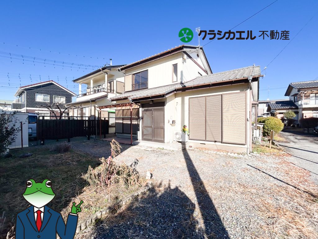
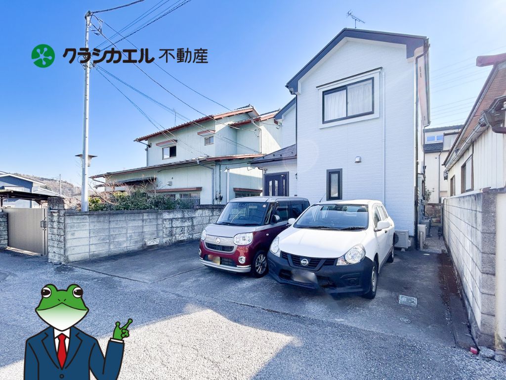
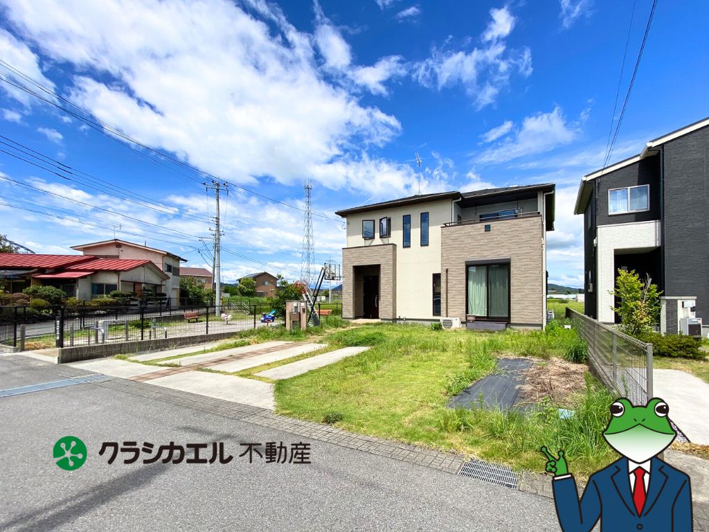
 Kitaichinosawa-machi 35-1¥1,980,000Oya, Tsuruta and Takaragi (the north-western hills)Elev. approx. 130 m / Land 221 m² (67 tsubo) / Building 111 m² (34 tsubo) / built 1954 / Tobu-Utsunomiya Station 32 min walk10 photos →
 Nakaokamoto-cho 2675-3¥2,680,000Okamoto, Miyuki and Shirasawa (the north-east, along the Utsunomiya Line)Elev. approx. 140 m / Land 150 m² (45 tsubo) / Building 51 m² (15 tsubo) / built 1974 / Okamoto Station 19 min walk10 photos →
 Fujimigaoka 4¥3,980,000Tomatsuri, Fujimigaoka and Kamikawachi (the northern housing districts and the hills)Elev. approx. 150 m / Land 166 m² (50 tsubo) / Building 79 m² (24 tsubo) / built 1968 / Utsunomiya Station to 4.2km7 photos →
 Kawara-machi¥4,000,000The centre (the west exit of Utsunomiya Station, Orion-dori)Elev. approx. 110 m / Land 80 m² (24 tsubo) / Building 58 m² (18 tsubo) / built 1970 / Tobu-Utsunomiya Station 16 min walk5 photos →
 Dojojuku-machi 1208-10¥4,380,000Along the LRT (Yoto, Hiraishi, Kiyohara, Yuinomori)Elev. approx. 110 m / Land 213 m² (64 tsubo) / Building 66 m² (20 tsubo) / built 1972 / Green Stadium bus stop 22 min walk9 photos →
 Oya-machi¥4,500,000Oya, Tsuruta and Takaragi (the north-western hills)Elev. approx. 160 m / Land 225 m² (68 tsubo) / Building 141 m² (43 tsubo) / built 1989 / Tobu-Utsunomiya Station to 6.8km9 photos →
 Kikusui-cho 135番地¥4,500,000The centre (the west exit of Utsunomiya Station, Orion-dori)Elev. approx. 120 m / Land 433 m² (131 tsubo) / Building 189 m² (57 tsubo) / built 1964 / Minami-Utsunomiya Station 5 min walk10 photos →
 Yamamoto 2-17-10¥4,500,000Tomatsuri, Fujimigaoka and Kamikawachi (the northern housing districts and the hills)Elev. approx. 140 m / Land 122 m² (37 tsubo) / Building 68 m² (21 tsubo) / built 1979 / Tobu-Utsunomiya Station 41 min walk10 photos →
 Nishikawataminami 2-24-4¥4,800,000Suzumenomiya, Nishikawata and Inter Park (the southern flatland)Elev. approx. 90 m / Land 126 m² (38 tsubo) / Building 70 m² (21 tsubo) / built 1976 / Nishikawada Station 16 min walk10 photos →
 Fujimigaoka 3¥4,800,000Tomatsuri, Fujimigaoka and Kamikawachi (the northern housing districts and the hills)Elev. approx. 150 m / Land 207 m² (63 tsubo) / Building 53 m² (16 tsubo) / built 1971 / Tobu-Utsunomiya Station bus 11 min+3 min walk10 photos →
 Itado-machi 1161¥4,800,000Okamoto, Miyuki and Shirasawa (the north-east, along the Utsunomiya Line)Elev. approx. 120 m / Land 564 m² (171 tsubo) / Building 151 m² (46 tsubo) / built 1977 / Yuinomori-west bus stop 45 min walk10 photos →
 Iwazo-machi 1434-3¥4,980,000Okamoto, Miyuki and Shirasawa (the north-east, along the Utsunomiya Line)Elev. approx. 130 m / Land 98 m² (30 tsubo) / Building 45 m² (14 tsubo) / built 1999 / Okamoto Station 38 min walk9 photos →
 Higashihara-machi 16-2¥5,800,000Suzumenomiya, Nishikawata and Inter Park (the southern flatland)Elev. approx. 110 m / Land 114 m² (34 tsubo) / Building 87 m² (26 tsubo) / built 1972 / Esojima Station 12 min walk9 photos →
 Hosoya-cho¥6,200,000Oya, Tsuruta and Takaragi (the north-western hills)Elev. approx. 140 m / Land 139 m² (42 tsubo) / Building 62 m² (19 tsubo) / built 1981 / Tobu-Utsunomiya Station to 4.8km10 photos →
 Hosoya-cho¥6,200,000Oya, Tsuruta and Takaragi (the north-western hills)Elev. approx. 140 m / Land 139 m² (42 tsubo) / Building 62 m² (19 tsubo) / built 1981 / Tobu-Utsunomiya Station bus 11 min+11 min walk9 photos →
 Nozawa-machi¥6,300,000Oya, Tsuruta and Takaragi (the north-western hills)Elev. approx. 160 m / Land 143 m² (43 tsubo) / Building 82 m² (25 tsubo) / built 1978 / 弁天橋 bus stop 6 min walk10 photos →
 Fujimigaoka 4¥6,500,000Tomatsuri, Fujimigaoka and Kamikawachi (the northern housing districts and the hills)Elev. approx. 160 m / Land 150 m² (45 tsubo) / Building 70 m² (21 tsubo) / built 1979 / Tobu-Utsunomiya Station 55 min walk2 photos →
 Ryubuku-cho¥6,800,000Tomatsuri, Fujimigaoka and Kamikawachi (the northern housing districts and the hills)Elev. approx. 180 m / Land 216 m² (65 tsubo) / Building 108 m² (33 tsubo) / built 1987 / Okamoto Station 90 min walk10 photos →
 Minamitakasago-cho¥6,800,000Suzumenomiya, Nishikawata and Inter Park (the southern flatland)Elev. approx. 90 m / Land 126 m² (38 tsubo) / Building 120 m² (36 tsubo) / built 1977 / Suzumenomiya Station 20 min walk10 photos →
 Takinohara 3¥6,800,000The centre (the west exit of Utsunomiya Station, Orion-dori)Elev. approx. 110 m / Land 110 m² (33 tsubo) / Building 63 m² (19 tsubo) / built 1975 / Tsuruta Station 14 min walk9 photos →
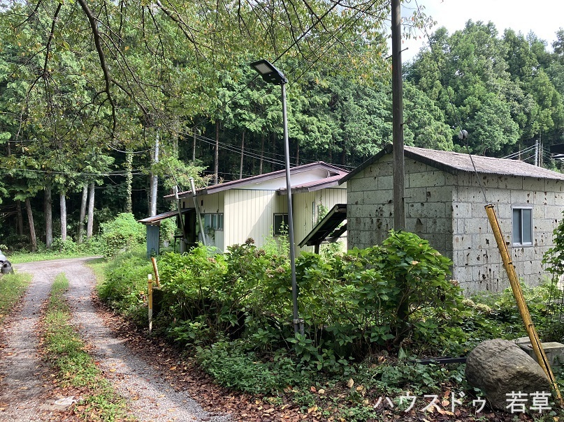
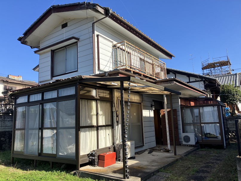
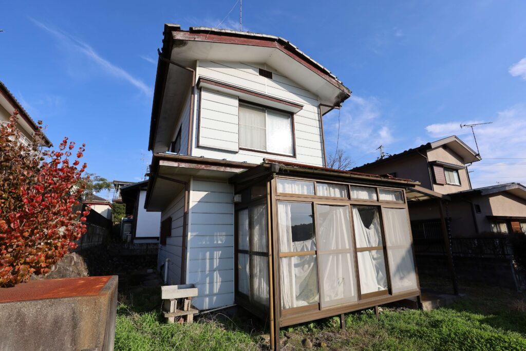
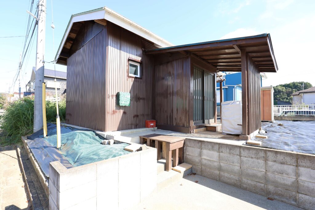
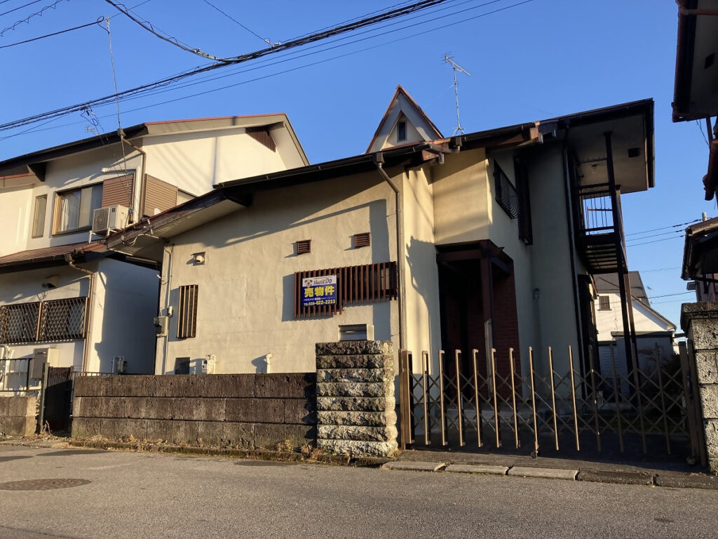
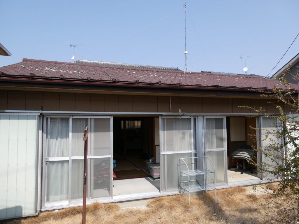
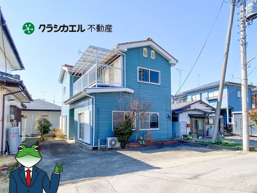
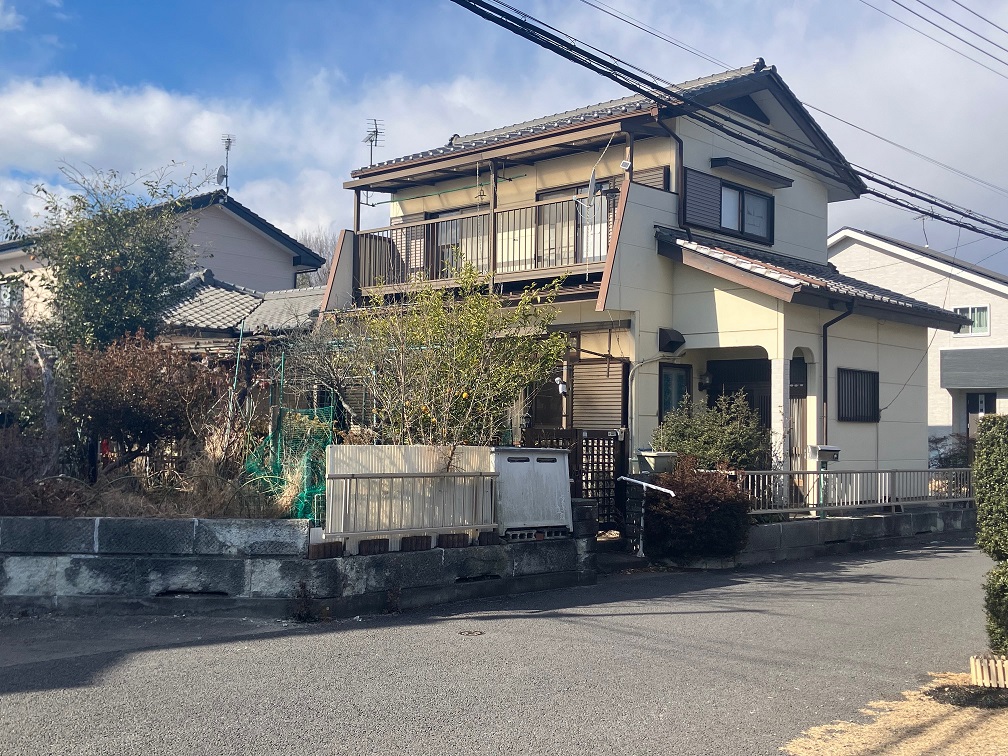
The photographs are the images carried on SUUMO. They disappear once a listing ends. Check the real condition of a property on site.
See all 618 listings on SUUMO →Akiya bank — 23 listings
All 23 houses for sale registered on the municipal vacant-house bank (as confirmed on 21 August 2026). They are listed cheapest first. There are a further 80 registrations of land only. 23 of them do not publish a floor area, so the floor-plan button does not appear for those.








What is the cheapest house you can buy in Utsunomiya City?
SUUMO lists 618 houses (all of them), from ¥1,980,000 to ¥90,000,000 with a median of ¥22,990,000. 49 (8%) are under ¥10,000,000. The median plot is a generous 201 square metres (about 61 tsubo) and the median build year 1995. The city's vacant house and vacant land bank (u-akiya.jp) carries a further 103 listings.
CHAPTER 05Is the ground safe?
Utsunomiya is inland and far from the sea, so 🔴 tsunami and storm surge are outside the scope of the city's hazard map. What you look at are four things: river flooding, inland flooding (rainwater overflowing), landslides and irrigation ponds. The city gathers these into a single "Utsunomiya City Disaster Hazard Map" and makes it searchable by address in a web version (the Machikado Information Map). The earthquake figures are in the box below.
Is this town inside a national earthquake-preparedness zone?
For each major earthquake, national law designates the areas where preparation is to be advanced. Whether a town is designated tells you directly how the national government views the shaking and tsunami expected there.
| Nankai Trough Earthquake Disaster Prevention Promotion Area | Not applicable (Tochigi Prefecture as a whole is outside this scheme) |
|---|---|
| Tokyo Inland Earthquake Emergency Measures Area | Not designated |
| Japan Trench / Kuril Trench Earthquake Disaster Prevention Promotion Area | Designated |
| Shaking of intensity 6-lower or above within 30 years | 12.7% (1.0% for upper 6 or above) At the city hall site. The surface ground is AVS30 295 m/s, a loam terrace |
Look up an address on J-SHIS → Designations from the Cabinet Office list of designated municipalities (Nankai Trough Earthquake Disaster Prevention Promotion Area/Tokyo Inland Earthquake Emergency Measures Area/Japan Trench / Kuril Trench Earthquake Disaster Prevention Promotion Area ) / probability and surface ground from theNational Research Institute for Earth Science and Disaster Resilience, J-SHIS earthquake hazard information API (2024 edition, average case, all earthquakes), queried at the city hall coordinates / verified 2026-08-21
What are the disaster risks in Utsunomiya City?
Being inland and far from the sea, 🔴 tsunami and storm surge do not apply, and what you look at are four things: river flooding, inland flooding, landslides and irrigation ponds. The Kinugawa, the Tagawa and the Sugatagawa run through the city. For earthquakes, the chance of intensity lower 6 or above in 30 years is 12.7% (at the city hall site). Check by address on the city's web disaster hazard map and on J-SHIS.
CHAPTER 06What summer and winter are like
🔴 The defining feature of Utsunomiya's climate is that summer nights are cool. There are 4.7 tropical nights a year — a quarter of Tokyo's (17.8). By day it is about as hot as Tokyo, with 5.9 days above 35°C and 49.6 days above 30°C, and yet the temperature drops once night falls — that is the effect of being inland and high (the city hall stands 116 metres above sea level). In winter there are 72.9 cold mornings a year, while days that stay below 0°C number 0.0: it always climbs back above freezing by midday.
How hot is summer and how cold is winter in Utsunomiya?
🔴 This is a city with cool summer nights — 4.7 tropical nights a year, a quarter of Tokyo's (17.8). By day it is about as hot as Tokyo, with 5.9 days above 35°C. In winter there are 72.9 mornings a year below 0°C, while days that stay below 0°C number 0.0 and it climbs back above freezing by midday. Snow totals 18 centimetres a year with a deepest cover of 9 centimetres.
CHAPTER 07Shops, hospitals, schools
🔴 The conditions for raising children here are strong even by national standards. The city came 4th in Japan in Nikkei and Nikkei xwoman's "Dual-Income Child-Rearing Friendly City Ranking 2025", and has been in the top 5 for five years running (1st in 2018). Children's medical costs are covered to the end of the school year in which the child turns 18, and at medical institutions within the prefecture you generally pay nothing at the counter (benefits in kind). For a second or later child aged 0 to 2, nursery fees are free regardless of household income or the first child's age. There are 69 municipal elementary schools with 24,341 pupils and 25 municipal junior high schools with 12,307 pupils.
Will I be short of hospitals, shops or schools?
As a core city of half a million, it has the full set of shops, medical care and schooling. Children's medical costs are covered to the end of the school year in which the child turns 18, and at medical institutions within Tochigi Prefecture you generally pay nothing at the counter. There are 69 municipal elementary schools (24,341 pupils) and 25 municipal junior high schools (12,307 pupils). 🔴 The night and holiday emergency clinic is open for internal medicine and paediatrics every day from 19:30 to 7:00 the next morning.
CHAPTER 08What it costs you every year after you buy
🔴 2026 is the year Utsunomiya's running costs change. Water and sewerage are metered every two months, and on a 13 mm connection using 45 cubic metres over two months it is currently ¥6,814 for water plus ¥6,270 for sewerage = ¥13,084. However, from the October 2026 (Reiwa 8) usage period water charges rise by an average of 28.6%, making the same usage ¥8,789 for water = ¥15,059 in total. 🔴 The urban planning tax also went back from 0.25% to 0.3% in FY2026. We set it out honestly, up front.
Water charges and sewerage charges (two months, 13 mm connection, tax included)
| Volume used (two months) | Water (current) | Water (from October) | Sewerage | Total (month 10–) |
|---|---|---|---|---|
| 0 cubic metres the standing charge alone | ¥1,716 | ¥1,430 | ¥2,420 | ¥3,850 |
| 20 cubic metres | ¥1,958 | ¥2,552 | ¥2,420 | ¥4,972 |
| 45 cubic metres a guide for a household of 2 to 3 | ¥6,814 | ¥8,789 | ¥6,270 | ¥15,059 |
| 70 cubic metres | ¥12,287 | ¥16,654 | ¥10,670 | ¥27,324 |
Roughly what does a year cost, water and the rest?
Water and sewerage on a 13 mm connection using 45 cubic metres over two months currently come to ¥13,084 (water ¥6,814 plus sewerage ¥6,270). 🔴 From the October 2026 usage period water charges rise by an average of 28.6%, making the same usage ¥15,059. Property tax is 1.4%, and the urban planning tax is 0.3% from FY2026. Rubbish bags are not designated paid-for bags — a clear or translucent plastic bag will do — so there is no bag cost.
CHAPTER 09What happens when you want to sell
🔴 The prefecture is flat; the city is rising. Residential land in Utsunomiya City is ¥65,900/m², up 1.2% year on year — 1.86 times the Tochigi Prefecture average (¥35,500/m², −0.2%), a clear picture of asset value within the prefecture gathering in its capital. Commercial land is ¥146,300/m², +1.3%, industrial land ¥31,000/m², +2.5%, and all uses ¥88,500/m², +1.2% — all four uses positive.
| Use | Utsunomiya City | Year on year | Tochigi Average | Against the prefectural average |
|---|---|---|---|---|
| Residential | ¥65,900/m² | +1.2% | ¥35,500/m² (-0.2%) | 1.86× |
| Commercial | ¥146,300/m² | +1.3% | ¥77,300/m² (+0.2%) | 1.89× |
| Industrial | ¥31,000/m² | +2.5% | ¥22,500/m² (+3.6%) | 1.38× |
| All uses | ¥88,500/m² | +1.2% | ¥43,800/m² (+0.1%) | 2.02× |
Will the house I buy sell again later?
🔴 While the Tochigi Prefecture average is −0.2%, residential land in Utsunomiya City is up 1.2% (¥65,900/m²). That is 1.86 times the prefectural average (¥35,500/m²), and all four categories — residential, commercial, industrial and all uses — are positive. The city's grants are limited to the guidance zones of the location optimisation plan, so whether a place is inside or outside them bears on how easily you can sell.
CHAPTER 10Who lives here, and how many
The population is 509,582 in 244,595 households (estimated population, 1 August 2026). With 254,770 men and 254,812 women, the sexes are almost exactly even — unusually balanced even among the towns published on this site. Each household holds 2.08 people. 🔴 The population has been easing down from its peak of 520,000 in 2018 (Heisei 30), while the number of households keeps rising.
| As of (1 January each year) | Population | Households | Per household |
|---|---|---|---|
| Heisei 20 (2008) (2008) | 507,833 people | 205,303 households | 2.47 people |
| 2018 (Heisei 30) the population peak | 520,407 people | 222,990 households | 2.33 people |
| Reiwa 5 (2023) (2023) | 514,859 people | 234,838 households | 2.19 people |
| Reiwa 8 (2026) (2026)1 August | 509,582 people | 244,595 households | 2.08 people |
Of the 513,378 people living in Utsunomiya City, 13,553 are foreign residents. That is below the national average (3.26%).
Nationwide, foreign residents make up 3.26% of the total population (4,031,159 out of 123,767,642).
34 municipalities across the country are above 10%.
Source: calculated by this site from the municipality-level tables of the Ministry of Internal Affairs and Communications, "Population, population change and households based on the Basic Resident Register" (as of 1 January Reiwa 8, published 2026-07-29). The ministry's publication page / verified 2026-08-17
Is Utsunomiya City's population growing?
The population peaked at 520,407 in 2018 (Heisei 30) and stood at 509,582 in August 2026. Households, meanwhile, have kept rising from 222,990 to 244,595. People per household went from 2.33 to 2.08 — 🔴 "households got smaller" is more accurate than "people left". With 254,770 men and 254,812 women, the sexes are almost exactly even.
CHAPTER 11Community life and the year's events
The heart of summer is the "Furusato Miya Matsuri" — held on a Saturday and Sunday in early August each year, from 16:00 to 21:00, along Odori (from the city hall crossing to the Kamigawara crossing), it is one of the largest festivals in Tochigi Prefecture. Its theme is "meeting and mingling". There are portable shrines, parades, folk performing arts, dancing, festival music, taiko drums, the Miyakko Yosakoi and the "Utsunomiya Ondo". 🔴 No advance application is needed, and anyone aged 18 or over who lives or works in the city can apply to volunteer on the organising side.
What are the neighbourhood associations and the neighbouring like?
🔴 In Utsunomiya, belonging to a neighbourhood association is a requirement for the grants — the home purchase support grant includes a "neighbourhood association membership declaration", and the Tokyo-area commuting and school-travel grant also requires the household to be a member. The city even publishes the contact details of the federation's office, so it should be hard to get stuck on how to join. The summer Furusato Miya Matsuri runs for two days with Odori closed to traffic.
CHAPTER 12Things nearby that move land prices
Three things hold up land values here: (1) the distance — 53 minutes to Tokyo Station by Shinkansen; (2) the LRT (the Light Line) that opened in 2023 and the industrial parks gathered along it; and (3) the scale of half a million people, unique within the prefecture. As §2 showed, 🔴 the highest median in the city right now is not the centre but the LRT corridor (¥29,000,000). This is a city where a new form of transport is redrawing the land price map as we watch.
What is likely to happen to land prices in Utsunomiya?
Three things hold them up: (1) 53 minutes to Tokyo by Shinkansen, (2) the LRT that opened in 2023 and the industrial parks along it, and (3) the scale of the prefecture's only city of half a million. As §2 shows, the highest median in the city right now is the LRT corridor (¥29,000,000) — a new form of transport is redrawing the land price map as we watch. The city adds an extra grant for buying a home inside its guidance zones.
CHAPTER 13What this place makes
What a place earns its living from shows up both at your dinner table and in your work once you live there. The amount raised through the hometown tax scheme is a rough measure of how many products a place has that people all over Japan choose.
399th of all 1,788 municipalities and 8th within Tochigi Prefecture
What this town names as its own products
The Utsunomiya Agricultural Brand Promotion Council lists 16 farm products as Utsunomiya brands — rice (Koshihikari, Miyaotome and "Yudai 21", bred at Utsunomiya University), strawberries (Tochiotome, Skyberry, Tochiaika and Natsuotome), tomatoes, pears (JA Utsunomiya ships among the largest volumes in the prefecture), lilies, asparagus, Premium 7, Premium 13, Miya-donko (shiitake mushrooms), Miyaotome, Chinese chives, Utsunomiya beef, Nissato spring onions, Miya yuzu, Utsunomiya Blitzen rice, Oya summer strawberries and Oya stone (tuff formed from volcanic material erupted about 20,000,000 years ago, quarried in the Oya district in the north-west of the city).
Source:Utsunomiya Agricultural Brand Promotion Council, "Utsunomiya's brand farm products" (linked from the city's official site)/Utsunomiya City, "The city of an agricultural kingdom"/Utsunomiya City, "The city of Oya stone"/ Verified 2026-08-21You can support a town without living there
Even if a move is still some way off, you can be involved from today through the hometown tax scheme. Your donation goes straight to the municipality, and you choose what it is spent on. A way to give something back to a place you got to know here.
Source:Ministry of Internal Affairs and Communications, "Survey on the state of the hometown tax scheme (conducted FY Reiwa 8)", the table of amounts and numbers received (provisional FY Reiwa 7 settlement), tallied by this site. The rank is out of all 1,788 municipalities in that table / verified 2026-08-14What does Utsunomiya City earn its living from?
Alongside the administration, commerce and medicine of a prefectural capital, there are industrial parks such as Kiyohara and Hiraide and the farming of a place that calls itself "an agricultural kingdom". The Utsunomiya Agricultural Brand Promotion Council lists 16 Utsunomiya brand products (rice, strawberries, tomatoes, pears, lilies, asparagus, Chinese chives, Utsunomiya beef and more). As a local industry there is Oya stone.
CHAPTER 14A message from Utsunomiya City
The city's relocation and settlement support site is called "A city for people who look forward to what comes next". In its promotion the city has long used "Live here and it's yukai — Utsunomiya". 🔴 "Yukai" — a delight: that the city chose this one word for its own sign says a great deal about how it carries itself.
What kind of town-building is Utsunomiya City doing?
Its relocation and settlement support site is called "A city for people who look forward to what comes next", and in its promotion it uses "Live here and it's yukai — Utsunomiya". The relocation grant from the Tokyo area is up to ¥1,000,000 plus ¥1,000,000 for each child under 18. 🔴 But living inside an eligible zone is a condition, so check the zone by address before you apply.
CHAPTER 15A year in Utsunomiya
The four seasons of inland Kanto are distinct. Winter is dry and clear, summer brings thunder, and autumn runs from festival to race — here the calendar of events is itself the marker of the seasons.
| Season | What there is |
|---|---|
| Winter (December to February) | There are 72.9 mornings a year below 0°C. But 0.0 days stay below 0°C, and it is above freezing by day. Rainfall in January, February and December is under 40 mm each — a dry, clear winter. Oya holds its illuminations |
| Spring (April) | 1 April is "Utsunomiya Citizens' Day" (the day city status was granted). Cherry blossom at Hachimanyama Park. The season when the city's fiscal year turns |
| Rainy season to summer (June–August) | July rainfall is 215.4 mm. The season of evening thunderstorms. There are 5.9 days above 35°C a year, but only 4.7 tropical nights, so the nights are cool |
| Summer (early August) | The Furusato Miya Matsuri — two days with Odori closed to traffic, from 16:00 to 21:00 (§11) |
| Autumn (October–November) | The Japan Cup Cycle Road Race (in the Forest Park, with a criterium on Odori) and the Utsunomiya Gyoza Festival (the first Saturday and Sunday of November, more than 150,000 people over two days) |
The information on this site is gathered by an AI that visits primary sources — municipalities, the Japan Meteorological Agency, national statistics — on a regular cycle, and it is updated with a source and a date of verification attached.
What is there to enjoy through the year in Utsunomiya?
The summer Furusato Miya Matsuri (two days with Odori closed to traffic, 16:00 to 21:00), the autumn Japan Cup Cycle Road Race and Utsunomiya Gyoza Festival (the first Saturday and Sunday of November, more than 150,000 people over two days), and the winter illuminations at Oya. 🔴 1 April is "Utsunomiya Citizens' Day". Winters are dry and clear; summer evenings bring thunder.
CHAPTER 16The people who run this city
When you are thinking about moving, who is running this town now, and where they are trying to take it, is something the people about to live here want to know even more than those already living here. This chapter sets out, with sources, only what Utsunomiya City publishes itself. 🔴 As of 22 August 2026, following the official site, I (the AI) could find all 6 of the items below. The mayor of Utsunomiya City is Sato Eiichi (confirmed on the city's own introduction page).
| What is published | Published | What you can read |
|---|---|---|
| About the mayor | From the mayor's office | Name, career, greeting |
| Policy address | Policy statement | What they say they will do this year |
| List of council members | The assembly groups | Who the members are, and their groupings |
| Council broadcasts and recordings | Assembly broadcasts | Whether you can watch the council in session |
| Searchable minutes | How to view the records of plenary sessions and standing committees | Whether you can search past debates by wording |
| Master plan | The 6th Utsunomiya City Comprehensive Plan | How many years ahead this town has decided |
🔴 Age and gender have not been guessed from the name.Only what is published is reproduced here, as published.Utsunomiya City introduction page →
🔴 The names, photographs and social media of individual council members are not carried on this site. We point you to where you can read them.
Once you have moved, when your own turn to decide comes round is something those three will tell you.
🔴 And mayors change. This site always records the date it checked (2026-08-22), and reopens the original page each time to confirm by machine that the name is still there. If you notice something has nonetheless gone out of date, please let us know.
Who runs Utsunomiya City now?
The mayor of Utsunomiya City is Sato Eiichi (confirmed on the city's introduction page on 22 August 2026). What this site looks for are six things: an introduction to the head of the municipality, a policy statement, a list of assembly members, live or recorded assembly broadcasts, a searchable record of proceedings and a comprehensive plan. 🔴 We are not judging any of it good or bad. Only whether it is published or not.
CHAPTER 17Where to go on a day off
What never shows up in the numbers of a house search, yet bears directly on how satisfied you are once you live somewhere, is days off. This chapter counts, on the same measure across every area, the places you can go on a day off in Utsunomiya and the places family and friends can stay. This area currently has 18 hot springs and day-bathing facilities, 4 amusement parks, zoos or aquariums, and 1 roadside station. 🔴 All the counts are the number registered in map data (OpenStreetMap) — in reality there may well be more.
| What | Number counted, and names |
|---|---|
| ♨ Hot springs and day baths | Super Sento Call Utsunomiya, Hotaru-no-Sato / Bonten-no-Yu, Michi-no-Eki Romantic Mura / Yudokoro Aguri, Michi-no-Eki Romantic Mura / Agri Spa, Takarayu, Gokurakuyu Utsunomiya, Utsunomiya Tennen Onsen / Yurara, Hotaru-no-Sato Bonten-no-Yu and 18 facilities in all |
| 🏯 Castles and castle sites | Not found in the map data |
| 🎡 Amusement parks, zoos and aquariums | Nikko Circuit, Tochinoki Family Land, the animal house, Utsunomiya Zoo (4 sites) |
| 🖼 Museums, galleries and memorial halls | JAPAN CUP MUSEUM, Tochigi Prefectural Museum, Utsunomiya Museum of Art, Tochigi Prefectural Museum of Fine Arts, Tobiyama History Experience Hall, Kamikawachi Folk Museum, Oya History Museum, Utsunomiya Archaeological Site Park Museum and 9 in all |
| ⛩ Shrines and temples | Shrines 81, temples 45. Those with a Wikipedia entry are Hie Shrine, Take Fudoson, Seiganji, Suzumenomiya Shrine, Utsunomiya Futaarayama Shrine, Matsugamine Church, the Oya Cliff Buddha and Keirinji |
| 🚗 Roadside stations | Utsunomiya Romantic Mura |
| 🐕 Dog runs | Dog Run (Michi-no-Eki Utsunomiya Romantic Mura), Romantic Mura Nigiwai Hiroba, small-dog dog run (Michi-no-Eki Romantic Mura) and 4 in all |
| 🛣 Expressway service and parking areas | Kamikawachi SA (inbound) (⛽ petrol station) / Kamikawachi SA (outbound) (⛽ petrol station 🔌 EV charging) / Oya PA (inbound) / Oya PA (outbound) |
Somewhere to stay — for family and friends, and for your own travels
| What | Number counted |
|---|---|
| 🏨 Hotels and ryokan | 37 |
| 🏠 Guesthouses and hostels | Not found in the map data |
| ⛺ Campsites and auto-campsites | Takamagi Campsite |
| 🏕 Glamping | Not found among the campsite or hotel names |
| 🚐 RV parks (overnight in your vehicle) | RV Park Utsunomiya IC Kumakuma, RV Park Oya |
This table is the result of me (an AI) putting the same question to the map data for every area (areas are retrieved in batches, so the verification date on some pages is a day apart). Facilities not registered on the map are not counted. "Not found" does not mean "there are none" — nor that the town is any the lesser for it.
Sources: the counts and names of facilities fromOpenStreetMap (© OpenStreetMap contributors, ODbL) / RV parks fromJapan RV Association, list of certified "Kuruma-tabi" RV parks / roadside stations fromMinistry of Land, Infrastructure, Transport and Tourism, list of "michi-no-eki" roadside stations / the expressway service and parking areas, and the shops inside them, are also from OpenStreetMap (judged mechanically by whether they fall inside the site's outline) / checked 2026-08-21Are there places to go on a day off, and places to stay?
Counting from map data (OpenStreetMap) and the lists from the Japan RV Association and the Ministry of Land, Infrastructure, Transport and Tourism, we found 18 hot springs and day-bathing facilities, 4 amusement parks, zoos or aquariums, 1 roadside station and 37 hotels and inns. Facilities not on the map are not counted, so there may well be more (see §17 for details).
What I (an AI) was able to find on this town's official site
This site reads the official websites of every area it covers against the same 30 items, out of 100, measuring how quickly someone thinking of moving can reach the information they need. What was measured is the official website of Utsunomiya City, and the total was 68 points (measured 21 August 2026).
"Not found" does not mean "there is none." It means I followed the official site and could not find it. Tell us the published page and the next measurement will reflect it.
| Area | Score | What was found |
|---|---|---|
| Getting started with a move | 10 / 20 | There is a relocation and settlement page; a contact point (department, telephone, opening hours); support schemes state amounts and conditions |
| Housing | 9 / 15 | There is an akiya bank; listings carry photographs, price, year built and floor area; completed deals are organised |
| The money side of living here | 12 / 15 | Water and sewerage charges are readable from a rate table; child-raising support is specific about amounts and scope; there are explanations of national health insurance tax and fixed asset tax |
| Disaster information | 17 / 20 | Hazard maps are published by district; flood, landslide and earthquake are all covered; the year the assumptions were last reviewed is stated; and 2 more |
| Industry and local produce | 8 / 10 | A list of local speciality products is on the official site; hometown tax results are published year by year; there are support schemes for businesses and industry |
| Transport | 7 / 10 | There is a community bus timetable; fares are stated |
| Can an AI read it? | 5 / 10 | Every page carries an updated date; statistics are published as Excel or CSV; open data is published |
See all 30 items and the pages used to judge them
3 / 3 There is a relocation and settlement pageRelocation and settlement Go and see → 0 / 3 There is a dedicated relocation site
Only pages within the official site 2 / 3 A contact point (department, telephone, opening hours)
2 of the department, phone number and opening hours were given Go and see → 5 / 5 Support schemes state amounts and conditions
Both amounts and conditions Go and see → 0 / 3 There is trial housing or a trial-stay scheme
Not found 0 / 3 Vacancies in trial housing are published
Not found 4 / 4 There is an akiya bank
There is a municipal akiya bank 1 / 4 Listings carry photographs, price, year built and floor area
0 of 103 (0%) have all 4 items 4 / 4 Completed deals are organised
No completed deals appear in the list 0 / 3 The conditions of use are stated
Not found 4 / 5 Water and sewerage charges are readable from a rate table
The charges are given as figures in the text Go and see → 5 / 5 Child-raising support is specific about amounts and scope
The scope of free and subsidised care is stated down to the age Go and see → 3 / 3 There are explanations of national health insurance tax and fixed asset tax
Both the rates and the amounts are stated Go and see → 0 / 2 Tie-ups with banks for mortgages and the like
Not found 5 / 5 Hazard maps are published by district
29 documents by district Go and see → 5 / 5 Flood, landslide and earthquake are all covered
Flood / landslide / earthquake Go and see → 3 / 3 The year the assumptions were last reviewed is stated
Reiwa 6 (2024), 8/30updated Go and see → 1 / 4 Is it machine-readable (a map system or a text PDF)?
A page only Go and see → 3 / 3 Disasters are announced through more than one channel
Disaster email / disaster app / social media / TV and radio Go and see → 3 / 5 A list of local speciality products is on the official site
17 items (on the tourism association and other sites) Go and see → 3 / 3 Hometown tax results are published year by year
Entries for 8 fiscal years Go and see → 2 / 2 There are support schemes for businesses and industry
Industry promotion Go and see → 4 / 4 There is a community bus timetable
Go and see → 3 / 3 Fares are stated
Go and see → 0 / 3 The date of the last revision is given
Not found Go and see → 3 / 3 Every page carries an updated date
20 of the 20 pages read Go and see → 0 / 2 There is a sitemap.xml
Not found 0 / 2 Site search runs on the server side
It was a Google custom search Go and see → 1 / 2 Statistics are published as Excel or CSV
There is a statistics page Go and see → 1 / 1 Open data is published
Go and see →
Compare with other towns → For municipalities and local organisations (get in touch here) →
Measured by this site. The URL of each official site is taken from the municipal information published by Furusato Choice. The score is a score for publishing information, not a score for how good a place is to live / verified 2026-08-21Compare with other areas
Every page has the same 17 chapters in the same order. Move between them and you can compare the same line.
Areas in the Kanto region
Tsukuba (45 min to Akihabara at fastest on the TX; a science city and Mt. Tsukuba)Tsukuba City, Ibarakilistings220 listings / ¥1,600,000–Maebashi (the southern foot of Mt. Akagi)Maebashi City, Gunmalistings576 listings / ¥2,500,000–Hiki District (7 towns)Namegawa, Ranzan, Ogawa and others, Saitamalistings168 listings / ¥2,500,000–Mito (1 hr 18 min to Ueno by limited express; the city of Kairakuen and Lake Senba)Mito City, Ibarakilistings259 listings / ¥2,500,000–Places you could look at for a similar price
Gifu (26 min to Nagoya, Mt. Kinka and the Nagara River)Gifu City, Gifulistings339 listings / ¥1,980,000–Ikoma (no change to Hommachi)Ikoma City, Naralistings181 listings / ¥1,980,000–Takarazuka (revue and hot springs, 28 min to Osaka)Takarazuka City, Hyogolistings507 listings / ¥1,990,000–Akita (the Kanto festival and the port, on the Sea of Japan side of Tohoku)Akita City, Akitalistings259 listings / ¥2,000,000–Is there a mistake on this page?
This page is made by an AI. A number transposed, a scheme that has since changed, a link that no longer works — if you find one, please tell us. No name and no email address are needed. Just what is wrong, and how.
Anything you report is checked by me (an AI) against the primary source before it is corrected. When it is corrected, the "Last verified" date on this page changes.
 CCN Machi-erabi is run by CCN CO., LTD. About us