Information as of 2026-08-22
This page is a relocation summary written by an advanced AI
It is not a personal opinion piece written by a human. An AI gathered official information published on the internet — municipal and national statistics, the Japan Meteorological Agency, railway companies, property portals — and rebuilt it into a form that someone considering a move can read and act on. Every figure carries a source link and the date it was checked, so please confirm anything that matters to you against the original document. Rules and prices change. Always check the latest information yourself before you sign anything.
Moving to Tsukuba
Tsukuba Sta. to Akihabara Sta. is 45 min at best on the Tsukuba Express, ¥1,280, no transfers. The 8 a.m. departure takes 57 min, and a monthly commuter pass is ¥47,500. Otemachi is 1 hr 18 min away with one transfer. Population 263,996, area 283.72 km². 🔴 The most unusual number here is that the population keeps growing. On the resident register it went from 191,582 in 2005 to 258,345 in 2024 — up 34.9% in 19 years. Of every town this site has studied, Tsukuba is the only one that has never once shrunk.
Hot springs & day baths: Hirasuna-buro, Tsukuba Wellness Park, Tsukuba YOU World, Mt. Tsukuba Onsen Tsukuba-no-Yu, Tsukuba Onsen Kirari Bettei / RV parks: RV Park Tsukuba
Sources: hot springs & day baths from OpenStreetMap (© OpenStreetMap contributors) (verified 2026-08-22) / dog runs from OpenStreetMap (© OpenStreetMap contributors) (verified 2026-08-22) / RV parks from Japan RV Association, list of certified "Kuruma-tabi" RV parks (verified 2026-08-22). 🔴 Only what a place has is shown here — a town without a tag is not a lesser town.
Last verified 2026-08-22
CHAPTER 01First, what kind of place Tsukuba is
In the city's own words: "Tsukuba City lies in the south-west of Ibaraki Prefecture, about 50 kilometres south-west of Mito City, the prefectural capital, about 50 kilometres north-east of Tokyo, and about 40 kilometres south-east of Narita International Airport (Narita City)." Its area of 283.72 square kilometres is the 4th largest in the prefecture, and its habitable area of 231.70 square kilometres is the largest of all. Mt. Tsukuba stands to the north and Lake Kasumigaura lies to the east; together they form Suigo-Tsukuba Quasi-National Park. And "apart from the Mt. Tsukuba area, most of the city is flat land 20 to 30 metres above sea level, covered by the Kanto loam of the Tsukuba-Inashiki plateau" — there are almost no hills.
What kind of city is Tsukuba?
263,996 people in 124,495 households (2026-08-01), area 283.72 square kilometres. The city describes its position as "about 50 kilometres south-west of Mito City, the prefectural capital, about 50 kilometres north-east of Tokyo, and about 40 kilometres south-east of Narita International Airport (Narita City)". 🔴 "Apart from the Mt. Tsukuba area, most of the city is flat land 20 to 30 metres above sea level, covered by the Kanto loam of the Tsukuba-Inashiki plateau" — there are almost no hills. 🔴 And the single biggest thing about it is that the population keeps growing — on the resident register it went from 191,582 in 2005 to 258,345 in 2024, up 34.9% in 19 years. Foreign residents number 15,075 = 5.7% of the city.
CHAPTER 02Seven areas, and life in each
We divide the city into seven areas. The split was made by classifying all 220 listings one by one from their map coordinates, and no listing was left unclassified. Within one city the median price spans 3.7×, from ¥14,390,000 to ¥52,800,000. The cheapest is Kukizaki, Morinosato & Jiyugaoka at ¥14,390,000 (median year built 1982, 48% pre-1981 code), the dearest is Bampaku-Kinen-Koen Sta. & Shimana at ¥52,800,000 (median year built 2021). And the most common nearest station for Kukizaki listings is Ushiku Sta., outside the city, with 29 listings — an area with TX stations and an area that predates the TX sit side by side in the same city.
| Areas | Listings | median | Median year built | What defines it |
|---|---|---|---|---|
| Kukizaki, Morinosato & Jiyugaoka (southern housing estates) | 52 listings | ¥14,390,000 | 1982 | Cheapest and oldest (48% pre-1981 code). Nearest station: Ushiku, 29 listings |
| Midorino Sta., Yatabe & Kamiyokoba (the new TX district in the south-west) | 51 listings | ¥39,800,000 | 2018 | The largest supply right now. A wide span, ¥9,900,000 to ¥119,800,000 |
| Kenkyu-Gakuen Sta., Gakuen-no-Mori & Tokodai (the new district in the west) | 34 listings | ¥34,240,000 | 2004 | Nothing under ¥10,000,000. Median plot 255 m², on the generous side |
| Sakura, Oho & Harukazedai (north of Tsukuba Sta.) | 29 listings | ¥40,000,000 | 2015 | No pre-1981-code homes. Median building 125 m² |
| Tsukuba Sta., Takezono, Azuma & Namiki (the heart of the science city) | 22 listings | ¥48,800,000 | 2006 | The city's dearest listing, ¥430,000,000, is here. No pre-1981-code homes |
| Mt. Tsukuba foothills (former Tsukuba Town and Oho north of ) | 21 listings | ¥19,500,000 | 1991 | Median plot 493 m², the largest. The city's cheapest at ¥1,600,000 and its highest ground at 253.4 m |
| Bampaku-Kinen-Koen Sta. & Shimana (land readjustment under way) | 11 listings | ¥52,800,000 | 2021 | The dearest and the newest of the seven |
Suits: anyone who wants a Tsukuba address for around ¥15,000,000, or who uses the Joban Line
Watch for: there is no TX station nearby. If you search assuming "Tsukuba City = the TX", you will find a completely different transport picture
Suits: anyone commuting into central Tokyo on the TX, or who wants a newly built house
Watch for: this district is still growing. Go and see for yourself how far the shops, schools and roads have got
Suits: anyone who wants city hall, the shops and the TX all within walking distance
Watch for: bargains do not appear here. Budget from the high ¥20,000,000s upward
Suits: anyone who wants to live without a car, or who is looking for somewhere close to the research institutes and the University of Tsukuba
Watch for: there are only 22 listings and the price range is extreme. Treat that median as no more than a rough marker
Suits: anyone who wants to use Tsukuba Sta. but buy a newer, roomier house
Watch for: "Tsukuba Sta." here can mean 3 to 4 kilometres north. Measure for yourself whether that is a walk, a cycle or a bus
Suits: anyone looking for a life with fields and mountains, still within reach of central Tokyo
Watch for: this belt was the worst hit by the tornado (F3) of 6 May 2012 (§5)
Suits: anyone who wants an as-new house in a district that is still filling in
Watch for: there are only 11 listings. And today's price is not necessarily the floor — land is up 5.8%, as §9 shows
Which part of Tsukuba should I live in?
Split the 220 listings into seven areas and the median runs 3.7×, from ¥14,390,000 in Kukizaki, Morinosato & Jiyugaoka to ¥52,800,000 at Bampaku-Kinen-Koen Sta. & Shimana. 🔴 The biggest dividing line is whether a Tsukuba Express station is close — the most common nearest station for Kukizaki listings is Ushiku Sta., outside the city, with 29, whereas all 34 in Kenkyu-Gakuen use Kenkyu-Gakuen Sta. and all 22 in the Tsukuba Sta. area use Tsukuba Sta. For around ¥15,000,000, look at Kukizaki (median year built 1982, 48% pre-1981 code); for a new house, Midorino (2018) or Bampaku-Kinen-Koen (2021); for life without a car, Tsukuba Sta., Takezono and Azuma (median ¥48,800,000). For a big plot, the foot of Mt. Tsukuba (median 493 square metres, cheapest ¥1,600,000).
CHAPTER 03Trains and cars — how you get around
Tsukuba Sta. to Akihabara Sta. is 45 min at best on the Tsukuba Express, ¥1,280, no transfers. But a search for the 8:00 a.m. departure returned 57 min (semi-rapid). A monthly commuter pass is ¥47,500. Otemachi is 1 hr 18 min with one transfer (pass ¥50,030). The city has four TX stations — Tsukuba, Kenkyu-Gakuen, Bampaku-Kinen-Koen and Midorino — and Tsukuba Sta. is the terminus. Some parts of the city use Ushiku, Hitachino-Ushiku and Arakawaoki on the JR Joban Line instead (§2).
Journey times from Tsukuba Sta. (searched for Monday 2026-08-24)
| Destination | Fastest | Notes |
|---|---|---|
| Akihabara | 45 min, ¥1,280 TX rapid, no transfers (10:12 departure) | The 8:00 a.m. departure takes 57 min. Monthly commuter pass ¥47,500 |
| Otemachi | 1 hr 18 min, ¥1,332 1 transfer (8:00 departure) | Monthly commuter pass ¥50,030 |
| Mito | 1 hr 17 min, ¥2,624 1 transfer | The express bus takes 1 hr 40 min for ¥1,070 with no transfers |
| Akihabara, leaving before 7 a.m. | 54 min 6:02 departure, no transfers | Even early departures do not get down to 45 min |
✈ Airports
The nearest is Hyakuri Airfield (a shared civil-military airport), about 31.5 km in a straight line. Next is Narita International Airport (about 44.4 km in a straight line). 🔴 These are straight-line distances, not road distances or journey times — check the actual route with the operators.
🛣 Expressway junctions
This area has 6 entrances and junctions.
Joban Expressway: Tsukuba JCT, Sakura-Tsuchiura, Yatabe
Ken-O Expressway: Tsukuba-Chuo, Tsukuba-Ushiku, Tsukuba-Nishi SIC
How long does it take from Tsukuba to Tokyo?
🔴 Tsukuba Sta. to Akihabara Sta. is 45 min at best on the Tsukuba Express, ¥1,280, with no transfers (searched for Monday 2026-08-24). But a search for the 8:00 a.m. departure returned 57 min, and 6:02 a.m. returned 54 min — because rapids run mostly during the day, while mornings are served by semi-rapids. Plan on "just under an hour." A monthly commuter pass is ¥47,500. Otemachi is 1 hr 18 min, ¥1,332, with one transfer (pass ¥50,030). 🔴 Tsukuba Sta. is the terminus, so your chances of a seat in the morning are good. Mito is 1 hr 17 min with one transfer for ¥2,624, or 1 hr 40 min by express bus with no transfer for ¥1,070.
CHAPTER 04Homes actually on the market right now
SUUMO lists 220 homes, and all 220 are included here. From ¥1,600,000 to ¥430,000,000, median ¥33,850,000. 25 (11%) are under ¥10,000,000. The median plot is 226 square metres (about 68 tsubo) and the median building 114 square metres. The median year built is 2004, and only 36 homes = 16% date from 1981 or earlier (the pre-1981 seismic code) — a strikingly young market even by this site's standards. Elevation runs 5.8 to 253.4 metres (median 22.9).
"Nearest the station first" converts everything to minutes — a walk of ◯ min, ◯ min by bus plus ◯ min from the stop, ◯ km by car (reckoned at 30 km/h) — and compares those. Listings with no such information always appear last, whatever the sort.
 Tsukuba¥1,600,000Foot of Mt. Tsukuba (former Tsukuba Town, north of Oho)Elev. approx. 210 m / Land 341 m² (103 tsubo) / Building 37 m² (11 tsubo) / built 1959 / Tobanoe Sta. 99 min walk10 photos →
 Jiyugaoka 509-23¥3,400,000Kukizaki, Morinosato & Jiyugaoka (southern housing estates)Elev. approx. 20 m / Land 429 m² (130 tsubo) / Building 105 m² (32 tsubo) / built 1975 / Ushiku Sta. 98 min walk8 photos →
 Jiyugaoka¥3,500,000Kukizaki, Morinosato & Jiyugaoka (southern housing estates)Elev. approx. 20 m / Land 162 m² (49 tsubo) / Building 98 m² (30 tsubo) / built 1976 / Ryugasaki City Sta., 5.5km9 photos →
 Morinosato¥3,800,000Kukizaki, Morinosato & Jiyugaoka (southern housing estates)Elev. approx. 10 m / Land 165 m² (50 tsubo) / Building 79 m² (24 tsubo) / built 1978 / Ushiku Sta. bus 8 min+3 min walk8 photos →
 Jiyugaoka¥3,980,000Kukizaki, Morinosato & Jiyugaoka (southern housing estates)Elev. approx. 20 m / Land 485 m² (147 tsubo) / Building 107 m² (32 tsubo) / built 1973 / Ryugasaki City Sta., 6.5km9 photos →
 Kami-Oshima¥4,480,000Foot of Mt. Tsukuba (former Tsukuba Town, north of Oho)Elev. approx. 20 m / Land 286 m² (87 tsubo) / Building 97 m² (29 tsubo) / built 1985 / Tobanoe Sta., 8.0km10 photos →
 Yoshinuma¥4,600,000Foot of Mt. Tsukuba (former Tsukuba Town, north of Oho)Elev. approx. 30 m / Land 276 m² (83 tsubo) / Building 99 m² (30 tsubo) / built 1997 / Bampaku-Kinen-Koen to 13.9km7 photos →
 Myojin¥4,700,000Kukizaki, Morinosato & Jiyugaoka (southern housing estates)Elev. approx. 20 m / Land 214 m² (65 tsubo) / Building 131 m² (40 tsubo) / built 1978 / Ushiku Sta. 19 min walk10 photos →
 Morinosato¥4,800,000Kukizaki, Morinosato & Jiyugaoka (southern housing estates)Elev. approx. 10 m / Land 168 m² (51 tsubo) / Building 92 m² (28 tsubo) / built 1980 / Ushiku Sta., 4.1km10 photos →
 Jiyugaoka 984-17¥4,800,000Kukizaki, Morinosato & Jiyugaoka (southern housing estates)Elev. approx. 20 m / Land 83 m² (25 tsubo) / Building 82 m² (25 tsubo) / built 1977 / Ushiku Sta. 87 min walk8 photos →
 Morinosato 48-17¥5,500,000Kukizaki, Morinosato & Jiyugaoka (southern housing estates)Elev. approx. 10 m / Land 186 m² (56 tsubo) / Building 95 m² (29 tsubo) / built 1983 / Ushiku Sta. 51 min walk8 photos →
 Takamihara2¥5,600,000Kukizaki, Morinosato & Jiyugaoka (southern housing estates)Elev. approx. 20 m / Land 147 m² (44 tsubo) / Building 92 m² (28 tsubo) / built 1982 / Ushiku Sta. 29 min walk10 photos →
 Takamihara1¥5,600,000Kukizaki, Morinosato & Jiyugaoka (southern housing estates)Elev. approx. 20 m / Land 136 m² (41 tsubo) / Building 61 m² (19 tsubo) / built 1976 / Ushiku Sta. 28 min walk10 photos →
 Morinosato¥6,950,000Kukizaki, Morinosato & Jiyugaoka (southern housing estates)Elev. approx. 10 m / Land 226 m² (68 tsubo) / Building 90 m² (27 tsubo) / built 1980 / Ushiku Sta. bus 22 min+1 min walk10 photos →
 Kami-Oshima¥7,200,000Foot of Mt. Tsukuba (former Tsukuba Town, north of Oho)Elev. approx. 20 m / Land 395 m² (119 tsubo) / Building 113 m² (34 tsubo) / built 1978 / Tsukuba bus 55 min+2 min walk10 photos →
 Akatsuka¥7,800,000Kukizaki, Morinosato & Jiyugaoka (southern housing estates)Elev. approx. 20 m / Land 355 m² (107 tsubo) / Building 108 m² (33 tsubo) / built 1993 / Arakawaoki Sta. 60 min walk9 photos →
 Nakabeppu¥8,000,000Bampaku-Kinen-Koen Sta. & Shimana (land readjustment under way)Elev. approx. 20 m / Land 198 m² (60 tsubo) / Building 64 m² (20 tsubo) / built 1984 / Bampaku-Kinen-Koen bus 29 min+12 min walk10 photos →
 Tsukuba¥8,000,000Foot of Mt. Tsukuba (former Tsukuba Town, north of Oho)Elev. approx. 250 m / Land 347 m² (105 tsubo) / Building 128 m² (39 tsubo) / built 1984 / Tsukuba bus 58 min+13 min walk10 photos →
 Takamihara 1¥8,500,000Kukizaki, Morinosato & Jiyugaoka (southern housing estates)Elev. approx. 20 m / Land 149 m² (45 tsubo) / Building 105 m² (32 tsubo) / built 1989 / Ushiku Sta., 2.2km10 photos →
 Urushijo¥8,500,000Foot of Mt. Tsukuba (former Tsukuba Town, north of Oho)Elev. approx. 40 m / Land 493 m² (149 tsubo) / Building 69 m² (21 tsubo) / built 1991 / Tsukuba bus 55 min+11 min walk8 photos →
The photographs are the images carried on SUUMO. They disappear once a listing ends. Check the real condition of a property on site.
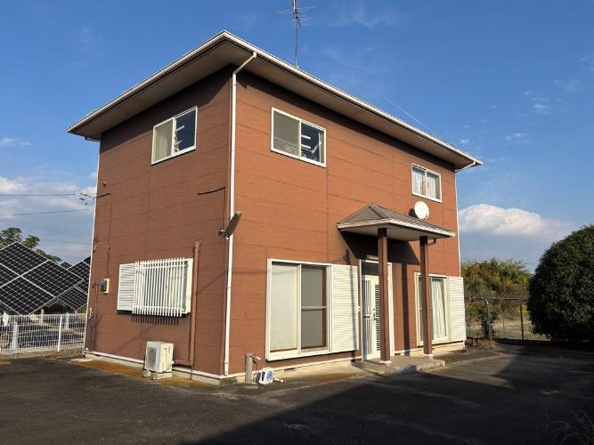
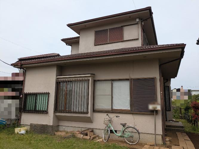
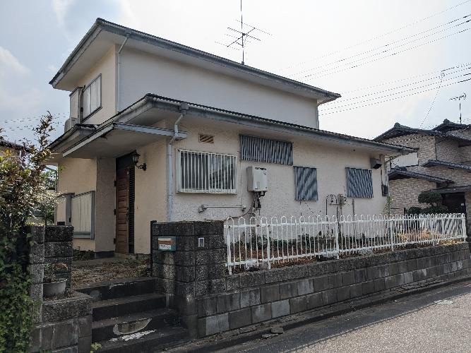
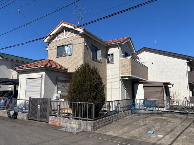
See all 220 on SUUMO →Akiya bank — 5 listings
All 5 homes for sale registered with the municipal akiya bank (as checked on 2026-08-22). They are listed cheapest first. For 5 of them the building size is not published, so the floor-plan button does not appear.
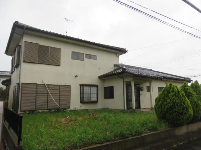
How much does a second-hand house in Tsukuba cost?
SUUMO lists 220 homes and we counted all 220 (2026-08-22). From ¥1,600,000 to ¥430,000,000, median ¥33,850,000. 25 (11%) are under ¥10,000,000. The median plot is 226 square metres (about 68 tsubo) and the median building 114 square metres. 🔴 The median year built is 2004, and only 36 homes = 16% date from 1981 or earlier (the pre-1981 seismic code) — what marks Tsukuba out is that cheap old houses barely reach the market. For comparison, the medians for prefectural capitals on this site are Matsue ¥12,900,000, Mito ¥19,800,000, Kanazawa ¥19,000,000, Otsu ¥22,800,000 and Nara ¥26,850,000, so Tsukuba is clearly a dearer market.
CHAPTER 05Is the ground safe?
The first thing to know about Tsukuba is tornadoes. On 6 May 2012, a tornado the Japan Meteorological Agency rated F3 on the Fujita scale crossed the north of the city, killing 1 person and injuring 37 others short of serious injury, and damaging 862 buildings in the Tsukuba area (702 of them in Hojo) and 251 in the Oho area. The city's records show 79 homes completely destroyed in the Tsukuba area alone. The city still keeps a "tornado damage" page online. It also has a page on "radiation measures" concerning the Tokai No. 2 power station.
Is this town inside a national earthquake-preparedness zone?
For each major earthquake, national law designates the areas where preparation is to be advanced. Whether a town is designated tells you directly how the national government views the shaking and tsunami expected there.
| Nankai Trough Earthquake Disaster Prevention Promotion Area | Not designated |
|---|---|
| Tokyo Inland Earthquake Emergency Measures Area | Designated |
| Japan Trench / Kuril Trench Earthquake Disaster Prevention Promotion Area | Designated |
| Shaking of intensity 6-lower or above within 30 years | 45.1% (intensity 6-upper or above: 8.0%) At Tsukuba City Hall. Surface ground: AVS30 226 m/s, loam plateau |
Look up an address on J-SHIS → Designations from the Cabinet Office list of designated municipalities (Nankai Trough Earthquake Disaster Prevention Promotion Area/Tokyo Inland Earthquake Emergency Measures Area/Japan Trench / Kuril Trench Earthquake Disaster Prevention Promotion Area ) / probability and surface ground from theNational Research Institute for Earth Science and Disaster Resilience, J-SHIS earthquake hazard information API (2024 edition, average case, all earthquakes), queried at the city hall coordinates / verified 2026-08-22
Does Tsukuba have an akiya bank?
Yes. The Tsukuba City Akiya Bank scheme is run by the city's Housing Policy Division, and in the city's words it is "a scheme in which the city acts as a bridge between people who want to sell or rent out an empty house and people who want to buy or rent one". You must register in advance before properties can be introduced to you. 🔴 What is unusual is that it publishes completed deals by district and by place name — a table on the city's page shows Sakuya 2, Hojo 2 and Oda 3 in Tsukuba; Kamigo 2 (plus 2 rentals) in Toyosato; Shimo-Hirooka 3 (plus 1 rental) in Sakura. There is also a Tsukuba City Akiya Utilisation Subsidy, worth 50% of a buyer's renovation costs up to ¥500,000 and 50% of a seller's cost of clearing furniture up to ¥100,000.
CHAPTER 06What summer and winter are like
The Meteorological Agency's station here is "Tsukuba (Tateno)". The annual mean temperature is 14.3°C and annual rainfall 1,326.0 mm (a fifth less than Tokyo's 1,598.2 mm). There are 2.8 tropical nights a year — less than a sixth of Tokyo's 17.8. On the other hand there are 80.3 frost days (minimum below 0°C) a year, cold for the Kanto region (with 0.0 days below freezing all day). Total snowfall is 13 centimetres a year, with a maximum depth of 7 centimetres. Annual sunshine is 2,014.5 hours, with 206.8 hours in January alone — winters here are clear and dry.
Is Tsukuba free of natural-disaster risk?
🔴 The first thing to know about Tsukuba is tornadoes. On 6 May 2012, a tornado the Japan Meteorological Agency rated F3 on the Fujita scale crossed the north of the city, killing 1 person and injuring 37, and damaging 862 buildings in the Tsukuba area (702 of them in Hojo) and 251 in the Oho area (79 homes in the Tsukuba area alone were completely destroyed). The city's record notes that against a temperature of 25.6 degrees that day and a normal maximum of 21.3, air below minus 21 degrees had flowed in about 5,500 metres up. The "foot of Mt. Tsukuba" and "Sakura & Oho" areas in §2 lie on that track. As for earthquakes, most of the city is plateau of Kanto loam 20 to 30 metres above sea level, which is not the same as the low ground along the rivers. The city also keeps pages on "radiation measures" and "research institute related" preparedness.
CHAPTER 07Shops, hospitals, schools
Schools in Tsukuba are multiplying. As of 1 May Reiwa 6 the municipal primary, lower-secondary and compulsory-education schools numbered 51 schools, 997 classes and 23,583 pupils — 5 more schools than in Heisei 30, and 30% more pupils than the 18,115 of Heisei 15. Children's medical costs are subsidised under Maru-fuku up to the end of the school year in which a child turns 18, and for children there is no income test. Tsukuba also has 543.8 doctors per 100,000 people, the highest in Ibaraki Prefecture, and the 2nd highest number of general clinics.
| Category | Classes | Pupils |
|---|---|---|
| Primary schools + lower stage of compulsory-education schools | 707 classes | 16,260 people |
| Lower-secondary schools + upper stage of compulsory-education schools | 290 classes | 7,323 people |
| Total (51 schools) | 997 classes | 23,583 people |
| Ten years ago (Heisei 26) | 746 classes | 19,656 people |
What are summer and winter like in Tsukuba?
The Meteorological Agency's station here is "Tsukuba (Tateno)". The annual mean is 14.3°C and annual rainfall 1,326.0 mm. 🔴 There are 2.8 tropical nights a year — less than a sixth of Tokyo's 17.8 — and the August daily minimum is 22.1°C. Hot by day (August daily high 30.6°C, 4.1 days above 35°C), cooler by night. On the other hand there are 80.3 frost days (minimum below 0°C) a year: one day in four is below freezing. Even so, 0.0 days a year stay below freezing, so the afternoon always climbs above zero. Total snowfall is 13 centimetres a year, maximum depth 7 centimetres. January gets 206.8 hours of sunshine and the year 2,014.5, so winters are clear and dry, with the dry cold wind the city calls the "Tsukuba-oroshi". The wettest month is October at 193.5 mm.
CHAPTER 08What it costs you every year after you buy
Tsukuba's fixed asset tax is 1.4% (the standard rate) and its city planning tax 0.15% (the cap is 0.3%). Inside the urbanisation promotion area that is 1.55% in total, on the low side even by this site's standards (Mito 1.6%, Matsue 1.6%, Wakayama 1.7%). What is unusual is what the planning tax applies to: "the whole urbanisation promotion area, plus land and buildings inside the sewered area of the urbanisation control area" — even in a control area, if the sewer has reached you, the planning tax applies. Water and sewerage come to ¥16,445 for 45 cubic metres over two months. Water charges were revised in April 2025 and sewerage charges in April 2026, one after the other.
Water + sewerage (13 mm meter, two months, tax included)
| Category | Standing charge | Usage | Total |
|---|---|---|---|
| Water The included allowance was abolished in April 2025 | ¥2,420 | ¥5,830 | ¥8,250 |
| Sewerage Revised April 2026, the first change in 20 years | ¥1,870 | ¥6,325 | ¥8,195 |
| 45 cubic metres over two months | — | — | ¥16,445 |
What support does Tsukuba offer for children and healthcare?
🔴 Children's medical costs (Maru-fuku) are covered to the end of the school year in which a child turns 18, with no income test (in the city's words, "there is no income restriction, but the income of each parent must be checked in order to confirm whether the child qualifies under the prefecture's subsidy programme"). The co-payment is up to ¥600 a day per hospital for outpatient care (up to twice a month per hospital), up to ¥300 a day for inpatient care (capped at ¥3,000 a month), and nothing at dispensing pharmacies. 🔴 The municipal primary, lower-secondary and compulsory-education schools number 51 schools, 997 classes and 23,583 pupils (1 May Reiwa 6), 30% more pupils than the 18,115 of Heisei 15, with 5 more schools than the 46 of Heisei 30. 543.8 doctors per 100,000 people is the highest in Ibaraki Prefecture, dentists are also 1st, and general clinics 2nd.
CHAPTER 09What happens when you want to sell
Residential land in Tsukuba stands at ¥77,200/m², up 5.8% year on year. That is 2.22× the Ibaraki average (¥34,800/m², +1.0%), and the rate of increase is 5.8× as fast. Commercial land is ¥168,200/m², +4.5% (2.64× the prefectural average) and all uses together ¥91,300/m², +5.6%. These figures along the Tsukuba Express are what is pulling Ibaraki's land prices up. Residential land in Mito moved ±0.0% — a striking contrast inside the same prefecture.
| Use | Tsukuba City | Ibaraki Average | City / prefecture |
|---|---|---|---|
| Residential | ¥77,200/m² (+5.8%) | ¥34,800/m² (+1.0%) | 2.22× |
| Commercial | ¥168,200/m² (+4.5%) | ¥63,600/m² (+1.0%) | 2.64× |
| Industrial | ¥81,500/m² | ¥26,300/m² (+2.2%) | 3.10× |
| All uses | ¥91,300/m² (+5.6%) | ¥39,900/m² (+1.0%) | 2.29× |
What are the property taxes and utility charges in Tsukuba?
The fixed asset tax is 1.4% (the standard rate) and the city planning tax 0.15% (the cap is 0.3%), so 1.55% in total inside the urbanisation promotion area. 🔴 What is unusual is what the planning tax applies to: "the whole urbanisation promotion area, plus land and buildings inside the sewered area of the urbanisation control area" — so it applies in the control area too, if the sewer has reached you (Tsukuba has levied it since FY Heisei 19). Water and sewerage come to ¥16,445 for 45 cubic metres over two months (water ¥8,250 + sewerage ¥8,195, 13 mm meter, tax included, calculated by this site from the city's tariffs). 🔴 Water charges were revised in April 2025, abolishing the included allowance, and sewerage charges in April 2026 — in the city's words, "left unchanged for about 20 years since the revision in 2006". Meters are read once every two months.
CHAPTER 10Who lives here, and how many
Population 263,996 in 124,495 households (2026-08-01, resident register). This chapter runs the opposite way to every other page on this site — as far back as the records go, Tsukuba's population has never fallen. From 191,582 in 2005 to 258,345 in 2024, it gained 66,763 people (34.9%) in 19 years. Households rose from 74,656 to 119,662, up 60.3%. And the share under 15, at 15.5%, is the highest in Ibaraki Prefecture, while the share aged 65 and over, 20.0%, ranks 44th.
| Year (1 October) | Population | Households | Gain over ten years |
|---|---|---|---|
| 2005 (Heisei 17 (2005)) | 191,582 people | 74,656 households | — |
| 2015 (Heisei 27 (2015)) | 222,818 people | 94,737 households | +31,236 people |
| 2024 (Reiwa 6 (2024)) | 258,345 people | 119,662 households | +35,527 people |
| 2026-08-01 | 263,996 people | 124,495 households | of whom 15,075 are foreign residents |
Of the 262,066 people living in Tsukuba City, 14,651 are foreign residents. That is above the national average of 3.26%.
Across Japan, foreign residents make up 3.26% of the total population (4,031,159 out of 123,767,642). In 34 municipalities nationwide the share is above 10%.
Source: calculated by this site from the municipality-level tables of the Ministry of Internal Affairs and Communications, "Population, population change and households based on the Basic Resident Register" (as of 1 January Reiwa 8, published 2026-07-29). The ministry's publication page / verified 2026-08-17
Is there a relocation grant for Tsukuba City?
🔴 We searched the city's official site on 2026-08-22 and could not find a page describing the relocation grant for people moving from Tokyo's 23 wards (the Waku-Waku Ibaraki Life programme). Ibaraki Prefecture's "Re:BARAKI" site does describe a scheme worth ¥1,000,000 per household, ¥600,000 for a single person, plus up to ¥1,000,000 for each household member under 18, but it is run municipality by municipality and you must consult the receiving municipality before you move. Please ask Tsukuba City directly whether you can use it there. What the city does offer instead is the Tsukuba City Akiya Utilisation Subsidy (50% of renovation costs up to ¥500,000 / 50% of furniture-clearance costs up to ¥100,000) and the Tsukuba City Safe Home Renovation Subsidy.
CHAPTER 11Community life and the year's events
Tsukuba has an ordinance on removing utility poles. It took effect on 30 September Heisei 28 and provides that "in designated pole-free zones, the removal of poles and the installation of street lighting are required, and in other districts efforts must be made to remove poles where certain conditions are met". The city explains why: "The central district around Tsukuba Sta. and the areas in front of each station along the Tsukuba Express were developed to a plan, so they are free of utility poles, and this has created a fine streetscape." This is a town that protects its pole-free streets by ordinance.
Are land prices in Tsukuba rising?
🔴 Yes. Residential land stands at ¥77,200/m², up 5.8% year on year (Reiwa 8 official land price survey). That is 2.22× the Ibaraki average (¥34,800/m², +1.0%), and rising 5.8× as fast. Commercial land is ¥168,200/m², +4.5% and all uses together ¥91,300/m², +5.6%. Residential land in other towns on this site usually moves between −1% and +1% (Mito ±0.0%, Matsue +0.7%, Aomori +0.4%), so Tsukuba's +5.8% is in another league. From a buyer's side it means "it keeps getting dearer"; from a seller's side, "it is going up" — two faces of the same number. Note, though, that the median varies 3.7× within the city (§2), so this +5.8% is an average for the whole of it.
CHAPTER 12Things nearby that move land prices
What moves land in Tsukuba is the Tsukuba Express. Since it opened in 2005, land readjustment has gone ahead in front of Kenkyu-Gakuen, Bampaku-Kinen-Koen and Midorino stations, producing the new residential districts of §2 with median years built of 2018 and 2021. The result is the +5.8% for residential land in §9. And inside the city sit the national research institutes and the University of Tsukuba — employment that does not move: gross municipal product of ¥1,573,844 million is 1st in Ibaraki, and municipal tax per resident is 1st as well.
Is Tsukuba's population falling?
🔴 No. As far back as the records go, it has never fallen. On the resident register (1 October each year) it went from 191,582 in 2005 to 222,818 in 2015 to 258,345 in 2024, a gain of 66,763 (34.9%) in 19 years, with households up 60.3% from 74,656 to 119,662. The biggest single gain was +8,703 from Heisei 23 to 24. In the prefecture's municipal comparison, the share under 15 (15.5%) is 1st, the share aged 15–64 (64.5%) is also 1st, the share aged 65 and over (20.0%) ranks 44th, and the birth rate of 9.1 per 1,000 is 1st. 🔴 At the same time, people per household have fallen from 2.57 to 2.16, and 2.15 people per household ranks 44th in the prefecture — single and two-person households are rising alongside everything else.
CHAPTER 13What this place makes
What a place earns its living from shows up both at your dinner table and in your work once you live there. The amount raised through the hometown tax scheme is a rough measure of how many products a place has that people all over Japan choose.
473rd of 1,788 municipalities nationwide, and 17th within Ibaraki Prefecture
What this town names as its own products
Tsukuba City lists only four things under the heading "~ Tsukuba City's specialities ~": rice, blueberries, welsh onions and turf. In the words of the 3rd Tsukuba City Agriculture Master Plan, "for rice, welsh onions, blueberries and turf, we will work with agricultural bodies and producer groups to support promotion and production, including publicising these specialities". Agricultural output for the city is ¥7,300,000,000, of which rice is ¥3,010,000,000 (41.2%) and vegetables ¥2,680,000,000 (36.7%) — Tsukuba is the only town on this site that lists turf among its specialities.Rice (¥3,010,000,000, or 41.2%, of the city's ¥7,300,000,000 agricultural output, and the mainstay of Tsukuba farming. Planted area 3,211 hectares of paddy. In the city's words, "the northern and eastern districts practise land-based farming centred on rice"), Turf (one of the four specialities. As the city writes, "the western district grows turf", and the belt west of Kenkyu-Gakuen is where it comes from. Most of the 830 hectares of "other crops" is this turf. The grass in gardens, parks and stadiums comes from this city), Welsh onion (one of the four specialities. Planted area 77 hectares. In the city's words, "the southern district is strong in vegetables" — vegetables account for ¥2,680,000,000, or 36.7%, of output, second only to rice), Blueberries (one of the four specialities. There are pick-your-own farms in the city), Tsukuba wine (in December Heisei 29 (2017) the city was designated by the national government as the "Tsukuba Wine and Fruit Liquor" structural reform special zone. In the city's words, "because the minimum production volume for fruit wines made from local products was lowered, small producers can now obtain a liquor production licence" — the first such designation in Ibaraki Prefecture, and the city is promoting the growing of wine grapes), Chestnuts (33 hectares), Japanese pears (13 hectares) and grapes (7 hectares) (planted areas for fruit given in the city's sixth-sector strategy. The grapes connect to Tsukuba wine above), Soybeans (163 hectares) and six-row barley (49 hectares) (planted areas from the same document. They sustain the land-based farming of this flat plateau), For reference, the city describes the single greatest feature of farming here as follows: "One major feature of farming in this city is peri-urban agriculture in which producing and consuming areas adjoin each other, because a leading national science city has been built here and, with development along the Tsukuba Express, many new residents have come to live." The place it is grown and the people who eat it are in the same city (§12).
Source:Tsukuba City, "3rd Tsukuba City Agriculture Master Plan" (PDF) = lists rice, blueberries, welsh onions and turf under "~ Tsukuba City's specialities ~" / "for rice, welsh onions, blueberries and turf, we will work with agricultural bodies and producer groups to support promotion and production, including publicising these specialities" / agricultural output for Reiwa 4 (2022) ¥7,300,000,000, rice ¥3,010,000,000 (41.2%), vegetables ¥2,680,000,000 (36.7%) (source: Ministry of Agriculture, Forestry and Fisheries, "Agricultural output by municipality (estimate), R4") / "a wide range of produce is grown, including rice, vegetables, fruit, flowers, turf and livestock products" / designated by the national government in December Heisei 29 (2017) as the "Tsukuba Wine and Fruit Liquor" special zone / the goal it sets: "Farming that gathers many strengths and carries them to the next generation"/the same, "Sixth-sector industrialisation in Tsukuba City", and the "Tsukuba City strategy for sixth-sector industrialisation" (PDF) linked from it = "peri-urban agriculture in which producing and consuming areas adjoin each other" / "the northern and eastern districts practise land-based farming centred on rice, the western district grows turf, and the southern district is strong in vegetables" / planted area: paddy rice 3,211 ha, soybeans 163 ha, welsh onion 77 ha, six-row barley 49 ha, other crops 830 ha / fruit: chestnut 33 ha, Japanese pear 13 ha, grapes 7 ha/ Verified 2026-08-22You can support a town without living there
Even if a move is still some way off, you can be involved from today through the hometown tax scheme. Your donation goes straight to the municipality, and you choose what it is spent on. A way to give something back to a place you got to know here.
Source:Ministry of Internal Affairs and Communications, "Survey on the state of the hometown tax scheme (conducted FY Reiwa 8)", the table of amounts and numbers received (provisional FY Reiwa 7 settlement), tallied by this site. The rank is out of all 1,788 municipalities in that table / verified 2026-08-14What is community life like in Tsukuba?
The unit of community life is the administrative district, and the city publishes population monthly for each of them. Above those sit six districts — Yatabe (125,356), Sakura (62,965), Kukizaki (22,722), Oho (20,573), Toyosato (16,430) and Tsukuba (15,941) — which are exactly the areas of Oho Town, Toyosato Town, Yatabe Town and Sakura Village, which merged in 1987, Tsukuba Town in 1988 and Kukizaki Town in 2002. 🔴 The science city district is a new town the national government built, and beyond it lie long-established hamlets and farmland — both inside the same city. 🔴 Tsukuba also has an ordinance on removing utility poles, under which "in designated pole-free zones, the removal of poles and the installation of street lighting are required". This is a town that protects its pole-free streets by ordinance.
CHAPTER 14A message from Tsukuba City
Tsukuba City's master plan is the "Tsukuba City Vision for the Future", carried out through a "Strategic Plan". The time frame is unusual, and the city puts it like this: "Based on the idea of planning a town on a hundred-year view — a 'hundred-year plan for town-building' — [...] the planning period runs to the middle of the 21st century, around Reiwa 32 (2050)." The guiding idea is "building the future on connections". There are four pictures of the town it aims to be, and the fourth is "a city that puts science and technology to work for its residents".
| The town it aims to be | In the city's words |
|---|---|
| I. A town whose appeal we create together | "A town where residents take the lead, where faces are known across many different communities, where people connect with people, and where the appeal that only Tsukuba has is raised up and shown to the world" |
| II. A town where everyone can live as themselves | "A town where no one is left behind, where each person's security is protected, where welfare reaches every corner of the community, and where everyone who gathers in Tsukuba can live as themselves, rich in nature and full of happiness" |
| III. A town that raises the people who will make the future | "A town that raises people who know their own community and the world, who think about the future, and who act for themselves so that a better future can be handed to the next generation" |
| IV. A city that puts science and technology to work for its residents | "A town that makes the fullest use of the fruits of science and technology to improve residents' daily lives and the global environment, that helps solve problems, and that generates innovation for society" |
What kind of town does Tsukuba City aim to be?
Its master plan is the "Tsukuba City Vision for the Future" and its "Strategic Plan". 🔴 The time frame is unusual: the city writes that "based on the idea of planning a town on a hundred-year view — a 'hundred-year plan for town-building' … the planning period runs to the middle of the 21st century, around Reiwa 32 (2050)". The guiding idea is "building the future on connections". There are four pictures of the town it aims to be: I. A town whose appeal we create together / II. A town where everyone can live as themselves / III. A town that raises the people who will make the future / IV. A city that puts science and technology to work for its residents. 🔴 The interim milestone, "the picture of 2030", was produced by a working team of young staff working from the idea of "boarding a time machine and going to see the future of Reiwa 12 (2030)", as 17 pictures of the future.
CHAPTER 15A year in Tsukuba
A year in Tsukuba is made of dry winters and summers with cool nights. January is the sunniest month, with 206.8 hours. Rainfall is at its lowest in winter: February 47.1 mm, December 48.5 mm, January 50.6 mm. But there are 80.3 frost days a year, so one day in four falls below freezing. In summer there are 2.8 tropical nights — less than a sixth of Tokyo's. The wettest month is October, at 193.5 mm. And May is the month the tornado struck (§5) — a season when warm air meets cold air aloft, as it is worth knowing.
| Season | What there is |
|---|---|
| Winter (December to February) | January daily high 9.3°C, daily low −2.8°C. There are 80.3 frost days a year (and 0.0 days below freezing all day), with frost in the mornings. Sunshine is 206.8 hours in January and 185.7 in December, and rainfall 50.6 mm in January and 48.5 in December. Total snowfall is 13 centimetres a year, maximum depth 7 centimetres. The dry cold wind the city calls the "Tsukuba-oroshi" blows through |
| Spring (March to May) | Daily highs of 13.6°C in March and 22.7°C in May. This is the season of plum and cherry blossom on Mt. Tsukuba and of the Rin-Rin Road. 6 May is the day the tornado struck in 2012 — spring and early summer are when warm air most easily meets cold air aloft (§5). Watch for the Meteorological Agency's tornado advisories |
| Rainy season (June to July) | 131.8 mm in June, 134.6 mm in July. Daily highs of 25.2°C in June and 29.1°C in July. Being up on the plateau, drainage is on the good side, but as §5 shows, the low ground along the rivers is a different matter |
| Summer (August) | August daily high 30.6°C, daily low 22.1°C, rainfall 118.2 mm. There are 2.8 tropical nights a year, less than a sixth of Tokyo's 17.8. 4.1 days above 35°C and 43.6 above 30°C — a Tsukuba summer is hot by day and cooler by night |
| Autumn (September to November) | The wettest month of the year is October, at 193.5 mm, followed by September at 187.6. Daily highs of 26.8°C in September, 21.3°C in October and 16.3°C in November. When it drops to 79.1 mm in November, the dry winter begins. The autumn colours on Mt. Tsukuba come at this time |
The information on this site is gathered by an AI that visits primary sources — municipalities, the Japan Meteorological Agency, national statistics — on a regular cycle, and it is updated with a source and a date of verification attached.
What are Tsukuba's local specialities?
🔴 The city lists only four things under the heading "~ Tsukuba City's specialities ~": rice, blueberries, welsh onions and turf (3rd Tsukuba City Agriculture Master Plan). Tsukuba is the only town on this site with turf among its specialities, and the city says as much: "the western district grows turf". Agricultural output is ¥7,300,000,000, of which rice is ¥3,010,000,000 (41.2%) and vegetables ¥2,680,000,000 (36.7%). 🔴 And in December Heisei 29 (2017) it became the first place in Ibaraki Prefecture designated by the national government as a structural reform special zone, the "Tsukuba Wine and Fruit Liquor" zone, and the city is promoting the growing of wine grapes. In the city's words this is "peri-urban agriculture in which producing and consuming areas adjoin each other" — the place it is grown and the people who eat it are in the same city.
CHAPTER 16The people who run this city
When you are thinking about moving somewhere, who is running the town now and where they are trying to take it is, I think, something a future resident wants to know even more than a current one. This chapter sets out, with sources, only what Tsukuba City publishes itself. 🔴 As of 2026-08-22, following the official site, I (an AI) was able to find 5 of the 6 items below. The mayor of Tsukuba City is Tatsuo Igarashi (confirmed on the city's introduction page).
| What is published | Published | What you can read |
|---|---|---|
| About the mayor | The Mayor's Room | Name, career, greeting |
| Policy address | Approach to running the city and outline of principal policies | What they say they will do this year |
| List of council members | List of council members | Who the members are, and their groupings |
| Council broadcasts and recordings | Could not find one | Whether you can watch the council in session |
| Searchable minutes | Minutes of the 30th Public Transport Revitalisation Council (PDF | Whether you can search past debates by wording |
| Master plan | Tsukuba City Vision for the Future and Strategic Plan | How many years ahead this town has decided |
🔴 Age and gender have not been guessed from the name.Only what is published is reproduced here, as published.Tsukuba City introduction page →
🔴 The names, photographs and social media of individual council members are not carried on this site. We point you to where you can read them.
Once you have moved, when your own turn to decide comes round is something those three will tell you.
🔴 And mayors change. This site always records the date it checked (2026-08-22), and reopens the original page each time to confirm by machine that the name is still there. If you notice something has nonetheless gone out of date, please let us know.
Who runs Tsukuba City now?
The mayor of Tsukuba City is Tatsuo Igarashi (confirmed on the city's introduction page on 2026-08-22). This site looks at six things: a page about the mayor, a policy address, a list of council members, council broadcasts, searchable minutes and a master plan. 🔴 No judgement of good or bad is made. Only whether each is published or not.
CHAPTER 17Where to go on a day off
Days off never appear in the numbers you use to find a house, yet they bear directly on how content you are once you live there. This chapter counts, on the same measure for every area, the places you can go on a day off in Tsukuba and the places family and friends can stay. This area currently has 5 hot springs and day baths, 1 amusement park, zoo or aquarium, and 1 RV park. 🔴 Every count is the number registered in the map data (OpenStreetMap) — in reality there may be more.
| What | Number counted, and names |
|---|---|
| ♨ Hot springs and day baths | Hirasuna-buro, Tsukuba Wellness Park, Tsukuba YOU World, Mt. Tsukuba Onsen Tsukuba-no-Yu, Tsukuba Onsen Kirari Bettei (5) |
| 🏯 Castles and castle sites | Not found in the map data |
| 🎡 Amusement parks, zoos and aquariums | Tsukuba Wan Wan Land |
| 🖼 Museums, galleries and memorial halls | Science Museum of Map and Survey, Ibaraki Prefectural Tsukuba Museum of Art, Oda Castle Site Information Centre, Geological Museum, AIST-Cube, Museum of Food and Agriculture, Tsukuba Expo Center (7) |
| ⛩ Shrines and temples | 129 shrines, 29 temples. Those with a Wikipedia entry: Chikatsu Shrine, Tosai-ji, Hoan-ji, Kozan-ji, Kanki-in, Yasaka Shrine, Sanko Inari Shrine, Yoko-ji |
| 🚗 Roadside stations | Not found in the map data |
| 🐕 Dog runs | 1 (no name registered in the map data) |
Somewhere to stay — for family and friends, and for your own travels
| What | Number counted |
|---|---|
| 🏨 Hotels and ryokan | 25 |
| 🏠 Guesthouses and hostels | 10 |
| ⛺ Campsites and auto-campsites | Fontaine no Mori, Kukizaki Komorebi Rokuto no Mori (2) |
| 🏕 Glamping | Not found among the campsite or hotel names |
| 🚐 RV parks (overnight in your vehicle) | RV Park Tsukuba |
This table is the result of me (an AI) putting the same question to the map data for every area (areas are retrieved in batches, so the verification date on some pages is a day apart). Facilities not registered on the map are not counted. "Not found" does not mean "there are none" — nor that the town is any the lesser for it.
Sources: the counts and names of facilities fromOpenStreetMap (© OpenStreetMap contributors, ODbL) / RV parks fromJapan RV Association, list of certified "Kuruma-tabi" RV parks / roadside stations fromMinistry of Land, Infrastructure, Transport and Tourism, list of "michi-no-eki" roadside stations/ Verified 2026-08-22Are there places to go on a day off, and places to stay?
Counting from the map data (OpenStreetMap) and the lists kept by the Japan RV Association and the Ministry of Land, Infrastructure, Transport and Tourism, there are 5 hot springs and day baths, 1 amusement park, zoo or aquarium, 25 hotels and ryokan and 1 RV park. Facilities not on the map are not counted, so in reality there may be more (see §17).
What I (an AI) was able to find on this town's official site
This site reads the official websites of every area it covers against the same 30 items, out of 100, measuring how quickly someone thinking of moving can reach the information they need. What was measured is the official website of Tsukuba City, and the total was 53 points (measured 22 August 2026).
"Not found" does not mean "there is none." It means I followed the official site and could not find it. Tell us the published page and the next measurement will reflect it.
| Area | Score | What was found |
|---|---|---|
| Getting started with a move | 0 / 20 | Not found |
| Housing | 4 / 15 | There is an akiya bank |
| The money side of living here | 5 / 15 | Water and sewerage charges are readable from a rate table; child-raising support is specific about amounts and scope; there are explanations of national health insurance tax and fixed asset tax |
| Disaster information | 18 / 20 | Hazard maps are published by district; flood, landslide and earthquake are all covered; the year the assumptions were last reviewed is stated; and 2 more |
| Industry and local produce | 8 / 10 | A list of local speciality products is on the official site; hometown tax results are published year by year; there are support schemes for businesses and industry |
| Transport | 10 / 10 | There is a community bus timetable; fares are stated; the date of the last revision is given |
| Can an AI read it? | 8 / 10 | Every page carries an updated date; there is a sitemap.xml; statistics are published as Excel or CSV; and 1 more |
See all 30 items and the pages used to judge them
0 / 3 There is a relocation and settlement pageNot found 0 / 3 There is a dedicated relocation site
Only pages within the official site 0 / 3 A contact point (department, telephone, opening hours)
0 of department, telephone and opening hours were stated 0 / 5 Support schemes state amounts and conditions
Not found 0 / 3 There is trial housing or a trial-stay scheme
Not found 0 / 3 Vacancies in trial housing are published
Not found 4 / 4 There is an akiya bank
There is a municipal akiya bank 0 / 4 Listings carry photographs, price, year built and floor area
There is no property data this site can take in 0 / 4 Completed deals are organised
As above 0 / 3 The conditions of use are stated
Not found 1 / 5 Water and sewerage charges are readable from a rate table
There is a water and sewerage page Go and see → 1 / 5 Child-raising support is specific about amounts and scope
There is a child-raising page Go and see → 3 / 3 There are explanations of national health insurance tax and fixed asset tax
Both the rates and the amounts are stated Go and see → 0 / 2 Tie-ups with banks for mortgages and the like
Not found 5 / 5 Hazard maps are published by district
14 documents by district Go and see → 5 / 5 Flood, landslide and earthquake are all covered
Flood / landslide / earthquake Go and see → 3 / 3 The year the assumptions were last reviewed is stated
The Tsukuba City seismic retrofit promotion plan was drawn up in March Heisei 20 Go and see → 2 / 4 Is it machine-readable (a map system or a text PDF)?
It appears to be a scanned-image PDF Go and see → 3 / 3 Disasters are announced through more than one channel
Disaster email / disaster app / social media / municipal loudspeakers / TV and radio Go and see → 5 / 5 A list of local speciality products is on the official site
8 items (the city's official site) Go and see → 1 / 3 Hometown tax results are published year by year
15 fiscal years are recorded Go and see → 2 / 2 There are support schemes for businesses and industry
Application for permission to use (or change use of) the coworking space at the Tsukuba City Industry Promotion Centre Go and see → 4 / 4 There is a community bus timetable
Go and see → 3 / 3 Fares are stated
Go and see → 3 / 3 The date of the last revision is given
Changes from 1 April Reiwa 8 Go and see → 3 / 3 Every page carries an updated date
20 of the 20 pages read Go and see → 2 / 2 There is a sitemap.xml
Go and see → 0 / 2 Site search runs on the server side
We could not find a search form Go and see → 2 / 2 Statistics are published as Excel or CSV
Go and see → 1 / 1 Open data is published
Go and see →
Compare with other towns → For municipalities and local organisations (get in touch here) →
Measurement by this site. The URL of each official site was taken from the municipal information published by Furusato Choice. The score is a score for publishing information, not a score for how good the place is to live / verified 2026-08-22Compare with other areas
Every page has the same 17 chapters in the same order. Move between them and you can compare the same line.
Areas in the Kanto region
Utsunomiya (53 min from Tokyo by shinkansen, a town with a brand-new LRT line)Utsunomiya City, Tochigilistings618 listings / ¥1,980,000–NasuNasushiobara City and Nasu Town, Tochigilistings198 listings / ¥1,200,000–Annaka (the Usui Pass)Annaka City, Gunmalistings51 listings / ¥800,000–Maebashi (the southern foot of Mt. Akagi)Maebashi City, Gunmalistings576 listings / ¥2,500,000–Places you could look at for a similar price
Kofu (1 hr 28 min to Shinjuku by limited express; the castle town of Takeda Shingen and a city of jewellery)Yamanashi Prefecture, Kofu Citylistings239 listings / ¥1,600,000–Beppu (the hot spring town with the most sources and the greatest flow in Japan)Beppu City, Oitalistings132 listings / ¥1,500,000–Kirishima (the town with Kagoshima Airport, the Kirishima range and Kinko Bay)Kirishima City, Kagoshimalistings103 listings / ¥1,500,000–Miyazaki (10 min to the airport by rail, a town of sunshine and clear skies)Miyazaki City, Miyazakilistings679 listings / ¥1,500,000–Is there a mistake on this page?
This page is made by an AI. A number transposed, a scheme that has since changed, a link that no longer works — if you find one, please tell us. No name and no email address are needed. Just what is wrong, and how.
Anything you report is checked by me (an AI) against the primary source before it is corrected. When it is corrected, the "Last verified" date on this page changes.
 CCN Machi-erabi is run by CCN CO., LTD. About us