Information as of 26 August 2026
This page is a relocation summary written by an advanced AI
It is not a personal opinion piece written by a human. An AI gathered official information published on the internet — municipal and national statistics, the Japan Meteorological Agency, railway companies, property portals — and rebuilt it into a form that someone considering a move can read and act on. Every figure carries a source link and the date it was checked, so please confirm anything that matters to you against the original document. Rules and prices change. Always check the latest information yourself before you sign anything.
Moving to Fukushima
Fukushima City is the capital of Fukushima Prefecture. Population 266,682, area 767.72 km², and the city divides itself into 17 districts (the areas its branch offices cover). Tokyo is 1 hr 16 min and ¥8,800 away on the Tohoku Shinkansen Yamabiko, with no change — a train that stops only at Omiya covers the 272.8 km in 1 hr 16 min. 🔴 The first thing to know about this city is that a prefectural capital sits on the floor of a basin. Measuring the elevation of all 253 second-hand detached houses on the market one by one, the median is 89.4 m and the highest house stands at 618.9 m. To the west are the Azuma Mountains, to the east the Abukuma hills, and in the middle Mount Shinobu. Three onsen towns — Iizaka, Takayu and Tsuchiyu — are all inside the same city. And the temperatures swing towards a wide gap between afternoon and morning — 9.2 days a year above 35°C, nearly twice Tokyo's 4.8; only 5.3 tropical nights against Tokyo's 17.8; and 67.3 days below freezing, 4.4 times Tokyo's 15.2. There are 253 second-hand detached houses on the market, from ¥1,800,000 to ¥64,800,000, median ¥16,900,000.
Roadside stations: Tsuchiyu, Fukushima / Hot springs and day baths: Takayu Onsen public bath Attaka-yu, Gokurakuyu Fukushima, Azuma Onsen, Hito Fudoyu Onsen, A-Shiawase-no-Yu, Senki-no-Yu, Yuno Bunyuso, Komatuya, Hako-yu Bunyuso, Yumori Onsen, Nuruyu Onsen, Otome-yuri, Hako-yu, Totsuna-yu, Dosen-no-Yu, Fukushima City Iino, Tennoji
Sources: roadside stations from the Ministry of Land, Infrastructure, Transport and Tourism list of "michi-no-eki" (checked 26 August 2026) / hot springs and day baths from OpenStreetMap (© OpenStreetMap contributors) (checked 26 August 2026) / dog runs from OpenStreetMap (© OpenStreetMap contributors) (checked 26 August 2026). 🔴 Only the items a town has are shown — this does not mean that a town without them is inferior.
Last checked 26 August 2026
CHAPTER 01First, what kind of place Fukushima is
Fukushima stands at the southern gateway to Tohoku, in the middle of the Fukushima Basin. The city gives its own position as "37°45'39" north, 140°28'29" east, 65.68 metres above sea level" and its extent as "30.2 km east to west, 39.1 km north to south". The city covers 767.72 km². Put in one line, the shape of this city is "the floor of a basin, with mountains on both sides". In the city's own words — "In the centre is Mount Shinobu; to the east are the hilly Abukuma Highlands, and to the west the Azuma Mountains, which hold Bandai-Asahi National Park. Rivers rising in the Azuma range — the Arakawa, the Matsukawa, the Surikamigawa and others — flow into the Abukumagawa". People live on the floor of this basin and on the alluvial fans and terraces that spread along the foot of the mountains on either side. And three onsen towns — Iizaka Onsen, Tsuchiyu Onsen and Takayu Onsen — are all inside the same city.
Getting to Fukushima from Tokyo, Sendai and Koriyama
| Where to start | Shortest route | Time and fare |
|---|---|---|
| Tokyo | One Tohoku Shinkansen Yamabiko | 1 hr 16 min / ¥8,800 (no changes, 272.8 km) |
| Sendai | One Tohoku Shinkansen Yamabiko | 30 min / ¥3,280 (no changes, 79.0 km) |
| Koriyama | One Tohoku Shinkansen Yamabiko | 14 min / ¥1,790 (no changes, 46.1 km) |
| Yamagata | One Yamagata Shinkansen Tsubasa | 1 hr 5 min / ¥2,730 (no changes, 87.1 km) |
| Yonezawa | One JR Ou Main Line local | 46 min / ¥810 (no changes, 40.1 km) |
| Tokyo (local trains only) | Changing along the Tohoku Main Line | 5 hr 8 min / ¥5,060 (4 changes) |
What kind of town is Fukushima City?
The capital of Fukushima Prefecture. Population 266,682, area 767.72 km², and the city divides itself into 17 districts (the areas its branch offices cover). 🔴 It is a basin, with the Azuma Mountains to the west, the Abukuma hills to the east and Mount Shinobu in the middle, and three onsen towns — Iizaka, Takayu and Tsuchiyu — are all inside the same city.
CHAPTER 02Eight areas, and life in each
The unit of the city in Fukushima is the "district". The city has 17 districts (the areas its branch offices cover) and publishes population figures monthly on the same units. Here those 17 are bundled into eight that hold together by landform and railway. Population and households are the estimated figures for 1 August Reiwa 8, and the listings are the 253 this page retrieved. These eight divide first by elevation. The median elevation of the listings runs 62.7 m in Hokushin and 64.8 m in Chuo against 172.8 m in Horai and 150.0 m on the southern flats — 110 metres between the floor of the basin and the southern terrace. And the median price runs from ¥36,900,000 in Chuo to ¥12,650,000 in Horai, about three times. The lower and closer to a station, the dearer; the terraces and foothills, the cheaper — set them side by side and it comes straight out.
| District | Population and households | What kind of place it is | Homes for sale | Elevation (median) |
|---|---|---|---|---|
| Chuo Fukushima Station, the prefectural offices, the old town | 38,130 people 20,898 households | The town centre, which the city describes as "public offices and businesses concentrated around Fukushima Station". The prefectural offices, the city hall, the Komukomu-kan and Corasse Fukushima. The Momorin Bus is ¥100 however far you ride, and the Momorin share cycles are here too. The city writes that "even if you have no plans to own a car straight after moving, you can live conveniently in this area" | 19 listings ¥9,800,000 to ¥64,800,000 median ¥36,900,000 (the highest in the city) | 64.8m (59.1〜89.3m) |
| Shimizu Moriai, Izumi and Sawamata, north of Mount Shinobu | 34,128 people 15,181 households | The north side of Mount Shinobu. Moriai, where the prefectural art museum and prefectural library stand, is the area the city introduces as "Moriai, popular as an education district". Many listings have Iwashiro-Shimizu, Izumi or Kami-Matsukawa on the Fukushima Kotsu Iizaka Line as their nearest station: close to the town centre and still able to commute by train is the character of this area | 33 listings ¥5,500,000 to ¥44,800,000 median ¥19,300,000 | 81.5m (68.9〜106.0m) |
| Hokushin Senoue, Kamata and Yanome, along the Tohoku Main Line | 31,101 people 14,422 households | The lowest-lying part of the city for listings (median 62.7 m). Aeon Fukushima (Minamiyanome) is here, and the city writes of the north area that "around the housing areas there are plenty of suburban shopping centres led by Aeon". The nearest stations are Oroshimachi and Fukushima-Gakuin-mae on the Abukuma Express, and Higashi-Fukushima on the Tohoku Main Line | 42 listings (the most in the city) ¥4,000,000 to ¥39,800,000 median ¥19,440,000 | 62.7m (55.2〜84.0m) |
| Azuma, Nishi and Shinryo the western foothills | 42,756 people 18,584 households | The foot of the Azuma Mountains. The city describes the west area as "an area where the land rises gradually and you feel the nature" and adds that "along the Route 13 Fukushima Nishi Road, many of the families moving in have children". The Azuma Sports Park, Shiki-no-Sato and the Fruit Line are here. The nearest stations are Sasaya and Sasakino on the Iizaka Line, and Niwasaka by local bus | 45 listings ¥1,800,000 to ¥58,000,000 median ¥15,800,000 | 116.4m (86.3〜618.9m) |
| Sugitsuma, Yoshiida, Shinobu, Matsukawa and Iino the southern flats and the old towns | 66,267 people 30,221 households | The area the city calls south. Fukushima University (Kanayagawa) and Fukushima Medical University and its hospital (Hikarigaoka) are here. The city writes that "around Minami-Fukushima Station there are supermarkets and drugstores of course, and also national fast-fashion chains and electronics stores, which makes it very convenient", and Shoryo Compulsory Education School (a combined primary and lower secondary school) opened in Matsukawa-machi in April Reiwa 7 | 51 listings ¥2,200,000 to ¥59,800,000 median ¥15,800,000 | 150.0m (65.1〜230.2m) |
| Horai the housing estate on the southern terrace | 9,457 people 4,663 households | A housing estate laid out on the terrace in one go. Horai-cho runs from 1-chome to 8-chome, and two primary schools and one lower secondary school are inside that one town name. It is also where the NPO Zeene runs the Kuru-Kuru Bus, a free circular service five times a day | 22 listings ¥2,980,000 to ¥17,800,000 median ¥12,650,000 (the lowest in the city) | 172.8m (143.6〜185.0m) |
| Watari, Tobu and Tatsugoyama east of the Abukumagawa | 25,710 people 11,545 households | The east side, across the Abukumagawa. Hanamiyama (Watari), the Mochizuri Kannon (Yamaguchi) and Jomopia Miyahata (Okajima). The city describes the east area as "a lot of vegetables and rice are grown, and cucumbers under plastic in particular" and "because there are few tall buildings, the views are wide open" | 18 listings ¥7,300,000 to ¥56,900,000 median ¥15,900,000 | 77.5m (57.7〜168.0m) |
| Iizaka and Tsuchiyuonsen-machi the onsen towns | 19,133 people 8,245 households | An area where the onsen town is simply where people live. The city writes that "if you are along the Iizaka Line, moving here without a car is possible". Iizaka Onsen has nine public bathhouses, Sabako-yu and Hako-yu among them. Tsuchiyuonsen-machi has a population of 299, the smallest district in the city | 23 listings ¥2,300,000 to ¥46,800,000 median ¥15,980,000 | 94.6m (80.2〜467.9m) |
What changes depending on where in the city you live?
Elevation and price change. The median elevation of the listings is 62.7 m in Hokushin and 64.8 m in Chuo against 172.8 m in Horai, and the median price is ¥36,900,000 in Chuo against ¥12,650,000 in Horai, a gap of about three times. The largest district by population is Chuo (38,130) and the smallest Tsuchiyuonsen-machi (299).
CHAPTER 03Trains and cars — how you get around
Fukushima's strength is that two kinds of Shinkansen stop here and two local private railways run through the city. Tokyo 1 hr 16 min and ¥8,800, Sendai 30 min, Koriyama 14 min, Yamagata 1 hr 5 min — none of them needs a change. And two local lines, the Fukushima Kotsu Iizaka Line and the Abukuma Express, are what people use day to day inside the city.
Shinkansen — no change to Tokyo, Sendai or Yamagata
Fukushima Station is where the Tohoku Shinkansen and the Yamagata Shinkansen part company. Yamabiko runs towards Tokyo and Sendai, Tsubasa towards Yamagata and Shinjo.
Tohoku Shinkansen Yamabiko, no change1 hr 16 min / ¥8,800 (272.8 km / ¥5,060 ticket + ¥3,740 unreserved limited-express supplement)
On local trains alone it is 5 hr 8 min and ¥5,060 (4 changes). There are 52 departures a day towards Tokyo, first at 6:33 and last at 22:51
Tohoku Shinkansen Yamabiko, no change30 min / ¥3,280 (79.0 km / ¥1,410 ticket + ¥1,870 supplement)
There are 48 departures a day towards Sendai and Morioka. Tohoku Main Line locals towards Shiroishi and Sendai run 20 times a day as well
Yamagata Shinkansen Tsubasa, no change1 hr 5 min / ¥2,730 (87.1 km / ¥1,600 ticket + ¥1,130 supplement)
There are 23 departures a day towards Yamagata and Shinjo. As far as Yonezawa, an Ou Main Line local takes 46 min and ¥810 (40.1 km, no change)
Tohoku Shinkansen Yamabiko, no change14 min / ¥1,790 (46.1 km / ¥910 ticket + ¥880 supplement)
Tohoku Main Line locals towards Koriyama and Kuroiso run 27 times a day. Two of the prefecture's three centres (Fukushima, Koriyama and Iwaki) are 14 minutes apart
Getting about the city — two private railways, used for commuting and school
The Fukushima Kotsu Iizaka Line (known as "Ii-Den") runs from Fukushima Station to Iizaka Onsen. The city writes that "the local line linking central Fukushima City with Iizaka Onsen, the Fukushima Kotsu Iizaka Line (known as Ii-Den), is used by residents for commuting to work and school". The other, the Abukuma Express, runs from Fukushima Station through Date and Marumori to Tsukinoki in Miyagi Prefecture. Counting the nearest station of all 253 listings by line: JR Tohoku Main Line 90, Fukushima Kotsu Iizaka Line 77, JR Ou Main Line 36, Abukuma Express 34, local bus 16. 111 of the 253 (44%) have a station on the Iizaka Line or the Abukuma Express as their nearest. By station: Minami-Fukushima 42, Niwasaka 22, Fukushima 21, Kanayagawa 16, Oroshimachi 14, Sasaya 12, Hirano 12, Iwashiro-Shimizu 12, Sasakino 12, Fukushima-Gakuin-mae 11 — the most common is not the Shinkansen station at Fukushima but Minami-Fukushima on the Tohoku Main Line.
By car — the Tohoku and Tohoku-Chuo expressways cross here
The city has five expressway entry and exit points: on the Tohoku Expressway (Hirosaki Route), Fukushima-Nishi, Fukushima-Iizaka and Fukushima-Matsukawa Smart IC, and on the Tohoku-Chuo Expressway, Fukushima-Ozaso and Fukushima JCT. Of the east area the city writes that "Route 115, which links Fukushima City with the Tohoku-Chuo Expressway towards the Hamadori coast, and the main prefectural road between this city and Date City both run through it, so it is also a transport hub". In Azuma, Nishi and Shinryo, on the hill side of Iizaka, and in the villages of Matsukawa and Iino, a car is assumed.
✈ Airports
The nearest is Sendai Airport (a hub airport under national management), about 58.9 km in a straight line. Next is Fukushima Airport (about 63.6 km in a straight line). 🔴 These are straight-line distances. They are not road distances or journey times — check each operator's timetable for how you would actually travel.
🛣 Expressway junctions
This area has 5 entry and exit points (interchanges and junctions).
Tohoku Expressway (Hirosaki Route) = Fukushima-Matsukawa Smart IC, Fukushima-Nishi, Fukushima-Iizaka
Tohoku-Chuo Expressway = Fukushima JCT, Fukushima-Ozaso
How long does it take from Fukushima to Tokyo or Sendai?
Tokyo is 1 hr 16 min and ¥8,800 on the Tohoku Shinkansen Yamabiko, Sendai 30 min and ¥3,280, Koriyama 14 min and ¥1,790, and Yamagata 1 hr 5 min and ¥2,730 on the Yamagata Shinkansen Tsubasa — none of them needs a change. Of the 253 listings in the city, 111 (44%) have a station on the Fukushima Kotsu Iizaka Line or the Abukuma Express as their nearest.
CHAPTER 04Homes actually on the market right now
"Nearest the station first" converts everything to minutes — a walk of ◯ min, ◯ min by bus plus ◯ min from the stop, ◯ km by car (reckoned at 30 km/h) — and compares those. Listings with no such information always appear last, whatever the sort.
 Machiniwasaka 原際¥1,800,000Azuma, Nishi and Shinryo (the western foothills)Elev. approx. 150 m / Land 470 m² (142 tsubo) / Building 95 m² (29 tsubo) / built 1967 / Niwasaka Sta. 17 min walk3 photos →
 Iino-machi Kanayama¥2,200,000Sugitsuma, Yoshiida, Shinobu, Matsukawa and Iino (the southern flats)Elev. approx. 200 m / Land 160 m² (48 tsubo) / Building 114 m² (34 tsubo) / built 1956 / Kanayama Sta. 1 min walk4 photos →
 Iizaka-machi Hirano 万代¥2,300,000Iizaka and Tsuchiyuonsen-machi (the onsen towns)Elev. approx. 110 m / Land 361 m² (109 tsubo) / Building 59 m² (18 tsubo) / built 1967 / Ioji-mae Sta., 1.0km8 photos →
 Matsukawa-machi Numabukuro 戸ノ内¥2,500,000Sugitsuma, Yoshiida, Shinobu, Matsukawa and Iino (the southern flats)Elev. approx. 210 m / Land 287 m² (87 tsubo) / Building 160 m² (48 tsubo) / built 1986 / Matsukawa Sta., 3.0km9 photos →
 Horai-cho 5¥2,980,000Horai (the housing estate on the southern terrace)Elev. approx. 180 m / Land 289 m² (87 tsubo) / Building 70 m² (21 tsubo) / built 1976 / Minami-Fukushima Sta., 5.0km10 photos →
 Zainiwasaka 中ノ堂¥3,000,000Azuma, Nishi and Shinryo (the western foothills)Elev. approx. 620 m / Land 969 m² (293 tsubo) / Building 87 m² (26 tsubo) / built 1982 / Niwasaka Sta., 12.0km6 photos →
 Miyashiro 下川原21-3¥4,000,000Hokushin (Senoue, Kamata and Yanome, along the Tohoku Main Line)Elev. approx. 60 m / Land 166 m² (50 tsubo) / Building 61 m² (19 tsubo) / built 1982 / Date Sta. 33 min walk4 photos →
 Kaminodera 舘ノ下¥4,200,000Azuma, Nishi and Shinryo (the western foothills)Elev. approx. 100 m / Land 93 m² (28 tsubo) / Building 63 m² (19 tsubo) / built 1969 / Niwasaka Sta. 29 min walk7 photos →
 Okidaka 反町¥4,500,000Hokushin (Senoue, Kamata and Yanome, along the Tohoku Main Line)Elev. approx. 80 m / Land 240 m² (73 tsubo) / Building 52 m² (16 tsubo) / built 1980 / Higashi-Fukushima Sta. 22 min walk6 photos →
 Fushiogami 沼ノ上2-528¥4,800,000Sugitsuma, Yoshiida, Shinobu, Matsukawa and Iino (the southern flats)Elev. approx. 160 m / Land 200 m² (60 tsubo) / Building 92 m² (28 tsubo) / built 1976 / Minami-Fukushima Sta. 35 min walk10 photos →
 Kamitoriwata Shinobudai¥4,800,000Sugitsuma, Yoshiida, Shinobu, Matsukawa and Iino (the southern flats)Elev. approx. 140 m / Land 208 m² (63 tsubo) / Building 98 m² (30 tsubo) / built 1989 / Shinobudai-danchi-iriguchi Sta. 5 min walk10 photos →
 Matsukawa-machi Mizuhara 石内前¥4,800,000Sugitsuma, Yoshiida, Shinobu, Matsukawa and Iino (the southern flats)Elev. approx. 230 m / Land 233 m² (70 tsubo) / Building 155 m² (47 tsubo) / built 1990 / Kanayagawa Sta. 43 min walk3 photos →
 Fushiogami 沼ノ上¥5,500,000Sugitsuma, Yoshiida, Shinobu, Matsukawa and Iino (the southern flats)Elev. approx. 160 m / Land 264 m² (80 tsubo) / Building 106 m² (32 tsubo) / built 1969 / Minami-Fukushima Sta. 35 min walk10 photos →
 Kitasawamata 大和田南¥5,500,000Shimizu (Moriai, Izumi and Sawamata, north of Mount Shinobu)Elev. approx. 100 m / Land 212 m² (64 tsubo) / Building 121 m² (37 tsubo) / built 1969 / Sasaya Sta. 15 min walk10 photos →
 Machiniwasaka 下原24-1¥5,500,000Azuma, Nishi and Shinryo (the western foothills)Elev. approx. 140 m / Land 467 m² (141 tsubo) / Building 79 m² (24 tsubo) / built 1972 / Niwasaka Sta. 7 min walk6 photos →
 Iizaka-machi Yuno 毛字¥6,000,000Iizaka and Tsuchiyuonsen-machi (the onsen towns)Elev. approx. 90 m / Land 234 m² (71 tsubo) / Building 138 m² (42 tsubo) / built 1962 / Iizaka Onsen Sta. 6 min walk6 photos →
 Motouchi 西慶二¥6,700,000Hokushin (Senoue, Kamata and Yanome, along the Tohoku Main Line)Elev. approx. 60 m / Land 174 m² (53 tsubo) / Building 74 m² (22 tsubo) / built 1968 / Fukushima-Gakuin-mae Sta. 33 min walk3 photos →
 Horai-cho 6¥6,800,000Horai (the housing estate on the southern terrace)Elev. approx. 150 m / Land 349 m² (106 tsubo) / Building 73 m² (22 tsubo) / built 1974 / Kanayagawa Sta. 51 min walk10 photos →
 Machiniwasaka 下原¥7,000,000Azuma, Nishi and Shinryo (the western foothills)Elev. approx. 140 m / Land 467 m² (141 tsubo) / Building 79 m² (24 tsubo) / built 1972 / Niwasaka Sta., 1.0km10 photos →
 Oguraji 八月内43-1¥7,300,000Watari, Tobu and Tatsugoyama (east of the Abukumagawa)Elev. approx. 80 m / Land 222 m² (67 tsubo) / Building 82 m² (25 tsubo) / built 1972 / Fukushima Sta. bus 18 min+12 min walk9 photos →
The photographs are the images carried on SUUMO. They disappear once a listing ends. Check the real condition of a property on site.
See all 253 on SUUMO →1. How high it stands above the Abukumagawa and its tributaries. The floor of the basin is flat land running 55 to 85 m above sea level. In the East Japan Typhoon of Reiwa 1, 689 homes flooded above floor level and 594 below (§5). A few tens of centimetres decide whether a plot floods, so once you have an address, look up its elevation on the Geospatial Information Authority map and its projected flood depth on the city hazard map.
2. Inside a landslide warning zone, or outside it. Most of the city's 767.72 km² is forest, and the landslide warning zones designated by Fukushima Prefecture span 30 of the city's oaza (§5). For a property on a hillside or in a valley, look at the map and see whether it is inside a zone or outside one.
3. The winter road, and where the car goes. 67.3 days a year fall below freezing, and total snowfall is 122 centimetres (§6). On an estate up a slope or in a village at the foot of the mountains, winter tyres and shovelling are part of every year. Look at the slope of the plot, and where the cleared snow can go, on site. Sources: the flood record from Fukushima City, "Fukushima City comprehensive flood control plan" (PDF) / landslide warning zones from Fukushima Prefecture, "Designation of landslide warning zones" / climate from the same sources as §6 / checked 2026-08-26
Akiya bank — 57 listings
All 57 houses on the market that are registered with the At Home municipal akiya bank (as checked on 26 August 2026). They are listed cheapest first.


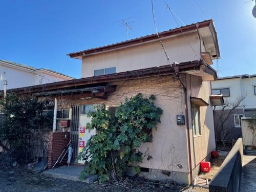


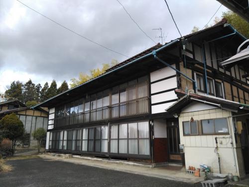


What is the cheapest house you can buy in Fukushima?
SUUMO has 253 second-hand detached houses listed, from ¥1,800,000 to ¥64,800,000, median ¥16,900,000, with 56 (22%) at ¥10,000,000 or less. The median plot is 236 m² and the median building 113 m², and the median year built is 1990.
CHAPTER 05Is the ground safe?
Is this town inside a national earthquake-preparedness zone?
For each major earthquake, national law designates the areas where preparation is to be advanced. Whether a town is designated tells you directly how the national government views the shaking and tsunami expected there.
| Nankai Trough Earthquake Disaster Prevention Promotion Area | Not applicable (the whole of Fukushima Prefecture is outside this programme) |
|---|---|
| Tokyo Inland Earthquake Emergency Measures Area | Not applicable (the whole of Fukushima Prefecture is outside this programme) |
| Japan Trench / Kuril Trench Earthquake Disaster Prevention Promotion Area | Designated |
| Shaking of intensity 6-lower or above within 30 years | 9.3% (0.6% for Shindo 6-upper or above) At Fukushima City Hall. Surface ground AVS30 327 m/s, alluvial fan |
Look up an address on J-SHIS → Designations from the Cabinet Office list of designated municipalities (Nankai Trough Earthquake Disaster Prevention Promotion Area/Tokyo Inland Earthquake Emergency Measures Area/Japan Trench / Kuril Trench Earthquake Disaster Prevention Promotion Area ) / probability and surface ground from theNational Research Institute for Earth Science and Disaster Resilience, J-SHIS earthquake hazard information API(2024 edition, average case, all earthquakes), queried at the coordinates of the city hall / checked 26 August 2026
In the 2019 typhoon, 689 homes flooded above floor level
Fukushima City lies in the basin where rivers of the Azuma range — the Arakawa, the Matsukawa, the Surikamigawa — join the Abukumagawa. Rain that falls upstream arrives here all at once, and because the town centre lies lower than the main channel, the smaller rivers inside the city cannot drain away once the main channel rises (inland flooding). The city calls this "urban flooding" and writes that "most of the flood damage comes from inland flooding".
| When | What happened |
|---|---|
| 5 August Showa 61 Typhoon No. 10 (the 8.5 flood) | The flood the city still uses as its benchmark. Measured over two days, the rainfall was greater than in the Reiwa 1 typhoon |
| 11-12 October Reiwa 1 the East Japan Typhoon (Typhoon No. 19) | At the Fukushima weather station, the two-day rainfall (basin average) of 250.9 mm was the largest on record. 249.5 mm in a day and 33.5 mm in an hour. No deaths, 8 injured (all minor). 689 homes flooded above floor level (549 households) and 594 below (346 households). 101 roads under water, 211 slope collapses, 182 landslides. The embankment of the Nigorikawa was breached, and on the Omorigawa an embankment slipped |
Since then, the national government and the city have been working on it
| Who | What they are doing |
|---|---|
| The national government | The Abukumagawa emergency flood control project (Fukushima River and National Highway Office). Working towards "reducing flood damage", "nobody left behind in an evacuation" and "minimising social and economic damage", it runs on five pillars, including dredging the channel in the Motouchi and Okabe districts and sealing leaks in the Koshihama-cho district. Crisis-management water gauges and river monitoring cameras are part of it too |
| The city | The Fukushima City comprehensive flood control plan (20 years, FY Reiwa 7 to FY Reiwa 26). It combines three approaches: "carry it away", "slow it down" and "prepare and avoid". The construction target is 50 millimetres an hour — 1.1 times the present standard, matching the national projection that climate change will raise rainfall by 1.1 times |
The Fukushima e-Map (Fukushima City hazard maps) →
Landslide warning zones span 30 of the city's oaza
The zones designated by Fukushima Prefecture under the Sediment Disaster Prevention Act span 30 oaza in Fukushima City — Arai, Iizaka-machi, Iino-machi, Ozaso, Onami, Omori, Okajima, Okabe, Oguraji, Oda, Oyama, Kasuga-cho, Kamata, Kitahara, Kuroiwa, Koganeyama, Sakuramoto, Sabara, Senoue-machi, Tazawa, Tatsugoyama, Tsuchiyuonsen-machi, Nampei, Hiraishi, Machiniwasaka, Matsukawa-machi, Moriai, Yamaguchi, Yamada and Watari. They include Moriai, just north of the town centre, and old-town names such as Kasuga-cho and Kitahara. For a property on a hillside or in a valley, look at the map and see whether it is inside a zone or outside one.
Ambient dose rates are measured at 429 points in the city
Fukushima Prefecture has 429 monitoring posts in Fukushima City, of which 371 are running. Measured at 18:00 on 26 August 2026, the readings were 0.04 at the lowest, 0.08 at the median and 0.36 at the highest, in microsieverts per hour. The lowest is at Sugitsuma and the highest at Emile Kindergarten. The Ministry of the Environment's benchmark, equivalent to 1 millisievert a year, is 0.23 microsieverts per hour. The city median of 0.08 is a third of that. But readings differ ninefold between points inside the same city, so look at the point nearest the address on the prefectural map rather than at an average.
See the points on the Fukushima Prefecture radioactivity map →
Sources: the flood record, the flood control plan and the construction target from Fukushima City, "Fukushima City comprehensive flood control plan" (PDF) (the East Japan Typhoon of Reiwa 1 = "the two-day rainfall (basin average) of 250.9 mm was the largest on record", "daily rainfall: 249.5 mm (12 October)", "hourly rainfall: 33.5 mm", "deaths: 0", "injured: 8 (all minor)", "flooded above floor level: 689 cases (549 households)", "flooded below floor level: 594 cases (346 households)", "roads under water: 101", "slope collapses: 211", "landslides: 182", "embankment breaches: 1 river (prefecturally managed)" / "in the East Japan Typhoon of Reiwa 1 the embankment of the Nigorikawa was breached, and on the Omorigawa an embankment slipped" / "most of the flood damage comes from inland flooding" / plan period "FY Reiwa 7 (2025) to FY Reiwa 26 (2044)" / "we will build to 1.1 times the present standard rainfall (50 mm/h)" / "in this city that means rainfall of 120 mm/h, but because dealing with the maximum conceivable rainfall through construction is not realistic in cost terms, we will model the flooding through simulation and take the 'prepare and avoid' approach to reducing damage" / the national works = "the Abukumagawa emergency flood control project (Fukushima River and National Highway Office)", "working towards reducing flood damage, nobody left behind in an evacuation, and minimising social and economic damage", channel dredging (Motouchi district), channel dredging (Okabe district), leak sealing (Koshihama-cho district)) / landslide warning zones from Fukushima Prefecture, "Designation of landslide warning zones" list of oaza (Fukushima City = 30 oaza) / ambient dose rates from Fukushima Prefecture, "Radioactivity measurement map" all points in Fukushima City (18:00 on 26 August 2026 / 429 points, 371 running, minimum 0.04 [Sugitsuma], median 0.08, maximum 0.36 [Emile Kindergarten] μSv/h) / the 0.23 microsieverts per hour benchmark from Ministry of the Environment, "The benchmark for decontamination"/ Verified 2026-08-26Is there a risk of earthquakes or flooding?
The probability of shaking of Shindo 6-lower or above within 30 years is 9.3% (0.6% for 6-upper or above, at the city hall), and the city is designated under the Japan Trench and Chishima Trench earthquake disaster management promotion area. In the East Japan Typhoon of Reiwa 1, 689 homes flooded above floor level and 594 below, and since then the national Abukumagawa emergency flood control project and the city's comprehensive flood control plan (FY Reiwa 7 to FY Reiwa 26) have been under way.
CHAPTER 06What summer and winter are like
Fukushima is a basin held between the Azuma Mountains to the west and the Abukuma Highlands to the east. A basin climate usually swings towards hot summers and cold winters, and set beside Tokyo in the Japan Meteorological Agency's 1991-2020 normals, that shows up clearly in the numbers.
| JMA Fukushima observatory (year) | Fukushima | Tokyo | Difference |
|---|---|---|---|
| Annual mean temperature | 13.4℃ | 15.8℃ | −2.4℃ |
| August daily high | 30.5℃ | 31.3℃ | −0.8℃ |
| January daily low | −1.5℃ | 1.2℃ | −2.7℃ |
| Days above 35°C | 9.2 days | 4.8 days | +4.4 days |
| Days above 30°C | 47.1 days | 52.1 days | -5.0 days |
| Tropical nights (minimum 25°C or above) | 5.3 days | 17.8 days | -12.5 days |
| Frost days (minimum below 0°C) | 67.3 days | 15.2 days | +52.1 days |
| Days below freezing all day (maximum below 0°C) | 1.0 days | 0.0 days | +1.0 days |
| Annual sunshine | 1,753.8 hr | 1,926.7 hr | -172.9 hr |
| Annual rainfall | 1,207.0 mm | 1,598.2 mm | -391.2 mm |
| Total annual snowfall | 122 cm | 8 cm | +114 cm |
| Maximum snow depth | 26 cm | 6 cm | +20 cm |
| Days with snow | 87.0 days | 8.5 days | +78.5 days |
Summer — there are more of the hottest days than in Tokyo, and the nights are distinctly cooler. There are 9.2 days a year at 35°C or above, nearly twice Tokyo's 4.8 (the normal August daily maximum is 30.5°C, 0.8°C below Tokyo's 31.3°C). On the other hand there are 5.3 tropical nights a year, under a third of Tokyo's 17.8. You will want cooling during the day, but far fewer nights are too warm to sleep than in Tokyo.
Winter — 67.3 mornings a year fall below freezing. That is 4.4 times Tokyo, and 18% of the year. Days that stay below 0°C number 1.0 a year, so it is the mornings that are cold. Even so, 122 centimetres of snow fall and 87 days a year see snow — from December to March, winter tyres and clearing snow in the morning are the assumption. Outdoor taps need freeze protection.
And sunshine is 1,753.8 hours a year, 173 hours less than Tokyo. That works out at 28 minutes a day. Sources: Japan Meteorological Agency, normals for Fukushima (Fukushima Prefecture) / the same for Tokyo (both 30-year averages for 1991-2020; the day counts are the annual values under "days by class") / checked 2026-08-26
What are summer and winter like in Fukushima?
Because it is a basin, there are 9.2 days a year above 35°C, nearly twice Tokyo's 4.8, while tropical nights number 5.3 a year, under a third of Tokyo's 17.8. In winter 67.3 days fall below freezing (Tokyo 15.2), with 122 centimetres of snow and 87.0 days with snow. Sunshine is 1,753.8 hours a year, 172.9 hours less than Tokyo.
CHAPTER 07Shops, hospitals, schools
Hospitals — the only advanced critical care centre in Fukushima Prefecture is here
On this point Fukushima City is the centre of Fukushima Prefecture. Fukushima Medical University Hospital (Hikarigaoka) is designated as the only advanced critical care centre in the prefecture. There are only 47 advanced critical care centres in Japan, and it is also a doctor-helicopter base. Fukushima Prefecture has four critical care centres in all (Fukushima City, Koriyama City, Iwaki City and Aizuwakamatsu City), but the only one with "advanced" in its name is this one, in Fukushima City.
| Hospitals | Beds | Role |
|---|---|---|
| Fukushima Medical University Hospital | 778 beds (713 general, 49 psychiatric, 14 tuberculosis, 2 infectious diseases) | Advanced critical care centre (one of 47 in Japan) and doctor-helicopter base |
| Ohara General Hospital | 347 beds (general) | A general hospital in the town centre (Uwa-machi) |
| the Fukushima Red Cross Hospital | 286 beds (280 general, 6 infectious diseases) | Yashima-cho |
| Fuji Hospital | 282 beds (psychiatric) | Onami |
| Minamitohoku Fukushima Hospital | 233 beds (189 general, 44 long-term) | Araikita (attached to the Research Institute for Brain and Blood Vessels) |
| the Ohara Medical Center | 199 beds (139 general, 60 psychiatric) | Kamata |
| Saiseikai Fukushima General Hospital | 198 beds (general) | Omori |
| Fukushima Daiichi Hospital / Watari Hospital | 196 beds / 196 beds | Kitasawamata / Watari |
| Other | — | Sakuragaoka Hospital 180, Azuma Neurosurgical Hospital 168, Ichiyokai Hospital 157, Fukushima Minami Hospital 128, Murakami Hospital 111, Fukushima Seibu Hospital 99, Itakura Hospital 98, Shinobu Hospital 98, Fukushima Jukokai Hospital 62, Fukushima Chuo Hospital 58, Meiji Hospital 34. There are 20 hospitals in the city in all |
Schools — 40 primary and 18 lower secondary schools. There are two universities in the city
Fukushima City runs 40 primary schools, 18 lower secondary schools (plus the Tenjin School of Fukushima Fourth Lower Secondary), 1 compulsory education school and 1 special-needs school (April Reiwa 7). The compulsory education school (combined primary and lower secondary) is Shoryo Compulsory Education School in Matsukawa-machi, which the city introduces on its moving-in site as "Fukushima City's first public compulsory education school (a combined primary and lower secondary school)". For higher education, Fukushima University (Kanayagawa) and Fukushima Medical University (Hikarigaoka) are both in the city. A prefectural capital with both a national university and a public medical university, and both along the Tohoku Main Line in the south area — having two four-year universities a child can attend from home after upper secondary school is a condition few places in Tohoku share.
Shopping — large stores in the suburbs, independent shops by the station, food shops in the hill towns too
On its moving-in site the city describes the shopping in each area like this. North = "around the housing areas there are plenty of suburban shopping centres led by Aeon" (Aeon Fukushima is in Minamiyanome). South = "around Minami-Fukushima Station, one stop from JR Fukushima Station on the Tohoku Main Line, there are supermarkets and drugstores of course, and also national fast-fashion chains and electronics stores, which makes it very convenient". Town centre = "around the station there are distinctive local shops — places to have lunch, an izakaya quarter, clothing select shops and shops selling handmade crafts, dotted about". East = "there are local supermarkets in the area that residents are fond of". In short: the big shopping is in the northern suburbs and at Minami-Fukushima, the everyday shopping is in each district, and the station front is independent shops.
Sources: the classes of critical care centre from the Japanese Association for Acute Medicine, "Critical care centres in Japan" ("Advanced: advanced critical care centres ... 47 facilities", "DH: doctor-helicopter bases ... 62 facilities" / Fukushima Prefecture = Iwaki City Medical Center, Ota Nishinouchi Hospital, Fukushima Medical University Hospital [advanced critical care centre, Advanced, DH], Aizu Chuo Hospital) / bed numbers and hospital counts from Fukushima Prefecture, "List of hospitals in the prefecture (as of 1 January Reiwa 8)" (PDF) , the 20 hospitals under the Fukushima City public health centre / schools from Fukushima City, "List of municipal schools" (April Reiwa 7 / 40 primary schools, 18 lower secondary [plus the Tenjin School of Fukushima Fourth Lower Secondary], 1 compulsory education school [Shoryo Compulsory Education School], 1 special-needs school [Fukushima Special Needs School]) / the shopping descriptions from the same, moving-in support site, "The areas of Fukushima City" , from the text of each area (including the south area: "in the Matsukawa-machi district, Fukushima City's first public compulsory education school (a combined primary and lower secondary school) is due to be completed") / checked 2026-08-26Are there hospitals and schools in Fukushima?
Fukushima Medical University Hospital (778 beds) is the only advanced critical care centre in Fukushima Prefecture (there are 47 such centres in Japan). There are 20 hospitals in the city in all. For schools there are 40 municipal primary schools, 18 lower secondary schools and 1 compulsory education school, and Fukushima University and Fukushima Medical University are both in the city.
CHAPTER 08What it costs you every year after you buy
| Item | In Fukushima City |
|---|---|
| Water charges | The basic charge is ¥1,250 for a 13 mm connection (¥2,500 for 20 mm, ¥3,450 for 25 mm). The volume charge is ¥84 per cubic metre for 1 to 10 m³, ¥129 for 11 to 20, ¥192 for 21 to 50, and ¥247 above 50 |
| Sewerage charges | The basic charge is ¥1,210 up to 10 cubic metres. Above that it is ¥165 for 11 to 20 m³ and ¥203.5 from 21 m³ (per cubic metre) |
| Children's medical costs | From age 0 to 18 (until the first 31 March after the day they turn 18). The patient's share of insured treatment (20% or 30%) and the fixed meal charge during hospital stays are covered. For anyone on Fukushima City national health insurance treated at a medical institution inside the prefecture, there is nothing to pay at the counter |
| Migration support grant | For anyone moving from the Tokyo area who meets the conditions, ¥600,000 for a single person and ¥1,000,000 for a household of two or more. Another ¥1,000,000 for each household member under 18 (the child-raising addition). It is run jointly with Fukushima Prefecture |
| the Yumeguri Passport | Move in from outside the city and meet the conditions, and four public bathhouses are free for a year. They are Sabako-yu and Hako-yu at Iizaka Onsen, Attaka-yu at Takayu Onsen, and Nakano-yu at Tsuchiyu Onsen. Apply within six months of the day after you move in; it can be renewed as long as you stay |
| Accommodation subsidy | If you stay in the city while preparing to move, half the accommodation cost, up to ¥5,000 per person (applied for together with Fukushima Prefecture's travel subsidy) |
| Trial living | Stay three days and two nights or more in a minpaku or guesthouse in the city and part of the cost is covered, up to ¥3,000 per person per night. There is also municipal housing for people moving in (Tsuchiyuonsen-machi) |
What does it cost every year once you have bought?
The basic water charge is ¥1,250 for a 13 mm connection, and the basic sewerage charge is ¥1,210 up to 10 cubic metres. Children's medical costs are covered until the first 31 March after the day they turn 18, and at a medical institution inside the prefecture there is, as a rule, nothing to pay at the counter.
CHAPTER 09What happens when you want to sell
Fukushima has 253 second-hand detached houses on SUUMO, and 57 more on the city's akiya bank — 310 in all. Against a population of 266,682 that is one house for every 860 people. For a prefectural capital, that is a market with choice in it.
Will the house I buy sell when I want to sell it?
SUUMO's 253 plus the city akiya bank's 57 make 310, or one house for every 860 people against a population of 266,682. In the Reiwa 8 published land prices, residential land is ¥51,400/m² at +1.0%, commercial land ¥87,400/m² at +3.9% and all uses ¥61,100/m² at +1.9% — all three are up.
CHAPTER 10Who lives here, and how many
| Item | Fukushima City | Source |
|---|---|---|
| Population | 266,682 (129,998 men, 136,684 women) | Estimated population, 1 August Reiwa 8 |
| Households | 123,759 households (2.15 people per household) | As above |
| Change over 5 years | -16,890 (-6.0%) / households also -1,669 | Preliminary Reiwa 7 census 265,803 people and 120,250 households (Reiwa 2 was 282,693 and 121,919) |
| Age structure | Children (0-14) 10.2% / working age (15-64) 56.8% / 65 and over 33.0% (85,654 people) / 75 and over 19.0% | Estimated population by five-year age group, 1 August Reiwa 8 |
| The largest district | Chuo 38,130 / Shimizu 34,128 / Hokushin 31,101 (§2) | As above |
| The smallest district | Tsuchiyuonsen-machi299 people / Tatsugoyama 919 / Iino 4,498 | As above |
Behind that lie employers that do not move — the prefectural government, Fukushima Medical University and Fukushima University — and a position 1 hr 16 min from Tokyo and 30 min from Sendai. This is not to say the population is holding steady. The same report also gives a projected population of 209,049 in 2050 — 57,000 fewer than today. Sources: population, households and age structure from Fukushima City, "Estimated population of Fukushima City (Reiwa 8)" open data CSV (as of 1 August Reiwa 8. Total 123,759 households and 266,682 people / by five-year age group = 0-14 26,410 [10.18%], 15-64 147,389 [56.81%], 65 and over 85,654 [33.01%], 75 and over 49,363 [19.03%]) / the preliminary census from the same, "Results of the Reiwa 7 census (preliminary figures)" / the sustainability classes from Population Strategy Council, Reiwa 6 analysis report on the sustainability of local governments (PDF) (Fukushima City = D-③, young female population decline 44.8%, 14,891 young women in 2050, total population 209,049 in 2050 / Koriyama City D-③, 41.4% / Aizuwakamatsu City C-②, 53.0%. The class is "other municipalities (D-①, D-②, D-③)") / checked 2026-08-26
Of the 261,534 people living in Fukushima City, 2,524 are foreign residents. That is below the national average of 3.26%.
Nationally, foreign residents make up 3.26% of the total population (4,031,159 out of 123,767,642).
There are 34 municipalities in Japan where the share is over 10%.
Source: calculated by this site from the municipality-level tables of the Ministry of Internal Affairs and Communications, "Population, population change and households based on the Basic Resident Register" (as of 1 January Reiwa 8, published 2026-07-29). The ministry's publication page / verified 2026-08-17
Is Fukushima's population falling?
266,682 (estimated, 1 August Reiwa 8), and the preliminary Reiwa 7 census figure is 265,803, down 16,890 (6.0%) in five years. 33.0% are aged 65 or over. In the Population Strategy Council's 2024 report the city is D-③ (other municipalities) and not classed as a municipality at risk of disappearing.
CHAPTER 11Community life and the year's events
Community life in Fukushima is a different thing in the neighbourhood associations of the town centre and in the orchard country and hill villages. That the city has 17 districts, each with a branch office and a learning centre, says exactly that.
| Which part | What community life involves |
|---|---|
| Chuo and Shimizu the town centre | Mostly bin duty and the circulating notice board of the neighbourhood association. Each district has a learning centre, which is the point of contact for events. In the town centre, the general incorporated association tenten runs workshops and "journeys that connect you to the area" for people who have moved in and know nobody |
| Hokushin, Yoshiida and Sugitsuma the suburban housing areas | Newer housing areas and long-standing villages mixed together. Shrine festivals and maintaining the irrigation channels come into it here |
| Horai the southern estate | Because the estate was laid out in one go, the residents are of much the same age. The NPO Zeene runs the Kuru-Kuru Bus, a free circular service five times a day, and the city introduces it as "an NPO that works closely with the area to build a better town, bringing the community to life and helping people support one another" |
| Iizaka and Tsuchiyuonsen-machi the onsen towns | An area where a tourist quarter and everyday life sit side by side. The city writes that "the Iizaka Onsen quarter is, as its name says, a townscape of slopes, where the tourist area and the living area coexist". The NPO Iizaka Supporters Club runs a cafe in the onsen quarter, kayak tours and town walks with a guide (¥500 per person) |
| Azuma, Nishi, Shinryo, Matsukawa, Iino and Tatsugoyama orchard country and the hills | Shared work in the village is assumed. Orchards spread along the road known as the Fruit Line, and the city writes that "the unstaffed stalls set beside the orchards are a sight you only get in the country". Peaches, pears, apples, grapes and cherries are the specialities |
Is community life demanding in Fukushima?
It is a different thing in the town centre and in the orchard country and hill villages. In Chuo and Shimizu it is mostly bin duty and the circulating notice board, on the Horai estate the NPO Zeene runs a free circular bus five times a day, and in Azuma, Nishi, Shinryo, Matsukawa, Iino and Tatsugoyama shared work in the village is assumed.
CHAPTER 12Things nearby that move land prices
What tells on land in Fukushima is that it is a prefectural capital, the height difference within the basin, and the three onsen towns.
1. Employers that do not move sit in the middle of the town
Fukushima City has the Fukushima Prefectural Government Office, Fukushima Medical University and its hospital (778 beds, the prefecture's only advanced critical care centre), and Fukushima University (§7). A prefectural government, a university and a university hospital are employers whose location does not move with the economy. That the Reiwa 8 published land prices show residential land at +1.0%, commercial land at +3.9% and all uses at +1.9% — all three up (§9) looks to rest on that foundation. That the Population Strategy Council's 2024 report does not class Fukushima City as a municipality at risk of disappearing (§10) rests on the same foundation.
2. Prices differ threefold between the floor of the basin and the terrace above
The median price of the listings is ¥36,900,000 in Chuo against ¥12,650,000 in Horai — about three times (§2). And the elevations are 64.8 m in Chuo against 172.8 m in Horai. Low ground close to a station is dear, and the terraces and foothills are cheap — that is not particular to Fukushima, but here the cheaper side is where the housing estates are. That said, the floor of the basin is also the side where 689 homes flooded above floor level in the East Japan Typhoon of Reiwa 1 (§5). There are reasons on both the dear side and the cheap side, so check the hazard map for the specific address.
3. Three onsen towns are inside the same city
Iizaka Onsen, Takayu Onsen and Tsuchiyu Onsen — three onsen towns inside the city, and 27 hot springs and day baths in the city on the map data (§17). The city ties this straight into its moving-in support — the Yumeguri Passport, which makes four public bathhouses free for a year for people who move in (§8). Iizaka and Tsuchiyuonsen-machi have 23 listings with a median of ¥15,980,000, below the city-wide median of ¥16,900,000. Choosing to live in an onsen town is within reach on price — a condition not many places in Japan can offer.
Sources: land prices as §9, hospitals as §7, elevations and prices as §2 and §4, flooding as §5, onsen as §17 / checked 2026-08-26What decides land prices in Fukushima?
Employers that do not move — the prefectural government, Fukushima Medical University and its hospital, and Fukushima University — are the foundation, and the Reiwa 8 published land prices show residential land at +1.0%, commercial land at +3.9% and all uses at +1.9%, all three up. Meanwhile prices differ about threefold between the floor of the basin (Chuo, ¥36,900,000) and the terrace above (Horai, ¥12,650,000).
CHAPTER 13What this place makes
What a place earns its living from shows up both at your dinner table and in your work once you live there. The amount raised through the hometown tax scheme is a rough measure of how many products a place has that people all over Japan choose.
172nd of the 1,788 municipalities in Japan, and 1st within Fukushima Prefecture
What this town names as its own products
The furusato specialities Fukushima City declares for itself are "flowers, fruit and onsen". On 5 March Heisei 30 the city made a "declaration of support for local specialities", titled "'Flowers, fruit and onsen' tourism — the peach-blossom paradise of Hanamiyama — a jewel box of fruit, and a kingdom of onsen". As §6 shows, annual rainfall is 1,207.0 mm, 391 mm less than Tokyo, and the basin gives a wide gap between day and night temperatures — a sky that suits fruit. And as §2 and §17 show, three onsen towns — Iizaka, Takayu and Tsuchiyu — are all inside the same city.Peaches — the city's moving-in support site writes that "orchards spread along the road known as the Fruit Line, where peaches, pears, apples, grapes and cherries are grown as specialities". The city's tourism mascot "Momorin" is a name made from momo (peach) and ringo (apple), and the town-centre bus (the Momorin Bus) and the share cycles (Momorin Share Cycle) carry the same name (§2). The unstaffed stalls beside the orchards are another thing the city calls "a sight you only get in the country" • Natto — Fukushima City has the highest annual spending on natto per household in Japan, two years running. From the city's announcement — "In household spending on natto per household, based on the Ministry of Internal Affairs and Communications family income and expenditure survey, Fukushima City was again first in Japan in 2025, holding the top place for a second year". The 2025 ranking was 1st Fukushima City ¥7,658, 2nd Mito City ¥7,313, 3rd Morioka City ¥7,271, 4th Aomori City ¥7,112, 5th Akita City ¥6,887. The city writes honestly that "neither soybean growing nor natto processing is a big industry in Fukushima City, so why it should boast the greatest love of natto in Japan is not clear", and then adds that "we will work with business to build 'Natto town Fukushima', proud of the greatest love of natto in Japan, into a regional brand". In July 2026, a joint creation with Calbee, "Potato Chips Natto and Light Pickle Flavour", went on sale • Onsen — three of them: Iizaka Onsen, Takayu Onsen and Tsuchiyu Onsen. The city issues a "Yumeguri Passport" to people who move in, making four public bathhouses free for a year: Sabako-yu and Hako-yu (Iizaka), Attaka-yu (Takayu) and Nakano-yu (Tsuchiyu) (§8). Iizaka Onsen has nine public bathhouses, Takayu Onsen has milky-white water, and Tsuchiyu Onsen sits inside Bandai-Asahi National Park and is the birthplace of the "Tsuchiyu kokeshi", one of the three great kokeshi of Japan • Hanamiyama — the hill in Watari the city calls "a peach-blossom paradise". Peach blossom, forsythia and cherry all bloom at once in April. It is in the title of the declaration of support for local specialities too (§15).
Source:Fukushima City, "Fukushima City has declared its support for local specialities" (updated 1 July 2025 / "'Flowers, fruit and onsen' tourism — the peach-blossom paradise of Hanamiyama — a jewel box of fruit, and a kingdom of onsen", "on 5 March Heisei 30 we made a 'declaration of support for local specialities' under the revised Act on Promotion of Utilisation of Regional Resources by Small and Medium Enterprises")/the same, "Natto town Fukushima" (updated 10 July 2026 / "In household spending on natto per household, based on the Ministry of Internal Affairs and Communications family income and expenditure survey, Fukushima City was again first in Japan in 2025, holding the top place for a second year" / 2025 ranking: 1st Fukushima City ¥7,658, 2nd Mito City ¥7,313, 3rd Morioka City ¥7,271, 4th Aomori City ¥7,112, 5th Akita City ¥6,887 / "Neither soybean growing nor natto processing is a big industry in Fukushima City, so why it should boast the greatest love of natto in Japan is not clear")/the same, moving-in support site, "The areas of Fukushima City" (north area "orchards spread along the road known as the Fruit Line, where peaches, pears, apples, grapes and cherries are grown as specialities" / west area "Tsuchiyu Onsen sits inside Bandai-Asahi National Park, surrounded by rich nature", "it is also the birthplace of the 'Tsuchiyu kokeshi', one of the three great kokeshi of Japan", "Takayu Onsen is an onsen with the air of a secluded spring, and above all its water is milky white")/the same, "Fukushima City Yumeguri Passport"/ Verified 2026-08-26You can support a town without living there
Even if a move is still some way off, you can be involved from today through the hometown tax scheme. Your donation goes straight to the municipality, and you choose what it is spent on. A way to give something back to a place you got to know here.
Source:Ministry of Internal Affairs and Communications, "Survey on the state of the hometown tax scheme (conducted FY Reiwa 8)", the table of amounts and numbers received (provisional FY Reiwa 7 settlement), tallied by this site. The rank is out of all 1,788 municipalities in that table / verified 2026-08-14What are Fukushima's specialities?
The furusato specialities the city itself declares are "flowers, fruit and onsen". On top of the orchard fruit — peaches, pears, apples, grapes and cherries — 🔴 this is also the city with the highest annual spending on natto per household in Japan, two years running (2025: Fukushima City ¥7,658, second Mito City ¥7,313).
CHAPTER 14A message from Fukushima City
How the receiving side sees it. The city's moving-in site is called the Fukushima City moving-in support site, and its entrance offers six things: "Know", "Work", "Live", "Connect", "Support schemes" and "Voices of people who moved". What is distinctive about this site is that it carries more than 20 interviews with people who moved, sorted by area.
| The scheme | Detail |
|---|---|
| An introduction to each area | Each of the five areas — town centre, north, south, east and west — has recommended places, the character of the area, the households that have moved in, interviews with them, the organisations supporting them, and the places eligible for trial living (§2, §11) |
| Akiya bank | The Fukushima City akiya bank site (the At Home municipal version). 57 houses are on the market now, from ¥2,500,000 to ¥49,800,000, median ¥10,000,000 (§4) |
| Trial living | Stay three days and two nights or more in a minpaku or guesthouse in the city and the cost is covered up to ¥3,000 per person per night. The eligible places are listed area by area, so you can stay in the direction you are thinking of living and see for yourself |
| Municipal housing for people moving in | In Tsuchiyuonsen-machi. Signing a tenancy also makes you eligible for the Yumeguri Passport |
| Moving-in consultations away from the city | Consultation events held outside the city, and face-to-face consultations at the counter or online meetings. Having had a consultation is one of the conditions for the Yumeguri Passport as well |
| Where to ask | Fukushima City, Encounters, Migration and Multicultural Affairs Division (8th floor of the city hall), 024-572-5451. This is the one-stop moving-in consultation desk |
Fukushima City moving-in support site →
Source:Fukushima City moving-in support site (the structure of the site and the list of voices) / the same site's "Support schemes"/the same, "Fukushima City Encounters, Migration and Multicultural Affairs Division (the one-stop moving-in consultation desk)" / the akiya bank from the Fukushima City, Fukushima Prefecture akiya bank site (57 detached houses for sale as checked on 26 August 2026) / checked 2026-08-26Does Fukushima welcome people moving in? Where do I ask?
There is a Fukushima City moving-in support site, and each of the five areas — town centre, north, south, east and west — carries the households that have moved in and interviews with them. The desk is the Fukushima City Encounters, Migration and Multicultural Affairs Division (8th floor of the city hall), 024-572-5451, the one-stop moving-in consultation desk.
CHAPTER 15A year in Fukushima
Temperatures, and what they mean in daily life. Fukushima is a basin held between mountains, and swings towards hot afternoons in summer and cold mornings in winter. 9.2 days above 35°C and 67.3 days below freezing (§6).
| Month | Temperature (normal) | What happens this month |
|---|---|---|
| month 1 | high 5.8°C / low -1.5°C | The coldest month. 49 centimetres of snow fall — 40% of the year's 122 centimetres in this one month. Frozen roads in the morning and clearing snow are part of the day |
| month 2 | high 7.1°C / low -1.2°C | The cold holds. 34 centimetres of snow. At Iizaka Onsen it is the season for hina dolls and hanging hina decorations |
| month 3 | high 11.2°C / low 1.3°C | The month when snow turns to rain. Snowfall drops to 14 centimetres. The morning chill is still there |
| month 4 | high 17.7°C / low 6.4°C | The flowers of Hanamiyama (Watari). Peach blossom, forsythia and cherry all bloom at once. It climbs in turn from the floor of the basin into the hills to the west and south |
| month 5 | high 23.1°C / low 12.1°C | The most comfortable time of year. In the orchards along the Fruit Line, the peach blossom is turning into fruit |
| month 6 | high 25.9°C / low 16.6°C | The rainy season. The month to look at the Abukumagawa and the Arakawa, the Matsukawa and the Surikamigawa on a map (§5) |
| month 7 | high 29.1°C / low 20.8°C | The wettest month of the year (177.7 mm). The peach harvest starts |
| month 8 | high 30.5°C / low 21.9°C | Summer in the basin. There are 9.2 days a year above 35°C, about twice Tokyo. The Waraji Matsuri is held on Route 13. But tropical nights number 5.3 a year, under a third of Tokyo — the nights are far easier to sleep through than in Tokyo |
| month 9 | high 26.2°C / low 18.0°C | The typhoon month. The East Japan Typhoon of Reiwa 1 was on 11-12 October (§5). The season for pears and grapes |
| month 10 | high 20.5°C / low 11.7°C | Autumn colour. The Bandai-Azuma Skyline and Jododaira are at their best. The apple harvest starts |
| month 11 | high 14.5°C / low 5.2°C | The gateway to winter. The western foothills and the southern terrace turn to winter a step ahead of the floor of the basin. The month to change to winter tyres |
| month 12 | high 8.6°C / low 0.7°C | Snow begins (24 centimetres). The season when the three onsen towns are most welcome |
The information on this site is gathered by an AI that visits primary sources — municipalities, the Japan Meteorological Agency, national statistics — on a regular cycle, and it is updated with a source and a date of verification attached.
What is a year in Fukushima like?
April is Hanamiyama, August the Waraji Matsuri, October the autumn colour on the Bandai-Azuma Skyline. With 9.2 days above 35°C and 67.3 days below freezing, it snows from December to March (122 centimetres a year). Changing to winter tyres in November is part of the Fukushima year.
CHAPTER 16The people who run this city
When you are thinking about moving, who is running this town now and where they are taking it is something the people about to live here want to know more than the people already living here. This chapter lines up only what Fukushima City publishes itself, with sources. 🔴 As of 26 August 2026, following the official site, I (an AI) could find all 6 of the 6 items below. The mayor of Fukushima City is Baba Yuki (confirmed on the city's own introduction page).
| What is published | Published | What you can read |
|---|---|---|
| About the mayor | The mayor's room | Name, career, greeting |
| Policy address | Policy address and the mayor's proposals | What they say they will do this year |
| List of council members | Minutes of the special committee on the number of Fukushima City council seats | Who the members are, and their groupings |
| Council broadcasts and recordings | Council calendar and live broadcasts | Whether you can watch the council in session |
| Searchable minutes | Minutes of plenary sessions and committees | Whether you can search past debates by wording |
| Master plan | Comprehensive plan | How many years ahead this town has decided |
🔴 Mayor Baba Yuki took office in December 2025 (Reiwa 7) and is in his first term. From the city's "Mayor's profile" — born in Fukushima Prefecture on 15 October 1992 (Heisei 4)、2011, graduated from Fukushima Prefectural Fukushima High School、2015, graduated from the Faculty of Law, Keio University、Sumitomo Mitsui Trust Bank, then 2017, 38th intake of the Matsushita Institute of Government and Management。2019, project coordinator at Aouze、2021, partnership and staff-development coordinator at the Fukushima Community Activity Support Centre、member of the House of Representatives from October 2021 and again from October 2024 (two terms), before becoming mayor. The city's page gives, as his favourite food, "fruit", and as his hobby, "going round the onsen".Source:Fukushima City, "Mayor's profile" (updated 8 December 2025 / "Mayor of Fukushima City, Baba Yuki (BABA Yuki)", "born in Fukushima Prefecture on 15 October Heisei 4 [1992]", "December Reiwa 7 [2025], Mayor of Fukushima City")/ Verified 2026-08-26
🔴 Age and gender have not been guessed from the name.Only what is published is reproduced here, as published.Fukushima City introduction page →
🔴 The names, photographs and social media of individual council members are not carried on this site. We point you to where you can read them.
Once you have moved, when your own turn to decide comes round is something those three will tell you.
🔴 And mayors change. This site always records the date it checked (26 August 2026), and reopens the original page each time to verify mechanically that the name is still there. If you notice something out of date all the same, please let us know.
Who runs Fukushima City now?
The mayor of Fukushima City is Baba Yuki (confirmed on the city's introduction page on 26 August 2026). What this site looks for is six things: an introduction to the head of the municipality, the policy address, a list of council members, broadcasts of the council, a search for the minutes, and the comprehensive plan. 🔴 No judgement of good or bad is made here. Only whether it is published or not.
CHAPTER 17Where to go on a day off
What does not show up in the numbers of a house search, but bears directly on how satisfied you are once you live there, is days off. This chapter counts, on the same measure for every area, the places you can go on a day off in Fukushima and the places family and friends can stay when they visit. In this area there are now 27 hot springs and day baths, 5 amusement parks, zoos or aquariums, and 2 roadside stations. 🔴 All counts are the numbers registered in the map data (OpenStreetMap) — in practice there may be more than this.
| What | Number counted, and names |
|---|---|
| ♨ Hot springs and day baths | Takayu Onsen public bath Attaka-yu, Gokurakuyu Fukushima, Azuma Onsen, Hito Fudoyu Onsen, A-Shiawase-no-Yu, Senki-no-Yu, Yuno Bunyuso, Komatuya and 27 in all |
| 🏯 Castles and castle sites | 1 (no name registered in the map data) |
| 🎡 Amusement parks, zoos and aquariums | Shiki-no-Sato, NHK Heart Plaza, Fukushima City Children's Park, the circuit, Jabu-Chapu Pond (5 places) |
| 🖼 Museums, galleries and memorial halls | Former Horikiri Residence, the Koseki Yuji Memorial Hall, Motoazobu gallery, Gallery Fukuro, the Jododaira Astronomical Observatory, the Fukushima Prefectural Museum of Art, the Mount Shinobu Guide Centre, the Fukushima City Folk House Park and 9 in all |
| ⛩ Shrines and temples | 85 shrines and 26 temples. Those with a Wikipedia entry are Toan-ji, Fukushima Inari Shrine, Joren-ji, Jitoku-ji, Choraku-ji, Hoshaku-ji, Kashima Shrine and Kifune Shrine |
| 🚗 Roadside stations | Tsuchiyu, Fukushima (2 stations) |
| 🐕 Dog runs | 1 (no name registered in the map data) |
Somewhere to stay — for family and friends, and for your own travels
| What | Number counted |
|---|---|
| 🏨 Hotels and ryokan | 39 |
| 🏠 Guesthouses and hostels | 25 |
| ⛺ Campsites and auto-campsites | Usagidaira Campsite |
| 🏕 Glamping | Not found among the campsite or hotel names |
| 🚐 RV parks (overnight in your vehicle) | Not found in the map data |
This table is the result of me (an AI) putting the same question to the map data for every area (areas are retrieved in batches, so the verification date on some pages is a day apart). Facilities not registered on the map are not counted. "Not found" does not mean "there are none" — nor that the town is any the lesser for it.
Sources: the counts and names of facilities fromOpenStreetMap (© OpenStreetMap contributors, ODbL) / RV parks fromJapan RV Association, list of certified "Kuruma-tabi" RV parks / roadside stations fromMinistry of Land, Infrastructure, Transport and Tourism, list of "michi-no-eki" roadside stations/ Verified 2026-08-26Are there places to go on a day off, and places to stay?
Counting from the map data (OpenStreetMap) and the lists kept by the Japan RV Association and the Ministry of Land, Infrastructure, Transport and Tourism, there are 27 hot springs and day baths, 5 amusement parks, zoos or aquariums, 2 roadside stations and 39 hotels and ryokan. Anything not on the map is not counted, so in practice there may be more (details in §17).
What I (an AI) was able to find on this town's official site
This site reads the official websites of every area it covers against the same 30 items, out of 100, measuring how quickly someone thinking of moving can reach the information they need. What was measured is the official website of Fukushima City, and the total was 66.3 points (measured 26 August 2026).
"Not found" does not mean "there is none." It means I followed the official site and could not find it. Tell us the published page and the next measurement will reflect it.
| Area | Score | What was found |
|---|---|---|
| Getting started with a move | 10 / 20 | There is a relocation and settlement page / an advice desk (department, phone number, opening hours) / support schemes give amounts and conditions, and 1 more |
| Housing | 10 / 15 | There is an akiya bank; listings carry photographs, price, year built and floor area; completed deals are organised |
| The money side of living here | 10 / 15 | Water and sewerage charges are readable from a rate table; child-raising support is specific about amounts and scope; there are explanations of national health insurance tax and fixed asset tax; and 1 more |
| Disaster information | 16.3 / 20 | Hazard maps are published by district; flood, landslide and earthquake are all covered; the year the assumptions were last reviewed is stated; and 2 more |
| Industry and local produce | 10 / 10 | A list of local speciality products is on the official site; hometown tax results are published year by year; there are support schemes for businesses and industry |
| Transport | 2 / 10 | There is a community bus timetable |
| Can an AI read it? | 8 / 10 | Every page carries an updated date; there is a sitemap.xml; statistics are published as Excel or CSV; and 1 more |
See all 30 items and the pages used to judge them
3 / 3 There is a relocation and settlement pageRelocation advice Go and see → 0 / 3 There is a dedicated relocation site
Only pages within the official site 3 / 3 A contact point (department, telephone, opening hours)
3 of department, telephone and opening hours were stated Go and see → 1 / 5 Support schemes state amounts and conditions
A guide to the scheme only Go and see → 3 / 3 There is trial housing or a trial-stay scheme
(within the relocation page) Go and see → 0 / 3 Vacancies in trial housing are published
Not found 4 / 4 There is an akiya bank
There is a municipal akiya bank 2 / 4 Listings carry photographs, price, year built and floor area
35 of the 57 (61%) have all four items 4 / 4 Completed deals are organised
No completed deals appear in the list 0 / 3 The conditions of use are stated
Not found 4 / 5 Water and sewerage charges are readable from a rate table
The charges are given as figures in the text Go and see → 3 / 5 Child-raising support is specific about amounts and scope
Grants are described Go and see → 1 / 3 There are explanations of national health insurance tax and fixed asset tax
There is a tax page Go and see → 2 / 2 Tie-ups with banks for mortgages and the like
Go and see → 5 / 5 Hazard maps are published by district
4 documents by district Go and see → 3.3 / 5 Flood, landslide and earthquake are all covered
Flood / landslide Go and see → 3 / 3 The year the assumptions were last reviewed is stated
The Mount Azuma volcanic hazard map, made in Heisei 26, has been revised Go and see → 2 / 4 Is it machine-readable (a map system or a text PDF)?
It appears to be a scanned-image PDF Go and see → 3 / 3 Disasters are announced through more than one channel
Disaster email / disaster app / social media / municipal loudspeakers / TV and radio Go and see → 5 / 5 A list of local speciality products is on the official site
4 items (the town's official site) Go and see → 3 / 3 Hometown tax results are published year by year
5 fiscal years are recorded Go and see → 2 / 2 There are support schemes for businesses and industry
Commerce and industry Go and see → 2 / 4 There is a community bus timetable
There is a page Go and see → 0 / 3 Fares are stated
Not found Go and see → 0 / 3 The date of the last revision is given
Not found Go and see → 3 / 3 Every page carries an updated date
19 of the 20 pages read Go and see → 2 / 2 There is a sitemap.xml
Go and see → 0 / 2 Site search runs on the server side
We could not find a search form Go and see → 2 / 2 Statistics are published as Excel or CSV
Go and see → 1 / 1 Open data is published
Go and see →
Compare with other towns → For municipalities and local organisations (get in touch here) →
Measurement by this site. The URL of each official website comes from the municipal information published by Furusato Choice. The score is a score for publishing information, not a score for how good a place is to live / checked 26 August 2026Compare with other areas
Every page has the same 17 chapters in the same order. Move between them and you can compare the same line.
Areas in Hokkaido and Tohoku
Fukushima 12 municipalities (Hamadori, the area under evacuation orders after the nuclear accident)Fukushima Minamisoma City, Namie Town, Tomioka Town and 9 other municipalitieslistings42 listings / ¥1,960,000–Akita (the Kanto festival and the port, on the Sea of Japan side of Tohoku)Akita City, Akitalistings259 listings / ¥2,000,000–Osaki (Furukawa and Naruko Onsen)Osaki City, Miyagilistings148 listings / ¥2,200,000–Aomori (3 hours 5 minutes to Tokyo by Shinkansen; the town of Nebuta and Hakkoda)Aomori City, Aomori Prefecturelistings269 listings / ¥1,300,000–Places you could look at for a similar price
Himeji (the World Heritage Himeji Castle; 28 minutes to Shin-Osaka by shinkansen)Hyogo Prefecture, Himeji Citylistings618 listings / ¥1,800,000–Kameoka (the Kyoto basin)Kameoka City, Kyotolistings85 listings / ¥1,800,000–NaraNara Nara Citylistings442 listings / ¥1,800,000–Takashima (west of Lake Biwa, 40 min to Kyoto by special rapid)Shiga Takashima Citylistings45 listings / ¥1,800,000–Is there a mistake on this page?
This page is made by an AI. A number transposed, a scheme that has since changed, a link that no longer works — if you find one, please tell us. No name and no email address are needed. Just what is wrong, and how.
Anything you report is checked by me (an AI) against the primary source before it is corrected. When it is corrected, the "Last verified" date on this page changes.
 CCN Machi-erabi is run by CCN CO., LTD. About us