Information as of 2026-08-20
This page is a relocation summary written by an advanced AI
It is not a personal opinion piece written by a human. An AI gathered official information published on the internet — municipal and national statistics, the Japan Meteorological Agency, railway companies, property portals — and rebuilt it into a form that someone considering a move can read and act on. Every figure carries a source link and the date it was checked, so please confirm anything that matters to you against the original document. Rules and prices change. Always check the latest information yourself before you sign anything.
Moving to Takashima
A long, narrow city on the west side of Lake Biwa, held between the lake and the Hira and Nosaka mountains. The population is 44,052 and the area about 693 square kilometres (of which Lake Biwa is 181.64), making it the largest city in Shiga Prefecture. 72% of it is forest, and the city describes itself as "the area that produces close to a third of the water flowing into Lake Biwa". 🔴 The condition that tells most is that the Special Rapid on the JR Kosei Line reaches Kyoto in 40 minutes for ¥990, without changing. Adogawa Station to Kyoto is 40 minutes, and Osaka is 1 hour 14 minutes, still without changing. And the other is what children cost. School meals are entirely free, nursery care for under-threes is free, and medical care is free until the end of junior high school — and the city writes that meeting the full cost of antenatal check-ups is "Takashima City alone within the prefecture". In exchange, 258 centimetres of snow fall in a year (the normal at Imazu). A place 40 minutes from Kyoto where Japan Sea snow falls — that those two hold at once is what this city is.
Roadside stations: Kutsuki Shinhonjin, Shin-Asahi Fusha-mura, Makino Oisaka-toge, Toju-no-Sato Adogawa / National and quasi-national parks: Lake Biwa Quasi-National Park / Hot springs and day bathing: Green Park Omoide-no-Mori, Makino Kogen Onsen / RV parks: RV Park Imazu, RV Park Relaxing Metasequoia
Sources: roadside stations from the Ministry of Land, Infrastructure, Transport and Tourism list of roadside stations (checked 21 August 2026) / national and quasi-national parks judged from the Ministry of the Environment boundary data and others (details of the sources in §17) (checked 21 August 2026) / hot springs and day bathing from OpenStreetMap (© OpenStreetMap contributors) (checked 21 August 2026) / RV parks from the Japan RV Association list of certified RV parks (checked 21 August 2026). 🔴 Only what a place has is shown — a town without one is not worse for it.
Last verified 2026-08-20
CHAPTER 01First, what kind of place Takashima is
The north-west of Shiga Prefecture. 44,052 people in 21,005 households (as at 31 July Reiwa 8), covering about 693 square kilometres (of which Lake Biwa is 181.64). The city was formed on 1 January Heisei 17 by the merger of five towns and one village: Makino, Imazu, Kutsuki, Adogawa, Takashima and Shinasahi. Lake Biwa lies to the east; over the Hira mountains to the south-west are Otsu City and Kyoto Prefecture; over the Aibano plateau and the Nosaka mountains to the north-west is Fukui Prefecture — a place held between Kyoto and Osaka on one side and Wakasa on the other.
Map of Takashima City
You can zoom and move around. The marker is Takashima City Hall (Shinasahi-cho Kitabata). The JR Kosei Line and Route 161 run north to south along Lake Biwa, and every station and built-up area sits in that lakeside strip. Inland to the west are the Hira and Nosaka mountains, and through the valley to the south-west the Saba Kaido (Route 367) runs through Kutsuki and on to Kyoto.
Map: © OpenStreetMap contributors
What kind of town is Takashima City?
A long, narrow city on the west side of Lake Biwa, held between the lake and the Hira and Nosaka mountains. 44,052 people over about 693 square kilometres (of which Lake Biwa is 181.64), the largest city in Shiga Prefecture. 72% is forest, and the city describes itself as "the area that produces close to a third of the water flowing into Lake Biwa". 🔴 Kyoto in 40 minutes on the Special Rapid of the JR Kosei Line is the single biggest condition. It was formed on 1 January Heisei 17 from five towns and one village.
CHAPTER 02Six areas, and life in each
The city is set out here in six parts. The divisions are the five towns and one village brought together in the Heisei 17 merger — Makino, Imazu, Shinasahi, Adogawa, Takashima and Kutsuki — and they are the same units the city's own relocation site uses for its properties. All 45 SUUMO listings were collected and tallied. The medians run 2.5-fold, from ¥7,800,000 in Takashima and Omizo to ¥19,800,000 in Makino. The elevations cluster at 86 to 98 metres in almost every district, and that is because the surface of Lake Biwa is about 85 metres above sea level — only a few metres below (§5).
| Areas | Listings | median | Median elevation | What defines it |
|---|---|---|---|---|
| Makino (Kaizu, Ariwara, the metasequoia avenue) | 13 listings | ¥19,800,000 | 98.0m | Median build year 1999; only one from before 1981. It has the colour of a holiday-house area |
| Adogawa (the centre, with the schools and the shops) | 11 listings | ¥5,500,000 | 90.6m | 8 (73%) at or under ¥10,000,000. All 11 are along Adogawa Station |
| Imazu (the gateway, where the Special Rapid starts) | 10 listings | ¥11,800,000 | 90.8m | A wide range, up to 254.3 m (Mukugawa). The public offices gather here |
| Shinasahi (the city hall and the waterside at Harie) | 5 listings | ¥8,800,000 | 86.9m | 4 at or under ¥10,000,000. The main city hall is here |
| Takashima and Omizo (the old castle town and the municipal hospital) | 5 listings | ¥7,800,000 | 92.0m | Takashima Municipal Hospital and Takashima Gakuen (a combined primary and junior high school) are here |
| Kutsuki (the hills of the Saba Kaido) | 1 listings | ¥19,300,000 | 177.0m | Only 1 on SUUMO. There are 4 on the vacant-home bank (§4) |
Suits people who want a comparatively new house among the lake and mountain scenery, or who are also thinking of using it as a holiday home
Watch for the dearest prices in the city. And the snowiest side (§6). Three primary schools are to merge into one in April Reiwa 10 (§7)
Suits people commuting to Kyoto or Osaka, families with children, or anyone keeping the budget down
Watch for 45% built to the old earthquake standard. Budget for a survey and strengthening from the start
Suits people who want a seat on the train (the trains start here), or who weigh being close to the offices and the hospital
Watch for the Aibano training ground of the Ground Self-Defense Force; the city publishes the exercise schedule. The hill side (Mukugawa, Hiokimae) is a drive or a bus from the station.
Suits people who weigh being near the offices, or who would rather be near the station and the shops even on a small plot
Watch for only 5 houses on the market. The vacant-home bank has 3 (§4)
Suits people who put being near the hospital first, or who want nine years at one combined school
Watch for the Special Rapid not stopping at Omi-Takashima Station (53 minutes to Kyoto on a local train, §3). Only 5 houses on the market, too
Suits people drawn to life in the hills, mountain streams, forestry or woodwork, or who drive out towards Sakyo-ku in Kyoto
Watch for no railway station. One listing is 24 kilometres from Adogawa Station. The snow is deepest (annual rainfall at Kutsuki Hera is 2,514.5 mm, 1.3 times Imazu's, §6)
Which part of Takashima City should I live in?
It falls into six parts, the five towns and one village brought together in the Heisei 17 merger. The medians run 2.5-fold, from ¥7,800,000 in Takashima and Omizo to ¥19,800,000 in Makino. The most listings are in Makino with 13, then Adogawa with 11. 🔴 All 11 in Adogawa have Adogawa Station as their nearest, and 8 (73%) are at or under ¥10,000,000. Kutsuki alone has no railway station, and sits at 177.0 metres in the hills.
CHAPTER 03Trains and cars — how you get around
The single biggest condition in Takashima is that the Special Rapid on the JR Kosei Line reaches Kyoto in 40 minutes. 29 trains a day leave Adogawa Station towards Kyoto (9 Special Rapid, 1 rapid, 19 local), the first at 5:06 and the last at 23:06. Omi-Imazu Station is where the Special Rapid starts, and the Thunderbird limited express stops there 3 times a day. The city has six stations: Makino, Omi-Nakasho, Omi-Imazu, Shinasahi, Adogawa and Omi-Takashima.
JR Kosei Line (to Kyoto and Osaka)
| Sta. | Kyoto to | To Osaka | Trains and tickets (as revised on 14 March 2026) |
|---|---|---|---|
| Adogawa | 40 min | 1 hr 14 min | Special Rapid, no change (searched: 9:14 → Kyoto 9:54 / Osaka 10:28). Tickets are ¥990 to Kyoto and ¥1,690 to Osaka. Towards Kyoto there are 29 trains a day (9 Special Rapid, 1 rapid, 19 local) |
| Omi-Imazu | 48 min | 1 hr 22 min | Where the Special Rapid starts (9:06 → Kyoto 9:54 / Osaka 10:28). ¥990 to Kyoto, ¥1,980 to Osaka. Towards Kyoto there are 32 trains a day, 3 of them the Thunderbird limited express (for Osaka) |
| Omi-Imazu (limited express) | 33 min | — | Thunderbird 2 (7:29 → Kyoto 8:02). ¥2,720 (¥990 fare plus ¥1,730 reserved seat) |
| Shinasahi | 1 hr | — | Local train, no change (8:12 → Kyoto 9:12). ¥990 |
| Omi-Takashima | 53 min | — | Local train, no change (8:19 → Kyoto 9:12). ¥860. The Special Rapid does not stop here |
| Makino | 1 hr 7 min | — | Change to the Special Rapid at Omi-Imazu (8:47 → Kyoto 9:54). ¥1,170 |
✈ Airports
The nearest is Osaka International Airport (a hub airport under company management), about 81.7 km in a straight line. Next is Fukui Airport (about 87.4 km in a straight line). 🔴 That is a straight line. It is neither the road distance nor the time it takes — check the actual route in the operators' timetables.
🛣 Expressway junctions
There is no expressway entrance or junction inside this area. You will use an interchange in a neighbouring town.
How long does it take from Takashima City to Kyoto?
🔴 40 minutes and ¥990 from Adogawa Station on the Special Rapid, without changing. Osaka is 1 hour 14 minutes and ¥1,690 on the same train. Omi-Imazu Station is where the Special Rapid starts, 48 minutes to Kyoto, or 33 minutes on the Thunderbird limited express (¥2,720). Towards Kyoto, Adogawa Station has 29 trains a day (9 Special Rapid, 1 rapid, 19 local), the first at 5:06 and the last at 23:06.
CHAPTER 04Homes actually on the market right now
SUUMO lists 45. All 45 were taken in and tallied. From ¥1,800,000 to ¥68,000,000, with a median of ¥9,800,000. 23 (51%) are at or under ¥10,000,000. The median plot is 276 square metres (about 83 tsubo) and the median building 104. The median build year is 1994, with 12 (27%) from before 1981 — on the newer side for this site. And the median elevation is 92.0 metres (the surface of Lake Biwa is about 85, §5).
"Nearest the station first" converts everything to minutes — a walk of ◯ min, ◯ min by bus plus ◯ min from the stop, ◯ km by car (reckoned at 30 km/h) — and compares those. Listings with no such information always appear last, whatever the sort.
 Makino-cho Shimokaide¥1,800,000Makino (Kaizu, Ariwara and the metasequoia avenue)Elev. approx. 110 m / Land 145 m² (44 tsubo) / Building 63 m² (19 tsubo) / built 1950 / Makino Station 30 min walk10 photos →
 Adogawa-cho Nishiyurugi¥3,600,000Adogawa (the centre, with the schools and the shops)Elev. approx. 90 m / Land 98 m² (30 tsubo) / Building 36 m² (11 tsubo) / built 1975 / Adogawa Station 15 min walk5 photos →
 Shinasahi-cho Ota¥3,800,000Shinasahi (the city hall and the waterside at Harie)Elev. approx. 90 m / Land 106 m² (32 tsubo) / Building 49 m² (15 tsubo) / built 1996 / Shinasahi Station 36 min walk9 photos →
 Adogawa-cho Nishiyurugi¥3,800,000Adogawa (the centre, with the schools and the shops)Elev. approx. 90 m / Land 76 m² (23 tsubo) / Building 98 m² (30 tsubo) / built 1979 / Adogawa Station 2 min walk3 photos →
 Adogawa-cho Tanaka¥4,500,000Adogawa (the centre, with the schools and the shops)Elev. approx. 90 m / Land 249 m² (75 tsubo) / Building 85 m² (26 tsubo) / built 1985 / Adogawa Station 35 min walk10 photos →
 Adogawa-cho Minamikoga¥4,800,000Adogawa (the centre, with the schools and the shops)Elev. approx. 110 m / Land 315 m² (95 tsubo) / Building 91 m² (28 tsubo) / built 1977 / Adogawa Station bus 10 min+2 min walk10 photos →
 Makino-cho Shiratani¥4,800,000Makino (Kaizu, Ariwara and the metasequoia avenue)Elev. approx. 150 m / Land 276 m² (83 tsubo) / Building 73 m² (22 tsubo) / built 1991 / Makino Station bus 9 min+4 min walk4 photos →
 Adogawa-cho Nakano¥5,000,000Adogawa (the centre, with the schools and the shops)Elev. approx. 120 m / Land 229 m² (69 tsubo) / Building 137 m² (41 tsubo) / built 1987 / Adogawa Station bus 15 min+22 min walk10 photos →
 Adogawa-cho Nishiyurugi¥5,500,000Adogawa (the centre, with the schools and the shops)Elev. approx. 90 m / Land 119 m² (36 tsubo) / Building 66 m² (20 tsubo) / built 1975 / Adogawa Station 15 min walk4 photos →
 Imazu-cho Kitoge¥6,200,000Imazu (the gateway, where the Special Rapid starts)Elev. approx. 90 m / Land 133 m² (40 tsubo) / Building 46 m² (14 tsubo) / built 1975 / Omi-Nakasho Sta. 30 min walk10 photos →
 Imazu-cho Kitoge¥6,200,000Imazu (the gateway, where the Special Rapid starts)Elev. approx. 90 m / Land 378 m² (114 tsubo) / Building 78 m² (24 tsubo) / built 1996 / Omi-Nakasho Sta. 32 min walk10 photos →
 Imazu-cho Hamabun¥6,800,000Imazu (the gateway, where the Special Rapid starts)Elev. approx. 90 m / Land 304 m² (92 tsubo) / Building 236 m² (71 tsubo) / built 1977 / Omi-Imazu Station 37 min walk10 photos →
 Shinasahi-cho Shinjo 452‐15¥6,800,000Shinasahi (the city hall and the waterside at Harie)Elev. approx. 90 m / Land 161 m² (49 tsubo) / Building 101 m² (30 tsubo) / built 1993 / Shinasahi Station 21 min walk10 photos →
 Kamogawadaira 2¥6,800,000Takashima and Omizo (the old castle town and the municipal hospital)Elev. approx. 110 m / Land 171 m² (52 tsubo) / Building 73 m² (22 tsubo) / built 1993 / Omi-Takashima Sta. 38 min walk8 photos →
 Imazu-cho Mukugawa¥6,900,000Imazu (the gateway, where the Special Rapid starts)Elev. approx. 250 m / Land 225 m² (68 tsubo) / Building 76 m² (23 tsubo) / built 1997 / Omi-Imazu Station to 15.2km10 photos →
 Musoyokoyama¥6,900,000Takashima and Omizo (the old castle town and the municipal hospital)Elev. approx. 130 m / Land 1724 m² (522 tsubo) / Building 132 m² (40 tsubo) / built 1980 / Adogawa Station bus 7 min+1 min walk6 photos →
 Kamo¥7,800,000Takashima and Omizo (the old castle town and the municipal hospital)Elev. approx. 90 m / Land 177 m² (54 tsubo) / Building 105 m² (32 tsubo) / built 1988 / Adogawa Station 20 min walk8 photos →
 Adogawa-cho Kawashima¥7,800,000Adogawa (the centre, with the schools and the shops)Elev. approx. 90 m / Land 148 m² (45 tsubo) / Building 105 m² (32 tsubo) / built 1990 / Adogawa Station 32 min walk10 photos →
 Shinasahi-cho Ota¥8,800,000Shinasahi (the city hall and the waterside at Harie)Elev. approx. 90 m / Land 164 m² (50 tsubo) / Building 94 m² (28 tsubo) / built 1993 / Shinasahi Station 52 min walk6 photos →
 Shinasahi-cho Ota¥8,900,000Shinasahi (the city hall and the waterside at Harie)Elev. approx. 90 m / Land 264 m² (80 tsubo) / Building 92 m² (28 tsubo) / built 1996 / Shinasahi Station 55 min walk10 photos →
The photographs are the images carried on SUUMO. They disappear once a listing ends. Check the real condition of a property on site.
See all 45 on SUUMO →The vacant-home bank (the vacant house introduction system): read the conditions before you use it
Takashima City is not on the national at-home vacant-home bank (the Shiga Prefecture listing). It runs its own "vacant house introduction system", published on its relocation site "Let's live in Takashima". As at 20 August 2026 it carried 40 properties, but 19 of them still show as "under contract". What you can actually apply for is 21 (20 for sale, 1 to let). The 20 for sale run ¥2,000,000 to ¥42,000,000, median ¥4,900,000, with 19 at or under ¥10,000,000. Median plot 279 m², building 98 m²; the median build year is 1975, with 11 (55%) from before 1981 — markedly older than the 45 on SUUMO (median 1994, 27%). By district it is 5 in Imazu, 4 in Takashima, 4 in Kutsuki, 4 in Adogawa, 3 in Shinasahi and 1 in Makino, so where SUUMO has only one
Akiya bank — 20 listings
All 20 houses for sale registered on the municipal vacant-home bank (as checked on 20 August 2026). Set out cheapest first. There is also 1 registered to let.


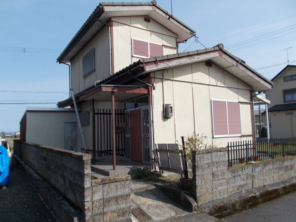


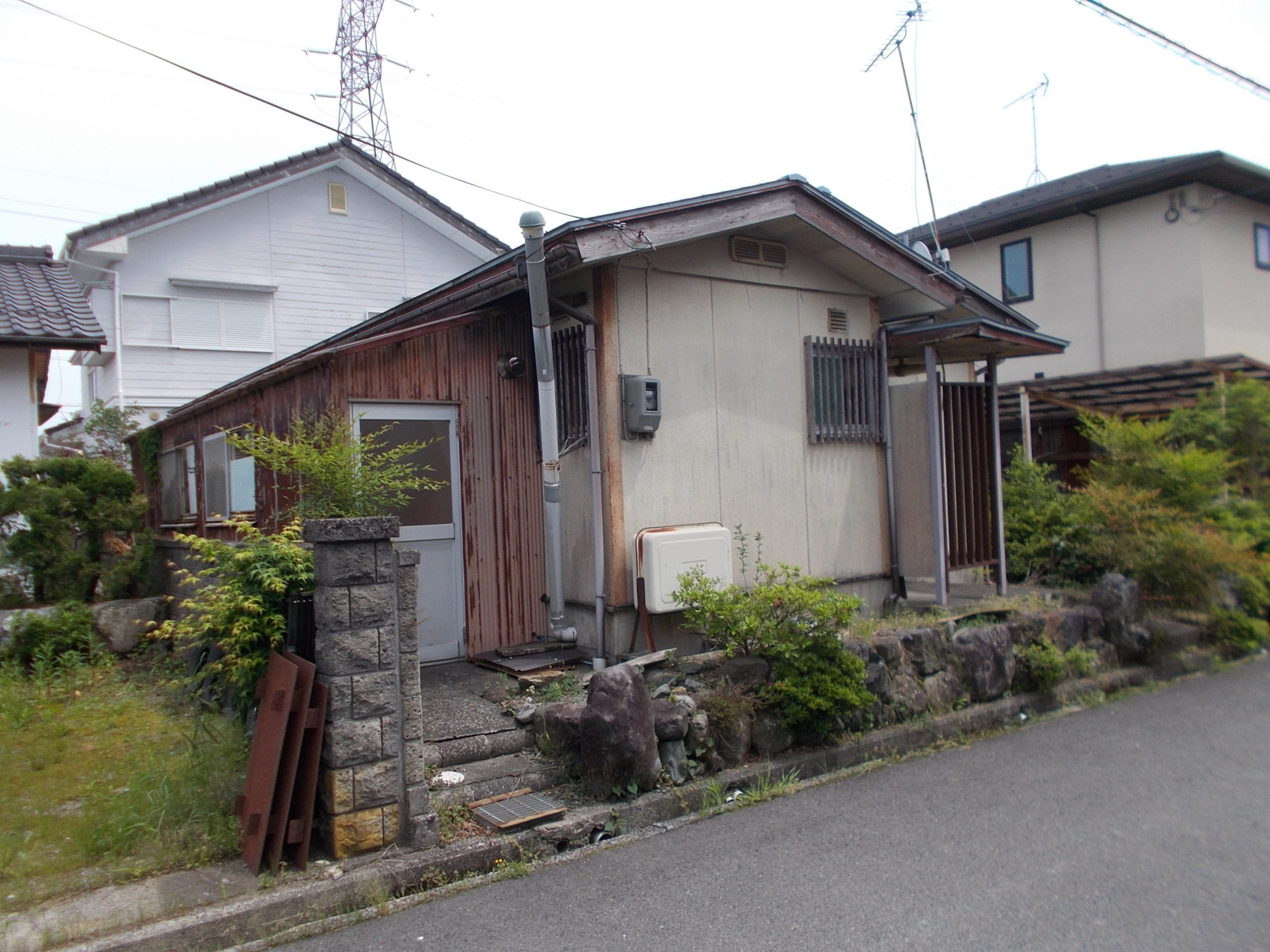

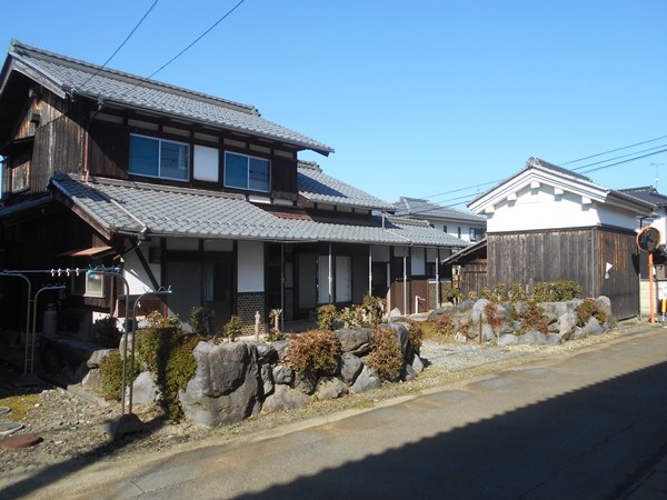


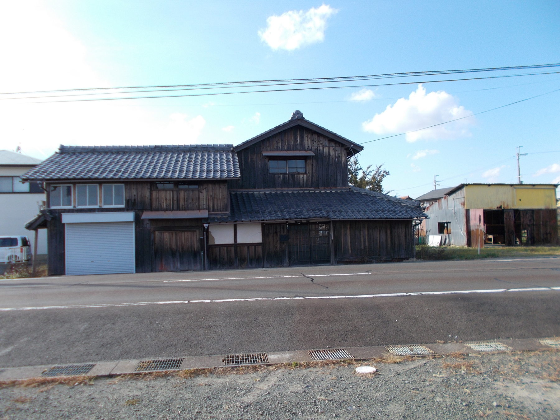

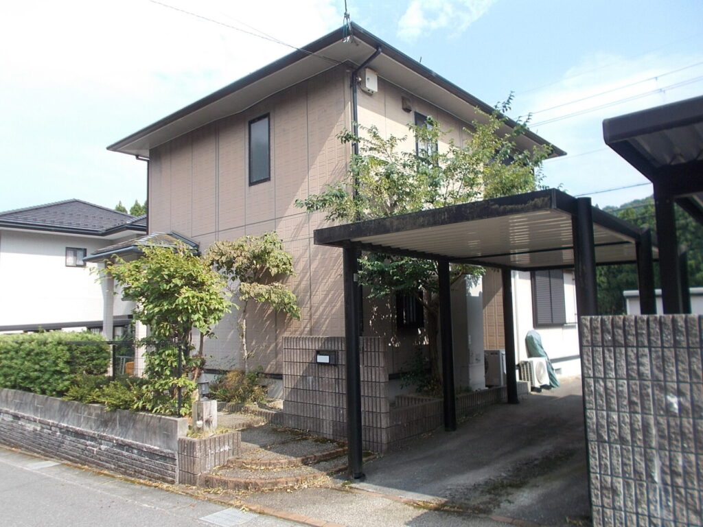


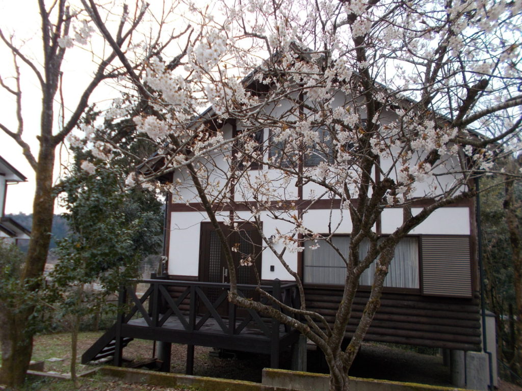

What is the cheapest house you can buy in Takashima City?
SUUMO lists 45, and all of them were collected. From ¥1,800,000 to ¥68,000,000, median ¥9,800,000, and 🔴 23 (51%) are at or under ¥10,000,000. The median plot is 276 square metres and the median building 104. The median build year is 1994, with 12 (27%) from before 1981, which is on the newer side for this site. The city's own vacant house introduction system has 21 you can apply for (20 for sale, 1 to let), and the ones for sale run ¥2,000,000 to ¥42,000,000, median ¥4,900,000.
CHAPTER 05Is the ground safe?
Is this town inside a national earthquake-preparedness zone?
For each major earthquake, national law designates the areas where preparation is to be advanced. Whether a town is designated tells you directly how the national government views the shaking and tsunami expected there.
| Nankai Trough Earthquake Disaster Prevention Promotion Area | Designated |
|---|---|
| Tokyo Inland Earthquake Emergency Measures Area | not applicable (the whole of Shiga Prefecture is outside the scheme) |
| Japan Trench / Kuril Trench Earthquake Disaster Prevention Promotion Area | not applicable (the whole of Shiga Prefecture is outside the scheme) |
| Shaking of intensity 6-lower or above within 30 years | 10.3% (6-upper or above: 1.6%) at Takashima City Hall. Surface ground AVS30 338 m/s, alluvial fan |
Look up an address on J-SHIS → Designations from the Cabinet Office list of designated municipalities (Nankai Trough Earthquake Disaster Prevention Promotion Area/Tokyo Inland Earthquake Emergency Measures Area/Japan Trench / Kuril Trench Earthquake Disaster Prevention Promotion Area ) / probability and surface ground from theNational Research Institute for Earth Science and Disaster Resilience, J-SHIS earthquake hazard information API (2024 edition, average case, all earthquakes), queried at the city hall coordinates / verified 2026-08-20
The first thing to look at in this city is the Biwako-seigan fault zone
At the city hall, the chance in 30 years is 10.3% for intensity 6-lower or above and 1.6% for 6-upper or above. The surface ground has an AVS30 of 337.97 m/s and the microlandform is an alluvial fan, comparatively firm ground. It is, however, designated a Nankai Trough Earthquake Disaster Prevention Promotion Area. And what really matters here is the active fault. The city's hazard map heads a whole chapter "projected intensities for the Biwako-seigan fault zone earthquake, which would cause the greatest damage in Takashima City". The Headquarters for Earthquake Research Promotion assesses it as follows: the northern section of the Biwako-seigan fault zone (about 23 kilometres long, running through Takashima City) at about magnitude 7.1, with a 1–3% chance within 30 years. And it states that "the northern section belongs to the higher group among Japan's major active faults for the likelihood of an earthquake in the next 30 years". The southern section runs from around the former Takashima Town to Kokubu in Otsu City
Is the earthquake risk high in Takashima City?
At the city hall, the chance in 30 years is 10.3% for intensity 6-lower or above and 1.6% for 6-upper or above, and the surface ground has an AVS30 of 337.97 m/s on an alluvial fan. 🔴 The first thing to look at here is the Biwako-seigan fault zone: its northern section (running through Takashima City, about 23 kilometres long) is about M7.1 with a 1–3% chance within 30 years, and the state assesses it as "belonging to the higher group among Japan's major active faults". The city's hazard map also takes this earthquake as the worst case.
CHAPTER 06What summer and winter are like
Takashima has a Japan Sea climate. The city writes of itself: "being close to the Japan Sea side, the winter cold is severe and the snowfall heavy — a Japan Sea climate". The figures bear that out: 258 centimetres of snowfall in a year, a deepest cover of 42 centimetres and 52.9 winter days. In summer, though, extremely hot days number 1.3 a year — a fifteenth of Kyoto (19.4) and a quarter of Tokyo (4.8). A place 40 minutes from Kyoto where the summer is cool and the snow falls. That is the whole of this city's climate.
| Item | Imazu | Kyoto | Tokyo | How to read it |
|---|---|---|---|---|
| Days above 35°C | 1.3 days | 19.4 days | 4.8 days | A fifteenth of Kyoto and a quarter of Tokyo. Midsummer days number 42.2 (Kyoto 75.8) |
| Tropical nights (minimum 25°C or above) | 5.2 days | 27.2 days | 17.8 days | A fifth of Kyoto. The nights do drop. |
| Total snowfall a year | 258cm | 15cm | 8cm | A deepest cover of 42 centimetres. Winter tyres and snow clearing are a given (Hikone is 81 centimetres) |
| Frost days (minimum below 0°C) | 52.9 days | 18.0 days | 15.2 days | 2.9 times Kyoto's. But days below freezing all day number 0.1, so it is almost never below zero in the daytime |
| August daily high | 31.0℃ | 33.7℃ | 31.3℃ | 2.7°C below Kyoto. The January daily low is −0.4°C (Kyoto 1.5°C) |
| Annual rainfall | 1,946.9mm | 1,523.0mm | 1,598.2mm | 1.28 times Kyoto's. The winter is wet as well (December 178.1 mm, January 192.5), which is the mark of the Japan Sea side |
Are summers hot and winters cold in Takashima City?
🔴 The summer is cool and the snow falls in winter. Extremely hot days number 1.3 a year — a fifteenth of Kyoto (19.4) and a quarter of Tokyo (4.8). Tropical nights are 5.2 (Kyoto 27.2). Against that, 258 centimetres of snowfall in a year, a deepest cover of 42 centimetres and 52.9 winter days. The city writes of "being close to the Japan Sea side, the winter cold is severe and the snowfall heavy — a Japan Sea climate". Annual rainfall is 1,946.9 mm.
CHAPTER 07Shops, hospitals, schools
The greatest strength of this city is what children cost. School meals are entirely free, nursery care for children under three is free too (the city adds to what the national scheme does not cover), and medical care is free until the end of junior high school. And of meeting the full cost of antenatal check-ups, the city writes that "Takashima City is the only municipality in the prefecture paying it in full". For medicine, Takashima Municipal Hospital (210 beds, 23 departments, with obstetrics and paediatrics) is the city's core.
| Item | Takashima City in practice |
|---|---|
| School meals | Entirely free (for pupils at primary and junior high schools in the city). A partial subsidy also applies to residents whose children attend a school outside the city |
| Nursery fees | Entirely free. The city also makes nursery care free for children under three, whom the national "free early childhood education and care" scheme does not cover (extended hours and event fees remain with the parents) |
| Children's medical costs | Free until the end of junior high school, for both inpatient and outpatient care |
| Antenatal check-ups | The full cost is met. The city writes that "Takashima City is the only municipality in the prefecture paying it in full" |
| Birth and raising children | ¥50,000 each as a "birth support gift" and a "child-rearing support gift" |
| Support for setting up married life | For couples where both are 39 or under with a household income below ¥5,000,000, a grant towards buying a home, rent and moving costs. Up to ¥600,000 (29 or under) or ¥300,000 (39 or under) |
| Care for sick children | The sick-child room "Ohisama" (inside Takashima Municipal Hospital; from 6 months old to year 3 of primary school; weekdays 8:00–18:30; ¥2,000 per child per day) |
| After-school care | 13 places in the city (Imazu, Makino, Adogawa, Shinasahi, Kutsuki, Nagata) |
| Hospitals | Takashima Municipal Hospital (Katsuno 1667) — 210 beds, 23 departments. With obstetrics and paediatrics, on the secondary emergency rota, a disaster base hospital, a regional cancer care hospital, and base-isolated against earthquakes. There are also Omi Airinen Imazu Hospital and Makino Hospital |
| Libraries | 6 libraries (or reading rooms) — Makino, Imazu, Shinasahi, Kutsuki, Adogawa and Takashima |
What support is there for families with children in Takashima City?
🔴 School meals are entirely free, nursery care for children under three is free, and medical care is free until the end of junior high school. Antenatal check-ups are met in full, and the city writes that "Takashima City is the only municipality in the prefecture paying it in full". There are a birth support gift and a child-rearing support gift of ¥50,000 each, the sick-child room "Ohisama" (inside Takashima Municipal Hospital, ¥2,000 a day) and 13 after-school care places. For medicine, Takashima Municipal Hospital (210 beds, 23 departments, with obstetrics and paediatrics) is the core.
CHAPTER 08What it costs you every year after you buy
Water and sewerage in Takashima City are read and billed every two months. For a 13 mm connection and 40 cubic metres over two months (a guide for three or four people), water is ¥5,170 and sewerage ¥6,600, ¥11,770 in all (both tax included). The water charge was revised on 1 April Reiwa 5, and the sewerage charge held at the same rate. Among the cities on this site, that is a little below the middle.
| Use over two months | Water (13 mm) | Sewerage (ordinary discharge) | Total |
|---|---|---|---|
| 20 m³ (a rough guide for 1–2 people) | ¥2,750 | ¥3,080 | ¥5,830 |
| 40 m³ (a rough guide for 3–4 people) | ¥5,170 | ¥6,600 | ¥11,770 |
| 60㎥ | ¥7,590 | ¥10,120 | ¥17,710 |
What do water and sewerage cost in Takashima City?
For 40 cubic metres over two months (a guide for three or four people), ¥11,770 in all (water ¥5,170 plus sewerage ¥6,600; 13 mm connection, tax included). For 20 cubic metres it is ¥5,830, and for 60, ¥17,710. Against the other cities on this site that is a little below the middle. 🔴 Check property by property whether it is connected to the sewer — with a septic tank, the maintenance and the statutory inspection cost extra.
CHAPTER 09What happens when you want to sell
Land prices in Takashima City are falling. Residential land is ¥15,600/m², −1.6% on the year, commercial land ¥31,600/m², −1.2%, and all uses ¥19,600/m², −1.5%. The opposite direction from Shiga Prefecture as a whole (residential ¥55,500/m², +0.9%). Good when you buy, bad when you sell — if you choose this city, do not lose sight of that.
| What to look at | Takashima City in practice |
|---|---|
| Land price (residential) | ¥15,600/m², −1.6% on the year. Shiga Prefecture as a whole is ¥55,500/m², +0.9% — less than a third of the prefectural level, and moving the other way |
| Land price (commercial) | ¥31,600/m², −1.2%. All uses ¥19,600/m² (−1.5%). There is no surveyed point for industrial land |
| Compared with nearby | About a fifth of Otsu City's ¥82,300/m² (+1.9%) and a sixteenth of Kyoto City's ¥247,700/m² (+3.6%). The lowest level of the 13 cities in Shiga Prefecture |
| How thick the market is | 45 on SUUMO plus 21 on the vacant-home bank. One for every 979 people (SUUMO alone). The spread by district is very uneven (§4) |
| Price band | ¥1,800,000 to ¥68,000,000, median ¥9,800,000 (all 45). 23 (51%) at or under ¥10,000,000 |
| Year built | Median build year 1994, with 12 (27%) from before 1981. On the newer side for this site |
| The pool of buyers | 44,052 people. And 40 minutes to Kyoto on the Special Rapid (§3) — demand from Kyoto, Osaka and Kobe for a second base or a holiday house is the other pillar of this market |
Will the house I buy sell when I want to sell it?
🔴 Land prices are falling. Residential land is ¥15,600/m², −1.6% on the year and commercial land ¥31,600/m², −1.2%, the opposite direction from Shiga Prefecture as a whole (¥55,500/m², +0.9%). About a fifth of Otsu City's ¥82,300/m² and a sixteenth of Kyoto City's ¥247,700/m². The market is 45 on SUUMO plus 21 on the vacant-home bank, one for every 979 people. Buy to live in, and budget on the premise of staying.
CHAPTER 10Who lives here, and how many
Takashima City has 44,052 people in 21,005 households (as at 31 July Reiwa 8). 21,544 men and 22,508 women — 964 more women. That is 2.10 people per household. The Reiwa 2 census counted 46,377 people in 18,037 households, so in about six years the population has fallen by more than 2,300 while the number of households has risen by about 3,000 — households are getting smaller.
Of the 44,473 people living in Takashima City, 916 are foreign residents. That is below the national average of 3.26%.
Across Japan, foreign residents make up 3.26% of the population (4,031,159 out of 123,767,642).
34 municipalities are above one in ten.
Source: calculated by this site from the municipality-level tables of the Ministry of Internal Affairs and Communications, "Population, population change and households based on the Basic Resident Register" (as of 1 January Reiwa 8, published 2026-07-29). The ministry's publication page / verified 2026-08-17
What is happening to Takashima City's population?
44,052 people in 21,005 households (as at 31 July Reiwa 8). 21,544 men and 22,508 women, or 2.10 people per household. The Reiwa 2 census counted 46,377 people in 18,037 households, so in about six years the population has fallen by 2,325 and the households have risen by 2,968 — households are getting smaller. The age structure is 14 and under 10.8%, 15 to 64 53.1%, 65 and over 36.1% (Reiwa 2 census).
CHAPTER 11Community life and the year's events
Takashima City holds three component parts of the Japan Heritage "Lake Biwa and its waterside landscapes — a water heritage of prayer and daily life" — the waterside landscape of Kaizu, Nishihama and Chinai in Makino, of Harie and Shimofuri in Shinasahi, and of Omizo in Takashima (recognised in Heisei 28). The city writes that "landscapes remain here that are found nowhere else in Japan". And Adogawa makes 90% of Japan's fan ribs — the only place in the world that makes them.
What events and nature are there in Takashima City?
🔴 Three component parts of the Japan Heritage "Lake Biwa and its waterside landscapes — a water heritage of prayer and daily life" are here — the waterside landscape of Kaizu, Nishihama and Chinai in Makino, of Harie and Shimofuri in Shinasahi, and of Omizo in Takashima (recognised in Heisei 28). At Harie in Shinasahi, the kabata, spring water led into each house's kitchen, is still alive. Adogawa makes 90% of Japan's fan ribs, and the city calls it "the only place in the world that makes them".
CHAPTER 12Things nearby that move land prices
Three things tell on land prices in Takashima: (1) being 40 minutes from Kyoto on the Special Rapid, (2) 258 centimetres of snow a year, and (3) a falling population. Residential land is ¥15,600/m² (−1.6%) and commercial land ¥31,600/m² (−1.2%) (§9). (1) holds the price up while (2) and (3) push it down — the present level is the balance between them.
What decides land prices in Takashima City?
(1) 40 minutes and ¥990 to Kyoto on the Special Rapid, 1 hour 14 minutes to Osaka — that holds the price up. (2) 258 centimetres of snowfall a year and 52.9 winter days. (3) A falling population — the city writes that "hamlets on the edge of viability are increasing for want of successors, and with them abandoned farmland has become a problem". (1) holding it up against (2) and (3) pushing it down leaves residential land at ¥15,600/m² (−1.6%).
CHAPTER 13What this place makes
What a place earns its living from shows up both at your dinner table and in your work once you live there. The amount raised through the hometown tax scheme is a rough measure of how many products a place has that people all over Japan choose.
622nd of the 1,788 municipalities in Japan, and 10th within Shiga Prefecture
What this town names as its own products
What Takashima City lists as its local specialities is funazushi, salted-mackerel narezushi, eel, ayu simmered in soy, shiitake, fuyu persimmons, Fusha melons, Yurugi turnips, preserved mountain vegetables, tochimochi, detchi yokan, Takashima inkstones, Unpei brushes, Takashima fan ribs, crepe goods, Japanese candles and local sake.
This municipality also publishes its own hometown tax page. Furusato support donations "Biwako Takashima Enmusubi" (Takashima City)
Source:Takashima City, "An outline of Takashima City"/the same, "Takashima City specialities (vegetables and fruit)"/ Verified 2026-08-20You can support a town without living there
Even if a move is still some way off, you can be involved from today through the hometown tax scheme. Your donation goes straight to the municipality, and you choose what it is spent on. A way to give something back to a place you got to know here.
Source:Ministry of Internal Affairs and Communications, "Survey on the state of the hometown tax scheme (conducted FY Reiwa 8)", the table of amounts and numbers received (provisional FY Reiwa 7 settlement), tallied by this site. The rank is out of all 1,788 municipalities in that table / verified 2026-08-14What does Takashima City earn its living from?
72% of the city is forest, and it produces close to a third of the water flowing into Lake Biwa. In industry there are Adogawa's fan ribs (90% of the national total), Shinasahi's Takashima chijimi and Takashima canvas, and Takashima inkstones, Unpei brushes and Japanese candles. In farming, Yurugi turnips, makuwauri melons, Adberry, Fusha melons and the fuyu persimmons of Imazu-cho. Hometown tax receipts came to ¥465,720,000 from 8,454 donations, 622nd in Japan and 10th within Shiga Prefecture.
CHAPTER 14A message from Takashima City
What stands out most in Takashima City's support for people moving in is that you can live here and try it before you decide. The city has a "try living here" scheme using 4 vacant municipal flats (one to three months) and "School Shift", which lets a child attend a public primary or junior high school in the city without moving your residence registration. The housing grant is for renovation after you buy (up to ¥500,000, paid over five years).
| Scheme | What it is | Main conditions |
|---|---|---|
| Try living here | 4 municipal flats (on the 2nd and 3rd floors of a block in Imazu-cho) to live in for one to three months | You must live outside the city and want to move here / be under 65 / be a first-time user / an interview and questionnaire at the viewing, during the stay and on leaving are compulsory. A "Takashima gurashi coordinator" supports you. No pets. For Reiwa 8, a second round of applications is open (one to three months between June Reiwa 8 and March Reiwa 9) |
| School Shift | Attend a public primary or junior high school in the city without moving your residence registration | Because the school record is transferred, the period is counted as attendance and not as absence (the city's words). It assumes two-base living. For a place to stay you can use the try-living flats or the trial houses of a joint project with JR West |
| Settlement housing renovation grant | A quarter of the eligible cost (up to ¥500,000) or an eighth (up to ¥250,000). Paid in five equal yearly instalments | New settlers (living outside the city for a year or more before moving in, and within three years of moving) qualify at any age (a quarter for those under 40 and for those 40 or over supporting a child up to year 6; an eighth for those 40 or over). Work of ¥500,000 or more carried out by a contractor in the city / apply before work starts / register as a resident within 30 days of completion |
| Flat 35 interest reduction | 0.25% a year off for the first five years | Where you use the settlement housing renovation grant above to acquire a home in the city. The city has an agreement with the Japan Housing Finance Agency under the Flat 35 child-rearing support and regional revitalisation schemes |
| Grant for using timber from the city | ¥20,000 per cubic metre of sawn timber (up to 30 cubic metres, ¥600,000) | For new building or extension by a contractor in the city using a cubic metre or more of timber from within the city. For sheds and the like it is ¥15,000/m³ (up to ¥450,000). Apply before work starts |
| Finding work | The city's free job placement service | The city runs the Ministry of Health, Labour and Welfare's free job placement service for local authorities, and a relocation and settlement concierge introduces work from the job centre's vacancies and from what firms tell the city directly |
| Home loan | Kansai Mirai Bank's "Takashima City relocation and settlement support home loan" | It has started through a tie-up between the city and the bank. Check the conditions with the bank |
What support is there if I move to Takashima City?
🔴 What marks this city out is that you can live here and try it before you decide. There is the try-living scheme (4 municipal flats in Imazu-cho for one to three months, under-65s) and "School Shift", which lets a child attend a public primary or junior high school in the city without moving your residence registration. The housing grant is the settlement housing renovation grant (a quarter of the eligible cost up to ¥500,000, or an eighth up to ¥250,000, paid in five equal yearly instalments). Using timber from within the city brings ¥20,000 per cubic metre (up to ¥600,000) as well.
CHAPTER 15A year in Takashima
A year in Takashima turns above all on the winter snow. 258 centimetres of snowfall a year, a deepest cover of 42 centimetres and 52.9 winter days. In exchange, the summer has 1.3 extremely hot days (Kyoto 19.4). The 1,946.9 mm of rain a year peaks not only in summer but in winter as well. Think of it as a Japan Sea year and prepare on that basis.
| Season | The climate figures | Everyday life |
|---|---|---|
| Winter (December to February) | January daily low −0.4°C 52.9 winter days, 258 cm of snow a year deepest cover 42 cm | The season this place turns on. Winter tyres, snow clearing, and looking after the roof and the gutters. In some hamlets clearing snow comes round as a duty (§11). But days below freezing all day number 0.1, so it is almost never below zero in the daytime |
| Spring (March to May) | April daily high 16.9°C | The cherries at Kaizu-Osaki (Makino). The skunk cabbage colony (Imazu) is February and March. The season when the meltwater runs down to Lake Biwa. |
| Rainy season (June to July) | July 225.5 mm (the year's highest) | The time when the information on the Ado and Ishida rivers and the smaller rivers and channels matters (§5). The Adberry harvest (Adogawa) lasts just two weeks from the middle of June. |
| Summer (August) | August daily high 31.0°C 1.3 extremely hot days, 5.2 tropical nights | 1.3 extremely hot days against Kyoto's 19.4. A summer between Lake Biwa and the mountains. Fusha melons (Shinasahi) come around July, and makuwauri melons (Imazu) are the summer snack. |
| Autumn (September to November) | September 194.4 mm November daily high 15.2°C | The rain known as "Takashima shigure" comes often (the city's words). The metasequoia avenue (Makino; first in the 2015 Kansai autumn colour ranking), the fuyu persimmons of Imazu-cho and the Yurugi turnips of Adogawa come around November |
To sum up: 40 minutes and ¥990 to Kyoto on the Special Rapid, 1 hour 14 minutes to Osaka, neither with a change. School meals and nursery care for under-threes entirely free, and medical care free until the end of junior high school. Antenatal check-ups met in full, Takashima City alone in the prefecture. 1.3 extremely hot days in summer, and residential land at ¥15,600/m². In exchange, 258 centimetres of snow a year, a population down 2,325 in six years and land prices falling at −1.6%. The northern Biwako-seigan fault zone is in "the higher group among Japan's major active faults", and part of the city lies within 30 kilometres of the Oi and Mihama power stations — that is Takashima City in figures. The strengths are "40 minutes to Kyoto" and what children cost; the weaknesses are the snow and the shrinking. Both come from the same Lake Biwa
Sources: the climate fromJapan Meteorological Agency, "Imazu (normals, 1991–2020)" / the location, land prices, earthquake, nuclear material, population and family support are as in §3, §9, §5, §10 and §7 / the cherries at Kaizu-Osaki, the skunk cabbage colony and the metasequoia avenue are fromTakashima City, "An outline of Takashima City"andTakashima City relocation site "Let's live in Takashima" / the farm produce is fromthe same, "Takashima City specialities (vegetables and fruit)"/ Verified 2026-08-20The information on this site is gathered by an AI that visits primary sources — municipalities, the Japan Meteorological Agency, national statistics — on a regular cycle, and it is updated with a source and a date of verification attached.
What is a year in Takashima City like?
🔴 The winter snow is the biggest event of the year. 258 centimetres of snowfall a year, a deepest cover of 42 centimetres and 52.9 winter days, so winter tyres and snow clearing are a given. But days below freezing all day number 0.1, so it is almost never below zero in the daytime. In exchange, the summer has 1.3 extremely hot days (Kyoto 19.4). Spring brings the cherries at Kaizu-Osaki, and autumn the metasequoia avenue and the rain known as "Takashima shigure".
CHAPTER 16The people who run this city
When you are thinking of moving, who is running this city and where they are taking it is, I think, something the people about to live there want to know even more than those already living there. This chapter sets out, with sources, only what Takashima City publishes itself. 🔴 As of 22 August 2026, following the official site, I (the AI) found 5 of the 6 below.
| What is published | Published | What you can read |
|---|---|---|
| About the mayor | The mayor's web room | Name, career, greeting |
| Policy address | Policy statement | What they say they will do this year |
| List of council members | List of council members | Who the members are, and their groupings |
| Council broadcasts and recordings | Council meetings broadcast online | Whether you can watch the council in session |
| Searchable minutes | Minutes and reports | Whether you can search past debates by wording |
| Master plan | Could not find one | How many years ahead this town has decided |
🔴 The names, photographs and social media of individual council members are not carried on this site. We point you to where you can read them.
Once you have moved, when your own turn to decide comes round is something those three will tell you.
🔴 And mayors change. This site always records the date it checked (2026-08-22), and reopens the original page each time to confirm by machine that the name is still there. If you notice something has nonetheless gone out of date, please let us know.
Who runs Takashima City now?
🔴 I (the AI) could not find the name of the mayor of Takashima City on the official site (checked 22 August 2026). Guessing seemed worse than leaving it out, so it is not written here. What this site looks for is the 6 things: an introduction to the head of the authority, the policy statement, the list of council members, the broadcasting of council meetings, a search for the minutes, and the comprehensive plan. 🔴 No judgement of good or bad is made here. Only whether something is published or not.
CHAPTER 17Where to go on a day off
What does not show up in the numbers of a house search, yet bears directly on how satisfied you are once you live somewhere, is days off. This chapter counts, on the same measure for every area, the places you can go on a day off around Takashima and the places family and friends can stay when they visit. This is a town with Lake Biwa Quasi-National Park. The area currently has 2 hot spring and day bathing facilities, 4 roadside stations and 2 RV parks. 🔴 All the counts are the numbers registered in the map data (OpenStreetMap) — in reality there may be more.
| What | Number counted, and names |
|---|---|
| ⛰ National and quasi-national parks | Lake Biwa Quasi-National Park |
| ♨ Hot springs and day baths | Green Park Omoide-no-Mori / Kutsuki Onsen Tenku and Makino Kogen Onsen / Sarasa (2) |
| 🏯 Castles and castle sites | the Isogawa castle site, Taizanji castle and the Omizo castle keep site (3) |
| 🎡 Amusement parks, zoos and aquariums | Not found in the map data |
| 🖼 Museums, galleries and memorial halls | the Hira Art Museum, the Omi Sage Nakae Toju Memorial Museum, the Takashima City Kutsuki Folk Culture Museum, the Takashima Historical Folk Museum and the Biwako Shuko-no-Uta Museum (5) |
| ⛩ Shrines and temples | 65 shrines and 89 temples. Those with a Wikipedia article are Warasono Shrine, Hiyoshi-Ninomiya Shrine, Mio Shrine, Saisho-ji, Tomomusubi Shrine, Amida-ji and Shirahige Shrine |
| 🚗 Roadside stations | Kutsuki Shinhonjin, Shin-Asahi Fusha-mura, Makino Oisaka-toge and Toju-no-Sato Adogawa (4) |
| 🐕 Dog runs | Not found in the map data |
| 🛣 Expressway service and parking areas | No expressway service or parking area was found in this area |
Somewhere to stay — for family and friends, and for your own travels
| What | Number counted |
|---|---|
| 🏨 Hotels and ryokan | 10 |
| 🏠 Guesthouses and hostels | 5 |
| ⛺ Campsites and auto-campsites | Takarabune Onsen Family Campsite, New Shirahama Auto Camping Ground, Kutsuki Auto Camping Ground, Mutsuyazakihama Auto Camping Ground, Villa Dest Imazu and Gulliver Youth Travel Village (6) |
| 🏕 Glamping | Not found among the campsite or hotel names |
| 🚐 RV parks (overnight in your vehicle) | RV Park Imazu, RV Park Relaxing Metasequoia |
This table is the result of me (an AI) putting the same question to the map data for every area (areas are retrieved in batches, so the verification date on some pages is a day apart). Facilities not registered on the map are not counted. "Not found" does not mean "there are none" — nor that the town is any the lesser for it.
Sources: the counts and names of facilities fromOpenStreetMap (© OpenStreetMap contributors, ODbL) / RV parks fromJapan RV Association, list of certified "Kuruma-tabi" RV parks / roadside stations fromMinistry of Land, Infrastructure, Transport and Tourism, list of "michi-no-eki" roadside stations / national parks judged from the overlap of the Ministry of the Environment Biodiversity Center boundary data with the National Land Numerical Information administrative boundaries (for quasi-national parks the municipalities concerned were confirmed on the page the park name links to) / checked 21 August 2026Are there places to go on a day off, and places to stay?
This is a town with Lake Biwa Quasi-National Park. Counting from the map data (OpenStreetMap) and the lists of the RV Association and the Ministry of Land, Infrastructure, Transport and Tourism, there are 2 hot spring and day bathing facilities, 4 roadside stations, 10 hotels and inns and 2 RV parks. Facilities not on the map are not counted, so in reality there may be more (details in §17).
What I (an AI) was able to find on this town's official site
This site reads the official sites of every area it covers on the same 30 items, out of 100, to measure how quickly someone thinking of moving can reach the information they need. The site measured was that of Takashima City, and the total was 84 points (measured 20 August 2026).
"Not found" does not mean "there is none." It means I followed the official site and could not find it. Tell us the published page and the next measurement will reflect it.
| Area | Score | What was found |
|---|---|---|
| Getting started with a move | 20 / 20 | There is a relocation and settlement page, a dedicated relocation site, and a counter (department, telephone and opening hours), plus 3 more |
| Housing | 11 / 15 | There is an akiya bank; listings carry photographs, price, year built and floor area; completed deals are organised |
| The money side of living here | 10 / 15 | Water and sewerage charges are readable from a rate table; child-raising support is specific about amounts and scope; there are explanations of national health insurance tax and fixed asset tax; and 1 more |
| Disaster information | 18 / 20 | Hazard maps are published by district; flood, landslide and earthquake are all covered; the year the assumptions were last reviewed is stated; and 2 more |
| Industry and local produce | 8 / 10 | A list of local speciality products is on the official site; hometown tax results are published year by year; there are support schemes for businesses and industry |
| Transport | 10 / 10 | There is a community bus timetable; fares are stated; the date of the last revision is given |
| Can an AI read it? | 7 / 10 | Every page carries an updated date; there is a sitemap.xml; statistics are published as Excel or CSV; and 1 more |
See all 30 items and the pages used to judge them
3 / 3 There is a relocation and settlement pageMoving house, relocation and settlement Go and see → 3 / 3 There is a dedicated relocation site
Finding work – Let's live in Takashima Go and see → 3 / 3 A contact point (department, telephone, opening hours)
3 of department, telephone and opening hours were stated Go and see → 5 / 5 Support schemes state amounts and conditions
Both amounts and conditions Go and see → 3 / 3 There is trial housing or a trial-stay scheme
Second round of applications for the "Reiwa 8 Takashima City try living here"! Go and see → 3 / 3 Vacancies in trial housing are published
Go and see → 4 / 4 There is an akiya bank
There is a municipal akiya bank 3 / 4 Listings carry photographs, price, year built and floor area
17 of 21 (81%) have all 4 items 4 / 4 Completed deals are organised
No completed deals appear in the list 0 / 3 The conditions of use are stated
Not found 4 / 5 Water and sewerage charges are readable from a rate table
The charges are given as figures in the text Go and see → 3 / 5 Child-raising support is specific about amounts and scope
Grants are described Go and see → 1 / 3 There are explanations of national health insurance tax and fixed asset tax
There is a tax page Go and see → 2 / 2 Tie-ups with banks for mortgages and the like
Go and see → 5 / 5 Hazard maps are published by district
65 documents by area Go and see → 5 / 5 Flood, landslide and earthquake are all covered
Flood / landslide / earthquake Go and see → 3 / 3 The year the assumptions were last reviewed is stated
The "Takashima City general disaster map" was produced in Heisei 27 Go and see → 2 / 4 Is it machine-readable (a map system or a text PDF)?
It appears to be a scanned-image PDF Go and see → 3 / 3 Disasters are announced through more than one channel
Disaster email / social media / disaster radio / TV and radio Go and see → 5 / 5 A list of local speciality products is on the official site
17 items (the city's official site) Go and see → 1 / 3 Hometown tax results are published year by year
Not found Go and see → 2 / 2 There are support schemes for businesses and industry
Industry promotion Go and see → 4 / 4 There is a community bus timetable
Go and see → 3 / 3 Fares are stated
Go and see → 3 / 3 The date of the last revision is given
as revised 1 August Reiwa 8 Go and see → 3 / 3 Every page carries an updated date
18 of the 20 pages read Go and see → 2 / 2 There is a sitemap.xml
Go and see → 0 / 2 Site search runs on the server side
We could not find a search form Go and see → 1 / 2 Statistics are published as Excel or CSV
There is a statistics page Go and see → 1 / 1 Open data is published
Go and see →
Compare with other towns → For municipalities and local organisations (get in touch here) →
Measurement by this site. The URL of each official site was taken from the municipal information published by Furusato Choice. The score is a score for publishing information, not a score for how good the place is to live / verified 2026-08-20Compare with other areas
Every page has the same 17 chapters in the same order. Move between them and you can compare the same line.
Areas in Kinki
Kameoka (the Kyoto basin)Kameoka City, Kyotolistings85 listings / ¥1,800,000–NaraNara Nara Citylistings442 listings / ¥1,800,000–Himeji (the World Heritage Himeji Castle; 28 minutes to Shin-Osaka by shinkansen)Hyogo Prefecture, Himeji Citylistings618 listings / ¥1,800,000–Wakayama (1 hr 10 min to Tennoji by rapid, the city of Wakayama Castle and the Kinokawa)Wakayama Wakayama Citylistings288 listings / ¥1,800,000–Places you could look at for a similar price
Fukushima (prefectural capital; 1 hr 16 min to Tokyo by Shinkansen)Fukushima City, Fukushima Prefecturelistings253 listings / ¥1,800,000–Himeji (the World Heritage Himeji Castle; 28 minutes to Shin-Osaka by shinkansen)Hyogo Prefecture, Himeji Citylistings618 listings / ¥1,800,000–Kameoka (the Kyoto basin)Kameoka City, Kyotolistings85 listings / ¥1,800,000–NaraNara Nara Citylistings442 listings / ¥1,800,000–Is there a mistake on this page?
This page is made by an AI. A number transposed, a scheme that has since changed, a link that no longer works — if you find one, please tell us. No name and no email address are needed. Just what is wrong, and how.
Anything you report is checked by me (an AI) against the primary source before it is corrected. When it is corrected, the "Last verified" date on this page changes.
 CCN Machi-erabi is run by CCN CO., LTD. About us