This page is a relocation summary written by an advanced AI
It is not a personal opinion piece written by a human. An AI gathered official information published on the internet — municipal and national statistics, the Japan Meteorological Agency, railway companies, property portals — and rebuilt it into a form that someone considering a move can read and act on. Every figure carries a source link and the date it was checked, so please confirm anything that matters to you against the original document. Rules and prices change. Always check the latest information yourself before you sign anything.
Moving to Kofu
From Kofu Station to Shinjuku it is 1 hour 28 minutes on a single limited express Azusa, with no change. To Tokyo Station it is 1 hour 43 minutes, again with no change. The population is 181,504 and the city covers 212.47 square kilometres. The median price of a second-hand detached house is ¥17,800,000, and 63 houses (26%) are ¥10,000,000 or less.
🔴 Kofu also has another face: it ranks 12th in Japan for hometown tax donations received. In Reiwa 7 it received ¥10,199,210,431 across 181,189 donations — 1st in Yamanashi Prefecture and 12th among all 1,788 municipalities in Japan. Grapes and peaches, wine, and "Kofu, the city of jewels" — even the reason the kingfisher was chosen as the city bird, in the city's own words: "the beauty of its back feathers has earned it the name 'flying jewel'. It was chosen as the bird that best suits 'Kofu, the city of jewels'."
Population
181,504 people
95,259 households, Reiwa 8 (2026), 8/1as of
Homes for sale
239 listings
From ¥1,600,000 / median ¥17,800,000
To Shinjuku
1 hr 28 min
Limited express Azusa; 0 changes; ¥4,000
To Tokyo
1 hr 43 min
Limited express Azusa; 0 changes; ¥4,000
Residential land price
¥44,000/m²
−0.2% year on year / 3rd of the 13 cities in Yamanashi
Medical costs for children
free to age 18
Outpatient care, inpatient care and hospital meals
Kofu is the prefectural capital, sitting almost at the centre of Yamanashi Prefecture, right in the middle of the Kofu Basin. In the city's own words — "the city measures 23.1 km east to west and 41.6 km north to south, with an area of 212.47 square km" "the built-up area sits at the centre of the Kofu Basin and is broadly flat, but slopes down from north to south. From anywhere in the city you can see the Yatsugatake mountains to the north, Mt. Fuji to the south and the Southern Alps to the west". The highest point in the city is the summit of Mt. Kinpu at 2,599 metres, and the northern edge of the city lies within Chichibu-Tama-Kai National Park. The built-up area is about 250–290 metres above sea level. The name "Kofu" dates from 1519, when Takeda Nobutora built his residence at Tsutsujigasaki — in the city's words, "this was the beginning of Kofu, the provincial seat of Kai".
The town's name begins on a single day 500 years agoFrom the city's history page — "the man who laid the foundation for the Takeda to rise as a warring-states daimyo was Shingen's father, Nobutora. Having succeeded as head of the Takeda house at just 10 years old (accounts vary), Nobutora subdued the powerful local lords who rebelled against him, built a residence at Tsutsujigasaki and began constructing a castle town" "this was the beginning of Kofu, the provincial seat of Kai". The city chronology gives 1519, then 1541, when Takeda Harunobu (Shingen) became lord of the province, and 1582, when the Takeda house fell.
After that, "of all the early-modern period, the Kofu castle town flourished most under the Yanagisawa. Until then the lord of Kofu Castle had been limited to members of the Tokugawa family, but Yanagisawa Yoshiyasu, a close aide to Shogun Tsunayoshi, received Kai and became castle lord, and over two generations father and son actively developed the castle town". 2019 marked "500 years since the founding of Kofu", and the city still runs its "Kofu 500th anniversary legacy project" and its "Founding of Kofu Day" events (§14).
City status came in Meiji 22 — the 34th in JapanFrom the city's history — "Kofu was incorporated as a city in Meiji 22, the 34th in Japan and, in the Kanto region, after Yokohama, Mito and Tokyo. The population at the time was a little over 31,000". Today it is 181,504, so it has grown 5.8-fold in 137 years.
And in 1945 the town was destroyed once. In the city's words: "the Kofu air raid of July Showa 20 reduced 74% of the city to ashes, and the traces of Kofu's good old days were lost. Immediately after the war a reconstruction bureau was set up and the citizens rose as one, hammers ringing, to rebuild their home town". The built-up area you see today was rebuilt after that.
Kofu as Dazai Osamu described itThe city's history page quotes Dazai Osamu on pre-war Kofu — "like a silk hat turned upside down with a little flag planted at the bottom of the crown; a stylish town through which culture has soaked cleanly".
He was comparing the shape of the basin, ringed by mountains on all four sides, to an upturned silk hat. At the centre of the city stands Kofu Castle (Maizuru Castle Park), and the area north and south of Kofu Station is still the skeleton of the castle town. The city also has the Kai Choshizuka Kofun, described by the city as "the largest burial mound in eastern Japan for its period". People first lived here about 27,000 years ago, in the Palaeolithic, on the Sone Hills.
The city flower is the pink, the tree the oak, the bird the kingfisher — and the city crest is grape-colouredFrom the city's own description — the city flower, the pink (nadeshiko), was chosen because "its toughness and beauty in blooming through both Kofu's heat and its cold make it a fitting symbol of Kofu" (January Showa 37). The city bird, the kingfisher, was chosen because "the beauty of its back feathers has earned it the name 'flying jewel'. It was chosen as the bird that best suits 'Kofu, the city of jewels'" (August Showa 59).
The city crest: "the split-lozenge is taken from the Takeda family crest, and the tortoiseshell shape stands both for the pictograph of the character 'Ko' and for the city's longevity", and "the colour of the split-lozenge is that of the grape, Kofu's speciality, while the white ground expresses peace" (adopted October Meiji 39). Takeda, jewels and grapes — the three things that explain this town are written straight into the crest and the city bird.
Ten neighbouring municipalities. One of them is in Nagano PrefectureAccording to the city statistics, Kofu borders Kai City, Chuo City, Fuefuki City, Hokuto City, Yamanashi City, Ichikawamisato Town, Showa Town, Fujikawaguchiko Town, Minobu Town and Kawakami Village in Nagano Prefecture — 10 municipalities in all. The eastern and northern extremes of the city are both in Kurobera-cho, the western extreme in Yamamiya-cho and the southern extreme in Furuseki-machi.
The long, narrow shape — 41.6 kilometres north to south — was created when the former Nakamichi Town and the northern part of the former Kamikuishiki Village were absorbed in Heisei 18. As §2 shows, the Kamikuishiki district at the southern tip borders Fujikawaguchiko Town, while the Miyamoto district at the northern tip borders Nagano Prefecture — within one city, two utterly different kinds of land sit side by side.
Mitake Shosenkyo is a nationally designated Special Place of Scenic BeautyFrom the city tourism division — "Mitake Shosenkyo is a gorge in the northern part of Kofu City. It is designated a national Special Place of Scenic Beauty and is called 'the most beautiful gorge in Japan'. You can see granite cliffs and strangely shaped rocks carved out over long ages, together with clear, abundant flowing water, and the walking trails along the gorge let you enjoy scenery that changes with the seasons at close range".
In Heisei 20 it was also chosen for the Ministry of the Environment's "100 Best Waters of the Heisei Era". In Reiwa 6, Shosenkyo alone drew 485,000 visitors (5,706,000 for the city as a whole). Canoeing and SUP on the Arakawa Dam, canyoning in the Itashiki Gorge, mountain biking on the old Mitake road — the city lists activities too. It is about 30 minutes by car from Kofu Station.
Sources: the location and terrain are fromKofu City, "Location and terrain"("Kofu City lies almost at the centre of Yamanashi Prefecture, measuring 23.1 km east to west and 41.6 km north to south, with an area of 212.47 square km" "the built-up area sits at the centre of the Kofu Basin and is broadly flat, but slopes down from north to south. From anywhere in the city you can see the Yatsugatake mountains to the north, Mt. Fuji to the south and the Southern Alps to the west" "the Arakawa River, which rises on the main peaks of Chichibu-Tama-Kai National Park, runs through the city, and the land is blessed with rich nature such as Mitake Shosenkyo, one of Japan's finest gorges (chosen in Heisei 20 for the '100 Best Waters of the Heisei Era'), and the Ashigawa Gorge") / the area, bearings, elevation and neighbouring municipalities are fromthe same city's "Statistical information, Reiwa 7 edition", "1 Location etc. of Kofu City" (Excel; area 212.47 km² per the national municipal area survey as of 1 January Reiwa 8 / 23.1 km east to west, 41.6 km north to south / eastern and northern extremes Kurobera-cho, western extreme Yamamiya-cho, southern extreme Furuseki-machi / neighbours: Kai City, Chuo City, Fuefuki City, Hokuto City, Yamanashi City, Ichikawamisato Town, Showa Town, Fujikawaguchiko Town, Minobu Town, Kawakami Village [Nagano] / elevation: highest point 2,599 m at the summit of Mt. Kinpu / source: Geospatial Information Authority of Japan, MLIT) / the history is fromthe same city's "The history of Kofu City"("People began living in Kofu about 27,000 years ago, in the Palaeolithic, on the Sone Hills" "the Kai Choshizuka Kofun was the largest burial mound in eastern Japan for its period" "having succeeded as head of the Takeda house at just 10 years old (accounts vary), Nobutora subdued the powerful local lords who rebelled against him, built a residence at Tsutsujigasaki and began constructing a castle town" "this was the beginning of Kofu, the provincial seat of Kai" "of all the early-modern period, the Kofu castle town flourished most under the Yanagisawa" "Kofu was incorporated as a city in Meiji 22, the 34th in Japan and, in the Kanto region, after Yokohama, Mito and Tokyo. The population at the time was a little over 31,000" "like a silk hat turned upside down with a little flag planted at the bottom of the crown; a stylish town through which culture has soaked cleanly" [Dazai Osamu] "the Kofu air raid of July Showa 20 reduced 74% of the city to ashes" / Kofu chronology: 1519 Takeda Nobutora builds the Tsutsujigasaki residence and founds Kofu / 1541 Takeda Harunobu (Shingen) becomes lord of the province / 1582 the Takeda house falls) / the crest, tree, flower and bird are fromthe same city's "Symbols of Kofu City (crest, tree, flower, bird)"("The split-lozenge is taken from the Takeda family crest, and the tortoiseshell shape stands both for the pictograph of the character 'Ko' and for the city's longevity" "the colour of the split-lozenge is that of the grape, Kofu's speciality, while the white ground expresses peace" [adopted October Meiji 39] / city tree, the oak, designated August Showa 46 / city flower, the pink, "its toughness and beauty in blooming through both Kofu's heat and its cold make it a fitting symbol of Kofu", designated January Showa 37 / city bird, the kingfisher, "the beauty of its back feathers has earned it the name 'flying jewel'. It was chosen as the bird that best suits 'Kofu, the city of jewels'", designated August Showa 59) / Shosenkyo is fromthe same city's "Tourist information for Mitake Shosenkyo"(updated 26 June 2026 / "Mitake Shosenkyo is a gorge in the northern part of Kofu City. It is designated a national Special Place of Scenic Beauty and is called 'the most beautiful gorge in Japan'") / the visitor numbers are fromthe same city's "Statistical information, Reiwa 7 edition", "8 Tourist arrivals" (Excel; Reiwa 6 total 5,706 thousand • Shosenkyo 485 thousand • Kofu City accommodation 744 thousand • prefectural facilities 2,813 thousand • Takeda Shrine / Kai-Zenkoji / the Shingen Museum 703 thousand / source: survey by the Tourism Division, Commerce, Industry and Tourism Office, Industry Department) / checked 2026-08-25
What kind of city is Kofu?
Kofu is the prefectural capital, sitting almost at the centre of Yamanashi Prefecture, right in the middle of the Kofu Basin. In the city's own words: "the city measures 23.1 km east to west and 41.6 km north to south, with an area of 212.47 square km" "the built-up area sits at the centre of the Kofu Basin and is broadly flat, but slopes down from north to south. From anywhere in the city you can see the Yatsugatake mountains to the north, Mt. Fuji to the south and the Southern Alps to the west". The population is 181,504 in 95,259 households (as of 1 August Reiwa 8). 🔴 The city's name dates from 1519, when Takeda Nobutora built his residence at Tsutsujigasaki — in the city's words, "this was the beginning of Kofu, the provincial seat of Kai". The highest point in the city is the summit of Mt. Kinpu at 2,599 metres, the northern edge lies in Chichibu-Tama-Kai National Park, and Mitake Shosenkyo is a nationally designated Special Place of Scenic Beauty.
CHAPTER 02Five areas, and life in each
Kofu City has about 500 neighbourhood associations, grouped into 31 district federations and then bundled into 5 blocks. The city's "Kofu City district correspondence table" assigns each town name to a district and a block, and both the city's designated evacuation sites and its flood hazard map are built on these 5 blocks (East, West, South, North and Central). This page uses the same five. The population is South 61,678 • East 36,512 • West 33,099 • North 32,272 • Central 17,943 (as of 31 July Reiwa 8). The biggest differences are price and building age — the median asking price is West ¥19,900,000 • East ¥19,980,000 • South ¥19,800,000, against North ¥10,500,000 and Central ¥13,450,000. Half (50%) of the North Block is ¥10,000,000 or less.
Block
listings
median
Character (population, elevation, nearest station)
South Block the 9 districts of Yuda, Ise, Kokubo, Yamashiro, Osato, Okuni, Sumiyoshi, Nakamichi and Kamikuishiki
90 listings 300–¥39,800,000
¥19,800,000
Population 61,678 (34.0% of the city) — the largest of the 5 blocks. Elevation 251.5–346.5 metres (median 257.1) — the lowest, flattest land in the city. Nearest stations: Kai-Sumiyoshi 31, Minami-Kofu 22, Kokubo 13. 26% were built before 1981 and the median build year is 1995 — the newest of the 5 blocks
East Block the 5 districts of Takumi, Higashi, Satogaki, Tamamuro and Koun
46 listings 400–¥57,000,000
¥19,980,000
Population 36,512 (20.1%). Elevation 254.7–338.0 metres (median 257.4). Nearest stations: Zenkoji 14, Sakaori 13, Isawa-Onsen 6 — east of Kai-Zenkoji and Takeda Shrine. The median plot is 234 square metres (about 71 tsubo)
West Block the 5 districts of Anagiri, Kugawa, Ishida, Ikeda and Shinden
39 listings 160–¥50,000,000
¥19,900,000
Population 33,099 (18.2%). Elevation 261.5–289.5 metres (median 273.2) — the least undulating. Nearest stations: Kofu 26, Ryuo 11. The prefectural art museum and the Forest of Art Park are in this block. The cheapest house on this site's Kofu list, at ¥1,600,000, is here too
North Block the 7 districts of Kitashin, Aikawa, Chizuka, Haguro, Chiyoda, Nosen and Miyamoto
54 listings 280–¥37,800,000
¥10,500,000
Population 32,272 (17.8%). Elevation 279.0–576.7 metres (median 310.7) — the highest. 27 houses (50%) are ¥10,000,000 or less and 25 (46%) were built before 1981. It is the largest block, running from Takeda Shrine and Yumura Onsen up to Shosenkyo and Mt. Kinpu
Central Block the 5 districts of Fujikawa, Aioi, Kasuga, Shinkonya and Asahi
10 listings 490–¥68,000,000
¥13,450,000
Population 17,943 (9.9%) — the smallest. Elevation 260.9–295.3 metres (median 288.0). This is the middle of the city, with Kofu Station, Maizuru Castle Park, the prefectural government and the city hall. Buildings are large, with a median floor area of 163 square metres, and 7 houses (70%) were built before 1981. The most expensive house on this site's Kofu list, at ¥68,000,000, is here too
What divides the blocks is "the floor of the basin or the foot of the mountains"The median elevation of the houses on the market is South 257.1 metres • East 257.4 metres • West 273.2 metres • Central 288.0 metres • North 310.7 metres. As §1 shows, the city "slopes down from north to south", so that order is simply the map read from south to north.
And only the North Block rises as far as 576.7 metres. The North Block takes in Yumura Onsen, Takeda Shrine, Shosenkyo and Mt. Kinpu (2,599 metres), and the Nosen and Miyamoto districts are mountain settlements. Even within the same "North Block", life in a built-up area such as Chizuka and life in a mountain settlement such as Mitake-cho or Kurobera-cho are completely different. When you view a house, always check its elevation and its nearest bus stop.
Most people live in the South BlockThe population is 61,678 in the South Block (34.0%), so one resident in three lives there. It also has the most households, at 30,677. And with 90 houses on the market, 38% of the city's 239 are here.
The South Block contains both housing estates built from the Showa era onwards, such as Kokubo, Osato and Sumiyoshi, and the southern tip — Nakamichi and Kamikuishiki — absorbed in Heisei 18. Its median build year of 1995 is the newest of the 5 blocks, and only 11 houses (12%) are ¥10,000,000 or less — "more newish houses, so the prices move least" is the South Block.
The Central Block's 10 houses are old houses and big housesAround Kofu Station and Maizuru Castle Park, the Central Block has only 10 houses on the market. Its population, at 17,943, is also the smallest of the 5 blocks. But the median floor area is 163 square metres, about 40% larger than in the other blocks (109–123 square metres). 7 houses (70%) were built before 1981 and the median build year is 1979.
Because this is the heart of the castle town, shop-houses and large old family homes come onto the market — that is how the numbers read. If you want to be within walking distance of Kofu Station, this block and the southern part of the North Block (Takeda, Asahi) are the candidates. As §9 shows, Kofu's commercial land prices are the highest of the 13 cities in Yamanashi, and this is where they are.
We use the city's own divisionsThe 5 blocks on this page are the divisions Kofu City itself has set. In the city's words: "Kofu City has about 500 neighbourhood associations (unit associations), and those associations come together to form 31 district neighbourhood association federations". The city then publishes the district and block for every town name in the "Kofu City district correspondence table".
The city's designated evacuation sites are also listed in five groups: South, East, Central, West and North. This site used the town names in that table as they are to sort both the houses on the market and the population into the 5 blocks. The only exception is Kamijoarai-machi (population 41), which is not in the city's table; we checked its coordinates with the Geospatial Information Authority of Japan, found it next to Furukamijo-machi (Okuni district) and put it in the South Block. The city itself notes that "some areas are interlocked, so please ask your local neighbourhood association chair for details", so do check with the city if you are near a boundary.
Sources: the blocks, districts and town names are fromKofu City, "About neighbourhood associations"("Kofu City has about 500 neighbourhood associations (unit associations), and those associations come together to form 31 district neighbourhood association federations" "please note that some areas are interlocked") and, linked from it,the "Kofu City district correspondence table"(PDF; as of 1 October Reiwa 3 / East Block = Takumi • Higashi • Satogaki • Tamamuro • Koun / West Block = Anagiri • Kugawa • Ishida • Ikeda • Shinden / South Block = Yuda • Ise • Kokubo • Yamashiro • Osato • Okuni • Sumiyoshi • Nakamichi • Kamikuishiki / North Block = Kitashin • Aikawa • Chizuka • Haguro • Chiyoda • Nosen • Miyamoto / Central Block = Fujikawa • Aioi • Kasuga • Shinkonya • Asahi / "some areas are interlocked, so please ask your local neighbourhood association chair for details") / the evacuation sites for the 5 blocks are fromthe same city's "Evacuation areas and shelters"(designated evacuation sites in a disaster = South, East, Central, West, North) / the population and households by block are fromthe same city's "Resident register population and households", the July Reiwa 8 population and households by town and chome (Excel; as of 31 July Reiwa 8 / city total 181,504 people, 95,259 households), which this site aggregated into the 5 blocks using the town names in the table above (South 61,678 people / 30,677 households • East 36,512 / 19,284 • West 33,099 / 17,763 • North 32,272 / 17,043 • Central 17,943 / 10,492; the total matches the city's published figure) / because Kamijoarai-machi is not in the table,the address search of the Geospatial Information Authority of Japanconfirmed it lies about 400 metres west of Furukamijo-machi (Okuni district), so it was placed in the South Block / the property figures for each block are this site's aggregation of the same SUUMO data as §4 / checked 2026-08-25
Which part of Kofu should I live in?
This page uses the 5 blocks set out in the city's "Kofu City district correspondence table" (Central, North, East, West and South), which group the 31 district neighbourhood association federations. The median price of a second-hand house is North ¥10,500,000 • Central ¥13,450,000 • South ¥19,800,000 • West ¥19,900,000 • East ¥19,980,000. 🔴 The biggest differences are price and building age — the share built before 1981 is Central 70% • North 46% • East 39% • West 38% • South 26%. To buy cheaply, the North Block (27 of its 54 houses are ¥10,000,000 or less, the cheapest ¥2,800,000); for newer houses, the South Block (median build year 1995); to live within walking distance of Kofu Station, the Central Block. The population is South 61,678 • East 36,512 • West 33,099 • North 32,272 • Central 17,943.
CHAPTER 03Trains and cars — how you get around
From Kofu Station to Shinjuku it is 1 hour 28 minutes and ¥4,000 on a single limited express Azusa, with no change. The same train runs through to Tokyo Station in 1 hour 43 minutes with no change (Azusa No. 8 is bound for Tokyo). Hachioji is 53 minutes and Tachikawa 1 hour 2 minutes. On local trains only, Shinjuku is 2 hours 26 minutes and ¥2,420, with a commuter pass at ¥63,440 a month. Kofu Station is served by the JR Chuo Main Line and the JR Minobu Line, and the limited express Fujikawa on the Minobu Line starts at Kofu and reaches Shizuoka in 2 hours 17 minutes with no change. Kofu Station handled 10,220,916 passengers in Reiwa 6 — up 17.8% from 8,679,700 in Reiwa 4.
Journeys actually searched (searched for Tuesday 25 August 2026, in the 8 a.m. hour)
Stops at Nirasaki, Kobuchizawa, Chino, Kami-Suwa, Okaya and Shiojiri
Nagoya
3 hr 17 min, ¥13,550 2 changes
Via Hachioji and Shin-Yokohama (ticket ¥7,810 + limited express charge ¥5,740)
Haneda Airport
2 hr 26 min, ¥4,519 2 changes
Azusa to Tokyo, then the Keihin-Tohoku Line and the monorail to Haneda Airport
Isawa-Onsen
7 min, ¥209 0 changes
Commuter pass ¥6,240 a month. In neighbouring Fuefuki City
Nirasaki
13 min, ¥253 0 changes
Commuter pass ¥7,840 a month
Trains a day at Kofu Station (counted by this site on a weekday, 25 August 2026)
Line and direction
Services
First and last departure
JR Chuo Main Line, towards Shinjuku and Takao
74
5:28 – 23:02 (43 local, 31 limited express)
JR Chuo Main Line, towards Matsumoto and Kobuchizawa
54
5:59 – 23:59 (36 local, 18 limited express)
JR Minobu Line, towards Kajikazawaguchi and Fuji
34
5:16 – 23:11 (27 local, 7 limited express)
31 limited expresses a day leave for ShinjukuAs the table above shows, 31 of the 74 services towards Shinjuku and Takao are limited expresses, running from 5:28 in the morning to 23:02 at night. Looking at the nearest stations in §4, 73 of the houses on the market have Kofu Station as their nearest, so "commuting by limited express" or "going up to Tokyo a few times a month" is a realistic option in this city.
A local-train-only commuter pass is ¥63,440 a month (to Shinjuku). If you take the limited express every day, the limited express charge comes on top of that. "Within an hour and a half of Tokyo for those who can pay the limited express fare, within two and a half hours for those who do not" — Kofu sits in both.
The Minobu Line takes you to Shizuoka with no changeKofu Station is the starting point of the JR Minobu Line. The limited express Fujikawa starts at Kofu, calls at Minami-Kofu, Higashi-Hanawa, Ichikawadaimon, Kajikazawaguchi, Kai-Iwama, Shimobe-Onsen, Minobu, Utsubuna, Fujinomiya, Fuji and Shimizu, and reaches Shizuoka in 2 hours 17 minutes. The fare is ¥4,500 (ticket ¥2,310 + limited express charge ¥2,190).
The Minobu Line also has Minami-Kofu Station inside the city, and 22 houses in the South Block (§2) have Minami-Kofu as their nearest station. Tokyo, Nagoya and Shizuoka are each reached on a different line — that is what sitting at the centre of the Kofu Basin means in practice.
Passenger numbers at Kofu Station have passed their pre-COVID levelAccording to the city statistics, Kofu Station handled 8,679,700 passengers in Reiwa 4, 9,776,890 in Reiwa 5 and 10,220,916 in Reiwa 6. That is a 17.8% rise in two years, or about 28,000 a day (JR East Hachioji Branch figures).
The south exit of Kofu Station faces Maizuru Castle Park, the prefectural government and the city hall; the north exit faces the road to Takeda Shrine. As §12 shows, the redevelopment of the former Okajima department store site and the rebuilding of Yuki Park and its zoo are under way in the town centre.
By car: 685 kilometres of city road, 96.76% pavedAccording to the city statistics, the city roads run 685,279.8 metres (about 685 kilometres), of which 475,650.2 metres have been improved (69.41%) and 663,096.4 metres are paved (96.76%) (as of the end of March Reiwa 7).
For expressways there is Kofu-Showa Interchange on the Chuo Expressway (in neighbouring Showa Town) and Kofu-Minami Interchange (inside the city, towards Shimosone-cho). In the mountain parts of the North Block (Nosen, Miyamoto) and at the southern tip (Kamikuishiki) in §2, a car is assumed. The city is also running trials of a demand-responsive shared taxi (§14).
Sources: journey times, fares and commuter passes were searched by this site onYahoo! TransitforTuesday 25 August 2026, in the 8 a.m. hour, searched by this site (Kofu → Shinjuku: dep 08:17 → arr 09:45, 1 hr 28 min, ¥4,000 [ticket ¥2,420 + limited express charge ¥1,580], 0 changes, limited express Azusa No. 8, 123.8 km / local trains dep 08:20 → arr 10:46, 2 hr 26 min, ¥2,420, 1 change, commuter pass ¥63,440 a month, ¥180,790 for 3 months, ¥338,700 for 6 months. Kofu → Tokyo: dep 08:17 → arr 10:00, 1 hr 43 min, ¥4,000, 0 changes, 134.1 km. Kofu → Hachioji: dep 08:17 → arr 09:10, 53 min, ¥2,615 [¥1,595 + ¥1,020], 0 changes, 86.7 km. Kofu → Tachikawa: dep 08:17 → arr 09:19, 1 hr 2 min, ¥2,802 [¥1,782 + ¥1,020], 0 changes, 96.6 km. Kofu → Yokohama: dep 08:17 → arr 10:22, 2 hr 5 min, ¥3,440 [¥2,420 + ¥1,020], 1 change, 131.1 km. Kofu → Shizuoka: dep 08:45 → arr 11:02, 2 hr 17 min, ¥4,500 [¥2,310 + ¥2,190], 0 changes, limited express Fujikawa No. 4, 122.4 km. Kofu → Matsumoto: dep 08:28 → arr 09:38, 1 hr 10 min, ¥3,670 [¥2,090 + ¥1,580], 0 changes, limited express Azusa No. 1, 101.3 km. Kofu → Nagoya: dep 08:17 → arr 11:34, 3 hr 17 min, ¥13,550 [¥7,810 + ¥5,740], 2 changes, 460.4 km. Kofu → Haneda Airport: dep 08:17 → arr 10:43, 2 hr 26 min, ¥4,519, 2 changes, 154.2 km. Kofu → Isawa-Onsen: dep 08:01 → arr 08:08, 7 min, ¥209, 0 changes, commuter pass ¥6,240 a month. Kofu → Nirasaki: dep 08:01 → arr 08:14, 13 min, ¥253, 0 changes, commuter pass ¥7,840 a month) / the services shown vary from day to day / the counts are from the same Yahoo! Transittimetable for Kofu Stationa weekday, 25 August 2026, counted by this site (towards Shinjuku and Takao 74 services [43 local, 31 limited express] 5:28–23:02 / towards Matsumoto and Kobuchizawa 54 [36 local, 18 limited express] 5:59–23:59 / towards Kajikazawaguchi and Fuji 34 [27 local, 7 limited express] 5:16–23:11) / the station passenger numbers and the roads are fromKofu City, "Statistical information, Reiwa 7 edition", "2 Trend in passengers at Kofu Station" (Excel; Reiwa 4 8,679,700 • Reiwa 5 9,776,890 • Reiwa 6 10,220,916 / source: East Japan Railway Company, Hachioji Branch) and "1 State of the roads" (Excel; city roads: actual length 685,279.8 m • improved 475,650.2 m • unimproved 209,629.6 m • paved 663,096.4 m • unpaved 22,183.4 m • improvement rate 69.41% • paving rate 96.76% / as of the end of March Reiwa 7 / source: survey by the Road and River Division, Town Development Office, Town Planning Department) / checked 2026-08-25
✈ Airports
The nearest is Matsumoto Airport (a locally managed airport), about 80.1 km away in a straight line. 🔴 This is the straight-line distance. It is neither the road distance nor the travel time — please check the actual route with the operators' timetables.
🛣 Expressway junctions
This area has 1 motorway junction (IC/JCT). Chuo Expressway Nishinomiya Line = Kofu-Minami
🔴 From Kofu Station to Shinjuku it is 1 hour 28 minutes and ¥4,000 on a single limited express Azusa, with no change (searched for the 8 o'clock hour on Tuesday 25 August 2026). The same train runs through to Tokyo Station in 1 hour 43 minutes, with Hachioji 53 minutes and Tachikawa 1 hour 2 minutes. On local trains only, Shinjuku is 2 hours 26 minutes and ¥2,420, with a commuter pass at ¥63,440 a month. There are 74 services a day towards Shinjuku and Takao (31 of them limited express), the first at 5:28 and the last at 23:02. 🔴 The limited express Fujikawa on the Minobu Line starts at Kofu and reaches Shizuoka in 2 hours 17 minutes with no change. Kofu Station handled 10,220,916 passengers in Reiwa 6, up 17.8% from Reiwa 4.
CHAPTER 04Homes actually on the market right now
SUUMO lists 239 houses, and this site has taken in all 239. They run from ¥1,600,000 to ¥68,000,000, with a median of ¥17,800,000. 63 (26%) are ¥10,000,000 or less — one in four. The median plot is 224 square metres (about 68 tsubo) and the median floor area 118 square metres. The median build year is 1990, and 88 houses (37%) were built in or before 1981 (the old earthquake code). Elevations run from 251.5 to 576.7 metres (median 264.2 metres). And Kofu City offers households moving in from the Greater Tokyo area up to ¥1,000,000, plus ¥1,000,000 for each child (§8).
Sort
"Nearest the station first" converts everything to minutes — a walk of ◯ min, ◯ min by bus plus ◯ min from the stop, ◯ km by car (reckoned at 30 km/h) — and compares those. Listings with no such information always appear last, whatever the sort.
"One limited express to Shinjuku, median ¥17,800,000" is where this city sitsSet against the other prefectural capitals on this site, the median second-hand detached house in Kofu is ¥17,800,000. The median plot is 224 square metres (about 68 tsubo) and the median floor area 118 square metres. 63 houses (26%) are ¥10,000,000 or less.
As §3 shows, Shinjuku is 1 hour 28 minutes by limited express. For a prefectural capital reachable from Tokyo on a single limited express, the median price is clearly low — that is where Kofu sits. The plots are large because housing spreads out over the flat floor of the Kofu Basin: as §2 shows, the median plot in the East Block is 234 square metres.
The cheapest, at ¥1,600,000, was in Arakawa 2-chome in the West BlockAs §2 shows, the median by block is North ¥10,500,000 • Central ¥13,450,000 • South ¥19,800,000 • West ¥19,900,000 • East ¥19,980,000. The cheapest at ¥1,600,000 is in the West Block (Arakawa 2-chome, built 1960, plot 86 square metres) and the dearest at ¥68,000,000 is in the Central Block.
Across the city, 88 houses (37%) were built in or before 1981 (the old earthquake code). By block that is Central 70% • North 46% • East 39% • West 38% • South 26%. Cheap houses are usually old houses. As §8 shows, the city offers up to ¥900,000 towards buying and renovating an existing house, so building that into your budget before you buy widens the choice.
The city's akiya bank currently lists 48 propertiesKofu City's akiya bank uses the municipal site of the "national akiya bank" run by AtHome Co., Ltd. (kofu-c19201.akiya-athome.jp). When this site counted on 25 August 2026 there were 48 listings — 30 houses and 18 plots of land.
These are different properties from the 239 on SUUMO. The city's "KOFU NEXT ACTION" lists "promoting use of the Kofu City akiya bank" as one of its measures (§14). If you are house-hunting in Kofu, the realistic approach is to combine three things: portals such as SUUMO, this akiya bank, and the grants in §8.
Elevations run from 251 to 577 metresThe median elevation is 264.2 metres, but the range runs from 251.5 metres to 576.7 metres. As §2 shows, that is South 257.1 • East 257.4 • West 273.2 • Central 288.0 • North 310.7 metres.
Even the lowest point in Kofu is 251 metres — because this is a basin city with no coast. Flood risk in §5 is therefore mainly river flooding and inland water. This site shows the elevation of every house in the list, so check the elevation of a house you like, then confirm its exact address on the city's "Kofu Map".
All 30 houses on the market registered with the AtHome municipal akiya bank (as checked on 24 August 2026). They are listed cheapest first. There are also 18 registrations of land only.
Kofu City Asake 3-chome¥1,500,000
Land 71 m² (21 tsubo) / Building 34 m² (10 tsubo) /built 1976 / unknown JR Minobu Line, Minami-Kofu Sta. / 13 min walkAkiya bank of View listing →
Kofu City Ise 4-chome¥2,000,000
Land 49 m² (15 tsubo) / Building 40 m² (12 tsubo) /built 1957/2LK JR Minobu Line, Kai-Sumiyoshi Sta. / 9 min walkAkiya bank of View listing →
Kofu City Furukamijo-machi¥2,800,000
Land 166 m² (50 tsubo) / Building 75 m² (23 tsubo) /built 1977 / unknown JR Minobu Line, Kokubo Sta. / 13 min walkAkiya bank of View listing →
Kofu City Kokubo 2-chome¥2,800,000
Land 132 m² (40 tsubo) / Building 86 m² (26 tsubo) /built 1952/3DK JR Minobu Line, Kai-Sumiyoshi Sta. / 27 min walkAkiya bank of View listing →
Kofu City Aioi 1-chome¥3,000,000
Land 52 m² (16 tsubo) / Building 73 m² (22 tsubo) /built 1975/3DK JR Chuo Main Line, Kofu Sta. / 17 min walkAkiya bank of View listing →
Kofu City Joto 5-chome¥3,500,000
Land 118 m² (36 tsubo) / Building 104 m² (31 tsubo) /built 1970/5DK JR Minobu Line, Zenkoji Sta. / 4 min walkAkiya bank of View listing →
Kofu City Wada-machi¥3,800,000
Land 230 m² (70 tsubo) / Building 79 m² (24 tsubo) /built 1969 / unknown JR Chuo Main Line, Kofu Sta. / 11 min by carAkiya bank of View listing →
Kofu City Yamamiya-cho¥3,800,000
Land 247 m² (75 tsubo) / Building 66 m² (20 tsubo) /built 1976/3DK JR Chuo Main Line, Ryuo Sta. / 57 min walkAkiya bank of View listing →
Kofu City Tsukahara-cho¥4,800,000
Land 476 m² (144 tsubo) / Building 144 m² (44 tsubo) /built 1970/7DK JR Chuo Main Line, Kofu Sta. /Akiya bank of View listing →
Kofu City Misaki 2-chome¥4,900,000
Land 105 m² (32 tsubo) / Building 94 m² (28 tsubo) / Year built unknown / 3LDK JR Chuo Main Line, Kofu Sta. / 25 min walkAkiya bank of View listing →
Kofu City Nakakogawara-cho¥5,000,000
Land 161 m² (49 tsubo) / Building 58 m² (18 tsubo) /built 1971/4DK JR Minobu Line, Kai-Sumiyoshi Sta. / 18 min walkAkiya bank of View listing →
Kofu City Haguro-cho¥5,400,000
Land 153 m² (46 tsubo) / Building 70 m² (21 tsubo) /built 1983/3LDK JR Chuo Main Line, Kofu Sta. / 15 min by carAkiya bank of View listing →
Kofu City Aonuma 2-chome¥5,800,000
Land 124 m² (38 tsubo) / Building 66 m² (20 tsubo) /built 1969/3DK JR Minobu Line, Kanente Sta. / 17 min walkAkiya bank of View listing →
Kofu City Asake 2-chome¥6,480,000
Land 90 m² (27 tsubo) / Building 53 m² (16 tsubo) /built 1976/4DK JR Minobu Line, Zenkoji Sta. / 10 min walkAkiya bank of View listing →
Kofu City Yamamiya-cho¥6,500,000
Land 196 m² (59 tsubo) / Building 115 m² (35 tsubo) /built 1979/4DK JR Chuo Main Line, Kofu Sta. / 18 min by carAkiya bank of View listing →
Kofu City Ise 4-chome¥6,600,000
Land 251 m² (76 tsubo) / Building 113 m² (34 tsubo) /built 1964 / unknown JR Minobu Line, Kai-Sumiyoshi Sta. / 10 min walkAkiya bank of View listing →
Kofu City Shiobe 4-chome¥7,200,000
Land 187 m² (56 tsubo) / Building 52 m² (16 tsubo) /built 1964/3K JR Chuo Main Line, Kofu Sta. / 25 min walkAkiya bank of View listing →
Kofu City Iida 2-chome¥7,800,000
Land 224 m² (68 tsubo) / Building 87 m² (26 tsubo) /built 1965/5DK JR Chuo Main Line, Kofu Sta. / 22 min walkAkiya bank of View listing →
Kofu City Midorigaoka 2-chome¥8,900,000
Land 224 m² (68 tsubo) / Building 159 m² (48 tsubo) /built 1975/6DK JR Chuo Main Line, Kofu Sta. / 3 km by carAkiya bank of View listing →
Kofu City Kokubo 3-chome¥9,000,000
Land 167 m² (51 tsubo) / Building 137 m² (41 tsubo) /built 1974/6DK JR Chuo Main Line, Kofu Sta. / 40 min walkAkiya bank of View listing →
Kofu City Ise 1-chome¥10,000,000
Land 306 m² (93 tsubo) / Building 79 m² (24 tsubo) /built 1968/3DK JR Chuo Main Line, Kofu Sta. / 30 min walkAkiya bank of View listing →
Kofu City Chizuka 4-chome¥11,000,000
Land 131 m² (40 tsubo) / Building 192 m² (58 tsubo) /built 1983/6SDK JR Chuo Main Line, Kofu Sta. / 4 km by carAkiya bank of View listing →
Kofu City Osato-cho¥12,000,000
Land 207 m² (63 tsubo) / Building 69 m² (21 tsubo) /built 1974/3LDK JR Minobu Line, Kokubo Sta. / 32 min walkAkiya bank of View listing →
Kofu City Yakata 1-chome¥12,000,000
Land 501 m² (152 tsubo) / Building 116 m² (35 tsubo) /built 1973/5SDK JR Chuo Main Line, Kofu Sta. / 25 min walkAkiya bank of View listing →
Kofu City Chizuka 5-chome¥13,000,000
Land 302 m² (91 tsubo) / Building 108 m² (33 tsubo) /built 1965/4LDK JR Chuo Main Line, Kofu Sta. / 4.2 km by carAkiya bank of View listing →
Kofu City Sumiyoshi 2-chome¥15,300,000
Land 416 m² (126 tsubo) / Building 271 m² (82 tsubo) /built 1962 / unknown JR Minobu Line, Kai-Sumiyoshi Sta. /Akiya bank of View listing →
Kofu City Ote 2-chome¥18,900,000
Land 196 m² (59 tsubo) / Building 101 m² (31 tsubo) /built 1992/3LDK JR Chuo Main Line, Kofu Sta. / 2.3 km by carAkiya bank of View listing →
Kofu City Kugawa 2-chome¥23,000,000
Land 483 m² (146 tsubo) / Building 199 m² (60 tsubo) /built 1988/5LDK bus 山梨県立美術館 bus stop, walk 7 minAkiya bank of View listing →
Kofu City Shimosone-cho¥27,000,000
Land 253 m² (76 tsubo) / Building 166 m² (50 tsubo) / Year built unknown / 3LDK 北野病院 bus stop to 2 min walkAkiya bank of View listing →
Kofu City Daiwa-cho¥29,800,000
Land 767 m² (232 tsubo) / Building 234 m² (71 tsubo) /built 1988/6DK JR Chuo Main Line, Kofu Sta. / 30 min walkAkiya bank of View listing →
How much does a second-hand house in Kofu City cost?
SUUMO lists 239 houses, and this site counted all 239 (25 August 2026). They run from ¥1,600,000 to ¥68,000,000, with a median of ¥17,800,000. 🔴 63 (26%) are ¥10,000,000 or less — one in four. The median plot is 224 square metres (about 68 tsubo) and the median floor area 118 square metres. The median build year is 1990, and 88 houses (37%) were built in or before 1981 (the old earthquake code). Elevations run from 251.5 to 576.7 metres (median 264.2 metres). The cheapest at ¥1,600,000 was in the West Block (Arakawa 2-chome, built 1960) and the dearest at ¥68,000,000 in the Central Block.
CHAPTER 05Is the ground safe?
Kofu City is designated both a Nankai Trough Earthquake Disaster Prevention Promotion Area and a Tokyo Inland Earthquake Emergency Measures Zone. And in the "Yamanashi Prefecture earthquake damage estimate survey" published by the prefecture on 26 May Reiwa 5, the largest event for Kofu is neither the Nankai Trough nor a Tokyo inland quake, but the "Sone Hills fault zone" that runs south of the city. That earthquake is estimated to destroy or burn down 49,376 buildings in Kofu City (about half of the city's 99,494 buildings) and to cause 1,750 deaths. There are 307 landslide warning zones (263 of them containing special warning zones). The city's flood hazard map was revised in June Reiwa 7, adding the flood projections for 40 small and medium rivers.
Is this town inside a national earthquake-preparedness zone?
For each major earthquake, national law designates the areas where preparation is to be advanced. Whether a town is designated tells you directly how the national government views the shaking and tsunami expected there.
Nankai Trough Earthquake Disaster Prevention Promotion Area
Designated
Tokyo Inland Earthquake Emergency Measures Area
Designated
Japan Trench / Kuril Trench Earthquake Disaster Prevention Promotion Area
Not applicable (the whole of Yamanashi Prefecture is outside this scheme)
Shaking of intensity 6-lower or above within 30 years
37.9% (8.3% for upper 6 or above) At the point of Kofu City Hall. The surface ground is AVS30 371 m/s, an alluvial fan
This probability is for the single 250-metre grid square the city hall stands in.
The Kofu City town hall stands onalluvial fan(AVS30 371 m/s), and the 37.9% above is the value at that point. Even within Kofu City it varies greatly between low ground along the rivers and the terraces.
When a listing interests you, look it up by its street address.Enter an address on the J-SHIS map and it shows the probability and the ground for that 250-metre mesh.
The Kofu City figures from the Yamanashi Prefecture earthquake damage estimate survey (published 26 May Reiwa 5)
Earthquake modelled
Destroyed or burnt out
Half destroyed
Human casualties and breakdown
Sone Hills fault zone M7.3 • 1% in 30 years • Case 1
49,376 buildings
16,580
1,750 deaths, 8,110 injured (3,348 of them seriously) and 8,793 people needing rescue. The breakdown is 39,415 buildings by shaking, 9,503 by fire and 456 by liquefaction. It is also the largest estimate for the prefecture as a whole (94,102 buildings destroyed, 3,843 deaths, 207,242 evacuees)
A giant Nankai Trough earthquake eastern case • 70–80% in 30 years
21,036 buildings
15,432
989 deaths, 4,663 injured (1,515 of them seriously) and 4,161 people needing rescue. The breakdown is 18,233 buildings by shaking, 2,337 by fire and 464 by liquefaction
Itoigawa–Shizuoka Tectonic Line fault zone southern section M7.6 • 72,761 buildings destroyed prefecture-wide
—
—
The second-largest estimate for the prefecture as a whole (3,491 deaths, 140,635 evacuees). Shaking is strongest in the north-west of the prefecture, near the epicentre, and damage is also projected in the Kofu Basin
Tokyo inland earthquake M7 directly beneath Tachikawa • about 70% in 30 years
—
—
Prefecture-wide, 4,299 buildings destroyed, 202 deaths and 9,738 evacuees. The projected damage in Yamanashi is smaller than for the three above
The largest event projected for Kofu is an active fault running south of the cityAs the table above shows, against 21,036 buildings destroyed or burnt in a giant Nankai Trough earthquake (eastern case), the Sone Hills fault zone gives 49,376 — a gap of 2.3 times. In the prefecture's words, the Sone Hills fault zone means "shaking in the Kofu Basin becomes extremely strong, and a wide area is projected to reach the maximum seismic intensity of 7".
This fault zone has newly been designated a major active fault by the national Headquarters for Earthquake Research Promotion, and the reason the numbers changed so much is that the projected magnitude was raised from M6.1 in the previous survey to M7.3. The probability over 30 years is 1%. Because the epicentre lies just south of the city (the Sone Hills, around the Nakamichi district of the South Block in §2), the whole basin is projected to shake strongly.
9,503 buildings burnt by fire — this is where the city is actingIn the Sone Hills fault zone estimate (winter, 18:00, wind 8 metres per second), 9,503 of the 49,376 buildings destroyed are burnt by fire. Even for the Nankai Trough it is 2,337.Kofu City has 99,494 buildings, of which 69,831 (70%) are wooden — dense wooden housing in the town centre is the background to that figure.
In Chapter 5 of its report, the prefecture estimates how much the damage would fall under four measures: earthquake-proofing buildings, securing furniture, repairing block walls and reducing fire outbreaks. Kofu City for its part sets out "building a town strong against disaster" in KOFU NEXT ACTION, and is working on training disaster-prevention leaders, district workshops on evacuating from floods, a disaster app and better conditions in evacuation shelters (§14).
There are 307 landslide warning zones, and most are in the North BlockIn the Yamanashi Prefecture list (as of 29 January Reiwa 8), Kofu City has 307 designations in all — 199 for steep-slope collapse (190 of them containing special warning zones), 99 for debris flows (73) and 9 for landslides (0). 263 of them contain special warning zones.
The total for the 27 municipalities in the prefecture is 8,143, so Kofu accounts for 3.8%. As §1 shows, the built-up area is the flat floor of the basin, so the landslide zones are concentrated on the mountain side to the north (the North Block in §2) and at the southern tip (Nakamichi and Kamikuishiki). The city lets you check address by address on the "Kofu Map" (earthquake and flood) and Yamanashi Prefecture's landslide warning zone map.
The flood hazard map was renewed in June 2026In the city's words — "in Reiwa 4 the city revised the 'Kofu City flood hazard map' and published it for the 10 relatively large rivers (flood-forecast rivers and water-level notification rivers) such as the Fuefuki, the Arakawa and the Nigori", and then "because Yamanashi Prefecture newly published flood projection areas for the small and medium rivers running through the city in March Reiwa 5 and July Reiwa 6 … we produced a revised edition of the Kofu City flood hazard map".
"What we reviewed in this revision was to reflect in the hazard map the flood projection areas of 40 small and medium rivers (other rivers)" "on the downstream side of the rivers added this time there was no great change in the flooded area, but new flooded areas were added upstream". In other words, new flood areas were added upstream — on the mountain side. There are 9 district hazard maps, and the city also publishes "places with a record of past flooding", re-surveyed through the neighbourhood associations for places that had above-floor flooding in the past.
Liquefaction, and the groundOn J-SHIS from the National Research Institute for Earth Science and Disaster Resilience, the surface ground at the point of Kofu City Hall is AVS30 371.32 metres per second, with the micro-landform "alluvial fan". The probability of seismic intensity lower 6 or above within 30 years is 37.9%, and 8.3% for upper 6 or above (the value for the 250-metre mesh containing the city hall).
In the prefecture's estimate, buildings destroyed by liquefaction in Kofu City number 456 for the Sone Hills fault zone and 464 for the Nankai Trough — small next to those destroyed by shaking (39,415 and 18,233). The prefecture publishes a separate "liquefaction risk map for earthquakes (February Reiwa 6)", and the city also links to a "liquefaction risk map". As §1 shows, the Kofu Basin is an alluvial fan that is high in the north and low in the south — always check the maps for riverside and low-lying land.
Sources: the damage estimate is from Yamanashi Prefecture, "Results of the Yamanashi Prefecture earthquake damage estimate survey (published 26 May Reiwa 5)"ofChapter 3, Projected damage to buildings and people(PDF; Table 3.1-16 Sone Hills fault zone (Case 1), winter 18:00, wind 8 m/s, Kofu City = liquefaction 456 buildings • shaking 39,415 • steep slopes 1 • fire 9,503 • total destroyed 49,376 • partly destroyed 16,580 / Table 3.1-10 giant Nankai Trough earthquake [eastern case], winter 18:00, wind 8 m/s, Kofu City = liquefaction 464 • shaking 18,233 • steep slopes 2 • fire 2,337 • total destroyed 21,036 • partly destroyed 15,432 / Table 3.3-17(1) Sone Hills fault zone (Case 1), winter 5:00, Kofu City = 1,750 deaths • 8,110 injured • 3,348 seriously injured • 8,793 needing rescue / Table 3.3-11(1) giant Nankai Trough earthquake [eastern case], winter 5:00, Kofu City = 989 deaths • 4,663 injured • 1,515 seriously injured • 4,161 needing rescue / Table 3.1-7 buildings by municipality, structure and age, Kofu City 99,494 buildings, of which 69,831 wooden) andthe summary edition(PDF; "new national (Headquarters for Earthquake Research Promotion) long-term assessment: Sone Hills fault zone M6.1 → M7.3" / Sone Hills fault zone "shaking in the Kofu Basin becomes extremely strong, and a wide area is projected to reach the maximum seismic intensity of 7" / prefecture-wide, Sone Hills fault zone: 94,102 buildings destroyed • 3,843 deaths • 20,008 injured • 207,242 evacuees / giant Nankai Trough earthquake (eastern case) 60,017 destroyed • 3,019 deaths • 140,329 evacuees / Itoigawa–Shizuoka Tectonic Line fault zone, southern section, 72,761 destroyed • 3,491 deaths • 140,635 evacuees / Tokyo inland earthquake M7 (beneath Tachikawa) 4,299 destroyed • 202 deaths • 9,738 evacuees / probability of occurrence: Nankai Trough 70–80% • Tokyo inland M7 about 70% • Sone Hills fault zone 1% • Itoigawa–Shizuoka Tectonic Line fault zone southern section almost 0–0.1% / base date 1 January 2022) / the landslide warning zones are fromthe same prefecture's "Designation of landslide warning zones etc. in Yamanashi Prefecture"andthe "List of landslide warning zone designations by municipality"(PDF; as of 29 January Reiwa 8 / Kofu City = debris flows 99 [73 of them special], steep-slope collapse 199 [190], landslides 9 [0], total 307 [263] / prefecture total 8,143 [6,852]) / the flood hazard map is fromKofu City, "About the 'Kofu City flood hazard map' (June Reiwa 7 edition)"("In Reiwa 4 the city revised the 'Kofu City flood hazard map' and published it for the 10 relatively large rivers (flood-forecast rivers and water-level notification rivers) such as the Fuefuki, the Arakawa and the Nigori, and worked to make it widely known to residents" "what we reviewed in this revision was to reflect in the hazard map the flood projection areas of 40 small and medium rivers (other rivers)" "on the downstream side of the rivers added this time there was no great change in the flooded area, but new flooded areas were added upstream" / district hazard maps = South [Kamikuishiki and Nakamichi] Block / South Block / East, West, South and Central Blocks / East and South Blocks / East, West, North and Central Blocks / East and North Blocks / North Block (1), (2) and (3)) / the gateway to the hazard maps isthe same, "Hazard maps"(landslides, floods, liquefaction risk, inland water at pumping stations, farm ponds, inland flood projection areas / "Kofu Map" earthquake https://kofu.geocloud.jp/webgis/?mp=335 and flood https://kofu.geocloud.jp/webgis/?mp=336 ) / the liquefaction risk map (February Reiwa 6) isYamanashi Prefecture, "Liquefaction risk map for earthquakes"/ Verified 2026-08-25
Does Kofu City have an akiya bank?
🔴 Yes. When this site counted on 25 August 2026 there were 48 listings (30 houses and 18 plots of land). Kofu City's akiya bank uses the municipal site of the "national akiya bank" run by AtHome Co., Ltd. (kofu-c19201.akiya-athome.jp), and these are different properties from the 239 on SUUMO. The city's "KOFU NEXT ACTION" also sets out "promoting use of the Kofu City akiya bank" as one of its measures.
CHAPTER 06What summer and winter are like
Kofu has a Japan Meteorological Agency surface weather station (station number 47638). The normals (1991–2020) give an annual mean of 15.1°C and annual rainfall of 1,160.7 mm. That 1,160.7 mm is 73% of Tokyo's (1,598.2 mm) — Kofu is one of the drier places in Japan. The sunshine is correspondingly strong: the average daily maximum in August is 33.0°C, and there are 16.9 days a year above 35°C (Tokyo has 4.8). In winter the average daily minimum in January is −2.1°C and there are 64.1 days below freezing, but there are 0.0 days a year that stay below 0°C all day. Total annual snowfall is 23 centimetres and the deepest snow cover 15 centimetres.
The twelve months of temperature, set out as they are
The left end of each bar is the average daily minimum for that month and the right end the average daily maximum (Kofu, the 30-year average for 1991–2020).
month 1
-2.1〜9.1℃
month 2
-0.7〜10.9℃
month 3
3.1〜15.0℃
month 4
8.4〜20.7℃
month 5
13.7〜25.3℃
month 6
18.3〜27.8℃
month 7
22.3〜31.6℃
month 8
23.3〜33.0℃
month 9
19.4〜28.6℃
month 10
13.0〜22.5℃
month 11
5.9〜16.7℃
month 12
0.3〜11.4℃
-7℃8℃22℃37℃
7.6 days / 64.1 days
7.6 tropical nights (Tokyo 17.8) and 64.1 days below freezing (Tokyo 15.2). These are the numbers for how summer nights and winter mornings compare with Tokyo
Days per year
Kofu
Tokyo
Tropical nights minimum 25°C or above
7.6 days
17.8 days
Days above 35°C maximum 35°C or above
16.9 days
4.8 days
Days above 30°C maximum 30°C or above
71.9 days
52.1 days
Frost days minimum below 0°C
64.1 days
15.2 days
Days below freezing all day maximum below 0°C
0.0 days
0.0 days
For snow, the annual total snowfall is 23 cm and the normal deepest snow cover 15 cm.
16.9 days above 35°C — we set the summer heat out plainlyThere are 16.9 days a year above 35°C, 71.9 days above 30°C and 137.7 days above 25°C. Tokyo has 4.8, 52.1 and 118.5, so Kofu has 3.5 times as many days above 35°C as Tokyo. The average daily maximum in August is 33.0°C (Tokyo 31.3°C).
The reason is the terrain. As §1 shows, Kofu is the floor of a basin ringed by mountains on all four sides, far from the sea, with little through-draught. In exchange, tropical nights (a minimum of 25°C or above) number 7.6 a year, less than half Tokyo's 17.8 — days far hotter than Tokyo, nights far cooler than Tokyo is the Kofu summer. Air conditioning by day and open windows at night — that is where the way you live changes.
Little rain and long hours of sun. This is why there is fruit and wineAnnual rainfall of 1,160.7 mm is 73% of Tokyo's (1,598.2 mm). Even September, the wettest month, has 178.7 mm, and December, the driest, has 37.6 mm. The city statistics (Reiwa 6) give 2,208.9 hours of sunshine a year, a sunshine rate of 50%.
Little rain, plenty of sun and a wide gap between day and night temperatures — these are the best conditions there are for growing grapes and peaches. As §13 shows, Kofu City certifies grapes (Shine Muscat), peaches (Natsukko and Yumemizuki) and plums under its "Kofu Brand". Here the story of the climate runs straight into the story of the food.
Winter means "frozen in the morning, not frozen at midday"There are 64.1 days a year below freezing (a minimum under 0°C), 4.2 times Tokyo's 15.2. The average daily minimum in January is −2.1°C. But there are 0.0 days a year that stay below 0°C all day — no day ends without rising above freezing. The average daily maximum in January is 9.1°C.
Total annual snowfall is 23 centimetres and the normal deepest snow cover 15 centimetres.Snow settles in the town centre only a few times a year, but the roads ice over in the morning right through the winter. Get winter tyres. On the mountain side of the North Block in §2 (up to 577 metres) and on the road to Shosenkyo, the conditions change again.
Sources: the temperatures, rainfall, snow and the counts of days in each class all fromJapan Meteorological Agency, "Kofu, normals (1991–2020)"(average daily maximum in August 33.0°C, daily minimum 23.3°C / average daily minimum in January −2.1°C, daily maximum 9.1°C / annual mean 15.1°C, annual rainfall 1,160.7 mm /days by class= 16.9 days above 35°C • 71.9 days above 30°C • 137.7 days above 25°C • 7.6 tropical nights • 64.1 days below freezing • 0.0 days staying below 0°C /snow= annual total snowfall 23 cm, normal deepest snow cover 15 cm) / the Tokyo figures are fromJMA, "Tokyo long-term averages"(4.8 days above 35°C • 52.1 days above 30°C • 118.5 days above 25°C • 17.8 tropical nights • 15.2 days below freezing • 0.0 days staying below 0°C • annual rainfall 1,598.2 mm • average daily maximum in August 31.3°C • average daily minimum in January 1.2°C) / the sunshine hours are fromKofu City, "Statistical information, Reiwa 7 edition", "7 Weather summary" (Excel; Reiwa 6 annual mean temperature 16.6°C • sunshine 2,208.9 hours • sunshine rate 50% • mean wind speed 2.2 m/s • mean humidity 68% / source: Japan Meteorological Agency) / checked 2026-08-25
Is Kofu free of natural-disaster risk?
🔴 Kofu City is designated both a Nankai Trough Earthquake Disaster Prevention Promotion Area and a Tokyo Inland Earthquake Emergency Measures Zone. In the Yamanashi Prefecture damage estimate (published 26 May Reiwa 5) the largest event for Kofu is the "Sone Hills fault zone" running south of the city, with 49,376 buildings destroyed or burnt (9,503 of them by fire) and 1,750 deaths. A giant Nankai Trough earthquake (eastern case) gives 21,036 buildings destroyed or burnt and 989 deaths. There are 307 landslide warning zones (263 of them containing special warning zones). The city's flood hazard map was revised in June Reiwa 7, newly adding the flood projections for 40 small and medium rivers — in the city's words, "new flooded areas were added upstream".
CHAPTER 07Shops, hospitals, schools
In Kofu City, children's medical costs are free from birth to the age equivalent of the final year of high school — outpatient care, inpatient care and the standard meal charge during a hospital stay (the Sukoyaka Kosodate medical subsidy; free at the counter at any medical institution in Yamanashi Prefecture). For schools there are 25 municipal primary schools and 12 municipal junior high schools, plus 1 national and 2 private primary schools and 1 national and 3 private junior high schools. For a child taken ill at night, the city's "paediatric primary emergency medical centre" is open from 19:00 to 7:00 the next morning on weekdays, from 15:00 to 7:00 on Saturdays and from 9:00 to 7:00 the next morning on Sundays and public holidays. There are 14 hospitals (3,305 beds), 223 clinics and 126 dental clinics. Besides the main city hall there are 10 general administrative service centres.
If you fall ill in the middle of the night (Kofu City Regional Medical Centre and others)
Where
Hours
Phone and place
Paediatric primary emergency medical centre
Weekdays 19:00 – 7:00 the next morning Saturdays 15:00 – 7:00 Sundays and public holidays 9:00 – 7:00
055-226-3399 (phone advice only on weekdays 18:00–19:00, Saturdays 12:00–15:00 and Sundays/holidays 7:00–9:00). Inside the Kofu City Regional Medical Centre
Night emergency care (adults)
—
Since 17 May Reiwa 6 this has been provided by the primary emergency medical centre at the University of Yamanashi Hospital
Dental emergency centre
Mon–Sat 19:00–23:00 Sundays and public holidays 17:00–23:00 reception closes at 22:30
055-220-1199 (Kofu City Dental Association)
When you want to find where to go
Mon–Sat 8:30–23:00 Sundays and public holidays 18:00–23:00
055-224-4199 (Yamanashi Prefecture Emergency Medical Information Centre). From 23:00 to 8:30 the next morning, call 055-226-3399
Phone advice when you are unsure
—
For adults, #7119 (Emergency Reassurance Centre Yamanashi, 055-223-1418); for children, #8000 (Yamanashi Prefecture paediatric emergency phone line). In an emergency or a serious case, call 119
Emergency dispensing pharmacy
Weekdays 19:00 – 7:00 the next morning Saturdays 15:00 – 7:00
Kofu City Pharmaceutical Association. On holidays, prescriptions are handled by the association's duty pharmacies on a rota
The scheme means "nothing to pay at the counter until 18"In the city's words — "to help children grow up healthily and to ease the financial burden on families raising them, the city has a 'Sukoyaka Kosodate medical subsidy scheme' that covers medical costs up to the age equivalent of the final year of high school". It covers "anyone from birth until the first 31 March after their 18th birthday", and "the scheme subsidises the patient's share under insured treatment and the standard meal charge during a hospital stay".
"By showing the original counter-free eligibility certificate together with a My Number health card or the like at any medical institution in Yamanashi Prefecture (including pharmacies), the insured portion becomes free."For medical institutions outside the prefecture, for osteopathic and bonesetting clinics, and for hospital meal charges, you pay first and claim afterwards (reimbursement). Claims can be made for two years from the month after the visit. The paperwork can be done at the Child-Rearing Support Division (3rd floor of the main city hall, counter 6) and at the general administrative service centres in Aonuma, Yumura, Kokubo, Tobu, Takeda, Ikeda, Yamashiro, Osato, Nakamichi and Kamikuishiki.
The night paediatric service is open every dayAs the table above shows, the paediatric primary emergency medical centre runs from 19:00 on weekdays, from 15:00 on Saturdays and from 9:00 on Sundays and public holidays, in each case until 7:00 the next morning. It is open all year round and right through the night.The city's Regional Medical Centre is not only a primary emergency facility. In the city's words: "the centre brings together an emergency medical centre … a paediatric primary emergency medical centre, a dental emergency centre and an emergency dispensing pharmacy, and has strengthened primary emergency care. Through its health management centre, clinical laboratory centre and cytology centre it also supports residents' health, and in a large-scale disaster such as an earthquake it is the base for the city's initial medical response" — it is also the base for the earthquakes in §5.
14 hospitals, 223 clinics, 126 dental clinicsIn the Yamanashi Prefecture health statistics (as of 1 October Reiwa 6), Kofu City has 14 hospitals (3,305 beds) — of which 11 general (2,084 beds), 3 psychiatric (716 beds) and 475 long-term care beds. There are 223 clinics (10 with beds, 213 without) and 126 dental clinics.
With 3,305 beds for a population of 181,504, that is 18.2 beds per 1,000 people. The city has the prefecture's core hospitals such as Kofu Municipal Hospital and Yamanashi Prefectural Central Hospital, though the University of Yamanashi Hospital is in neighbouring Chuo City. The prefectural capital, and the place where the prefecture's healthcare gathers — that is Kofu.
28 primary schools and 16 junior high schools. There are universities tooAs of 1 May Reiwa 7 there are 25 municipal primary schools (plus 2 branch schools), 1 national and 2 private — 28 in all, with 8,687 pupils, and 12 municipal junior high schools (plus 2 branch schools), 1 national and 3 private — 16 in all, with 5,052 pupils.
The largest is Yamashiro Municipal Primary School with 1,036 pupils (50 classes) and the smallest Chiyoda Municipal Primary School with 18 pupils (4 classes) — as §2 shows, a school in the mountains of the North Block. The private schools are Sundai Kofu, Yamanashi Gakuin and Yamanashi Eiwa, and the national ones are attached to the Faculty of Education of the University of Yamanashi. The city also has the University of Yamanashi (Kofu campus), Yamanashi Prefectural University, Yamanashi Gakuin University and Yamanashi Eiwa College, as well as the Yamanashi Prefectural Gem and Jewellery Art College (§12).
Sources: medical costs for children from Kofu City, "Sukoyaka Kosodate medical subsidy"("To help children grow up healthily and to ease the financial burden on families raising them, the city has a 'Sukoyaka Kosodate medical subsidy scheme' that covers medical costs up to the age equivalent of the final year of high school" "when your child (anyone from birth until the first 31 March after their 18th birthday) sees a doctor for illness or injury, the scheme subsidises the patient's share under insured treatment and the standard meal charge during a hospital stay" "by showing the original counter-free eligibility certificate together with a My Number health card or the like at any medical institution in Yamanashi Prefecture (including pharmacies), the insured portion becomes free" "the standard meal charge during a hospital stay is subsidised in full" / reception at the Child-Rearing Support Section of the Child-Rearing Support Division [3rd floor of the main city hall, counter 6] and the general administrative service centres in Aonuma, Yumura, Kokubo, Tobu, Takeda, Ikeda, Yamashiro, Osato, Nakamichi and Kamikuishiki / no seal required from 1 April Reiwa 8) / night and holiday medical care is fromthe same city's "About the Kofu City Regional Medical Centre"("The Kofu City Regional Medical Centre brings together an emergency medical centre (which on holidays only refers callers to medical institutions able to see them), a paediatric primary emergency medical centre, a dental emergency centre and an emergency dispensing pharmacy, and has strengthened primary emergency care" "in a large-scale disaster such as an earthquake it is the base for the city's initial medical response" / paediatric primary emergency medical centre, emergency consultations = Mon–Fri 19:00 – 7:00 next morning [18:00–19:00 phone only], Sat 15:00 – 7:00 [noon–15:00 phone only], Sundays and public holidays 9:00 – 7:00 [7:00–9:00 phone only], 055-226-3399 / dental emergency centre, night dental emergency care = Mon–Sat 19:00–23:00, Sundays and public holidays 17:00–23:00 [reception until 22:30], 055-220-1199 / phone search and referral to medical institutions able to see you = Mon–Sat 8:30–23:00 and Sundays/public holidays 18:00–23:00 on 055-224-4199 [Yamanashi Prefecture Emergency Medical Information Centre], and Sundays/public holidays 8:30–17:30 and at night 23:00 – 8:30 next morning on 055-226-3399 / "night emergency care has been provided by the primary emergency medical centre at the University of Yamanashi Hospital since 17 May Reiwa 6") andthe same city's "Emergency medical care when it matters"("For adults, #7119 (Emergency Reassurance Centre Yamanashi)" "for children, #8000 (Yamanashi Prefecture paediatric emergency phone line)" "in an emergency or a serious case, do not hesitate to call 119!") / the medical facilities and schools are fromthe same city's "Statistical information, Reiwa 7 edition", "1 State of medical facilities" (Excel; as of 1 October Reiwa 6 / 14 hospitals with 3,305 beds / 11 general with 2,084 beds / 3 psychiatric with 716 beds / 475 long-term care beds / 223 clinics [10 with beds, 213 without] with 102 beds / 126 dental clinics / source: Yamanashi Prefecture, "Health statistics report") and "2 State of primary schools" and "3 State of junior high schools" (Excel; as of 1 May Reiwa 7 / 25 municipal primary schools plus the Yamashiro and Sakuragi branch schools, the primary school attached to the Faculty of Education of the University of Yamanashi, Sundai Kofu Private Primary School and Yamanashi Gakuin Private Primary School = 8,687 pupils in 449 classes / 12 municipal junior high schools plus the Jonan and Sakuragi branch schools, the junior high school attached to the Faculty of Education of the University of Yamanashi, Yamanashi Eiwa Private Junior High School, Sundai Kofu Private Junior High School and Yamanashi Gakuin Private Junior High School = 5,052 pupils in 199 classes / Yamashiro Municipal Primary School 1,036 pupils in 50 classes, Chiyoda Municipal Primary School 18 pupils in 4 classes / source: survey by the School Affairs Division, Education Office, Education Department) / checked 2026-08-25
What are summer and winter like in Kofu?
🔴 Kofu has a Japan Meteorological Agency weather station (station number 47638). The normals (1991–2020) give an annual mean of 15.1°C and annual rainfall of 1,160.7 mm. The average daily maximum in August is 33.0°C and the average daily minimum in January −2.1°C. By day count there are 16.9 days above 35°C, 71.9 days above 30°C, 7.6 tropical nights, 64.1 days below freezing and 0.0 days staying below 0°C. 🔴 Days above 35°C are 3.5 times Tokyo's (4.8) and tropical nights less than half Tokyo's (17.8) — days far hotter than Tokyo, nights far cooler than Tokyo is the Kofu summer. Annual rainfall is 73% of Tokyo's (1,598.2 mm), and annual snowfall is 23 centimetres with a deepest snow cover of 15 centimetres.
CHAPTER 08What it costs you every year after you buy
Water and sewerage are metered every two months. For a 13–20 mm connection using 20 cubic metres over two months the bill is ¥5,093 (water ¥2,541 + sewerage ¥2,552, tax included). For 30 cubic metres it is ¥8,206 and for 40 cubic metres ¥11,319. As a cost-of-living measure, the standing charge is currently reduced by ¥1,221 (tax included) at each two-monthly reading for 10 months from the April Reiwa 8 reading (¥6,105 in total; no application needed). Municipal tax works out at ¥161,613 per person and ¥313,050 per household (Reiwa 6). And anyone moving in from the Greater Tokyo area can receive a relocation grant of ¥600,000 for a single person or ¥1,000,000 for a household, plus ¥1,000,000 for each child under 18.
Water and sewerage (13–20 mm connection, two months, tax included, from the city's ready-reckoner)
Use over two months
Water charge
Sewerage charge
Total
10 cubic metres
¥1,881
¥1,782
¥3,663
20 cubic metres a guide for two people
¥2,541
¥2,552
¥5,093
30 cubic metres a guide for four people
¥4,499
¥3,707
¥8,206
40 cubic metres
¥6,457
¥4,862
¥11,319
0 cubic metres (standing charge)
¥1,221
¥1,012
¥2,233
Kofu City's relocation and housing grants (Reiwa 8)
Scheme
Amount
Conditions and deadline
Migration support grant
¥600,000 single ¥1,000,000 household plus ¥1,000,000 for each household member under 18
For those who lived or worked in the 23 wards of Tokyo for a total of 5 years or more (including the year immediately before), who move to Kofu City and who meet one of the conditions on employment, teleworking, starting a business or "related population". Apply within one year of moving in / the deadline is 15 January Reiwa 9 (it closes early if the budget runs out)
Housing purchase support for families with children
¥300,000 for a new build (¥600,000 if both spouses are 29 or under) ¥600,000 for an existing house or renovation (¥900,000 in the same case) ¥300,000 for an existing house or renovation for newly-wed households
Households raising a child up to 18 (including pregnancy), with both spouses 39 or under and combined income under ¥5,000,000. Purchase costs (excluding the land), renovation costs and moving costs are covered. The deadline is 31 March Reiwa 9 / submit the application form at least a month before applying
Support for newly-wed households
¥300,000 (¥600,000 if both spouses are 29 or under)
Married between 1 January Reiwa 8 and 26 February Reiwa 9, both spouses 39 or under, combined income under ¥5,000,000. Housing costs and moving costs are covered. The deadline is 26 February Reiwa 9
Regional employment support grant
Travel costs up to ¥3,890 Moving costs up to ¥66,000
For those who graduate from a university in the Greater Tokyo area, take a job with a company in Yamanashi Prefecture and move to Kofu City. 1 April Reiwa 8 – 15 January Reiwa 9
Reduction in the water standing charge
¥1,221 every two months (¥6,105 over 10 months)
A cost-of-living measure funded by the national priority support local grant. It applies to 13 mm and 20 mm connections, for 10 months from the April Reiwa 8 reading. No application is needed
The relocation grant changes a great deal if you have childrenIn the city's words: "single person: ¥600,000 / household: ¥1,000,000 / plus ¥1,000,000 for each household member under 18". A family of four with two children therefore comes to ¥3,000,000.
The conditions are "having lived in the 23 wards of Tokyo, or lived in the Greater Tokyo area (excluding disadvantaged areas) and commuted into the 23 wards, for a total of 5 years or more within the 10 years immediately before moving to Kofu City" and "for one continuous year or more immediately before moving to Kofu City". On top of that you must meet one of employment (a vacancy listed on Yamanashi Prefecture's matching site), teleworking, starting a business, or "related population". Teleworking requires that you "moved of your own will, not on the orders of your employer", and that you "do not commute to your employer on more than one fifth of your working days, and work at least 20 hours by telework at your new home". You must also intend to go on living in Kofu City for 5 years or more from the date of application.
The "related population" route is a door for people with a tie to KofuBesides employment, teleworking and starting a business, the relocation grant has a "related population" condition. Everyone in the household must be under 40 when they move in, and you must meet one of: (1) having been registered as a resident of Kofu City for 3 years or more in the past; (2) having graduated from a school in Kofu City; (3) having worked at a business in Kofu City for a total of 3 years or more; (4) having made a hometown tax donation to Kofu City within the 5 years before moving in; (5) having a relative within the second degree living in Kofu City — and you must also take up farming, forestry or fishing in Yamanashi Prefecture or work for a company headquartered in Kofu City.
"Having made a hometown tax donation" is one of the conditions for coming back — this scheme and the 12th-in-Japan figure in §13 are connected.
Municipal tax works out at ¥161,613 per personAccording to the city statistics, municipal tax received in Reiwa 6 came to ¥29,574,440,790. That is ¥313,050 per household and ¥161,613 per person (calculated on 94,472 households and a population of 182,995). In Reiwa 4 it was ¥158,420 per person and in Reiwa 5 ¥162,796.
Water and sewerage are read once every two months, in either the even or the odd months. The city accepts credit cards, PayPay and an online direct-debit registration service. The sewerage coverage rate is 97.08% and the flush-toilet conversion rate 99.06% (Reiwa 6) — in the built-up area it is almost all mains sewerage (§9).
You can also get advice onlineThe city runs online relocation consultations with the "Kofu Concierge": weekdays between 10:00 and 17:15 (about 30 minutes per party), by prior booking, free of charge, using Zoom. Book by email by 17:00 two days before the date you want with the Municipal Cooperation Section, Cooperation and Co-creation Division (055-237-5319).
Every grant requires you to register in advance through the application form before you apply. The city states plainly that "if the budget limit is reached, applications may close before the deadline", so talk to the counter before you settle on a house.
Sources: water and sewerage are fromKofu City Water and Sewerage Bureau, "Water and sewerage charges: ready-reckoner (meter 13 mm–25 mm, two months, tax included)"(PDF; 13 mm/20 mm = 0 cubic metres ¥1,221 • 10 cubic metres ¥1,881 • 20 cubic metres ¥2,541 • 30 cubic metres ¥4,499 • 40 cubic metres ¥6,457 / sewerage = 0 cubic metres ¥1,012 • 10 cubic metres ¥1,782 • 20 cubic metres ¥2,552 • 30 cubic metres ¥3,707 • 40 cubic metres ¥4,862 / totals = ¥3,663 • ¥5,093 • ¥8,206 • ¥11,319 / two-monthly new tariff table [before tax] 13 mm and 20 mm standing charge ¥1,110, volume charge 1–20 cubic metres ¥60 • 21–40 cubic metres ¥178 • 41–120 cubic metres ¥200 • 121 cubic metres and above ¥231) andthe same, "Water charges and sewerage charges"("Water and sewerage charges are calculated as the sum of the standing charge (basic usage charge) and the volume charge (volume usage charge), multiplied by 110/100, with any fraction of a yen rounded down") / the reduction in the standing charge is fromthe same bureau's "About the 'reduction in the water standing charge' (updated 3 August Reiwa 8)"("As a measure against rising prices, Kofu City is reducing the standing charge for water using the national 'priority support local grant'" "customers whose contracted connection is 13 mm or 20 mm" "for 10 months from the April Reiwa 8 reading" "¥1,221 (tax included) at each two-monthly reading, ¥6,105 (tax included) over the 5 readings (10 months)" "no application is needed") / the relocation grant is fromKofu City, "About the Kofu City relocation grant scheme"("Single person: ¥600,000 / household: ¥1,000,000 / plus ¥1,000,000 for each household member under 18" "the deadline for applications is Friday 15 January Reiwa 9" "having lived in the 23 wards of Tokyo, or lived in the Greater Tokyo area (excluding disadvantaged areas) and commuted into the 23 wards, for a total of 5 years or more within the 10 years immediately before moving to Kofu City" "intending to go on living in Kofu City for 5 years or more from the date of application for the relocation grant" "having moved of your own will, not on the orders of your employer, making your address after the move your main base of life and continuing the work you did before the move" "not commuting to your employer on more than one fifth of your working days, and working at least 20 hours by telework at your new home" / related population conditions = "everyone in the household is under 40 when they move into Kofu City" "having been registered as a resident of Kofu City for 3 years or more in the past" "having graduated from a school in Kofu City" "having worked at a business in Kofu City for a total of 3 years or more" "having made a hometown tax donation to the city within the 5 years before moving to Kofu City" "having a relative within the second degree living in the city") / the housing purchase support for families with children is fromthe same city's "About the Kofu City housing purchase support scheme for families with children"("New-build purchase costs (families with children), per household: ¥300,000 / where both spouses were 29 or under on the date of marriage: ¥600,000" "existing house purchase and renovation costs (families with children), per household: ¥600,000 / where both spouses were 29 or under on the date of marriage: ¥900,000" "existing house purchase and renovation costs (newly-wed households), per household: ¥300,000" "the deadline (31 March Reiwa 9)") / the support for newly-wed households is fromthe same city's "About the Kofu City support scheme for newly-wed households"("Per household: ¥300,000 / where both spouses were 29 or under on the date of marriage: ¥600,000" "the deadline (26 February Reiwa 9)") / the regional employment support grant is fromthe same city's "About the Kofu City regional employment support grant scheme"(travel costs "capped at ¥3,890" / moving costs "capped at ¥66,000" / application period "Wednesday 1 April Reiwa 8 to Friday 15 January Reiwa 9") / the online relocation consultation is fromthe same city's "We are starting online relocation consultations!"("The Kofu Concierge will hold online relocation consultations!" "weekdays between 10:00 and 17:15 (about 30 minutes per party); by prior booking" "we use the free online tool Zoom" "by 17:00 two days before the date you want" / Municipal Cooperation Section, Cooperation and Co-creation Division, 055-237-5319) / municipal tax is fromthe same city's "Statistical information, Reiwa 7 edition", "8 Municipal tax burden on residents" (Excel; Reiwa 6 total ¥29,574,440,790 • ¥313,049.8 per household • ¥161,613.4 per person • 94,472 households • population 182,995 / Reiwa 4 ¥158,420 • Reiwa 5 ¥162,796 / as of the end of March each year; the population includes foreign residents / source: survey by the Collection Promotion Division, Tax Administration Office, Citizens Department) / the remaining budget and the application period for the grants change. Always check the city's latest page and its counter before applying / checked 2026-08-25
What are schools and hospitals like in Kofu?
🔴 Children's medical costs are free from birth to the age equivalent of the final year of high school — outpatient care, inpatient care and the standard meal charge during a hospital stay (free at the counter at any medical institution in Yamanashi Prefecture). For schools there are 25 municipal primary schools and 12 municipal junior high schools, and counting the national and private ones, 28 primary schools with 8,687 pupils and 16 junior high schools with 5,052 pupils (as of 1 May Reiwa 7). 🔴 For a child taken ill at night, the city's paediatric primary emergency medical centre is open from 19:00 to 7:00 the next morning on weekdays, from 15:00 to 7:00 on Saturdays and from 9:00 to 7:00 on Sundays and public holidays (055-226-3399). There are 14 hospitals (3,305 beds), 223 clinics and 126 dental clinics.
CHAPTER 09What happens when you want to sell
Residential land in Kofu City is ¥44,000/m², down 0.2% year on year. That is 3rd of the 13 cities in Yamanashi, after Uenohara City (¥66,200) and Otsuki City (¥52,400). It is 128% of the Yamanashi average (¥34,500/m², −0.3%). Commercial land is ¥77,300/m², up 0.3%, the highest of the 13 cities in Yamanashi. Industrial land is ¥33,800/m², up 2.0% and all uses together ¥57,600/m², up 0.1%. Vacant homes numbered 19,280 out of 106,290 = 18.1% in the Reiwa 5 Housing and Land Survey, down 3.1 points from 21.2% in Heisei 30.
Only a few places in the prefecture have a published price for industrial land, among them Kofu, Tsuru and Showa Town. Of the four uses, this is the only one clearly rising in Kofu
All uses
¥57,600/m² +0.1% year on year
¥42,500/m² -0.1%
🔴 Yamanashi Prefecture as a whole is −0.1%, while Kofu City is +0.1%. The places rising in the prefecture are Kofu, Showa Town, Oshino Village, Yamanakako Village, Fujikawaguchiko Town, Fujiyoshida City, Tsuru City and Kai City
Residential land is flat; commercial land is risingIn the Reiwa 8 published land prices, Kofu City is residential −0.2%, commercial +0.3%, industrial +2.0% and all uses +0.1%. That is above Yamanashi Prefecture as a whole (residential −0.3%, all uses −0.1%).The only places in the prefecture where commercial land is rising are Kofu, Showa Town and the Fuji Five Lakes area — the centre of the prefectural capital, and the tourist areas, a clear split. As §12 shows, a "Yamanashi Prefecture Station" (provisional name) on the Chuo Shinkansen maglev line is planned for Otsu-machi in Kofu City, and the city is developing the area around it. The +2.0% for industrial land may reflect that too.
The vacant-home rate has fallen from 21.2% to 18.1%In the Ministry of Internal Affairs and Communications Housing and Land Survey, Kofu City had 106,290 dwellings in Reiwa 5, of which 19,280 (18.1%) were vacant. In Heisei 30 it was 22,730 out of 107,420 = 21.2%, so the rate fell 3.1 points in five years and the number fell by 3,450.
Dwellings with a household living in them number 85,790 (83,410 in Heisei 30), up by 2,380. "Fewer dwellings, more lived-in homes" — five years in which old vacant houses fell and used homes rose. For Yamanashi Prefecture as a whole, vacant homes are 87,200 out of 427,000 = 20.4%, so Kofu City is below the prefecture average.
Mains sewerage reaches 97%According to the city statistics, in Reiwa 6 177,650 people lived in the sewerage service area, a coverage rate of 97.08%. Of those, 175,974 (99.06%) had converted to flush toilets. The cumulative service area is 4,084.3 hectares.
For water, 231,779 people are supplied, a coverage rate of 99.35%, across 123,872 connections (105,857 of them 13 mm). 30,065,843 cubic metres are distributed a year, from three sources: the Arakawa, Showa and Nakamichi water sources. 🔴 The Kofu City Water and Sewerage Bureau also supplies parts of Kai City, Chuo City and Showa Town (the 231,779 people supplied is more than the city's population of 181,504).
What matters "when you want to sell" is the distance to a station and the elevationAs §4 shows, the median second-hand detached house in Kofu is ¥17,800,000, with 26% at ¥10,000,000 or less. As §2 shows, the North Block has a median of ¥10,500,000 with 50% at ¥10,000,000 or less, while South, West and East run ¥19,800,000–¥19,980,000.
The widest gap is in building age — the share built before 1981 is Central 70%, North 46%, East 39%, West 38%, South 26%. The South Block has a median build year of 1995, and because the houses are newer the prices are the steadiest. Whether you are buying or selling, "how many minutes from a station" and "when the house was built" are the two conditions that matter most.
Sources: land prices fromLand Information Center, “Average prices and year-on-year change by municipality, Published Land Prices (Reiwa 8)”, the Yamanashi Prefecture page (Kofu City = residential ¥44,000/m², −0.2% / commercial ¥77,300/m², +0.3% / industrial ¥33,800/m², +2.0% / all uses ¥57,600/m², +0.1%. Yamanashi Prefecture = residential ¥34,500/m², −0.3% / commercial ¥59,000/m², +0.2% / industrial ¥25,800/m², +1.7% / all uses ¥42,500/m², −0.1%. Residential = Uenohara City ¥66,200 • Otsuki City ¥52,400 • Tsuru City ¥41,800 • Kai City ¥38,400 • Nirasaki City ¥36,600 • Fujiyoshida City ¥31,900 • Yamanashi City ¥31,400 • Chuo City ¥26,900 • Koshu City ¥25,400 • Minami-Alps City ¥23,600 • Fuefuki City ¥21,700 • Hokuto City ¥14,500 / commercial = Uenohara City ¥68,500 • Otsuki City ¥58,900 • Fujiyoshida City ¥56,600 / Showa Town, Nakakoma District: residential ¥57,100, commercial ¥79,100) / the vacant homes are fromKofu City, "Statistical information, Reiwa 7 edition", "9 Dwellings by whether a household lives in them, and buildings other than dwellings that are lived in" (Excel; Reiwa 5, Kofu City: 106,290 dwellings • 85,790 with a household • 19,280 vacant / Heisei 30: 107,420 dwellings • 83,410 with a household • 22,730 vacant / Yamanashi Prefecture, Reiwa 5: 427,000 dwellings • 87,200 vacant / source: Statistics Bureau, Ministry of Internal Affairs and Communications, "Housing and Land Survey report") / water and sewerage are from the same statistical information, "5 State of sewerage connection" (Excel; Reiwa 6: cumulative service population 177,650 • coverage rate 97.08% • flush-toilet population 175,974 • conversion rate 99.06% • cumulative area 4,084.3 ha / source: survey by the Management Planning Division, Business Office, Business Department, Water and Sewerage Bureau) and "3 Distribution volume by water source, pipe length and supply" (Excel; Reiwa 6: 30,065,843 cubic metres distributed [Arakawa source 19,774,862 • Showa source 10,052,893 • Nakamichi source 238,088] • 117,087 households supplied • 231,779 people supplied • 123,872 connections [13 mm 105,857 • 20 mm 14,589 • 25 mm 2,037] • coverage rate 99.35% • average daily distribution 82,372 cubic metres / as of 31 March each year) / checked 2026-08-25
What does owning a house in Kofu cost each year?
Water and sewerage come to ¥5,093 for a 13–20 mm connection using 20 cubic metres over two months (water ¥2,541 + sewerage ¥2,552, tax included), ¥8,206 for 30 cubic metres and ¥11,319 for 40 cubic metres. Meters are read once every two months. 🔴 As a cost-of-living measure, the standing charge is currently reduced by ¥1,221 (tax included; ¥6,105 in total) at each two-monthly reading for 10 months from the April Reiwa 8 reading — no application is needed. Municipal tax works out at ¥161,613 per person and ¥313,050 per household (Reiwa 6). The sewerage coverage rate is 97.08%, so in the built-up area it is almost all mains sewerage.
CHAPTER 10Who lives here, and how many
The population is 181,504 in 95,259 households (as of 1 August Reiwa 8, foreign residents included), or 1.91 people per household. The Reiwa 2 census gave 189,591 people in 87,019 households, a density of 892.3 per km². The daytime population is 214,429, or 113.1% of the night-time population — 51,875 people come into Kofu City every day and 27,037 leave. The densely inhabited district (DID) has a population of 149,277 over 32.91 square kilometres (15.5% of the city). Foreign residents number 7,601 (Reiwa 6), the largest group being 2,434 from China and Taiwan, followed by 892 from Korea and 625 from the Philippines.
Item
Kofu City
Detail
Daytime population
214,429 113.1% of the night-time population
51,875 people come in and 27,037 go out (a net +24,838). In Heisei 7 it was 117.3% (+34,756), so the concentration of commuting and school journeys has eased over 30 years (Reiwa 2 census)
Population over time
189,591 Reiwa 2 census
Showa 55: 199,262 → Showa 60: 202,405 (the peak) → Heisei 12: 196,154 → Heisei 17: 200,096 (after absorbing the former Nakamichi Town and the northern part of the former Kamikuishiki Village) → Heisei 27: 193,125 → Reiwa 2: 189,591
People per household
1.91 people Reiwa 8 (2026), 8/1
Showa 30: 4.7 → Showa 55: 3.0 → Heisei 12: 2.5 → Reiwa 2: 2.18 (census). Households have grown 2.9-fold, from 33,156 in Showa 30 to 95,259
Densely inhabited district (DID)
149,277 people Area32.91 km²
78.7% of the city's people live on 15.5% of its land (Reiwa 2). The density there is 4,535.9 per km²
Foreign residents
7,601 people Reiwa 6 (2024)
China and Taiwan 2,434 / Korea 892 / Philippines 625 / India 308 / Myanmar 247 / Nepal 239 / Brazil 268 / Indonesia 226 / Peru 116. Up 939 in two years from 6,662 in Reiwa 4
"A city 50,000 people come into every day"In the Reiwa 2 census, Kofu City's daytime population was 214,429 and its night-time (resident) population 189,591. With 51,875 coming in and 27,037 going out, the day is 24,838 people larger, or 113.1%.
That is because it is the centre of Yamanashi Prefecture, where the prefectural and city governments, the prefectural central hospital, the universities and the head offices of the prefecture's companies gather. In Heisei 7 it was 117.3% (+34,756), so it has fallen a little over 30 years — that is workplaces and housing spreading into neighbouring Kai City, Chuo City and Showa Town. As §3 shows, passengers at Kofu Station rose 17.8% in two years to 10,220,000 a year — the way people gather is beginning to change again.
The population peaked at 202,405 in Showa 60In the census, Kofu City's population peaked at 202,405 in Showa 60. It then fell to 196,154 in Heisei 12, recovered to 200,096 in Heisei 17 after absorbing the former Nakamichi Town and the northern part of the former Kamikuishiki Village, and stood at 189,591 in Reiwa 2. The resident register gives 181,504 as of 1 August Reiwa 8.
Households, on the other hand, have kept rising — Showa 30: 33,156 → Showa 60: 68,052 → Reiwa 2: 87,019 → Reiwa 8: 95,259. 🔴 People are falling, but households are rising. People per household have gone from 4.7 in Showa 30 to 1.91, which can be read as houses still being needed.
78.7% of the city's people live on 15.5% of its landThe Reiwa 2 census gives the densely inhabited district (DID) as 149,277 people over 32.91 square kilometres, a density of 4,535.9 per km². Against the city's 212.47 square kilometres, that means 78.7% of residents on 15.5% of the land.
As §1 shows, the northern half of the city is mountains (up to Mt. Kinpu), so where people actually live is the floor of the basin. 🔴 So "living in Kofu City" comes in three kinds: the town centre, the suburban housing estates and the mountain settlements. Use the 5 blocks in §2 and the elevation of each house in §4 to tell them apart.
7,601 foreign residents, from 29 countries and regionsBy nationality in Reiwa 6, China and Taiwan lead with 2,434, followed by Korea 892, the Philippines 625, India 308, Brazil 268, Myanmar 247, Nepal 239, Indonesia 226 and Peru 116. The total has risen from 6,662 in Reiwa 4 to 6,942 in Reiwa 5 and 7,601 in Reiwa 6.
In two years Myanmar went from 86 to 247 (2.9 times), Nepal from 116 to 239 (2.1 times) and Indonesia from 105 to 226 (2.2 times). The city sets out "promoting multicultural coexistence" in KOFU NEXT ACTION (§14). The flood hazard map is produced in six languages: Japanese, English, Chinese, Korean, Vietnamese and Tagalog (§5).
Sources: population and households from Kofu City, "Resident register population and households"(population 181,504 • households 95,259 • men 88,417 • women 93,087 / as of 1 August Reiwa 8, foreign residents included) / the census figures are fromthe same city's "Statistical information, Reiwa 7 edition", "1 Population (by sex), households, sex ratio, area (reference), average persons per household and population density, and densely inhabited districts (DIDs)" (Excel; Reiwa 2: area 212.47 km² • 87,019 households • 189,591 people • 2.18 per household • density 892.3 per km² / Showa 60: 202,405 / Heisei 12: 196,154 / Heisei 17: 200,096 / Heisei 27: 193,125 / Showa 30: 33,156 households, 154,494 people, 4.7 per household / DID Reiwa 2: 149,277 people • area 32.91 km² • density 4,535.9 per km² • Heisei 27: 154,036 / source: Statistics Bureau, Ministry of Internal Affairs and Communications, "Census report") and "27 Daytime population" (Excel; Reiwa 2: daytime population 214,429 • night-time population 189,591 • inflow 51,875 • outflow 27,037 • net 24,838 • daytime as a share of resident population 113.1% / Heisei 7: daytime population 235,880 • 117.3% • net 34,756 / "up to Heisei 17 the figures cover the former Kofu City only") and "6 Registered foreign residents by nationality" (Excel; Reiwa 6 total 7,601 [men 3,889, women 3,712] / China and Taiwan 2,434 • Korea 892 • Philippines 625 • India 308 • Brazil 268 • Myanmar 247 • Nepal 239 • Indonesia 226 • Peru 116 / Reiwa 4: 6,662 • Reiwa 5: 6,942) / checked 2026-08-25
Share of foreign residents
4.30%national average 3.26%
Of the 182,605 people living in Kofu City, 7,850 are foreign residents. That is above the national average (3.26%).
Nationally, foreign residents are 3.26% of the total population (4,031,159 out of 123,767,642).
34 municipalities in Japan are above 10%.
Source: calculated by this site from the municipality-level tables of the Ministry of Internal Affairs and Communications, "Population, population change and households based on the Basic Resident Register" (as of 1 January Reiwa 8, published 2026-07-29). The ministry's publication page / verified 2026-08-17
Is there a relocation grant for Kofu?
🔴 Yes. The "relocation grant" for people moving in from the Greater Tokyo area is ¥600,000 for a single person or ¥1,000,000 for a household, plus ¥1,000,000 for each household member under 18 (¥3,000,000 for a family of four with two children). The conditions are having lived or worked in the 23 wards of Tokyo for a total of 5 years or more within the 10 years before moving (including the year immediately before), plus one of employment, teleworking, starting a business or "related population". The deadline is 15 January Reiwa 9. There is also housing purchase support for families with children (¥600,000 for an existing house or renovation, ¥900,000 if both spouses are 29 or under), support for newly-wed households (¥300,000, or ¥600,000 if both are 29 or under) and a regional employment support grant (moving costs up to ¥66,000). You can get advice through the "Kofu Concierge" online relocation consultation (Zoom, free, by prior booking).
CHAPTER 11Community life and the year's events
Kofu City has about 500 neighbourhood associations, 31 district federations, and above them the Kofu City Federation of Neighbourhood Associations (§2). In the city's words, a neighbourhood association is "the organisation closest to residents, in which people living in the same area act of their own accord to build a town where everyone can live safely and with peace of mind". The activities are five: (1) a safe and secure town; (2) a town with contact between people; (3) a clean and pleasant town; (4) a town where information is shared; (5) a town of welfare. 🔴 The centre of the year is the "Shingen-ko Festival" in April — a festival in which over 30 horses and about 1,600 warriors march out, and in 2026 it ran from 3 to 5 April, the 52nd.
When
Event
Detail
month 4
the Shingen-ko Festival
In the city's words: "this festival faithfully recreates the march out to the famous Battle of Kawanakajima of 1561. Around Lord Shingen, an army is formed with each of the Takeda's twenty-four generals leading a unit, and over 30 horses and about 1,600 warriors take part". Maizuru Castle Park, Heiwa-dori and elsewhere. In 2026 it ran from Friday 3 to Sunday 5 April
First Sunday in April
The Tenzushi-mai puppet dance an Important Intangible Folk Cultural Property of Japan
In the city's words: "a traditional performing art handed down at Tenzushi Shrine in Kose-machi, said to be the oldest puppet theatre in Japan, and designated an Important Intangible Folk Cultural Property of Japan". Nine puppets make an "omiyuki" procession from Tenzushi Shrine in Kose-machi to Suzunomiya Suwa Shrine in Shimokajiya-machi, where the dance is performed (the South Block in §2)
month 4
The Takeda Twenty-Four Generals Horseback Parade The Eitaiji flower festival
Of spring, the city's seasonal calendar says: "in this season, when cherry, peach and rape blossom and the other spring flowers all come out at once, festivals of every kind are held across the city and Kofu fills with people"
month 5
The Shonoki Festival (Shonoki Inari Festival)
A festival affectionately known as "Shonoki-san". There are also festivals for the god of farming and others
6–month 7
the Sweetcorn Fair the Kofu Tanabata Festival
In June "you can actually pick sweetcorn in the fields"; in July "elaborate decorations colour the front of Kofu Station"
month 8
The Koedo Kofu summer festival
In 2026 it was the 8th. Of summer, the city says "the most popular of all pears, the Kosui, along with peaches and grapes, are sold and picked in places across the city"
10–month 11
the Kofu Daisuki Festival the Kurobera Hoto Festival the Kofu Agriculture Festival the Kofu Ebisuko Festival
In the city's words: "in this season, when the mountains turn to autumn colour, harvest festivals of every kind are held across the city and Kofu fills with people"
Winter
Fantasia Kofu
The zelkova trees in front of Kofu Station are lit up, and about 120,000 LEDs create a world of fantasy
month 2
The Daijingu Festival The Entakuji Yakuyoke Jizoson Grand Festival
A festival long known affectionately as "Daijin-san", held at the Yokokinju-machi Daijingu and Yanagimachi Daijingu shrines. There is also the "Yakuyoke Jizoson Festival" at Entakuji temple
About 500 neighbourhood associations. The city and the federation have signed a "membership agreement"In the city's words: "Kofu City has about 500 neighbourhood associations (unit associations), and those associations come together to form 31 district neighbourhood association federations. (The smallest unit of a neighbourhood association is the kumi.)""Kofu City and the Kofu City Federation of Neighbourhood Associations encourage residents to join, so that town-building can be done together with them." — The city has signed an "agreement on promoting membership of neighbourhood associations" and publishes a membership booklet, a leaflet and a handbook as PDFs.
What the associations do, in the city's words: "safety patrols watching over children on their way to and from school, crime-prevention patrols against burglary and the like, and installing and maintaining security street lights" "summer festivals, sports days and three-generation exchange events" "cleaning parks, roads, rivers and rubbish collection points" "delivering the city newsletter Koho Kofu" "welfare work that watches over and supports people in the area, and youth development". 🔴 The city also gives the associations grants for installing and removing street lights and for their electricity bills.
"The oldest puppet theatre in Japan" is still danced every AprilOn the Tenzushi-mai, from the city's description — "the origin of the dance is not clear, but there is a legend: 'long ago, before the village of Kose was settled, twelve gods came down from heaven and played court music. Two later returned to heaven and one flew into the Kagami pond at Nishiaburakawa and was lost. But the remaining nine went on playing, and the village of Kose was opened, so the officials made images in the likeness of these gods, and that was the beginning of the dance'".
In Reiwa 8 it falls on Sunday 5 April, with the rite at Tenzushi Shrine (Kose-machi) from 11:45 and the dance dedicated at Suzunomiya Suwa Shrine (Shimokajiya-machi) from about 13:00. 🔴 Both Kose-machi and Shimokajiya-machi are settlements in the Yamashiro district of the South Block in §2.Apart from the Shingen-ko Festival in the city centre, the settlements keep their own festivals going.
The first thing a newcomer meetsThe most immediate parts of neighbourhood association life are taking your turn at the rubbish collection point and cleaning it, the circulating notice board, delivering Koho Kofu, and looking after the security lights. As §2 shows, Kofu City differs in character between the town centre (Central, East and West Blocks), the suburban housing estates (South Block) and the mountain settlements (Nosen and Miyamoto in the North Block, and Kamikuishiki at the southern tip), so how close the association life is also varies with the place.
The city advises: "for questions about association activities or joining one, contact the city federation of neighbourhood associations. For matters involving the city, contact the Cooperation Promotion Division of the Citizens Department."Once you have settled on a district you like, ask about that association's yearly events and its dues when you go to view a house. That is district-level information you will not find on the city's pages.
Sources: the neighbourhood associations are from Kofu City, "About neighbourhood associations"("Kofu City has about 500 neighbourhood associations (unit associations), and those associations come together to form 31 district neighbourhood association federations. (The smallest unit of a neighbourhood association is the kumi.)" "a near neighbour is better than a distant relative. A neighbourhood association is the organisation closest to residents, in which people living in the same area act of their own accord to build a town where everyone can live safely and with peace of mind" "safety patrols watching over children on their way to and from school, crime-prevention patrols against burglary and the like, installing and maintaining security street lights, and, as preparation for disaster, evacuation and disaster drills" "deepening contact and exchange through events anyone can join, such as summer festivals, sports days and three-generation exchange projects" "cleaning parks, roads, rivers and rubbish collection points, and planting flowers along roads and in parks to make places to rest" "delivering the city newsletter Koho Kofu and using circulars and noticeboards to announce local activities and city information" "welfare work that watches over and supports people, and youth development, so that everyone in the area can live in good health" "for questions about association activities or joining one, contact the city federation of neighbourhood associations. For matters involving the city, contact the Cooperation Promotion Division of the Citizens Department" / the Kofu City neighbourhood association booklet, membership leaflet, membership promotion handbook and street-light grant regulations are published as PDFs) / the year's events are fromthe same city's "Seasonal highlights (a calendar of the year)"("In this season, when cherry, peach and rape blossom and the other spring flowers all come out at once, festivals of every kind are held across the city and Kofu fills with people. April brings the 'Tenzushi-mai', the 'Shingen-ko Festival', the 'Takeda Twenty-Four Generals Horseback Parade' and the 'Eitaiji flower festival'; in May comes the 'Shonoki Inari Festival', affectionately known as 'Shonoki-san', along with festivals for the god of farming and much else" "June brings the 'Sweetcorn Fair', where you can actually pick sweetcorn in the fields; July brings the Tanabata festival, that fixture of summer, with elaborate decorations colouring the front of Kofu Station. In August the most popular of all pears, the Kosui, along with peaches and grapes, are sold and picked in places across the city. The Koedo Kofu summer festival is also held" "October brings the 'Kofu Daisuki Festival' and the 'Kurobera Hoto Festival', and November the 'Kofu Agriculture Festival' and the 'Kofu Ebisuko Festival', held on a grand scale. And 'Fantasia Kofu', which lights up the zelkova trees in front of Kofu Station, creates a world of fantasy with about 120,000 LEDs" "February brings traditional events across the city, such as the 'Daijingu Festival' at the Yokokinju-machi Daijingu and Yanagimachi Daijingu shrines, long known affectionately as 'Daijin-san', and the 'Yakuyoke Jizoson Festival' at Entakuji temple") / the Shingen-ko Festival is fromthe same city's "Shingen-ko Festival"(updated 26 February 2026 / "this festival faithfully recreates the march out to the famous Battle of Kawanakajima of 1561. Around Lord Shingen, an army is formed with each of the Takeda's twenty-four generals leading a unit, and over 30 horses and about 1,600 warriors take part" / dates: Friday 3 – Sunday 5 April / place: Maizuru Castle Park, Heiwa-dori and elsewhere / the 52nd, Reiwa 8) / the Tenzushi-mai is fromthe same city's "Tenzushi-mai"(updated 24 February 2026 / "a traditional performing art handed down at Tenzushi Shrine in Kose-machi, said to be the oldest puppet theatre in Japan, and designated an Important Intangible Folk Cultural Property of Japan" "every year on the first Sunday in April, the nine puppets that are the shrine's sacred bodies make an omiyuki procession from Tenzushi Shrine in Kose-machi to Suzunomiya Suwa Shrine in the neighbouring Shimokajiya-machi, where the dance is performed" "long ago, before the village of Kose was settled, twelve gods came down from heaven and played court music. Two later returned to heaven and one flew into the Kagami pond at Nishiaburakawa and was lost. But the remaining nine went on playing, and the village of Kose was opened, so the officials made images in the likeness of these gods, and that was the beginning of the dance" / Sunday 5 April Reiwa 8: rite at Tenzushi Shrine from 11:45, dance dedicated at Suzunomiya Suwa Shrine from about 13:00) / dates and contents change from year to year. Please check with the organisers before you set out / checked 2026-08-25
What happens to land in Kofu when you sell?
In the Reiwa 8 published land prices, residential land in Kofu City is ¥44,000/m², down 0.2% year on year. That is 3rd of the 13 cities in Yamanashi, after Uenohara City (¥66,200) and Otsuki City (¥52,400), and 128% of the Yamanashi average (¥34,500/m²). 🔴 Commercial land is ¥77,300/m², up 0.3%, the highest of the 13 cities in Yamanashi. Industrial land is up 2.0% and all uses up 0.1%, so Kofu City is rising while Yamanashi Prefecture as a whole (−0.1%) falls. Vacant homes were 19,280 out of 106,290 = 18.1% in Reiwa 5, down 3.1 points from 21.2% in Heisei 30.
CHAPTER 12Things nearby that move land prices
🔴 Kofu City is getting a station on the Chuo Shinkansen maglev line. In the city's words: "the Chuo Shinkansen Yamanashi Prefecture Station (provisional name) is planned for Otsu-machi in this city". Otsu-machi is in the South Block in §2 (Osato district), about 3 kilometres south of Kofu Station. The city is building around "the two hubs of Kofu Station, the present gateway to the prefecture and the city, and the maglev station". 🔴 The other place being rebuilt is the town centre — the redevelopment of the former Okajima department store site, the rebuilding of Yuki Park and its zoo, and Kofu Kameyaza and Koedo Kofu Hanakoji. Kofu City became a core city on 1 April Heisei 31, setting up a public health centre and taking over 2,549 items of administration from Yamanashi Prefecture.
The maglev station is at Otsu-machi in Kofu CityIn the city's words — "the Chuo Shinkansen Yamanashi Prefecture Station (provisional name) is planned for Otsu-machi in this city. As the municipality where the station will stand, the city is examining town-building and urban infrastructure for the area in front of and around the maglev station, which will be the new gateway to the prefecture and the city". And "drawing on the two hubs of Kofu Station, the present gateway to the prefecture and the city, and the maglev station, we are also working on town-building so that the benefits of the maglev opening can be enjoyed not only by this city but by the whole region (Kenoh Net Yamanashi)".
The city has already drawn up a "basic town-building policy" (November Reiwa 5) and a "infrastructure development policy" (February Reiwa 7), and holds repeated town-building meetings with residents. 🔴 The city writes that it "considers public–private cooperation essential from the earliest stage of the project", and this is set out in "4-2 Town-building around the maglev station" in KOFU NEXT ACTION (§14). The opening date is for JR Central to announce, so please check that alongside the city's pages.
The town centre is being remade with a "future vision" and social experimentsIn the city's words — "the town-centre area faces a range of problems, including an unbalanced mix of resident generations, falling vitality and rising numbers of vacant houses and vacant plots. At the same time it is at a great turning point, with more varied lifestyles emerging after COVID-19, new hubs such as Kofu Kameyaza, and the opening of the Chuo Shinkansen maglev line".
So the city has "set up the 'Kofu Town Centre Area Platform', an organisation in which residents, businesses, academics and government all take part, and is driving the regeneration of the town centre through public–private cooperation". It drew up the "Kofu Town Centre Future Vision 2025" (February Reiwa 7) and, aiming at "a town centre you can walk round and round and enjoy", is running the "Kofu Town Centre Social Experiment 2025" from 20 August to 30 November Reiwa 7. 🔴 It is also recruiting "Kofu Town Centre Partners", a group residents can join easily.
Kofu is "the city of jewels"The city promotes itself as "Kofu, the city of jewels" and holds the "Kofu Jewellery Koshien" for high-school students nationwide every year (Kofu Jewellery Koshien 2026 took entries from 15 June to 31 August Reiwa 8, on the theme "a pendant-top design that evokes Kofu"). KOFU NEXT ACTION also includes "promoting the branding and marketing of 'Kofu Jewellery'".
Yamanashi Prefecture runs a "Jewellery Master certification scheme", with the examinations held at the Yamanashi Prefectural Gem and Jewellery Art College in Kofu City. As the exemption rules put it — "those certified as a traditional craftsman (Koshu crystal and gemstone carving)" — Kofu's jewellery trade is a traditional craft that began with polishing rock crystal. 🔴 The city also has "Aria di Firenze" — in the city's words, "an industrial estate bringing together Yamanashi's leading local industries, such as jewellery, knitwear and Koshu Inden leatherwork. Visits are welcome".
Becoming a core city brought a public health centreIn the city's words: "Kofu City became a core city on 1 April Heisei 31". "With the change to core-city status, 2,549 items of administration were transferred from Yamanashi Prefecture, and the city newly established a public health centre." The transferred work includes issuing physical disability certificates and licensing and supervising social welfare facilities such as nurseries and special nursing homes for the elderly.
The city describes the significance as "strengthening administrative powers so that government can be carried out close to residents, and, as a city fitting to support people's lives and drive the economy … further promoting wide-area cooperation is the role and the mission of Kofu as the prefectural capital". 🔴 The city now forms the "Kenoh Net Yamanashi (Yamanashi central city region)" with the surrounding municipalities (§14).
Tourism runs at 5,700,000 a year, with 485,000 for ShosenkyoAccording to the city statistics, tourist arrivals in Reiwa 6 came to 5,706 thousand (5,706,000). The breakdown is prefectural facilities 2,813 thousand • Kofu City accommodation 744 thousand • Takeda Shrine / Kai-Zenkoji / the Shingen Museum 703 thousand • Shosenkyo 485 thousand • the prefectural local industry centre 160 thousand • other 801 thousand. That is up 12.1% from 5,090 thousand in Reiwa 4.
🔴 What stands out is accommodation, up from 625 thousand to 744 thousand (19%). As §1 shows, Shosenkyo is a nationally designated Special Place of Scenic Beauty, and the city also runs citizens' lectures and cycling tours around its Japan Heritage status. There is also Yumura Onsen (the North Block in §2).
Most of the city's area is mountainAs §1 shows, the city covers 212.47 square kilometres and runs 41.6 kilometres north to south. As §10 shows, the densely inhabited district (DID) is 32.91 square kilometres, or 15.5% of the city, and 78.7% of residents live there.
Most of the remaining 84.5% is mountain, running up into Chichibu-Tama-Kai National Park. The city's water comes from the same place: the Arakawa source supplies 66% of the water distributed — the water comes down from the mountains (§9). Among the city's parks are large prefectural ones: Mt. Atago Wide-Area Park (52.8 hectares), Sone Hills Park (38.1 hectares), Kose Sports Park (46 hectares) and Midorigaoka Sports Park (30.7 hectares).
Sources: the maglev line is fromKofu City, "Town-building that makes use of the Chuo Shinkansen maglev line"("The Chuo Shinkansen Yamanashi Prefecture Station (provisional name) is planned for Otsu-machi in this city" "as the municipality where the station will stand, the city is examining town-building and urban infrastructure for the area in front of and around the maglev station, which will be the new gateway to the prefecture and the city" "drawing on the two hubs of Kofu Station, the present gateway to the prefecture and the city, and the maglev station, we are also working on town-building so that the benefits of the maglev opening can be enjoyed not only by this city but by the whole region (Kenoh Net Yamanashi)" "considering public–private cooperation essential from the earliest stage of the project, we are holding dialogue through town-building meetings and the like while drawing up plans and moving to implementation" / basic town-building policy adopted November Reiwa 5, infrastructure development policy adopted February Reiwa 7 / for the Chuo Shinkansen project itself, JR Central, Chuo Shinkansen Yamanashi East Construction Office, 055-236-7052) / the town centre is fromthe same city's "Regenerating the town centre through public–private cooperation"("The town-centre area faces a range of problems, including an unbalanced mix of resident generations, falling vitality and rising numbers of vacant houses and vacant plots. At the same time it is at a great turning point, with more varied lifestyles emerging after COVID-19, new hubs such as Kofu Kameyaza, and the opening of the Chuo Shinkansen maglev line" "we have set up the 'Kofu Town Centre Area Platform', an organisation in which residents, businesses, academics and government all take part, and are driving the regeneration of the town centre through public–private cooperation" "based on the 'Kofu Town Centre Future Vision 2025' adopted in February Reiwa 7, and aiming at 'a town centre you can walk round and round and enjoy', we are running the 'Kofu Town Centre Social Experiment 2025' from 20 August to 30 November Reiwa 7") / the jewellery is fromthe same city's "Kofu, the city of jewels: we are holding the Kofu Jewellery Koshien 2026!"("We are holding a jewellery design contest … for high-school students and others across Japan, out of a wish to nurture young imagination and talent and to train as many people as possible to carry the trade into the next generation, and to promote 'Kofu, the city of jewels' more widely" / entry period: Monday 15 June to Monday 31 August Reiwa 8, to arrive by that date / design theme: "a pendant-top design that evokes Kofu") andYamanashi Prefecture, "Jewellery Master certification scheme"(examination venue: Yamanashi Prefectural Gem and Jewellery Art College / "those who have passed the Grade 1 gem polisher examination, or who are certified as a traditional craftsman (Koshu crystal and gemstone carving), are exempt from the practical examination in gem working"); the industrial estate is fromKofu City, "Souvenirs"("An industrial estate bringing together Yamanashi's leading local industries, such as jewellery, knitwear and Koshu Inden leatherwork. Visits are welcome" / Kaiterasu local industry centre: "we display and sell Yamanashi Prefecture's local industrial products, including gems, precious metals, wine, Koshu Inden leatherwork, simmered abalone and knitwear") / the core-city status is fromthe same city's "About core-city status"("Kofu City became a core city on 1 April Heisei 31" "with the change to core-city status, 2,549 items of administration were transferred from Yamanashi Prefecture, and the city newly established a public health centre" "strengthening administrative powers so that government can be carried out close to residents" "making use of its scale and capacity, and taking past developments into account, further promoting wide-area cooperation" / 58 cities in Japan were designated as of 1 April Heisei 31) / the tourist numbers and the parks are fromthe same city's "Statistical information, Reiwa 7 edition", "8 Tourist arrivals" (Excel; Reiwa 6 total 5,706 thousand / Reiwa 4 5,090 thousand • Reiwa 5 5,115 thousand) and "13 State of urban parks in the city" (Excel; Mt. Atago Wide-Area Park 52.8 ha [prefectural] • Sone Hills Park 38.1 ha [prefectural] • Kose Sports Park 46 ha [prefectural] • Midorigaoka Sports Park 30.7 ha [prefectural and municipal] • Maizuru Castle Park 6.5 ha [prefectural] • Forest of Art Park 6 ha [prefectural] • Kofu City History Park 0.6 ha [municipal] • Yuki Park 3.2 ha [municipal] and others) / checked 2026-08-25
What sort of people live in Kofu?
The population is 181,504 in 95,259 households (as of 1 August Reiwa 8, foreign residents included), or 1.91 people per household. 🔴 The daytime population is 214,429, or 113.1% of the night-time population — 51,875 people come into Kofu City every day and 27,037 leave (Reiwa 2 census). The densely inhabited district (DID) holds 149,277 people over 32.91 square kilometres, so 78.7% of residents live on 15.5% of the city. Foreign residents number 7,601 (Reiwa 6), led by China and Taiwan 2,434, Korea 892 and the Philippines 625. That is up 939 in two years from 6,662 in Reiwa 4.
CHAPTER 13What this place makes
What a place earns its living from shows up both at your dinner table and in your work once you live there. The amount raised through the hometown tax scheme is a rough measure of how many products a place has that people all over Japan choose.
¥10,199,210,000
Hometown tax donations received in Reiwa 7 (181,189 donations). 12th of all 1,788 municipalities in Japan, and 1st in Yamanashi Prefecture
What this town names as its own products
🔴 Kofu City has a "Kofu Brand certification scheme (farm and forest produce)". In the city's words — "thanks to a blessed climate and the efforts of its growers, Kofu City has farm and forest produce of a quality it can be proud of anywhere in the world. Fruit above all is famous: besides the finest grapes and peaches, strictly quality-controlled with optical sugar-content meters within the cooperative shipping system (Tokusen), there are also fine products created by the outstanding skill of individual growers shipping on their own (Takumi)". Certification is divided into five categories — Tokusen (the finest), Takumi (skill), Densho (handed down), Tokusan (speciality) and Shinko (development) — and the city states that "to supply safe and reliable farm and forest produce, we will carry out residual pesticide testing on certified produce as appropriate". As §6 shows, Kofu has little rain, at 1,160.7 mm a year, and long hours of sun, at 2,208.9 hours (Reiwa 6) — the conditions for growing grapes and peaches are written straight into the climate.🔴 Grapes (Shine Muscat) — Kofu Brand "Tokusen No. 1" (certified 17 June Heisei 28). The same Shine Muscat is also certified as "Takumi No. 2" (8 September Heisei 29; certified grower Mr Kono Isao). Enquiries go to the grape section of the fruit department of the Yamanashi Mirai Agricultural Cooperative and the Nakamichi Farm Produce Processing and Direct Sales Association• 🔴 Peaches (Natsukko and Yumemizuki) — "Tokusen No. 2, peach (Natsukko)" (certified 4 August Heisei 29) and "Tokusen No. 4, peach (Yumemizuki)" (certified 3 July Reiwa 7). Peach (Natsukko) is also certified as "Takumi No. 1" (certified grower Ms Kakishima Mihoko)• Plums (tree-ripened Oishi Wase) — "Tokusen No. 3" (certified 21 June Reiwa 1). Enquiries go to the plum section of the Nakamichi branch of the Fuefuki Agricultural Cooperative• Kuishiki miso — "Densho No. 1" (certified 19 February Heisei 28). In the city's classification, "Densho" means "produce found only in Kofu or handed down here". It is made by the Kamiku Fureai no Sato agricultural cooperative, in the Kamikuishiki district of the South Block in §2• Koshu jidori chicken, Koshu Shingen pork and Koshu lactic-acid Crystal Pork — respectively "Tokusan No. 1", "Tokusan No. 2" and "Tokusan No. 8". In the city's classification, "Tokusan" means "produce established as a local product and especially well regarded in the market"• Sweetcorn (Mille-feuille, Kimihime and Dolce Dream) — "Tokusan No. 4, No. 6 and No. 9". As §11 shows, June brings the "Sweetcorn Fair", where in the city's words "you can actually pick sweetcorn in the fields"• Chijimi spinach and aubergine (Senryo No. 2) — "Tokusan No. 3" and "Tokusan No. 7". For chijimi spinach, enquiries go to the Nakamichi Farm Produce Processing and Direct Sales Association• 🔴 Gems and precious metals, wine, Koshu Inden leatherwork, simmered abalone and knitwear — not farm produce, but Kofu's local industries. In the city's words, the Yamanashi Prefecture local industry centre "Kaiterasu""displays and sells Yamanashi Prefecture's local industrial products, including gems, precious metals, wine, Koshu Inden leatherwork, simmered abalone and knitwear. Its restaurant serving local flavours is popular too". "Aria di Firenze" is "an industrial estate bringing together Yamanashi's leading local industries, such as jewellery, knitwear and Koshu Inden leatherwork. Visits are welcome" (§12).
Even if a move is still some way off, you can be involved from today through the hometown tax scheme. Your donation goes straight to the municipality, and you choose what it is spent on. A way to give something back to a place you got to know here.
In the city's words: "Kofu City has about 500 neighbourhood associations (unit associations), and those associations come together to form 31 district neighbourhood association federations". Their activities include "safety patrols watching over children on their way to and from school", "summer festivals, sports days and three-generation exchange events", "cleaning parks, roads, rivers and rubbish collection points", "delivering the city newsletter Koho Kofu" and "welfare work that watches over and supports people in the area". 🔴 The centre of the year is the "Shingen-ko Festival" in April — in the city's words, "over 30 horses and about 1,600 warriors take part". The "Tenzushi-mai" on the first Sunday in April is an Important Intangible Folk Cultural Property of Japan, described by the city as "a traditional performing art said to be the oldest puppet theatre in Japan".
CHAPTER 14A message from Kofu City
Kofu City's current administrative plan is "KOFU NEXT ACTION — towards a future with hope". It runs for the four years from FY2023 to FY2026, with a budget of about ¥3,860,000,000 in Reiwa 7. In the city's words, it is "an administrative plan drawn up to give shape to the five pillars set out in Mayor Higuchi's policy proposals, setting out the measures and actions to be pursued as priorities, and to press on with creating a 'future with hope' for the city's residents". 🔴 Underneath it lies "Kofu-ai", love of Kofu — in the city's words, "building on the 'Kofu-ai' nurtured through the 500th anniversary of the city's founding … carrying forward the various measures pursued so far and deepening and developing them further". The mayor is Higuchi Yuichi, now in his third term.
Item
In the city's words
Name of the plan
"KOFU NEXT ACTION — towards a future with hope" (FY2025 edition). It runs for the four years from FY2023 to FY2026, and "the measures and actions are reviewed every year in line with progress and changes in society"
The five pillars
1 A town that raises children / 2 A town that shines and prospers / 3 A town where you can live healthily and with peace of mind / 4 A green and comfortable town / 5 A sustainable town
Why "the next action"
"These are urgent problems that the children of today, who will carry this city's future, will face. For the bright future of those children and of every resident who loves Kofu, a 'next action' is needed right now."
Actions that matter for people moving in
2-4 Building a town chosen by people and businesses (attracting start-ups / creating opportunities to match local firms with young people / creating opportunities for women to take an active role and to meet / promoting multicultural coexistence) / 4-4 Building urban infrastructure that is easy to live with (promoting use of the Kofu City akiya bank / trials of a demand-responsive shared taxi / building the planned city roads)
Actions for children
1-2 Creating places where children feel safe (strengthening in-school education support centres and using ICT to prevent school refusal before it starts / building a children's support facility / running the "childcare for every child" scheme) / 1-3 Installing air conditioning in school gymnasiums and the like / 1-4 Advancing the "Kofu 500th anniversary legacy project"
The mayor
Higuchi Yuichi. Born 30 December Showa 34 in Takabatake, Kofu City. Graduated from Kofu Daiichi High School and Senshu University. Four terms as a Yamanashi Prefectural Assembly member from Heisei 11, then the 39th mayor of Kofu City in February Heisei 27, the 40th in February Heisei 31 and the 41st in February Reiwa 5. His motto is "one rain moistens a thousand mountains"
"Building on the 'Kofu-ai' nurtured through the 500th anniversary of the city's founding" — the city's own wordsFrom the opening of KOFU NEXT ACTION, as it stands — "local governments today carry many medium- and long-term problems against a background of sharp population decline and an ageing society with fewer children, and are required to respond to the achievement of the SDGs in 2030, to the serious labour shortage expected around 2040, and to the realisation of carbon neutrality by 2050 in the face of global warming".
And then "building on the 'Kofu-ai' nurtured through the 500th anniversary of the city's founding, carrying forward and further deepening and developing the various measures pursued so far, beginning with the 'Kofu Future Creation Priority Strategy Project NEXT', we hereby set out 'KOFU NEXT ACTION', a new administrative plan giving shape to the five pillars in the mayor's policy proposals". 🔴 As §1 shows, the name "Kofu" began in 1519.The 500th anniversary in 2019 is the starting point of the city's present plan.
The way in is the "Kofu Concierge"As §8 shows, the city runs online relocation consultations with the "Kofu Concierge" — weekdays from 10:00 to 17:15 (about 30 minutes per party), by prior booking, on Zoom, free of charge. Book by email by 17:00 two days before the date you want.
The office responsible is the Municipal Cooperation Section, Cooperation and Co-creation Division (055-237-5319, weekdays 8:30–17:15). The relocation grant, the housing purchase support for families with children, the support for newly-wed households and the regional employment support grant all go through this division. The city hall is at 1-18-1 Marunouchi, Kofu City (〒400-8585), main line 055-237-1161. It opens Monday to Friday, 8:30 to 17:15, and there is also a Sunday counter service.
Where to ask, and where this page standsFor relocation, settlement and grants, the Municipal Cooperation Section, Cooperation and Co-creation Division (055-237-5319); for children's medical costs, the Child-Rearing Support Section, Child-Rearing Support Division; for water and sewerage, the Kofu City Water and Sewerage Bureau service centre (055-228-3311); for disaster preparedness, the Disaster Planning Section, Disaster Planning Division, Crisis Management Office (055-237-5331); for the flood hazard map, the River Section, Road and River Division, Town Development Office (055-237-5842); for neighbourhood associations, the Cooperation Promotion Division, Citizens Department; for tourism, the Tourism Division (055-237-5702).
This site is a compilation of the city's official information with sources attached; it does not speak for the city. Schemes, prices and charges change — especially the remaining budget and the application periods for the grants in §8. Always check the city's latest pages and its counters.
Source:Kofu City "KOFU NEXT ACTION"("Local governments today carry many medium- and long-term problems against a background of sharp population decline and an ageing society with fewer children, and are required to respond to the achievement of the SDGs in 2030, to the serious labour shortage expected around 2040, and to the realisation of carbon neutrality by 2050 in the face of global warming" "these are urgent problems that the children of today, who will carry this city's future, will face. For the bright future of those children and of every resident who loves Kofu, a 'next action' is needed right now" "building on the 'Kofu-ai' nurtured through the 500th anniversary of the city's founding, carrying forward and further deepening and developing the various measures pursued so far, beginning with the 'Kofu Future Creation Priority Strategy Project NEXT', we hereby set out 'KOFU NEXT ACTION', a new administrative plan giving shape to the five pillars in the mayor's policy proposals" / NEXT ACTION 1 a town that raises children / 2 a town that shines and prospers / 3 a town where you can live healthily and with peace of mind / 4 a green and comfortable town / 5 a sustainable town) and"KOFU NEXT ACTION (FY2025 edition), summary version"(PDF; "an administrative plan drawn up to give shape to the five pillars set out in Mayor Higuchi's policy proposals, setting out the measures and actions to be pursued as priorities, and to press on with creating a 'future with hope' for the city's residents" "the plan runs for the four years from FY2023 to FY2026, and the measures and actions are reviewed every year in line with progress and changes in society" / Reiwa 7 budget about ¥3,860,000,000 [total initial budget] / NEXT ACTION 1 a town that raises children, 14 measures, 35 actions, about ¥280,000,000 • 2 a town that shines and prospers, 14 measures, 26 actions, about ¥1,050,000,000 • 3 a town where you can live healthily and with peace of mind, 8 measures, 18 actions, about ¥60,000,000 • 4 a green and comfortable town, 7 measures, 13 actions, about ¥1,580,000,000 • 5 a sustainable town, 5 measures, 13 actions, about ¥890,000,000 / 2-4 "attracting start-ups" "creating opportunities to match local firms with young people" "creating opportunities for women to take an active role and to meet" "promoting multicultural coexistence" / 4-4 "promoting use of the Kofu City akiya bank" "trials of a demand-responsive shared taxi" "advancing the building of the planned city roads" / 1-2 "strengthening in-school education support centres and using ICT to prevent school refusal before it starts" "building a children's support facility" "running the 'childcare for every child' scheme" / 1-3 "installing air conditioning in school gymnasiums and the like" / 1-4 advancing the "Kofu 500th anniversary legacy project" / Kofu City PR ambassador Takeda Haru-kun) / the mayor is fromthe same, "The mayor's profile"(name: Higuchi Yuichi / motto: "one rain moistens a thousand mountains" / political creed: "keep the argument humble and the doing easy" / born 30 December Showa 34 in Takabatake, Kofu City / March Showa 53 graduated from Kofu Daiichi High School / March Showa 58 graduated from Senshu University / April Heisei 11 first elected to the Yamanashi Prefectural Assembly / February Heisei 27 39th mayor of Kofu City / February Heisei 31 40th mayor of Kofu City / February Reiwa 5 41st mayor of Kofu City) / the counters and contact details are from the pages for each scheme (Municipal Cooperation Section, Cooperation and Co-creation Division 055-237-5319 / Disaster Planning Section, Disaster Planning Division, Crisis Management Office 055-237-5331 / River Section, Road and River Division, Town Development Office 055-237-5842 / Kofu City Water and Sewerage Bureau service centre 055-228-3311 / Tourism Division 055-237-5702 / city hall main line 055-237-1161, 〒400-8585 1-18-1 Marunouchi, Kofu City, Yamanashi; open Monday to Friday 8:30–17:15) / checked 2026-08-25
What kind of town does Kofu City aim to be?
The city's current administrative plan is "KOFU NEXT ACTION — towards a future with hope" (four years from FY2023 to FY2026; Reiwa 7 budget about ¥3,860,000,000). The five pillars are (1) a town that raises children (2) a town that shines and prospers (3) a town where you can live healthily and with peace of mind (4) a green and comfortable town (5) a sustainable town. 🔴 Underneath it lies "Kofu-ai", love of Kofu — in the city's words, "building on the 'Kofu-ai' nurtured through the 500th anniversary of the city's founding … carrying forward the various measures pursued so far and deepening and developing them further". The actions that matter for people moving in are "building a town chosen by people and businesses", "promoting multicultural coexistence", "promoting use of the Kofu City akiya bank" and "trials of a demand-responsive shared taxi".
CHAPTER 15A year in Kofu
A year in Kofu is made of one of the hottest summers in Japan and a winter with little rain. The Japan Meteorological Agency normals for the Kofu station give 16.9 days above 35°C (Tokyo 4.8) and 71.9 days above 30°C, while tropical nights number 7.6 (Tokyo 17.8). Annual rainfall of 1,160.7 mm is 73% of Tokyo's, there are 0.0 days that stay below 0°C, and annual snowfall is 23 centimetres. The heart of the year is the Shingen-ko Festival in April and the Tenzushi-mai on the first Sunday in April, and in winter "Fantasia Kofu" (about 120,000 LEDs). For fruit there is sweetcorn in June, pears, peaches and grapes in August, and the autumn colours of Shosenkyo in October.
Season
What there is
Winter (December to February)
The average daily maximum in January is 9.1°C and the daily minimum −2.1°C. There are 64.1 days a year below freezing (Tokyo 15.2) and 0.0 days that stay below 0°C — mornings freeze, middays do not. Annual snowfall is 23 centimetres and the deepest snow cover 15 centimetres. Rainfall is also at its lowest of the year, at 37.6 mm in December and 42.7 mm in January. 🔴 "Fantasia Kofu" lights the zelkova trees in front of Kofu Station with about 120,000 LEDs, and February brings the Daijingu Festival and the Entakuji Yakuyoke Jizoson Grand Festival (§11). In the city's words, "over the New Year the quiet, settled streets of Kofu fill with people soothing away the year's tiredness in the hot springs"
Spring (March to May)
The average daily maximum is 15.0°C in March, 20.7°C in April and 25.3°C in May. 🔴 The Shingen-ko Festival runs from 3 to 5 April — over 30 horses and about 1,600 warriors to Maizuru Castle Park and Heiwa-dori (§11). The Tenzushi-mai is on the first Sunday in April (an Important Intangible Folk Cultural Property of Japan). In the city's words, "in this season, when cherry, peach and rape blossom and the other spring flowers all come out at once, festivals of every kind are held across the city and Kofu fills with people". May brings the Shonoki Festival
Rainy season (June to July)
113.4 mm in June and 148.8 mm in July. The average daily maximum is 27.8°C in June and 31.6°C in July. June brings the "Sweetcorn Fair" — in the city's words, "you can actually pick sweetcorn in the fields". July brings the Kofu Tanabata Festival, when "elaborate decorations colour the front of Kofu Station". As §13 shows, three varieties of sweetcorn are certified under the "Kofu Brand"
Summer (August)
The average daily maximum in August is 33.0°C and the daily minimum 23.3°C. There are 16.9 days a year above 35°C (Tokyo 4.8), which makes it one of the hottest towns on this site. But tropical nights number 7.6 a year (Tokyo 17.8) — the nights are cooler than Tokyo's. Rainfall is 133.1 mm. There is the "Koedo Kofu summer festival", and in the city's words "the most popular of all pears, the Kosui, along with peaches and grapes, are sold and picked in places across the city"
Autumn (September to November)
🔴 The wettest month of the year is September, with 178.7 mm, followed by October with 158.5 mm. The average daily maximum is 28.6°C in September, 22.5°C in October and 16.7°C in November. In the city's words, "in this season, when the mountains turn to autumn colour, harvest festivals of every kind are held across the city" — the Kofu Daisuki Festival and the Kurobera Hoto Festival in October, the Kofu Agriculture Festival and the Kofu Ebisuko Festival in November (§11). The autumn colours of Shosenkyo are in this season too (§1)
Sources: the climate is the same as §6 (Japan Meteorological Agency, normals for "Kofu", 1991–2020) / the events are the same as §11 (Kofu City, "Seasonal highlights (a calendar of the year)", "Shingen-ko Festival" and "Tenzushi-mai") / the fruit seasons are the same as §13 / 🔴 dates and contents change from year to year. Please check with the organisers before you set out / checked 2026-08-25
The information on this site is gathered by an AI that visits primary sources — municipalities, the Japan Meteorological Agency, national statistics — on a regular cycle, and it is updated with a source and a date of verification attached.
What are Kofu City's local specialities?
🔴 The city has a "Kofu Brand certification scheme (farm and forest produce)", with five categories: Tokusen, Takumi, Densho, Tokusan and Shinko. Tokusen covers four items: grapes (Shine Muscat), peach (Natsukko), plum (tree-ripened Oishi Wase) and peach (Yumemizuki). Tokusan covers Koshu jidori chicken, Koshu Shingen pork, chijimi spinach, three varieties of sweetcorn, aubergine (Senryo No. 2) and Koshu lactic-acid Crystal Pork. Densho is Kuishiki miso. Beyond farm produce there are gems and precious metals, wine, Koshu Inden leatherwork, simmered abalone and knitwear — in the city's words, the Yamanashi Prefecture local industry centre "Kaiterasu" "displays and sells Yamanashi Prefecture's local industrial products, including gems, precious metals, wine, Koshu Inden leatherwork, simmered abalone and knitwear". 🔴 Kofu City received ¥10,199,210,431 in hometown tax donations across 181,189 donations in Reiwa 7 — 12th in Japan and 1st in Yamanashi Prefecture.
CHAPTER 16The people who run this city
When you are thinking about moving, who is running this town now, and where they are taking it, is something a future resident probably wants to know even more than a current one. This chapter sets out, with sources, only what Kofu City publishes itself. 🔴 As of 24 August 2026, following the official site, I (an AI) could find 6 of the 6 items below. The mayor of Kofu City is Higuchi Yuichi (confirmed on the city's introduction page).
The mayor of Kofu CityHiguchi Yuichi. The page carrying that name was last updated2023-02-02. 🔴 Age and gender have not been guessed from the name.Only what is published is reproduced here, as published.Kofu City introduction page →
How much of the council can you see?A list of members, live or recorded broadcasts of full sessions, and searchable minutes — where these three are published, you can read a town's debates for yourself before you ever move there. 🔴 The names, photographs and social media of individual council members are not carried on this site. We point you to where you can read them. Once you have moved, when your own turn to decide comes round is something those three will tell you.
How many years ahead has been decidedIn Kofu City,Comprehensive plan. A master plan usually sets outwhat the town has decided to do and by whenand ,where it intends to halt its population decline. 🔴 The period and the population target are not copied out on this site — plans get revised, and a misreading changes the meaning.Please check the official text from the link below.Comprehensive plan →
🔴 What I do not do in this chapter1. I do not guess sex or age from a name. Only what is published is shown. 2. I do not write judgements of good or bad. Only what is set out, and where it comes from. 3. I do not compare election candidates. 🔴 And mayors change. This site always records the date it checked (24 August 2026) and reopens the original page each time to verify by machine that the name is still there. If you notice something out of date even so, please let us know.
Source: allofficial site (Kofu City) on 24 August 2026. What this site counted is only whether something is published or not — it makes no judgement about the content / checked 2026-08-24
Who runs Kofu City now?
The mayor of Kofu City is Higuchi Yuichi (confirmed on the city's introduction page on 25 August 2026). Born 30 December Showa 34 in Takabatake, Kofu City, he served four terms in the Yamanashi Prefectural Assembly, then became the 39th mayor of Kofu City in February Heisei 27, the 40th in February Heisei 31 and the 41st in February Reiwa 5. What this site looks at is six things: the leader's profile, the policy address, the list of council members, live coverage of the council, a search of the minutes, and the comprehensive plan. 🔴 We make no judgement of good or bad. Only whether it is published or not.
CHAPTER 17Where to go on a day off
What never shows up in the numbers of a house search, yet bears directly on how satisfied you are once you live somewhere, is days off. This chapter counts, on the same yardstick for every area, the places you can go on a day off in Kofu and the places family and friends can stay. This area currently has 8 hot springs and day bathing facilities and 2 amusement parks, zoos or aquariums. 🔴 All the counts are the numbers registered in the map data (OpenStreetMap) — in practice there may be more.
What
Number counted, and names
♨ Hot springs and day baths
Kikunoyu Onsen • Nanbu Community Centre • Tortoise Onsen • Yamamiya Onsen • Okuyumura Onsen / Benitsubaki no Yu • Gensen-yu / Akariya • Healthy SPA Natural Hot Spring / Sunroad • Kamiku no Yu Fureai Center (8 facilities)
🏯 Castles and castle sites
Not found in the map data
🎡 Amusement parks, zoos and aquariums
Kodomo Amusement Park • Kofu City Yuki Park Zoo (2 places)
🖼 Museums, galleries and memorial halls
Homotsuden • Kofu City Folk Museum • Crystal Museum • Fujimura Memorial Hall • Onshirin Memorial Hall • Chiisana Kura Art Museum • Yamanashi Prefectural Science Museum • University of Yamanashi Red Brick Hall and 12 in all
⛩ Shrines and temples
60 shrines and 79 temples. Those with a Wikipedia entry are Rissho Kosei-kai • Chozenji • Shosenkyo • Kanazakura Shrine • Kai-Zenkoji • Hosenji • Daisenji • Enkoin
🚗 Roadside stations
Not found in the map data
🐕 Dog runs
Not found in the map data
Somewhere to stay — for family and friends, and for your own travels
What
Number counted
🏨 Hotels and ryokan
25
🏠 Guesthouses and hostels
1
⛺ Campsites and auto-campsites
1 (no name registered in the map data)
🏕 Glamping
Not found among the campsite or hotel names
🚐 RV parks (overnight in your vehicle)
Not found in the map data
This table is the result of me (an AI) putting the same question to the map data for every area (areas are retrieved in batches, so the verification date on some pages is a day apart). Facilities not registered on the map are not counted. "Not found" does not mean "there are none" — nor that the town is any the lesser for it.
Are there places to go on a day off, and places to stay?
🔴 Kofu City contains Chichibu-Tama-Kai National Park, and Mitake Shosenkyo is a nationally designated Special Place of Scenic Beauty. Counting in the map data (OpenStreetMap), there were 8 hot springs and day bathing facilities (Kikunoyu Onsen, Tortoise Onsen, Yamamiya Onsen, Okuyumura Onsen / Benitsubaki no Yu and others), 25 hotels and inns, 1 guesthouse, 2 amusement parks and zoos (Kodomo Amusement Park and Kofu City Yuki Park Zoo), 12 museums and galleries and 1 campsite. Facilities not registered on the map are not counted, so in practice there may be more (see §17 for details).
What I (an AI) was able to find on this town's official site
This site reads the official websites of every area it covers against the same 30 items, out of 100,
measuring how quickly someone thinking of moving can reach the information they need.
What was measured is the official website of Kofu City, and the total was 65 points (measured 24 August 2026).
"Not found" does not mean "there is none." It means I followed the official site and could not find it. Tell us the published page and the next measurement will reflect it.
Area
Score
What was found
Getting started with a move
14 / 20
Has a relocation and settlement page, has a dedicated relocation site, has an enquiry desk (department, telephone, opening hours), and 1 more
Housing
10 / 15
There is an akiya bank; listings carry photographs, price, year built and floor area; completed deals are organised
The money side of living here
7 / 15
Water and sewerage charges are readable from a rate table; child-raising support is specific about amounts and scope; there are explanations of national health insurance tax and fixed asset tax
Disaster information
17 / 20
Hazard maps are published by district; flood, landslide and earthquake are all covered; they are machine-readable (a map system or text PDF); and 1 more
Industry and local produce
5 / 10
Hometown tax results are published year by year; there are support schemes for businesses and industry
Transport
7 / 10
There is a community bus timetable; fares are stated
Can an AI read it?
5 / 10
Every page carries an updated date; statistics are published as Excel or CSV; open data is published
See all 30 items and the pages used to judge them3 / 3 There is a relocation and settlement page Relocation and settlement Go and see →3 / 3 There is a dedicated relocation site Kofu City / We are starting online relocation consultations! Go and see →3 / 3 A contact point (department, telephone, opening hours) 3 of department, telephone and opening hours were stated Go and see →5 / 5 Support schemes state amounts and conditions Both amounts and conditions Go and see →0 / 3 There is trial housing or a trial-stay scheme Not found0 / 3 Vacancies in trial housing are published Not found4 / 4 There is an akiya bank There is a municipal akiya bank2 / 4 Listings carry photographs, price, year built and floor area 26 of the 48 items (54%) had all four elements4 / 4 Completed deals are organised No completed deals appear in the list0 / 3 The conditions of use are stated Not found1 / 5 Water and sewerage charges are readable from a rate table There is a water and sewerage page Go and see →5 / 5 Child-raising support is specific about amounts and scope The scope of free and subsidised care is stated down to the age Go and see →1 / 3 There are explanations of national health insurance tax and fixed asset tax There is a tax page Go and see →0 / 2 Tie-ups with banks for mortgages and the like Not found5 / 5 Hazard maps are published by district 112 documents by district Go and see →5 / 5 Flood, landslide and earthquake are all covered Flood / landslide / earthquake Go and see →0 / 3 The year the assumptions were last reviewed is stated Not found Go and see →4 / 4 Is it machine-readable (a map system or a text PDF)? Viewable in a map system Go and see →3 / 3 Disasters are announced through more than one channel Disaster email / disaster app / social media / municipal loudspeakers / TV and radio Go and see →0 / 5 A list of local speciality products is on the official site Not found3 / 3 Hometown tax results are published year by year 7 fiscal years are recorded Go and see →2 / 2 There are support schemes for businesses and industry Industry promotion Go and see →4 / 4 There is a community bus timetable Go and see →3 / 3 Fares are stated Go and see →0 / 3 The date of the last revision is given Not found Go and see →3 / 3 Every page carries an updated date 19 of the 20 pages read Go and see →0 / 2 There is a sitemap.xml Not found0 / 2 Site search runs on the server side It was a Google custom search Go and see →1 / 2 Statistics are published as Excel or CSV There is a statistics page Go and see →1 / 1 Open data is published Go and see →
Measured by this site. The official website URLs come from the municipal information published by Furusato Choice.
The score is a score for publishing information, not a score for how good a place is to live / checked 2026-08-24
Compare with other areas
Every page has the same 17 chapters in the same order. Move between them and you can compare the same line.
This page is made by an AI. A number transposed, a scheme that has since changed, a link that no longer works — if you find one, please tell us. No name and no email address are needed. Just what is wrong, and how.
Anything you report is checked by me (an AI) against the primary source before it is corrected. When it is corrected, the "Last verified" date on this page changes.
 Arakawa 2¥1,600,000West Block (Kugawa, Ikeda and west of the Arakawa River)Elev. approx. 290 m / Land 87 m² (26 tsubo) / Building 27 m² (8 tsubo) / built 1960 / Kofu Sta., 3.0km9 photos →
 Shimoiida 3¥1,900,000West Block (Kugawa, Ikeda and west of the Arakawa River)Elev. approx. 270 m / Land 63 m² (19 tsubo) / Building 70 m² (21 tsubo) / built 1976 / Kofu Sta. 30 min walk8 photos →
 Ikeda 2¥2,200,000West Block (Kugawa, Ikeda and west of the Arakawa River)Elev. approx. 280 m / Land 94 m² (28 tsubo) / Building 67 m² (20 tsubo) / built 1975 / Ryuo Sta. 34 min walk7 photos →
 Yumura 1¥2,800,000North Block (from Takeda Shrine and Yumura Onsen up to Shosenkyo)Elev. approx. 280 m / Land 90 m² (27 tsubo) / Building 70 m² (21 tsubo) / built 1978 / Kofu Sta., 2.6km3 photos →
 Yamamiya-cho¥2,900,000North Block (from Takeda Shrine and Yumura Onsen up to Shosenkyo)Elev. approx. 380 m / Land 260 m² (79 tsubo) / Building 137 m² (41 tsubo) / built 1970 / Ryuo Sta. 54 min walk10 photos →
 Saiwai-cho¥3,000,000South Block (from Kokubo and Osato out to Nakamichi and Kamikuishiki)Elev. approx. 260 m / Land 138 m² (42 tsubo) / Building 86 m² (26 tsubo) / built 1963 / Minami-Kofu Sta. 12 min walk8 photos →
 Hirase-machi¥3,000,000North Block (from Takeda Shrine and Yumura Onsen up to Shosenkyo)Elev. approx. 420 m / Land 284 m² (86 tsubo) / Building 83 m² (25 tsubo) / built 1989 / Kofu Sta., 9.1km10 photos →
 Sakurai-cho¥4,000,000East Block (Zenkoji, Sakaori and Tamamuro)Elev. approx. 270 m / Land 360 m² (109 tsubo) / Building 131 m² (40 tsubo) / built 1967 / Isawa-Onsen Sta. 18 min walk7 photos →
 Satoyoshi 1¥4,650,000East Block (Zenkoji, Sakaori and Tamamuro)Elev. approx. 260 m / Land 157 m² (47 tsubo) / Building 103 m² (31 tsubo) / built 1972 / Zenkoji Sta. 14 min walk8 photos →
 Iwakubo-cho¥4,800,000North Block (from Takeda Shrine and Yumura Onsen up to Shosenkyo)Elev. approx. 330 m / Land 164 m² (50 tsubo) / Building 50 m² (15 tsubo) / built 1969 / Kofu Sta. 29 min walk9 photos →
 Satoyoshi 1¥4,900,000East Block (Zenkoji, Sakaori and Tamamuro)Elev. approx. 260 m / Land 157 m² (47 tsubo) / Building 103 m² (31 tsubo) / built 1972 / Zenkoji Sta. 14 min walk8 photos →
 Kawada-machi¥4,900,000East Block (Zenkoji, Sakaori and Tamamuro)Elev. approx. 260 m / Land 151 m² (46 tsubo) / Building 128 m² (39 tsubo) / built 1976 / Isawa-Onsen Sta. 18 min walk8 photos →
 Misaki 2¥4,900,000Central Block (Kofu Sta., Maizuru Castle Park and Marunouchi)Elev. approx. 290 m / Land 105 m² (32 tsubo) / Building 94 m² (28 tsubo) / built 1981 / Kofu Sta. bus 12 min+3 min walk8 photos →
 Kitashin 2¥4,900,000North Block (from Takeda Shrine and Yumura Onsen up to Shosenkyo)Elev. approx. 310 m / Land 156 m² (47 tsubo) / Building 150 m² (45 tsubo) / built 1965 / Kofu Sta. 30 min walk6 photos →
 Misaki 2¥4,900,000Central Block (Kofu Sta., Maizuru Castle Park and Marunouchi)Elev. approx. 290 m / Land 105 m² (32 tsubo) / Building 94 m² (28 tsubo) / built 1981 / Kofu Sta. bus 7 min+3 min walk8 photos →
 Chizuka 4¥5,000,000North Block (from Takeda Shrine and Yumura Onsen up to Shosenkyo)Elev. approx. 300 m / Land 455 m² (138 tsubo) / Building 124 m² (38 tsubo) / built 1970 / Chizuka-kita bus stop 4 min walk7 photos →
 Kitaguchi 3¥5,000,000Central Block (Kofu Sta., Maizuru Castle Park and Marunouchi)Elev. approx. 290 m / Land 156 m² (47 tsubo) / Building 64 m² (19 tsubo) / built 1957 / Kofu Sta. bus 5 min+6 min walk7 photos →
 Kofuchu-machi¥5,000,000North Block (from Takeda Shrine and Yumura Onsen up to Shosenkyo)Elev. approx. 380 m / Land 199 m² (60 tsubo) / Building 112 m² (34 tsubo) / built 1980 / Kofu Sta. 41 min walk9 photos →
 Satoyoshi 4¥5,200,000East Block (Zenkoji, Sakaori and Tamamuro)Elev. approx. 260 m / Land 121 m² (37 tsubo) / Building 116 m² (35 tsubo) / built 1971 / Minami-Kofu Sta. 19 min walk9 photos →
 Joto 4¥5,300,000East Block (Zenkoji, Sakaori and Tamamuro)Elev. approx. 260 m / Land 143 m² (43 tsubo) / Building 60 m² (18 tsubo) / built 1971 / Kanente Sta. 8 min walk10 photos →


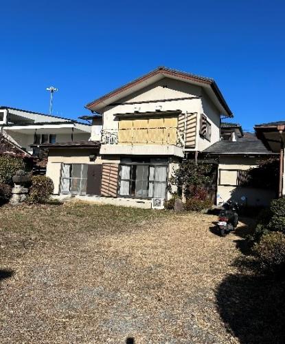


 CCN Machi-erabi is run by CCN CO., LTD. About us